Route details, maps, pubs, features, local history and folklore for a wide variety of walks focusing primarily on Norfolk and Suffolk

Walks
Showing posts sorted by relevance for query Ilfracombe. Sort by date Show all posts

Sunday 6 February 2022

Ilfracombe to Lee Bay circular Walk

Ilfracombe to Lee Bay circular

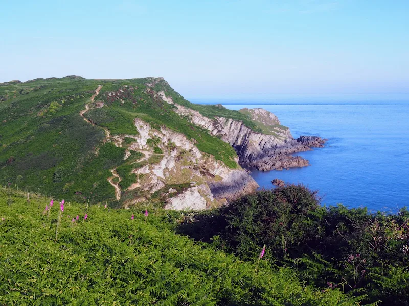
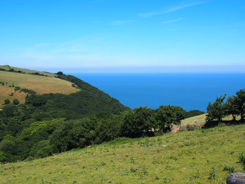
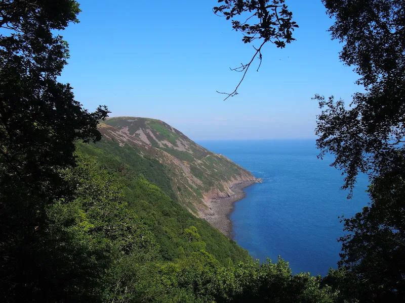
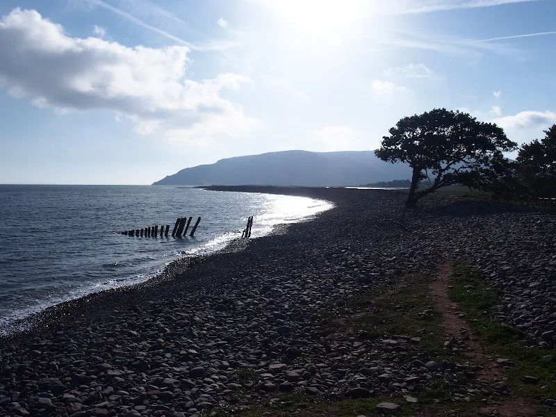
Circular route from Ilfracombe along the old railway track to Lee Bay, returning along the South West Coast Path

The route follows the old track bed of the former Ilfracombe to Barnstaple section of the Southern Railway. These days it is a paved cycle way that twists through the hills past the Slade Reservoirs. There is some country lane and footpath walking to reach Lee Bay on the coast, this includes a steep descent through woodland to the village of Lee where the Grampus Pub is an ideal place for refreshment. ` Return is along the SWCP, and then taking Langleigh Lane back into town.

Thursday 5 July 2018

Hele Bay to Braunton Walk Summary

Salt marsh

Extensive Walk along the SWCP between Hele Bay near Ilfracombe and Braunton

This route provides an alternative to the official SWCP whereby it short cuts the headland at Baggy Point and goes directly into Braunton omitting the section around Braunton Burrows. This achieves a sub 20 mile walk with bus access between Braunton and Ilfracombe. The cliffpath from Hele Bay to Woolacombe provides spectacular views and challenging walking whilst the sands of Woolacombe and Croyde make an easier terrain to navigate across.

Saturday 5 February 2022

Hele Bay and Hillsborough

Hele Bay and Hillsborough

A short but strenuous walk across Hillsborough Hill that separates Ilfracombe and Hele Bay.

Hillsborough is a promontory that sits between the towns of Ilfracombe and Hele Bay to the east. With a height of some 114m, this made an ideal location for an iron age for around 2500 years ago although there is nothing obvious other than information boards to point this out to the untrained eye. There are numerous paths around the hill and this walk roughly follows the South West Coast Path route although veers off to explore Raperee Cove, and to follow the path past the location of the fort.

Wednesday 4 July 2018

Friday 6 July 2018

Hele Bay to Combe Martin Walk Summary

Salt marsh

Short Walk along the SWCP between Hele Bay near Ilfracombe and Combe Martin

This walk offers a few challenges but nothing untoward and is probably one of the best routes to introduce anyone to the SWCP. The views are outstanding and the numerous coves and small beaches tempting to spend a little more time in exploring. A very popular area with frequent transport links and plenty of refreshment options along the route.

Wednesday 15 December 2021

Hele Bay to Berrynarbor Circular Walk

View across the valleys to Berrynarbor

A 7 mile walk around coastal North Devon from Hele Bay to Berrynarbor

This walk takes inland footpaths and tracks to navigate from the village of Hele Bay through to Berrynarbor, which, with its whitewashed stone walls takes on the guise of a Mediterranean village. The village plays host to numerous flower pot men in comical poses which makes an intriguing spectacle as one wanders through the streets. Return is along the South West Coast Path

Sunday 6 February 2022

Baggy Point Circular Walk

Baggy Point Circular Walk

Short walk round the headland known as Baggy Point

A short circular walk starting and ending at Croyde. This route uses the South West Coast Path to navigate around Baggy Point, the headland just north of the village of Croyde. Return is across the headland using footpaths and tracks.

Tuesday 10 July 2018

Combe Martin to Lynmouth Walk Summary

Salt marsh

Strenuous walk from Combe Martin to Lynmouth passing over the highest point on the SWCP

A strenuous walk between Combe Martin and Lynmouth passing over Great Hangman which at 319m is the highest point on the SWCP. This specific route provides an alternative to the official SWCP path out of the Heddon Valley which does reduce the distance slightly. This does give an advantage if one needs to return to the start using public transport as there is only a limited bus survice back to Combe Martin which involves having to travel via Barnstaple.

Sunday 6 February 2022

SWCP Braunton to Croyde

Braunton to Croyde

Walk along the South West Coast Path between Braunton and Croyde on the North Devon Coast

Not the typical landscape for the SWCP, this section navigates around the Braunton Marshes that surround the River Caen and then the dunes of the Braunton Burrows, although this section is mainly on a track due to the dunes being part of a military training area. The route navigates between the bus service that connects the two towns, with bus stops at either end of the route.

Wednesday 18 July 2018

Porlock Weir to County Gate Walk Summary

Salt marsh

A simple 6 mile walk from Porlock Weir to County Gate Car Park

The walk navigates along the higher SWCP route through to Wheatham Combe from where the County Gate car park can be reached along bridleways. This route has the advantage of some fantastic views over the coast as opposed to the lower route through the wooded lower reaches of the cliffs. This walk does need the assistance of a friend or acquaintance to provide a return journey between the two ends of the walk, alternatively the walk can use the lower SWCP to make a circular route.

Saturday 16 June 2018

South West Coast Path - Westward Ho! to Barnstaple

Salt marsh

One of the few low level and flat walks on the SWCP, 12.5 miles between Westward Ho! to Barnstaple

A very easy walk that can be split into two if required. The first part navigates around Northam Burrows, the duned area that juts out into the Taw and Torridge estuary. A ferry at Appledore links across to Instow where the trail continues making use of the former Bideford and Barnstaple railway trackbed.

Tuesday 17 July 2018

County Gate to Lynmouth Circular Walk Summary

Salt marsh

Circular walk linking the County Gate car park and Lynmouth

There is no public transport between Porlock and Lynmouth, therefore a days linear walk is not possible if one requires to return to the start. This walk uses a mid-point of the County Gate car park, located on Exmoor, to provide a circular route using the SWCP and Coleridge Way. The SWCP section is not too strenuous and provides some amazing coastal views whilst the Coleridge Way makes a very pleasant ramble alongside the East Lyn River to return to the County Gate

Tuesday 17 December 2019

South West Coast Path - Bucks Cross to Westward Ho!

Babbacombe

An 8 mile walk along the South West Coast Path between Bucks Cross to Westward Ho!

A moderate walk along the cliffs to Westward Ho!, the town renowned for being the only place in Britain to have an exclamation mark in its name. This walk presents a good introduction to the South West Coast Path being under 10 miles and with few difficult or strenuous ascents and descents. There are amazing panoramas of the coastline throughout with views to Hartland in the west and Westward Ho! and north Devon to the East and North.

Thursday 19 July 2018

Porlock Weir to Minehead Walk Summary

Salt marsh

A 9 mile walk along the SWCP between Porlock Weir and Minehead

Walking in an anti-clockwise direction, this walk marks the end to the South West Coast Path. There are no gold embossed certificates handed out, no congratulating parades to cheer the triumphant walker across the finishing line, or national media around to film the completion of this mammoth 630 mile trek. Just a sculpture of a pair of hands holding an OS map and a self-satisfying sense of achievement with a hint of sadness that the trail is over and another challenge must be sought... or maybe turn around and do it all again in the opposite direction!

Walk Summaries

Latest walk summaries are basic information sheets for walks that have yet to be fully documented. These provide links to maps, public transport and walks stats, although detailed notes and features are not included.

Latest Walk Summaries

Featured Walk

In Search of Sizewell Chapel

A 10 mile walk following the southern side of the parish boundary of Leiston in Suffolk This walk follows the route of a 17th century peramb...

What is GPX

All you need to know about GPX, electronic mapping and how to use modern apps and mobile devices as navigation devices

Popular Walks

Maps