Route details, maps, pubs, features, local history and folklore for a wide variety of walks focusing primarily on Norfolk and Suffolk

Walks
Showing posts sorted by relevance for query South Haven Point. Sort by date Show all posts

Monday, 26 April 2021

South West Coast Path - Swanage to South Haven Point

Old Harry's Rocks

An moderately easy walk to the end of the South West Coast Path at South Haven Point

Old Harry Rocks is the highlight of this walk, and the ascent to Handfast Point, off of which the rocks are located, is the only real effort that has to be expended during the duration of this walk.The rest of the walk is easy all the way through to the end of the South West Coast Path at South Haven Point.

Saturday, 26 June 2010

South West Coast Path - Swanage to South Haven Point


This was the ninth stage of 10 days walk along the Jurassic Coast section of the South West Coast Footpath between Exmouth and Poole. Sadly the tenth day would not happen as that was to be the walk through the military range and the bus to the start (Wilts and Dorset Service 40) did not start running until 23rd July :( never mind - another day.

Tuesday, 17 December 2019

South West Coast Path - Bude to Boscastle

View from Buckator

An 16 mile walk along the South West Coast Path between Bude and Boscastle

A challenging walk along a spectacular part of the South West Coast Path. Although this can be achieved in a single day there is the village of Crackington haven near to the half way mark which allows one to cut the walk into two smaller options. Waterfalls to see, steep valleys to cross and some amazing views of the coastline.

Saturday, 7 December 2019

South West Coast Path - Port Isaac to Polzeath

Port Isaac Haven

An 9 mile walk along the South West Coast Path between Port Isaac and Polzeath

A stunning walk that is not too challenging. It starts at the picturesque village of Port Isaac before winding its way past Port Quin and around the Rumps headland and Pentire Point before descending to the surfing Mecca of Polzeath. The scenery takes ones breath away and every turn there is something new to see.

Saturday, 15 December 2018

Lincolnshire Coast Path - Skegness to Gibraltar Point

Beach looking towards Gibraltar Point

A 7.5 mile beach walk from Skegness to Gibraltar Point

Gibraltar Point, with its Nature Reserve, Visitor Centre and Wash Study Centre can be accessed via a dedicated road from Skegness town centre. This walk attempts to access the Point by way of the beach. It is imperative that one heeds the tide times in order to walk this route, but those doing so will be treated to some outstanding beach views and the solitude that this deserted area brings with it.

Thursday, 10 January 2019

South West Coast Path - Helford to Coverack

Porthoustock

An 11 mile walk along the South West Coast Path between Helford and Coverack

A fairly easy section of the Cornish section of the South West Coast Path but it still presents some spectacular and rewarding scenery. With rivers to cross and charming fishing villages nestled in hidden coves this makes a well worthwhile full days trail.

Sunday, 12 December 2021

In Search of Leiston's Ancient Pagan Sites, the Procession Rayles and Gallows

Harrow Lane

A 7 mile walk following the western parish boundary of Leiston in Suffolk, as described in a document from the middle-ages

This walk attempts to follow the instructions of a perambulation around the western side of the Leiston Parish boundary that was undertaken in the year AD1620. Leiston's history is renowned for its Abbey and the Garret's works, but this walk also discovers the site of a possible ancient pre-Christian shrine or temple, the location of the Leiston gallows and the procession route taken by those attending this gruesome public spectacle.

Sunday, 4 February 2018

In Search of Sizewell and Thorpe Beacons

Sizewell

A 10 mile walk following the southern side of the parish boundary of Leiston in Suffolk

This is the second article devoted to the walk following the route of a 17th century perambulation around the southern side of the Leiston Parish boundary. This article is concentrates on two landmarks from the past, namely Sizewell and Thorpe Beacons, which are thought to have been part of the Armada warning system.

Tuesday, 17 December 2019

South West Coast Path - Bucks Cross to Hartland

Blockchurch rock

An 16 mile walk along the South West Coast Path between Bucks Cross and Hartland

An easy start to a walk through the tree covered cliff-tops makes a pleasant ramble through to Clovelly. There follows a couple of challenging valleys to cross and then broad open meadows for more easy walking through to Hartland Point. At this stage the coast turns South to reveal a coastline that can only be described as truly spectacular.

Wednesday, 22 July 2020

Polzeath to Pentire Point Circular Walk

Binyons plaque looking out to the Rumps

Short circular walk around the headland that fronts Pozeath

An awesome wander around Pentire Point from the village of Polzeath. This is a must for anyone who visits this classic piece of Cornish coastline. A few challenges but nothing that an average walker can muster

Saturday, 29 December 2018

South West Coast Path - Mevagissey to Porthscatho

Place ferry

A 17 mile walk along the Cornish section of the South West Coast Path between Mevagissey and Porthscatho

This walk navigates along the Roseland Peninsular with diversions from the official Coast Path along country lanes. This provides a safer alternative for when the weather conditions are poor and the paths are slippery and visibility poor. This section of coastline has some remarkable scenery when the sun does shine and the paths are not too strenuous. The drawback is the lack of public transport between the two ends of the walk.

Tuesday, 1 January 2019

Lincolnshire Coast Path

Cleethorpes

An overview of a possible route for a Lincolnshire Coast Path

There is currently no official Lincolnshire Coast Path although Natural England are committed to having something in place as part of the English Coast Path by 2020. This overview details the current possible routes taken from research conducted into a walk between Cleethorpes and Boston during September 2014

Sunday, 8 December 2013

2013 Storm Surge at Sizewell and Thorpeness

The strange egg-shaped object on the left is most likely a piece of fallen cliff

A walk at high tide of the 2013 Storm Surge between Sizewell and Thorpeness

This is a photographic excursion of the 2013 Storm Surge down the Suffolk Coast. With media firmly concentrated on events in South Africa the only real way to find out was happening was to visit this destructive storm surge oneself. Although this part of Suffolk was relatively unscathed it still presented awe-inspiring seas and crashing waves.

Friday, 28 December 2018

Angles Way - Oulton Broad to Beccles

Beccles

A 9 mile walk along the Angles Way between Oulton Broad and Beccles in Suffolk

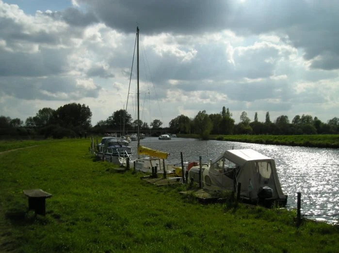
The path between Oulton Broad and Beccles doubles up as both The Angles Way and the East Suffolk Coast Line walk. There is not much to this walk other than following the winding path alongside the River Waveney. It is a pleasant enough stroll but without much activity on the river it can become a little monotonous until Beccles approaches. Nonetheless, what a better way than to spend a sunny afternoon other than ambling alongside the river.

Monday, 16 December 2019

South West Coast Path - Boscastle to Tintagel

Boscastle Harbour

An 5 mile walk along the South West Coast Path between Boscastle and Tintagel

A scenic walk that is not too much of a challenge to any seasoned walker. Rocky Valley presents a steep climb in and out but this really is a delight to behold and well worth the effort to get across it. The end of the walk is at Tintagel with all its Arthurian legend. Behold Camelot.

Tuesday, 1 January 2013

Coastal Erosion at Thorpeness

Erosion at Thorpeness

A circular walk from Sizewell to Thorpeness along the Suffolk Coast Path

In recent years the Suffolk Coast Path has been rerouted in-land from Sizewell across the commons to Thorpeness due to coastal erosion. The old coast route can still be walked when the tide is right and there is always an escape up the cliffs to Thorpeness Common just before the Thorpeness cliffs where the tide cuts off access to the beach.

Thursday, 7 January 2021

In Search of Leiston Gibbet, Friday Market Heath and St Andrews Green

Land by the River Hundred at Aldringham

A 6 mile walk around the heaths and commons of Coldfair Green

This walk follows an investigation to seek out the location of the Leiston Gibbet and an area of heathland that was known in the 1600's as Friday Market Heath. The only reference to these places comes from an old book from 1910 entitled 'The Chronicles of Theberton' which details the route past the gibbet. This walk attempts to retrace this route by navigating along the heathland and footpaths around the River Hundred which marks the boundary between the hundreds of Blything and Plomestead. Extensive research which has been undertaken and documented in the feature of this walk with some revealing insights to long forgotten places.

Monday, 16 December 2019

Walk Around the Wash - Boston to Fosdyke

Haven River

An 11 mile along the sea defence banks from Boston to Fosdyke

This walks follows the start of the Macmillan Way as the first stage of the walk around the Wash. The route follows the Haven river before heading down to Fosdyke bridge on the River Welland. The walk is typified with acres of flat marsh, water filled creeks, wide open skies and views for miles around.

Thursday, 7 May 2015

Aldeburghs Martello Tower Now Boasts an Anthony Gormley Sculpture

Martello Tower

A 7 mile walk from Thorpeness to Aldeburghs Martello Tower

For a period of 12 months starting in May 2015, a life size sculpture of a human figure will look out across the sea atop Aldeburghs Martello Tower. This is the work of Anthony Gormley, the artist who is renowned for creating the iconic Angel of the North sculpture, and is part of the celebrations to mark 50 years of the Landmark Trust.

Saturday, 15 December 2018

Lincolnshire Coast Path - Skegness to Mablethorpe

Mablethorpe donkeys

A 15.5 mile beach walk along the Lincolnshire Coast between Skegness and Mablethorpe

This walk follows the coastline using the proms and the beach throughout. An excellent beach walk by all accounts with acres of sand and under wide open skies. One cant really get lost, just keep the sea on the right, or left if walked in reverse.

Walk Summaries

Latest walk summaries are basic information sheets for walks that have yet to be fully documented. These provide links to maps, public transport and walks stats, although detailed notes and features are not included.

Latest Walk Summaries

Featured Walk

In Search of Sizewell Chapel

A 10 mile walk following the southern side of the parish boundary of Leiston in Suffolk This walk follows the route of a 17th century peramb...

What is GPX

All you need to know about GPX, electronic mapping and how to use modern apps and mobile devices as navigation devices

Popular Walks

Maps