South West Coast Path - Newquay to Porthcothan
Saturday, 29 December 2018
|
No comments |
![]()
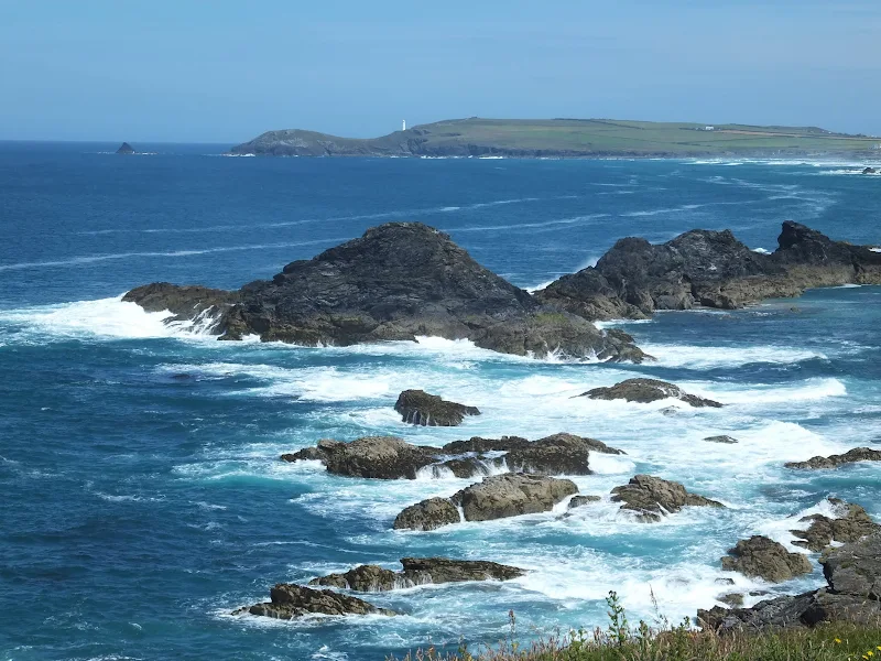
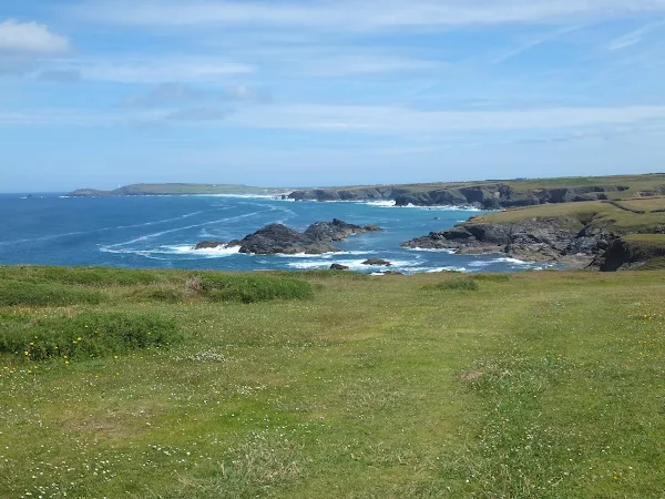
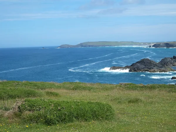
An 10.5 mile walk along the South West Coast Path between Newquay and Porthcothan
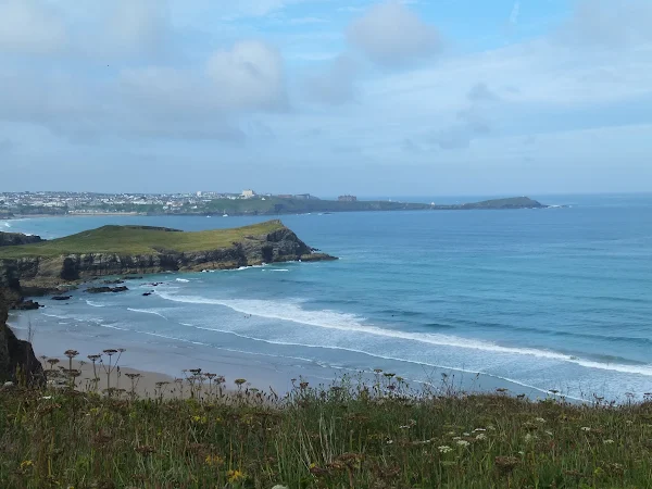
This section of the South West Coast Path provides typical picture postcard images of Cornwall in its full glory over a terrain that is not too demanding for the average walker. With stories of Mermaids and Giants there is plenty of folklore and history to read up about. An outstanding section without a doubt.

Walk Statistics
- Start location: Newquay
- End location: Porthcothan
- Distance: miles ( km)
- Total Gain: ft ( metre)
- Total Descent: ft ( metre)
- Min Height: ft ( metre)
- Max Height: ft ( metre)
- Est. Walk Time:
- Walk type: Linear
- Walk Grade: Moderate
- Terrain: Cliff top paths with some climbs and descents
- Obstacles: There are a couple of steep climbs on this section, notably the climb up from Watergate beach

Maps
The following maps and services can assist in navigating this route. There are links to printed maps and links to downloadable GPX route data for importing into navigational software and apps.
- Ordnance Survey Explorer Map
- OS Explorer 104 - Redruth & St Agnes
- GPX Route File
Accommodation
Valley Camping and Caravan Park, PolzeathView in OS Map | View in Google Map
- Website
- https://www.valleycaravanpark.co.uk/
- Description
- A friendly and welcoming family owned camp and caravan site close to the beach at polzeath
Transport
First Group - Bus Service
- Service Details
- 56 - At the time of walking this route the local 56 bus service was provided by First Kernow and linked Newquay, Mawgan Porth, Porthcothan and Padstow. Due to the ever changing landscape of public transport it is advised to use the Traveline website to get the latest timetables and operators.
- Timetable
- Traveline Website
Walk Notes
A sign unseen - A Murder of Crows
A Murder of Crows is the collective noun for a group of crows. Let me explain. This walk was part of a series of sectional walks between Portreath and Port Isaac on the North Cornwall section of the South West Coast Path undertaken in the summer of 2015. As with many sectional walks on this site, this made use of a base-camp from which each days walk could be accessed via public transport. On this specific expedition base camp was made at Valley Park campsite at Polzeath. This was not specifically chosen for strategic purposes but because it was the favourite holiday haunt of a few friends who accompanied us during the week in Cornwall. Although they were there for the surf rather than the walking, it nonetheless gave the communal friendship each evening where we could have a meal and drinks and swap our days stories. In addition it gave the added advantage of having the favour of being driven to certain destinations when public transport was not accommodating.
Valley Park is both a caravan and camp site which is situated in the valley that leads up from the beach. It is a quiet and friendly family owned site that proved to be an excellent place to stay. The eastern side of the park is bordered by a steep hill that is covered in tall broadleaved trees. It was in these trees that hundreds of crows nested, and together they would form a very loud dawn chorus each morning. Naturally, the noise of the squawking crows awoke all and sundry on the campsite and presented many discussions in the evening as we all gathered around our little encampment to debate the actions of the crows. The most annoying aspect of the early morning awakening was the fact that the crowing would slowly start with the first rays of the sun, and then cascade into an avalanche of noise whereupon they all left their roost, circled around the campsite and then back to their nests and the noise would come to an abrupt end. Their job of waking the populous up complete. Once one was awakened by this commotion, sleep was hard to return to because of the glare of the sunshine through the canvas.
It was during one of these camp-fire discussions that the question of the collective noun for these black critters came up. A murder of crows. It was a term which all of us either knew or had heard as an answer to pub quiz questions. But why a murder of crows. No-one had an explanation. A search of the Internet gave various explanations including the fact that crows are scavengers and will often be seen feeding on rotting bodies such as roadkill. But this is hardly murdering, and why not a scavenge of crows if this was the case. Another theory comes from folklore that crows hold court over members of their flock that have committed offenses and if the defendant crow is found guilty then the rest of the flock swoop down and kill it. But surely this should then be known as a parliament of crows. None of the explanations appeared to offer a decent interpretation. But then came an alternative idea, and one that could not found in the realms of the web. This was related by our companion Jason. He was brought up by his grandfather who was the game keeper to a country estate. He was always taught that no matter how much noise and nuisance a flock of crows become, one should never attempt to move them. A stern word was offered by his grandfather that even if a single nest is disturbed then it will bring a death to the perpetrators family. Could this be the reason they are known as a murder of crows? Could the crows instigate the murderous death of a family member? It is probably as good an explanation as any of the others.
So what has all this to do with the walk. Well, the morning after this discussion, after being awoken at 4.30am by the crows and then unable to return to sleep, we had set off to begin the days expedition from Newquay to Porthcothan. This was not a difficult walk and one where we had plenty of time to achieve our aims. The day was full of glorious sunshine and blue skies which presented the Cornish coast at its very best with deep azure seas and golden sandy coves.
The path leaves the urbanisation of Newquay and follows the cliffs above Watergate Beach and onto Beacon Cove where it descends into a valley then ascends back out to Beryls Point. It was around Beacon Cove that a couple of other footpaths lead inland to the village of Trevarrian. These paths are well marked and accessed through wooden gates from the coast path. It was on the upright to one of these gates that a sign was attached. A long wooden sign in portrait orientation with an embossed coastal scene at its base above which the words 'A MURDER OF CROWS' were carved. This was one of those uncanny experiences. A sign that reflected the previous evenings discussion. It also stated in smaller lettering 'An unkindness of ravens' under which it stated 'A sign, unseen'. Was this just the crows warning us that Jason's explanation was true and we should just put up and shut up! Despite subsequent exhaustive searches of online resources, no explanation can be found as to what or why such a sign had been placed here, or what the intention of 'A sign, unseen' was.
Logistics
Transport - The walks' ends can be linked directly using the First Group 56 bus service which connects Newquay and Padstow and roughly follows the course of the coast path up to Porthcothan. This is an hourly service during the summer months although there are no evening services. In this instance of the walk, as we were staying at Polzeath, this involved a lift to Wadebridge from where a bus to Newquay took us to the start of the walk, returning via Padstow and Rock and an additional 3 mile walk back around to Polzeath.
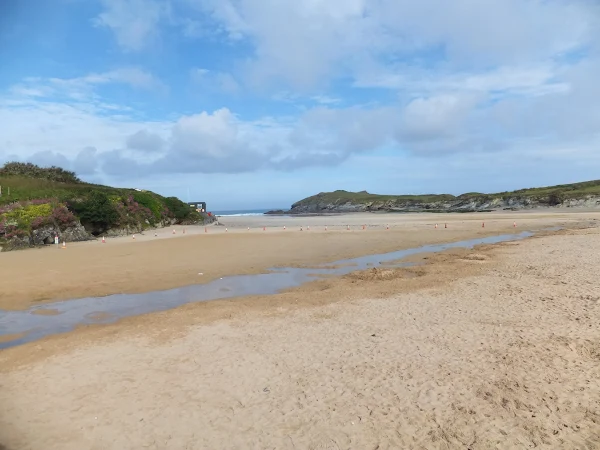
Refreshments - The best place to stop on this walk is the half way point marked by the small hamlet of Mawgan Porth, which is nestled in a valley with a large sandy beach that sits in the cove. The name of the place has changed over the centuries with it being known as Porthglyvyan in 1334 and later as Porthmaugan in 1755, the name in Cornish which translates as the cove of St Mawgan, a Cornish Saint from the 5th or 6th century. The River Menalhyl runs down the valley and out across the beach, its extent being no more than a small stream during these dry summer months. Around the head of the cove are scattered a pub, a general store, and several hotels, guest houses and caravan parks. It was unfortunate that on this occasion we were too early to take advantage of the pub, although the store provided a long and cooling soft drink which was definitely needed on such a hot summers day.
At the end of the walk, at Porthcothan, there is another little store where refreshments can be had. This shop, which is located on the track down to the beach, has wooden benches for the use of customers in a small courtyard outside. There is also a pub in the village but it is a long trudge up the hill and away from the bus stop. Therefore after a minutes thought the store seemed a more inviting prospect for some savoury snacks and cold drinks. There was a group of surfers sprawled about on the benches outside. About ten of them. All kitted up in wet suits. All keenly chatting away. We made our way through the group to the one remaining bench, a circular affair with four individual seats around its circumference. It was a sheer pleasure to divulge oneself of a rucksack and have a chance to rest ones tired legs in the shade. Now, I don't like to openly admit my personal blunders but if I don't then someone surely will. For on this occasion, as I sat down, I somehow completely missed the wooden seat and toppled down into a dishevelled heap onto the concrete ground. My bottom just did not connect with its intended perch. My buttocks assumed base was sadly miscalculated. My posterior parted company with its perceived parking place. My derrieres final vertical coordinates were not at the eventual expected altitude. My bum hit the deck. How the surfers laughed. They rolled about in cries of merriment at my predicament. Even the shop keeper had to come out to join the frivolity. And a couple of passers by. And a cat. You don't see many cats falling about laughing but this one did. And who wouldn't. I surely would have done the same if i was in their position.
Directions
The South West Coast Path is clearly marked with the usual acorn markers of a national trail
The path is picked up from Newquay bus station by following the coast road out of town and then keeping to the clifftops at Barrowfields to get through the Porth Beach. The route now follows the road around to the beach and the OS map depicts that it follows the cliff top around to Trevelgue Head although on this occasion it appeared to have been diverted past this headland and straight onto the clifftop path above Whispiderry Beach.
At the far end of the beach is a large beach-side hotel and the path drops down to its entrance then follows the road up the steep hill opposite. There is a sign pointing up an alley between the buildings on the hill which then leads up steep steps back to the cliff tops. There rest of the route follows the cliff tops and is well marked.
Pubs
Merrymoor Inn, Newquay View in OS Map | View in Google Map

- Address
- Mawgan Porth, Newquay
- Website
- www.merrymoorinn.com/
This pub which sits at the head of the beach was originally a snack bar and restaurant but was made into a pub in the 1960's by the Evans family whom have retained the licence ever since. The pub has built itself a name for good beer, good food and accommodation by the beach
Unfortunately it was too early in the day for the pub to be open on this occasion.
Features
Trenance MermaidsView in OS Map | View in Google Map
An interesting story that is taken from the 19th century archives of The Gentleman's Magazine refers to the Trenance Mermaids. Taken from c.1 v.142 of the 1827 edition, on page 80 is published a story which it states as being recorded by a correspondent in the Plymouth Journal. The story states
...there have been several Mermaids seen on the rocks at Trenance, in the parish of Mawgan. One evening a young man who lives adjoining the beach at Mawgan Forth had made an appointment to meet another person on the beach to catch sprats with him. He went out about ten o'clock at night, and coming near a point which runs into the sea, he heard a screeching noise proceeding from a large cavern which is left by the tide at low water, but which has some deep pools in it, and communicates with the sea by another outlet. He thought it was the person he appointed to meet, and called out to him; but his astonishment is not to be described, when, on going up, he saw something in the shape of a human figure staring at him, with long hair hanging all about it. He then ran away, thinking, as he says, that he had seen the devil.
The next day, some men being on the cliffs near this place, saw three creatures of the same description. The following day five were seen. The persons who saw the last five describe them in this manner:— The mermaids were about forty feet below the men (who stood on the cliff) and were lying on a rock, separated from the land some yards by deep water; two of them were large, about four feet and a half to five feet long, and these appeared to be sleeping on the rock; the other small ones were swimming about, and went off once to sea, and then came back again. The men looked at them for more than an hour, and flung stones at them, but they would not move off. The large ones seemed to be lying on their faces; their upper parts were like those of human beings, and black or dark coloured, with very long hair hanging around them; their lower parts were of a bluish colour, and terminating in a fin, like fish. The sea would sometimes wash over them, and then leave them dry again. The hair of these mermaids extended to a distance of nine or ten feet.
This story is also mentioned in a 1903 publication called Old Falmouth which goes on to state that the Plymouth Journal carried a subsequent corroboration of the sighting in its July 14th edition of that year, stating that
...this was gravely corroborated by someone who wrote that they were exactly like Christians. Will anyone undertake to find mermaids in a cavern at Mawgan now ?
where it denotes the use of the word Christians in this context refers to seals. This is a common explanation for mermaid sightings although such a word usage has not been found elsewhere. Even so, one would have thought that the folk who lived in this area would have been used to seeing seals which are a common sight along the north Cornish coastline.
Generally, the sighting of a mermaid is an unlucky omen foretelling disaster, therefore it is curious that on sighting a group of mermaids that the witnesses proceed to throw stones at them.
References
The legend of BedruthanView in OS Map | View in Google Map
Cornwall has many tales and legends of giants. The legend of Bedruthan concerns one such giant who was said to use the beach stacks at the area of the same name as a short cut across the bay, although it is said that he failed to continue his journey as the neighbouring giant, known as Diggory, would turn him back. These rocky stacks have consequently become to be known as the Bedruthan steps.
The story sounds typical of the larger than life Cornish tales of ancient times but in this instance it would appear to have been a modern creation. The first recorded reference to the Bedruthan Steps dates from a newspaper known as The West Briton in February 1847. The name at this time referred to one of the two cliff starcases to access Carnewas mine that was used by the miners although the name came to refer to the entire beach.
There are many resources across both the web and in guide books that assume the story to have been invented by the local land owners of the time, with the intention of attracting tourists when they could profit from charging to look after their horses and no doubt selling refreshments and other paraphernalia. The Victorian age certainly introduced tourism to the more common classes with the coming of the railways and there are reference books of the time which contain entries for the Bedruthan Steps, also known at the time as Bedruggan Steps. Such references can be found in 'A Handbook for Travellers in Devon and Cornwall' from 1865 and 'The route book of Cornwall' of 1861 , although there is no mention of the Giant legend. We can therefore assume it was on the tourist trail even though the nearest railway station would have been Newquay.
Despite extensive searches it is not until modern times that the legend starts to appear in printed publications. The name has changed and in older publications it is refered to as Bodruthan. Can we therefore assume this to have been passed on by word-of-mouth? It is curious that such a tale is not being recorded unless the authors of the time knew it to be a tall tale. Most modern publications just reiterate the same simple story in much the same words but no common root has been found for this. Maybe it is a tall story invented in modern times with the fallacy that the Victorians invented it. Who knows?
Today the area is owned by the national Trust and is a very popular tourist destination. It certainly is a spectacular scene and well worth visiting.
References
Image Gallery


Route Validation Cards
Validation Date - 2015-06-29
- Time of Walk: 08:30 to 13:30
- Validators: Griffmonster, Kat
- Weather Conditions: Clear blue skies, sunshine, very warm
- Notes: Initial route undertaken
Summary of Document Changes
Last Updated: 2026-01-12
- 2015-08-31 : Initial Publication
- 2018-12-29 : General website updates
- 2021-03-17 : Update website improvements and removal of ViewRanger reliance
- 2021-12-01 : Removal of ViewRanger links due to its imminent demise


0 comments:
Post a Comment