Lincolnshire Coast Path - Boston to Wrangle
Tuesday, 17 December 2019
|
No comments
|
![]()
An 10 mile beach walk from Boston to Wrangle
An alternative route to the coastal defence banks that provides a change to the marsh views. Open flat farmland, tiny hamlets, large churches and plenty of pubs along the way. Not strictly part of a coast path but this route roughly follows the coast of medieval times when Wrangle boasted the third largest harbour along this section of coastline.

Walk Statistics
- Start location: Boston
- End location: Wrangle
- Distance: miles ( km)
- Total Gain: ft ( metre)
- Total Descent: ft ( metre)
- Min Height: ft ( metre)
- Max Height: ft ( metre)
- Est. Walk Time:
- Walk type: Linear
- Walk Grade: Easy
- Terrain: Country lanes and footpaths
- Obstacles: There is a small section along the main A52 which is a very busy road. There is a pavement along this section.

Maps
The following maps and services can assist in navigating this route. There are links to printed maps and links to downloadable GPX route data for importing into navigational software and apps.
- Ordnance Survey Explorer Map
- OS Explorer 261 - Boston
- GPX Route File
Accommodation
Golden SandscampsiteView in OS Map | View in Google Map
- Website
- https://www.haven.com/parks/lincolnshire/golden-sands/
- Description
- Golden Sands is a holiday park mainly based around self catering chalets and caravans but it does include a campsite which is tucked away at the back of the site. The park is part of the Haven group and has entertainment, bars, takeways and activities on site.
Transport
Stagecoach - Bus Service
- Service Details
- 7 - Lincolnshire Interconnect Service 57, operated by Stagecoach and linking Boston and Skegness
- Timetable
- Lincs Interconnect Service 57
Walk Notes
This walk was done as a part of a Lincolnshire coastal walk. The original intention was to walk the defence banks from Boston up to the Wainfleet river, although it was uncertain of the public access towards the end of this route. However plans changed due to the weather. The preceding days and the day of the walk were full of persistent sea mist which was very reluctant to clear. A defence bank walk with nothing but sea on one side and flat open farmland on the other would be monotonous with the gloom of sea mist obscuring all views. Therefore an alternative route was sought to provide a little more stimulation and interest. This route roughly follows the medieval coastline which was much further inland than the present day coast as can be seen depicted on John Careys map from the 18th century.
The chosen route had some distinct advantages over the defence bank course. Firstly, the walk could be split into two shorter walks, Boston to Wrangle and then Wrangle to Wainfleet as it roughly follows the bus route between the two places. Secondly, the route passed through numerous villages and hamlets which provided a stimulation and interest with churches, pubs and various features along the way. Lastly, this is a shorter route with most of the distance along country lanes with little traffic apart from farm vehicles. This walk is 10 miles with another 7 to get through to Wainfleet, which is covered by a separate walk detailed on this site. This compares to 24 miles to complete the full defence banks and then navigating up to Wainfleet. To split such a walk into 2 sections would involve an additional 3 miles to access the bus route. Once the England Coast Path has negotiated with landowners for a full public access along the coastal route between Skegness and Boston, then this will be revisited.
On the day of the walk, the intention was to catch the Interconnect Bus Service from Skegness to Boston Bus station. However there was major roadworks taking place on the main road through Boston which caused the traffic to snarl up and completely disrupt the bus timetable. As a result, the Boston bound bus became embroiled in this chaos and it was thought prudent to alight on the main road through town at Main Ridge East rather than continue to the Bus Station. This appeared to be a common idea as many other passengers alighted at this point from where it was a simple walk through to the town centre.
During the bus journey we had engaged in conversation with a fellow woman passenger. She had immediately assumed that we were tourists and had reeled off the places to visit in Boston, which were mainly the palaces of consumerism rather than historic edifices and natural wonders. All this advice was tempered with a stern caution to tread carefully in Boston and not to stray into the 'foreign parts' of the town. Boston has, in recent years, been inundated with migrant workers from Eastern Europe. This has somewhat displaced the local population and has caused a lot of tension between the migrants and the locals. She iterated a few stories about what these foreign parts are like, warning us not to walk through such districts in case we were accosted, robbed or generally taunted with verbal abuse. 'It does happen' she emphasised with an expression of experience although it was difficult to tell whether the stories and tales related were from first hand experience or nothing more than rumour and hearsay garnered over recent years. One cannot blame the migrants for wanting a better life, there is plenty of work on the farms in these parts and the British government provides plenty of handouts and benefits for such poorly paid work, which is big money in their countries of origin. Equally one can understand the frustration and resentment felt by those who have been brought up in the area and have been somewhat forgotten by the authorities. Thankfully we had no thoughts of wandering around any towns on our walking excursions, therefore confrontation with migrants with chips on their shoulders would be kept to a minimum.
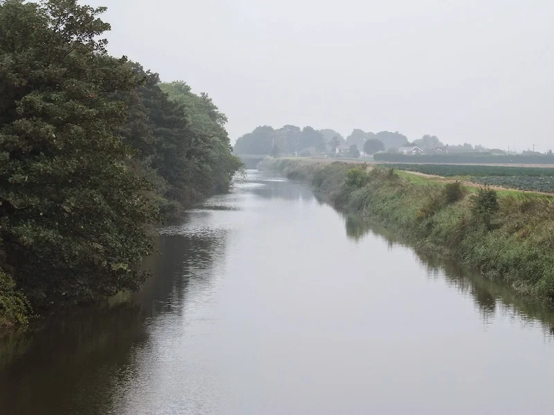
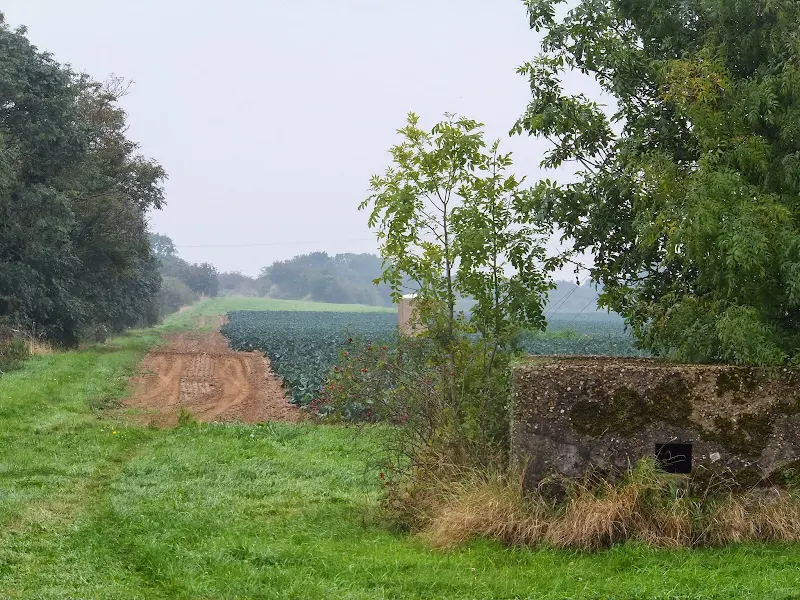
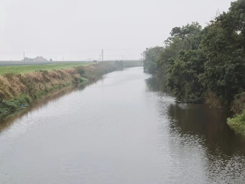
This walk provides typical English fenland scenes through the flat Lincolnshire landscape. Although misty on this occasion, one can imagine the glory it would invoke under blue skies and summer sunshine. Tiny villages with country pubs and large iconic churches. Fields full of cabbages and cauliflowers, ripe for picking, and gangs of farmhands, most likely the eastern European migrants, following tractors and trailers doing just such work. The workers would often take time out to watch us wander past, seemingly bemused that anyone should be walking this landscape. One crew started waving. We waved back. Obviously no chips on their shoulders, just cauliflowers.
One can see for miles on such a flat landscape even with the slowly lifting misty conditions. A distant tree-line suggests the coastal defence banks are just beyond. Power and telephone lines lead across the fields providing perches for flocks of birds along their straight lines into the oblivion of the horizon. Lonely cottages sit amid the fields and along the roadside with no signs of life - probably dormitories for the city folk rather than accommodation for farm hands. Amid these scenes, us two walkers ambling through the landscape. Two distinctive vertical figures that contrasted with the vertical lines of the telegraph poles and the odd lonely tree. The only moving vertical features in the landscape. It gives one a sense that one is the stranger in this landscape and is subject to all and sundry prying eyes. Every move under inspection. This is not a land where one can confidently stop for a number one without someone seeing - it is best to continue and hold it in.
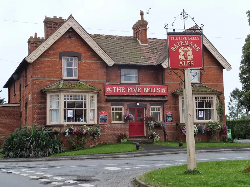
The walk does have the potential for a veritable pub crawl, with two pubs at Freiston; a village pub in Butterwick (The Angel Inn in Benington closed for business in January 2019) ; another just off route at Old Leake and a final pub at Wrangle. Unfortunately these hostelries appear to be fighting for survival with little trade which is apparent from their limited opening hours. Some limit their trading period to weekends, others only open in the evenings. On this particular Wednesday, the charming Freiston Kings Head did advertise a lunchtime opening but it was passed too early in the morning. Similar also for the Bull and Dog which stands opposite the church and at the position where the village stocks once stood many centuries ago. In fact, it was uncertain whether this pub was still in business at all. The grand building of The Five Bells at Butterwick looked promising but had some strange opening times with Wednesdays advertised hours being '2pm to close'. This unspecific closing time was contrasted with specifics for the weekend which suggested the landlord would poke his head out of the door at 2pm on a Wednesday and if no-one was around, would promptly disappear back into the building and lock the door. On this occasion the door was locked. However, the Admiral Nelson at Benington was open as was the Angel Inn at Wrangle.
There are specific landmarks to look out for on this walk, the first being Hawthorn Tree corner which is dealt with in the features section. Freiston has the iconic St James church and behind it the site of a St James Priory which was founded by Benedictine monks in 1114. Nothing remains of the priory buildings but an ancient cross which used to stand at the junction by the church and is marked on OS maps from the late 19th century is said to still have its shaft in existence in the church yard. The area adjacent to this used to be known as Caythorpe Cross and the Bull and Dog pub opposite once had the name of the Cross Hill House. It is interesting to note that there is a village called Caythorpe near Grantham and it has a corresponding district called Freiston.
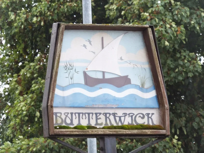
Next along the road is St Andrews church in the village of Butterwick followed by All Saints church at Benington. The route now heads through to Leverton on a long straight road. This meets a crossroads and the building on the right is the old Ostrich pub, now converted to a private dwelling. Beyond this, along Moat Lane there is a house on the right simply called the Moat House. This sits on the site of the 14th century Lawrence's Chantry. Finally, across footpaths to the walks end at Wrangle and the 12th century church dedicated to St Mary and St Nicholas.
As stated at the start of these notes, the roadworks in Boston severely disrupted the bus service to and from Skegness. The pub at Wrangle is adjacent to the bus stop and on this occasion the buses passed by with no obvious relation to the scheduled timetable. It appeared obvious that one needed to catch the Skegness bound bus at the stop adjacent to the pub as opposed to the shelter on the opposite side of the road which would be for the Boston bound buses. The first bus that turned up stopped on the opposite side of the road but had Skegness on its destination blind. This was somewhat confusing, especially on this occasion with the timetable disruptions. It would appear some drivers loop through the village from the main road in one direction regardless of their destination. The cheerful lady driver acknowledged the bus was very late, excusing this with a derogatory remark about the roadworks plus adding that another bus had broke down earlier that day. She was not even supposed to be driving the service but had stepped in due to the allocated driver being caught up in this chaos. She was supposed to have finished her shift and be on the way home. She laughed at the predicament. It is a rare sight to find a cheerful driver for one of these national bus concerns, especially when the day has not gone as planned.
Directions
Once out of Boston, country lanes and footpaths lead through to the village of Wrangle from where there is a bus link to both Boston and Skegness
Leave Boston Bus Station via Bond Street and then turn left into West Street. Continue until it meets the High Street, then turn left following the road across the Town bridge and on into an open area amidst the shops. Take the walkway under the metal arch named Dolphin Lane, by the side of the Nationwide building. At the far end continue straight ahead, bearing left then right into Main Ridge West. The road bends round aside the busy dual carriage way known as John Adams Way at which point there is a pedestrian crossing. Cross the carriageways and continue ahead into Main Ridge East. After the river bridge bear left into Freiston Road. Keep straight ahead along this road, which changes name to Eastwood Road, until it meets a mini-roundabout. Bear left along Priory Road and continue out of the town into open countryside to Freiston.
At Freiston, where the road junctions with Church Road, turn right, the take Church View on the left past the church. Take the next left, Butterwick Road and follow this through to Butterwick. Keep to the road through the village and proceed straight across the crossroads onto Benington Road. This road leads onto the busy A52 where there is a pavement aside the road through the village of Benington. At the far end of the village is the pub The Admiral Nelson, and opposite, on the right, is the next country lane to proceed down.
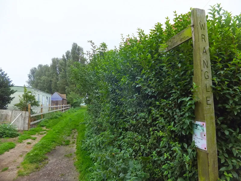
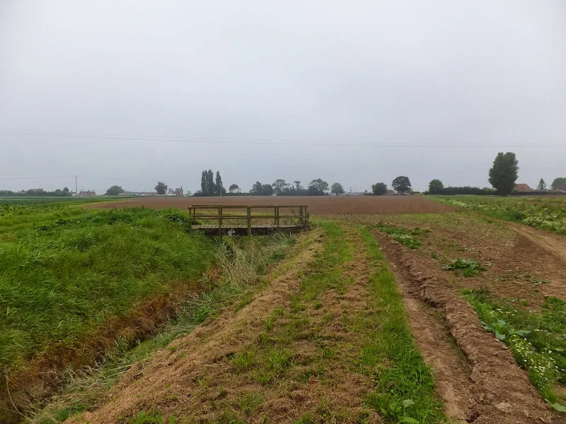
Follow the road for several miles, ignoring all other roads leading off of it. Eventually it passes through a chicane preceded by a road on the right and then a crossroads. Keep straight ahead into Moat Lane and follow this until there is a road on the right by some houses named Sea Lane. After a few hundred yards Nut Lane leads off to the left, take this for a few yards and on the right is a footpath between the houses. The OS map indicates this gently bends around to the next road. In reality it meets a drainage ditch and then follows this around to a wooden footbridge and then leads back down the opposite side of the ditch before emerging onto the road. Proceed across the road and onto the next footpath into Wrangle village. Turn left onto the road into the village and continue to the junction. The Angel pub is opposite with the bus stops on either side of the road. Note that buses can use either side of the road for either Boston or Skegness as they loop through the village.
Pubs
The Admiral Nelson, Benington View in OS Map | View in Google Map

- Address
- Main Road, Benington
A friendly and hospitable pub on the main A52 Home cooked food available both lunchtime and evenings (apart from Sunday evenings). Bed and breakfast available and dogs accommodated by prior arrangement. Does not open on Sunday evenings. Batemans ales on hand pump.
Unfortunately this pub closed for business in January 2019
Certainly a friendly little local although very few folk in the pub on this visit. Nonetheless a conversation was sparked up with the bar staff and a local. A decent pint Batemans XB and toasted sandwiches a worthy rest from the days walk
The Angel Inn, Wrangle View in OS Map | View in Google Map

- Address
- Church End, Wrangle
- Website
- https://theangelinn.uk/
A warming and welcoming atmosphere of a traditional English pub is offered at this 100 year old pub. The Inn offers bar food and a full menu in a dedicated restaurant area. Ales supplied by Batemans and Everards and the pub is CAMRA listed.
An excellent traditional pub full of character. Good to find Everards Tiger sitting alongside Batemans.
Features
The legend of the Fishtoft HawthornView in OS Map | View in Google Map
An interesting piece of folklore concerning a hawthorn tree in the parish of Fishtoft is recorded by Pishey Thompson on page 493 of his 1854 publication, The History and Antiquities of Boston, where he states;
The tree is, traditionally, stated to have been originally a stake, driven into the grave of a suicide who was buried at the cross roads, as was the custom very generally at one period, and, we believe, is not altogether discontinued at the present time. We have heard the name of the femail said to have been ignominiously interred here, and many traditional particulars respecting her, more than half a century ago, but do not recollect them.
Although he does not enlarge upon the original date other than stating that the legend was recorded in the Fishtoft Acre Books for the years 1662, 1709 and 1733 as well as Braziers map of 1724, he does give a description of the location.
at the point of intersection of the Tower Lane, and the road to Fishtoft Church, with the Low Road to Freiston.
This would place it on the modern day housing estate by the mini roundabout at the intersection of Rochford Tower Lane, Eastwood Road, Priory Road and Church Green Road. Indeed, if we look at the OS maps from the late 19th century there is an item marked 'Hawthorn' at this point. Even today this area is known as 'Hawthorn Tree Corner'.
One does wonder if the householders around that roundabout know of the legend and the ground their homes are built upon .
The folklore is also mentioned in the 1866 volume of Notes and Queries , a publication which denotes itself as 'A Medium of Inter-communication for Literary Men, Artists, Antiquaries, Genealogists, Etc', where a query is made by a correspondent who initializes themselves as K P D E, requesting further information on the particulars of the story. Unfortunately a reply does not appear to have been forthcoming.
References
WrangleView in OS Map | View in Google Map
Writing in the 1814 publication entitled The History of Lincolnshire, William Marrat records that Wrangle formerly had a haven which was accessed from the sea by Hengel Creek coming to within half a mile of where the church now stands. The Haven provided Wrangle with trade from sea going vessels, the harbour being the third largest along this coastal stretch, with only Swineshead (which is west of Boston and now completely landlocked) and Boston itself being of more importance. Salt making from the bountiful silt was one of the main exported items that brought prosperity to the area. It is even recorded that ship building was also undertaken here, the town supplying one ship with eight men to assist Edward III in the Hundred Years War.
The town is also reputed to have held a market on a piece of ground called the thorough-fare which was close to the Haven and The Angel pub was also said to be originally located on the banks of the Haven. By all accounts this was a thriving and prosperous town but this was soon to come to an end. By the mid 17th century the salt exports had come to an end, their economic viability terminated by other producers who used cheap coal and brine evaporation techniques for salt production. As a consequence trade dwindled and the harbour silted up, accelerated by the enclosure and reclamation of land for pasture.
Wrangle church dates from the 12th century although it is thought to have replaced a Saxon church on the same site. There appears to be a little confusion on the dedication of the church over the years. The present day dedication is to St Mary and St Nicholas which is also referenced in numerous books from the 19th century. However it is also referred in other books from the same period as the church of St Peter and St Paul. With the descriptions of 6 bells matching both it is uncertain why this anomaly exists. One possibility is that it was mistaken for a chapel associated with Wrangle Hall. Although no longer in existence, local folklore states that this chapel was destroyed many centuries ago with the ruins lasting until the 18th century.
References
Image Gallery


Route Validation Cards
Validation Date - 2014-09-16
- Time of Walk: 11:00 to 14:30
- Validators: Griffmonster, Kat
- Weather Conditions: A misty and overcast start that cleared to blue skies and sunshine
- Notes: Initial route undertaken
Summary of Document Changes
Last Updated: 2026-04-20
- 2021-03-17 : Update website improvements and removal of ViewRanger reliance
- 2021-12-01 : Removal of ViewRanger links due to its imminent demise
- 2026-01-12 : Major website update with all walks recast to the new format


0 comments:
Post a Comment