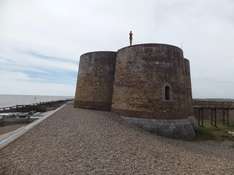
Route details, maps, pubs, features, local history and folklore for a wide variety of walks focusing primarily on Norfolk and Suffolk

label

Archive Label Search

Essex Walks Map

Essex Map image

As an aid to navigating and finding a map specific to your geographical requirements, we have generated a Google map of all Suffolk walks that are detailed on this site. The map below is zoomable and uses icons to locate each walk, specified on the geographical location of either the start/end of the walk or its main feature. Click on any icon to display a brief description which contains a link to the full walk details.

Seaside Walk Week

Seaside Walk Week

It will soon be 2016 Seaside Walk Week. From Sunday 29 May to Sunday 5 June, this event, which is in its second year and organized by the charity Family Holiday Association, is dedicated to getting everyone outside to enjoy some fresh air and the beauty of the Great British seaside. The event will launch with an official walk in Scarborough, Britain’s first seaside resort, and end with another official walk as part of a grand finale weekend in Weston-super-Mare. Full details are available from their website page for Seaside Walk Week.

Norfolk Walks Map

Norfolk Map image

As an aid to navigating and finding a map specific to your geographical requirements, we have generated a Google map of all Norfolk walks that are detailed on this site. The map below is zoomable and uses icons to locate each walk, specified on the geographical location of either the start/end of the walk or its main feature. Click on any icon to display a brief description which contains a link to the full walk details.

Suffolk Walks Map

Suffolk Map image

As an aid to navigating and finding a map specific to your geographical requirements, we have generated a Google map of all Suffolk walks that are detailed on this site. The map below is zoomable and uses icons to locate each walk, specified on the geographical location of either the start/end of the walk or its main feature. Click on any icon to display a brief description which contains a link to the full walk details.

Dads Army Weekend 2015

Dont panic Mr Mainwaring

An easy 9 mile Norfolk coastal walk to visit the Dads Army weekend hosted on the North Norfolk Railway

The third episode of the sixth series of the popular British comedy series Dad's Army was titled 'The Royal Train' in which King George VI was due to pass through Walmington-on-Sea and the platoon were to form a guard of honour. The location chosen to film this episode was Weybourne station on the North Norfolk Railway and each year this is celebrated with a Dad's Army weekend where a group of enthusiasts from the Dads Army Museum in Thetford re-enact this memorable episode.

Aldeburghs Martello Tower Now Boasts an Anthony Gormley Sculpture

Martello Tower

A 7 mile walk from Thorpeness to Aldeburghs Martello Tower

For a period of 12 months starting in May 2015, a life size sculpture of a human figure will look out across the sea atop Aldeburghs Martello Tower. This is the work of Anthony Gormley, the artist who is renowned for creating the iconic Angel of the North sculpture, and is part of the celebrations to mark 50 years of the Landmark Trust.

Winter Walks in the Suffolk Coastal Area

Winter Walks in the Suffolk Coastal Area

Many of the walks on this site are suitable for any season, but just to get into the Christmas spirit here are a few that were specifically walked during the winter months. Frosty and snowy scenes. A little intrigue and some good old mysteries make a well worthy walk. From simple 2 mile town trails to walks that will use virtually all the daylight hours on these short winter days.

Proposed Route for the Norfolk Coast Path from Hopton to Sea Palling Released

Proppsed route through the Winterton dunes

Details of the proposed route for the 19.2 miles of the Norfolk Coast Path between Hopton and Sea Palling

Details have been published for the proposed route of the Norfolk leg of English Coastal Footpath between Hopton to Sea Palling. Much of the proposed route is along existing footpaths and walked routes as well as beach sections. The entire distance can be walked at present either following the proposed route or just using the beach, given the right tide conditions. This proposal, if adopted, will extend the Norfolk Coast Path from Hunstanton to Hopton.

An Amazing Adventure to Westleton Barrel Fair 2012 (Diversion in Place)

Barrel Race

A simple 11 mile walk across the Suffolk heaths and woodland from Leiston to attend the annual Westleton Barrel Fair.

Despite a brief thunderstorm, a fantastic Summers day was had at the Westleton Barrel Fair 2012 living up to its expectations with all the usual fun and merriment. This years event featured music from Westleton's Doc Cox and Leiston's Random Blues Company, morris dancing from the Rumburgh Morris Dancers, outside bars from the White Horse and the Westleton Crown and, of course, the ever popular, chaotic, breath-taking and entertaining barrel races. This is a unique annual Suffolk event and well worth taking the time out to visit.

North Norfolk Railway Beer Festival 2012

Beer Festival

The 11th North Norfolk Railway beer festival

Once again the North Norfolk Railway came up with another outstanding beer festival. Over 100 ales plus ciders were on offer in the perfect surroundings of a working steam railway together with live music. Carriages on platform 2 gave ample seating and cover for the few times when rain began to fall and a bbq in a wagon offered hotdogs and burgers. In my opinion the best beer festival around!

The Rather Curious Herring Festival 2011

An 8.8 mile circular walk through the Suffolk countryside to attend the 2011 Suffolk Herring Festival at Middleton.

I have been to music festivals and folk festivals and country fairs and even the novel barrel fair, but I can honestly say that I have never ever attended a Herring Festival until this walk. Held on the grounds of the Farm Shop in the village of Middleton this two day event features food and drink, exhibitions, music and games, competitions, and demonstrations of herring preservation and preparation.

Walk Statistics

  • Start location: Leiston 
  • Distance:   miles (  km)
  • Total Gain:   ft (  metre)
  • Total Descent:   ft (  metre)
  • Min Height:   ft (  metre)
  • Max Height:   ft (  metre)
  • Est. Walk Time:  
  • Walk type: Circular
  • Walk Grade: Easy
  • Terrain:

Maps

The following maps and services can assist in navigating this route. There are links to printed maps and links to downloadable GPX route data for importing into navigational software and apps.

 
Walk Notes

There are more direct routes to Middleton from Leiston but for this expedition we decided to amble out across to the Cakes and Ale campsite. This uses footpaths that I certainly haven't walked before which provided added spice and discovery to the days events. Return was along the Minsmere River to Eastbridge, then following the Sandlings trail back to Leiston.

As expected the festival was truly unique and I am glad to say that it seemed to be well attended, with a makeshift car park set up in the field across the road from the Farm Shop. Although there was no draught ales on offer at the bar, they did have a bottled ale, brewed by the Brandon Brewery for the occasion and named Silver Darling which was a light and refreshing bitter. When we arrived the mini opera Peter Herring was being played out. It was difficult to hear but was nonetheless entertaining, centered around the infamous Aldeburgh sculpture which was dressed up as a crab centre-stage. Lunch was a freshly filleted and BBQd herring in a crusty french stick served with peppers which was very tasty. For those who don't like herrings there was a baked potato stall, though quite why anyone who does not like herrings attends an herring festival is pretty much beyond me! Before leaving we caught some music and singing about herrings and the sea, heard some poetry about the sea and herrings, had a look around the herring sculptures and Farm Shop where the herring beer and herrings were on sale. So, in conclusion, I was somewhat bemused by it all, but the festival is a totally unique event and I do hope that it continues to get better and better in years to come. I will certainly attend again and recommend this to any herring fancier! So if you have a fetish, or just want to attend something totally different then be there for the next festival in 2013.

Directions

A simple walk using existing footpaths, lanes and tracks

Head down Victory Road adjacent to the park in Leiston. Contiue along the footpath at the end of the road which eventually emerges at the church and out onto Waterloo Avenue. Turn left and follow the road out of town, beyond the cemetary until a terrace of houses on the right. A footpath on the leiston side of the terrace follows the field boundaries, across the railway, across a country lane, then directly across an open field to Fishers Farm. The path cuts through the hedge and onto the drive to the farm. Follow this down to the road, turn right and keep to the road until there is a junction on the left. Follow this road all the way through to the end junction, carry straight ahead across the field along a footpath into Theberton where it emerges onto the main road through the village. At the church turn right and follow the lane out of the village. Take the first turning on the left and take the footpath on the left, through the gap in the hedge and across the fields. This eventually comes out at Fenn Farm in Middleton. As it meets the road , turn right down through the village.

RETURN: continue through the village until it meets the river bridge. Take the footpath on the right which follows the river through to the Eastbrdge road. Turn right and follow the road through Eastbridge and continue until a track on the left, marked with the Sandlings waymarker, is found. Take this track through to the Sizewell road, where it emerges on a sharp bend. Continue straight ahead and down the hill. At the bottom of the hill a footpath on the right leads through to Valley Road in Leiston. Keep on Valley Road until junctions at Barclays Bank in the centre of town. Turn left up the hill and then turn right at the traffic lights onto Cross street which end where the walk began.

Pubs

Eastbridge Eels Foot View in OS Map | View in Google Map

Image of pub
Address
Eastbridge Eels Foot
Website

A curious name for a pub; some say it comes from a Heel's Foot, a cobblers implement, others will argue that it is named after the Eel's Boot, a type of woven reed basket used in Eel Fishing. A more fanciful explanation is that it is a derivation of Neale's Boot, named after a medieval priest who trapped the Devil in his boot and tossed him into the river. The Devil escaped disguised as an eel.

The pub is an Adnams establishment and regularly has three of their cask ales on tap, these usually being the Bitter, Broadside and a seasonal ale. The pub is popular with walkers and birdwatchers from nearby Minsmere bird Reserve.

Food and Bed and Breakfast accommodation is on offer and The Eels Foot is renowned for its long tradition of Folk Music which still continue on Thursday evenings with a jam session.

On the interior walls of the pub there is a curious painting of a medieval country feast. If you look closely you will see that some of the men are wearing rather large codpieces. The painting appears to be a corruption of 'The The Peasants Wedding Feast' by Pieter Bruegel. I gather that his son, Pieter the Younger would copy his fathers work and this could well be a humorous copy as the original has a completely different background and no cod-pieces. But then I am no art expert so this is purely conjecture. Nonetheless it is amusing!

Review (2011-10-15)

Although it was late afternoon by the time we arrived, this lovely village pub still had a few customers. Judging by their walking boots and waterproofs they were mostly walkers or twitchers. A pint of Adnams Bitter was refreshing, well kept as always at this pub. It still amuses me to look at the print featuring the large cod-pieces that adorns the wall.

Features

Herring FestivalView in OS Map | View in Google Map

A biennial event promoting interest in the the Suffolk herring industry

Suffolk has a long historical association with the herring and herring fisheries and although there is little demand for this locally caught fish today, the Suffolk Herring festival seeks to reverse this decline and help people rediscover the humble herring. Autumn was the traditional peak of the herring fisheries and this, the second festival, is timed to coincide with that time of the year.

The Festival is organized by Suffolk Herring Festival Community Interest Company to keep alive the heritage of the Suffolk herring fisheries and promote the use of herrings in present day cooking in both home and restaurants. A varied programme of events take place throughout each day of the two day event and include demonstrations of filleting, preparing and cooking the Humble Herring, singing with Bridget Cousins, Captain Haddocks knotty workshop, Withy and Net Making, BBQ and bar, a mini opera called Peter Herring, Acoustic Guitar with David Harvey, Sea songs from Richard Turner and Brian Barker and an assortment of poems of the sea.

Paul Richardson's Steel Sculptures, Middleton: View in OS Map | View in Google Map

Larger than life metal sculptures and charactatures

This is a real treat that makes walking so worthwhile. The footpath that crosses the fields from Theberton descends across a marsh before coming back up to Middleton where it joins the road by a cottage named Ambleside. This is the residence of Suffolk Sculptor Paul Richardson. He sculpts in metal and his house is surrounded by examples of his work which are larger than life caricatures which, to say the least, are impressive. No-one who walks past this house can escape their curiosity and take time out to look at these magnificent works of art. Other examples of his work can be seen on peering out of the top of an Ipswich public convenience and in Ipswich Hospital.

References

Mother Lumpkins HoleView in OS Map | View in Google Map

A piece of local folklore

Mother Lumpkin's Hole is a deep hollow in the bed of the Minsmere River near Rackford Bridge. According to locals this teems with carp as big as pigs, and pike the size of baby sharks. Local legend states that a complete wagon and horses is said to have vanished into the hole and even today folk are warned away from this place for fear of being dragged in by the baleful monster that lives there.

Route Validation Cards

Validation Date - 2011-10-15

  • Time of Walk: 10:30 to 16:00
  • Validators: Griffmonster, Kat
  • Weather Conditions: Lovely sunny autumn day
  • Notes: Initial route undertaken
Summary of Document Changes

Last Updated: 2026-01-15

  • 2021-03-17 : Update website improvements and removal of ViewRanger reliance
  • 2021-12-01 : Removal of ViewRanger links due to its imminent demise
  • 2026-01-12 : >Major website update with all walks recast to the new format

Completion of The Woodfordes Ale Trail 2011

The Woodfordes Ale Trail ended on 30th September and it was time to total up our stamps and collect our prizes. To recollect the rules, one has to visit Woodfordes outlets that are contained in their 2011 guide and on purchasing a pint of Woodfordes ale the publican will add an entry to the Trail Card with a unique stamp. There is only one stamp allowed for each venue and the trail only runs from June to the end of September. There is a different prize for collecting multiples of 10 stamps with the top prize being a polypin of ale for 60 stamps. In 2009 we managed to fill 2 Trail Cards and had started a third giving us a bounty of 2 polypins and a Nelsons Revenge t-shirt. This year we were not as successful due to being away from the area for a few weeks over the summer months. The end result was that we only completed half of the card. Nonetheless, this was thirty stamps collected which was rewarded with a mighty fine Woodfordes Hoody worth £25 as modelled by Kat in the photo above, an item that will most certainly keep us warm on our camping and walking expeditions

An Amazing Adventure to Westleton Barrel Fair 2011 (Diversion in Place)

Barrel Race

A simple 11 mile walk across the Suffolk heaths and woodland from Leiston to attend the annual Westleton Barrel Fair.

For the second year on the trot we made our way through the lanes, tracks and footpaths to experience the unique adventures of Westleton Barrel Fair. This year there was the usual barrel races across the village green, open to residents and all-comers, together with straight sprints and sack races providing a full days entertainment in the August sunshine. Music was provided on the outdoor stage from the Bruisyard Light Orchestra performing a mixture of blues and pop cover versions in their unique style, together with performances by Rumburgh Morris Men. Other attractions included Punch and Judy shows, Donkey rides, Owls and exotic creatures on display, Coconut Shy, hog roast and various stalls offering local crafts. Adnams ales were available from the White Horse pub and their outside bar by the duck pond though unfortunately the Crown beer tent wasn't here this year so for guest ales we had to resort to wandering down to the Crown. An excellent day out and well worth the walk!

Ale Trail - Mundesley to Cromer

Cromer

A beach walk along the Norfolk Coast between Mundesley and Cromer including a clifftop stroll from Cromer to Overstrand.

This section of the Norfolk Coast can only be walked when the tide allows as high tide reaches the foot of the cliffs and is impassable at Overstrand. There is frequent erosion all along the route so the scenery changes from year to year. The beach is predominantly sand with numerous groynes that present frequent obstacles to get past - sometimes decaying steps assist getting over the groynes and sometimes, at low tide or with boots and socks off, it is possible to get around the end of some of the groynes. Mostly, it involves clambering as best as you can over these eroded, seaweed covered, mussel encrusted defences but that is half the fun of it! Although there is a cliff top path from Cromer to Overstrand, which has some outstanding views, beyond this there is no official right of way and a full circular walk would involve heading inland, using the Paston Way. However, a frequent bus service links Overstrand and Mundesley to make a good and easy days coast walking.

North Norfolk Railway Beer Festival 2011

The 10th North Norfolk Railway beer festival

There was a selection of 120 ales from around the country plus a range of ciders and perrys all for the price of £2.80 a pint. Entertainment and food was available throughout the weekend together with both diesel and steam train workings to make a truly unique event. Even the rain throughout the weekend could not dampen the enthusiasm of those attending, with plenty of shelter available in the carriages alongside Platform 2 where the beer tent was situated. This was an excellent weekend with ample opportunity for some walking along the picturesque coast to Cromer. There was also a late bus between Sheringham and Cromer calling at Woodhill saving us the walk across Beeston Bump in the dark back to the campstie at East Runton. When it comes to beer festivals you cannot beat this one.

Woodfordes Ale Trail 2011

image for ale trail
After a one year gap Woodfordes have announced their popular Ale Trail for 2011. The Ale Trail is an incentive to visit outlets of Woodfordes ales in order to collect stamps which can win you a variety of prizes including a polypin of either Admirals Reserve or Nelsons Revenge. The outlets are principally throughout Norfolk and Suffolk and provide a chance to create walks to visit some of these off-the-beaten-track hostelries. The trail card and pub guide, originally appeared on Woodfordes website, but can now be found on Archive.org's Wayback Machine. Griffmonster Walks originally transpossed the pub locations into an interactive map that was loaded onto some free webspace. This has long since been taken down, but we may revivie it some time in the future as a pub guide of Norfolk.

New Sandlings Waymarker Design

The Suffolk Coast and Heaths Area of Outstanding Natural Beauty (AONB) Unit has started to replace the old Sandlings Waymarkers with a new design. These green plastic plaques have been mounted over the previous logo on existing fingerposts. The new plaques carry a nightjar logo and are part of resigning process that is being carried out throughout the long distance walk that links Ipswich and Southwold. During the resigning process damaged fingerposts are being replaced.

Saxmundham to Kelsale Circular Walk

Saxmundham from the junction with the Sizewell branch line

At least once a year I have my car serviced in Saxmundham. The time it takes to complete the service doesnt warrant a return journey to Leiston. So, with an hour or two to kill, here is a very enjoyable way to pass that time. Of course you don't have to get your car serviced to do this walk, you can just walk it for the sheer sake of walking it and I won't tell! On this particular instance of the walk there had been a lot of overnight heavy rain so some of the footpaths were a little slippery and muddy but nothing to deter your average walker with a decent pair of walking boots. The walk ambles along the side of the East Suffolk railway line and then through the pretty village of Kelsale before returning across the fields via Carlton to Sax . There is plenty to see en route. A most rewarding little walk.

diversity_3

Popular Walks