Route details, maps, pubs, features, local history and folklore for a wide variety of walks focusing primarily on Norfolk and Suffolk

find_in_page

Keyword Search Results

Walks
Showing posts sorted by relevance for query Middleton. Sort by date Show all posts

A Walk through the Garden of Suffolk

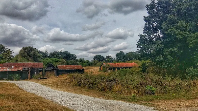
A 14 mile walk between Saxmundham and Darsham along the East Suffolk Line Walk.

It is Yoxford that gives us the name of this walk which is part of the East Suffolk Line Walks and this specific ramble extends the line walk to return to Leiston where a regular bus service connects the two ends. Yoxford sits on the banks of the River Yox surrounded by three country house parks; Sibton Park that contains large well stocked fishing lake; Grove Park situated in the village; and Rookery Park on the Leiston road. This has earned Yoxford the name of the 'Garden of Suffolk'. The whole route of this walk is a pleasant amble through the rural fields of Suffolk with a return journey through the pretty country lanes following the Minsmere river through to Middleton, Theberton and finally Leiston.

Leiston to Middleton Mill Circular Walk

A walk across the coastal Suffolk countryside to the village of Middleton

A splendid way to spend a days walking, cross fields and countryside and heading to the location of the Middleton Watermill. There are churches to stop and investigate on the way.

The Rather Curious Herring Festival 2011

An 8.8 mile circular walk through the Suffolk countryside to attend the 2011 Suffolk Herring Festival at Middleton.

I have been to music festivals and folk festivals and country fairs and even the novel barrel fair, but I can honestly say that I have never ever attended a Herring Festival until this walk. Held on the grounds of the Farm Shop in the village of Middleton this two day event features food and drink, exhibitions, music and games, competitions, and demonstrations of herring preservation and preparation.

Walk Statistics

  • Start location: Leiston 
  • Distance:   miles (  km)
  • Total Gain:   ft (  metre)
  • Total Descent:   ft (  metre)
  • Min Height:   ft (  metre)
  • Max Height:   ft (  metre)
  • Est. Walk Time:  
  • Walk type: Circular
  • Walk Grade: Easy
  • Terrain:

Maps

The following maps and services can assist in navigating this route. There are links to printed maps and links to downloadable GPX route data for importing into navigational software and apps.

 
Walk Notes

There are more direct routes to Middleton from Leiston but for this expedition we decided to amble out across to the Cakes and Ale campsite. This uses footpaths that I certainly haven't walked before which provided added spice and discovery to the days events. Return was along the Minsmere River to Eastbridge, then following the Sandlings trail back to Leiston.

As expected the festival was truly unique and I am glad to say that it seemed to be well attended, with a makeshift car park set up in the field across the road from the Farm Shop. Although there was no draught ales on offer at the bar, they did have a bottled ale, brewed by the Brandon Brewery for the occasion and named Silver Darling which was a light and refreshing bitter. When we arrived the mini opera Peter Herring was being played out. It was difficult to hear but was nonetheless entertaining, centered around the infamous Aldeburgh sculpture which was dressed up as a crab centre-stage. Lunch was a freshly filleted and BBQd herring in a crusty french stick served with peppers which was very tasty. For those who don't like herrings there was a baked potato stall, though quite why anyone who does not like herrings attends an herring festival is pretty much beyond me! Before leaving we caught some music and singing about herrings and the sea, heard some poetry about the sea and herrings, had a look around the herring sculptures and Farm Shop where the herring beer and herrings were on sale. So, in conclusion, I was somewhat bemused by it all, but the festival is a totally unique event and I do hope that it continues to get better and better in years to come. I will certainly attend again and recommend this to any herring fancier! So if you have a fetish, or just want to attend something totally different then be there for the next festival in 2013.

Directions

A simple walk using existing footpaths, lanes and tracks

Head down Victory Road adjacent to the park in Leiston. Contiue along the footpath at the end of the road which eventually emerges at the church and out onto Waterloo Avenue. Turn left and follow the road out of town, beyond the cemetary until a terrace of houses on the right. A footpath on the leiston side of the terrace follows the field boundaries, across the railway, across a country lane, then directly across an open field to Fishers Farm. The path cuts through the hedge and onto the drive to the farm. Follow this down to the road, turn right and keep to the road until there is a junction on the left. Follow this road all the way through to the end junction, carry straight ahead across the field along a footpath into Theberton where it emerges onto the main road through the village. At the church turn right and follow the lane out of the village. Take the first turning on the left and take the footpath on the left, through the gap in the hedge and across the fields. This eventually comes out at Fenn Farm in Middleton. As it meets the road , turn right down through the village.

RETURN: continue through the village until it meets the river bridge. Take the footpath on the right which follows the river through to the Eastbrdge road. Turn right and follow the road through Eastbridge and continue until a track on the left, marked with the Sandlings waymarker, is found. Take this track through to the Sizewell road, where it emerges on a sharp bend. Continue straight ahead and down the hill. At the bottom of the hill a footpath on the right leads through to Valley Road in Leiston. Keep on Valley Road until junctions at Barclays Bank in the centre of town. Turn left up the hill and then turn right at the traffic lights onto Cross street which end where the walk began.

Pubs

Eastbridge Eels Foot View in OS Map | View in Google Map

Image of pub
Address
Eastbridge Eels Foot
Website

A curious name for a pub; some say it comes from a Heel's Foot, a cobblers implement, others will argue that it is named after the Eel's Boot, a type of woven reed basket used in Eel Fishing. A more fanciful explanation is that it is a derivation of Neale's Boot, named after a medieval priest who trapped the Devil in his boot and tossed him into the river. The Devil escaped disguised as an eel.

The pub is an Adnams establishment and regularly has three of their cask ales on tap, these usually being the Bitter, Broadside and a seasonal ale. The pub is popular with walkers and birdwatchers from nearby Minsmere bird Reserve.

Food and Bed and Breakfast accommodation is on offer and The Eels Foot is renowned for its long tradition of Folk Music which still continue on Thursday evenings with a jam session.

On the interior walls of the pub there is a curious painting of a medieval country feast. If you look closely you will see that some of the men are wearing rather large codpieces. The painting appears to be a corruption of 'The The Peasants Wedding Feast' by Pieter Bruegel. I gather that his son, Pieter the Younger would copy his fathers work and this could well be a humorous copy as the original has a completely different background and no cod-pieces. But then I am no art expert so this is purely conjecture. Nonetheless it is amusing!

Review (2011-10-15)

Although it was late afternoon by the time we arrived, this lovely village pub still had a few customers. Judging by their walking boots and waterproofs they were mostly walkers or twitchers. A pint of Adnams Bitter was refreshing, well kept as always at this pub. It still amuses me to look at the print featuring the large cod-pieces that adorns the wall.

Features

Herring FestivalView in OS Map | View in Google Map

A biennial event promoting interest in the the Suffolk herring industry

Suffolk has a long historical association with the herring and herring fisheries and although there is little demand for this locally caught fish today, the Suffolk Herring festival seeks to reverse this decline and help people rediscover the humble herring. Autumn was the traditional peak of the herring fisheries and this, the second festival, is timed to coincide with that time of the year.

The Festival is organized by Suffolk Herring Festival Community Interest Company to keep alive the heritage of the Suffolk herring fisheries and promote the use of herrings in present day cooking in both home and restaurants. A varied programme of events take place throughout each day of the two day event and include demonstrations of filleting, preparing and cooking the Humble Herring, singing with Bridget Cousins, Captain Haddocks knotty workshop, Withy and Net Making, BBQ and bar, a mini opera called Peter Herring, Acoustic Guitar with David Harvey, Sea songs from Richard Turner and Brian Barker and an assortment of poems of the sea.

Paul Richardson's Steel Sculptures, Middleton: View in OS Map | View in Google Map

Larger than life metal sculptures and charactatures

This is a real treat that makes walking so worthwhile. The footpath that crosses the fields from Theberton descends across a marsh before coming back up to Middleton where it joins the road by a cottage named Ambleside. This is the residence of Suffolk Sculptor Paul Richardson. He sculpts in metal and his house is surrounded by examples of his work which are larger than life caricatures which, to say the least, are impressive. No-one who walks past this house can escape their curiosity and take time out to look at these magnificent works of art. Other examples of his work can be seen on peering out of the top of an Ipswich public convenience and in Ipswich Hospital.

References

Mother Lumpkins HoleView in OS Map | View in Google Map

A piece of local folklore

Mother Lumpkin's Hole is a deep hollow in the bed of the Minsmere River near Rackford Bridge. According to locals this teems with carp as big as pigs, and pike the size of baby sharks. Local legend states that a complete wagon and horses is said to have vanished into the hole and even today folk are warned away from this place for fear of being dragged in by the baleful monster that lives there.

Route Validation Cards

Validation Date - 2011-10-15

  • Time of Walk: 10:30 to 16:00
  • Validators: Griffmonster, Kat
  • Weather Conditions: Lovely sunny autumn day
  • Notes: Initial route undertaken
Summary of Document Changes

Last Updated: 2026-01-15

  • 2021-03-17 : Update website improvements and removal of ViewRanger reliance
  • 2021-12-01 : Removal of ViewRanger links due to its imminent demise
  • 2026-01-12 : >Major website update with all walks recast to the new format

Leiston to Reckford Circular Walk Summary

Salt marsh

A circular walk encapsulating Leiston Airfield, Theberton woods and the Minsmere River

A walk that encapsulates the varied landscape of the East Suffolk are. There is history, there is ancient woodland and a wander along the river. An ideal escape to potter around the route and a glorious summers day.

The Aftermath of the 2013 Storm Surge Dunwich to Walberswick

Flattened dunes by the Northern Sea Wall to Minsmere

A 10 mile circular walk to witness the damage caused by the 2013 Storm Surge

The 2013 Storm Surge proved to be the highest tide in 60 years. Although much of the flooding had recede the evidence remained of where the waters reached. Viewing the changes in coastline shows just how vulnerable this stretch of the Suffolk coast really is, especially in view of the fact that such storms appear to be increasing in frequency. The walk returns through the heath and forest via Dunwich Heath and Eastbridge where the results of Octobers St Jude storm are evident from the many fallen trees.

In Search of Sizewell Chapel

Broom Covert

A 10 mile walk following the southern side of the parish boundary of Leiston in Suffolk

This walk follows the route of a 17th century perambulation around the southern side of the Leiston Parish boundary. The walk uses the ancient track down to Sizewell and continues down to Thorpe before turning inland to follow the River Hundred through to Cold Fair Green. The details are contained in two articles, this being the first, focusing on the medieval history of Sizewell.

An Amazing Adventure to Westleton Barrel Fair 2011 (Diversion in Place)

Barrel Race

A simple 11 mile walk across the Suffolk heaths and woodland from Leiston to attend the annual Westleton Barrel Fair.

For the second year on the trot we made our way through the lanes, tracks and footpaths to experience the unique adventures of Westleton Barrel Fair. This year there was the usual barrel races across the village green, open to residents and all-comers, together with straight sprints and sack races providing a full days entertainment in the August sunshine. Music was provided on the outdoor stage from the Bruisyard Light Orchestra performing a mixture of blues and pop cover versions in their unique style, together with performances by Rumburgh Morris Men. Other attractions included Punch and Judy shows, Donkey rides, Owls and exotic creatures on display, Coconut Shy, hog roast and various stalls offering local crafts. Adnams ales were available from the White Horse pub and their outside bar by the duck pond though unfortunately the Crown beer tent wasn't here this year so for guest ales we had to resort to wandering down to the Crown. An excellent day out and well worth the walk!

The Aftermath of the 2013 Storm Surge at Minsmere

Flattened dunes by the Northern Sea Wall to Minsmere

A 10 mile circular walk to witness the damage caused by the 2013 Storm Surge

The 2013 Storm Surge proved to be the highest tide in 60 years. Although much of the flooding had recede the evidence remained of where the waters reached. Viewing the changes in coastline shows just how vulnerable this stretch of the Suffolk coast really is, especially in view of the fact that such storms appear to be increasing in frequency. The walk returns through the heath and forest via Dunwich Heath and Eastbridge where the results of Octobers St Jude storm are evident from the many fallen trees.

A Walk around Suffolk's Minsmere Bird Reserve

Minsmere sluice

A 10 mile circular walk through the Suffolk Coastal Area of Outstanding Natural Beauty taking in Sizewell and the Minsmere Bird Reserve

One does not have to have an enthusiasm for ornithology to enjoy this walk. The natural surroundings of marshland and heathland are enough to inspire everyone and there is a lot of associated history along this route which dates back to the 12th century when Leiston Abbey once occupied an island in the marshes. Note that charges apply to the Minsmere section.

An Amazing Adventure to Westleton Barrel Fair 2012 (Diversion in Place)

Barrel Race

A simple 11 mile walk across the Suffolk heaths and woodland from Leiston to attend the annual Westleton Barrel Fair.

Despite a brief thunderstorm, a fantastic Summers day was had at the Westleton Barrel Fair 2012 living up to its expectations with all the usual fun and merriment. This years event featured music from Westleton's Doc Cox and Leiston's Random Blues Company, morris dancing from the Rumburgh Morris Dancers, outside bars from the White Horse and the Westleton Crown and, of course, the ever popular, chaotic, breath-taking and entertaining barrel races. This is a unique annual Suffolk event and well worth taking the time out to visit.

The Wensum Way - Dereham to Lenwade

River Wensum near Bylaugh

A 13 mile walk through the Norfolk countryside following the Wensum Way

Opened in 2012, the Wensum Way was the connecting link between the Nar Valley Way and The Marriott's Way to enable a Cross Norfolk Trail from Kings Lynn to Great Yarmouth. The name of the trail is taken from the River Wensum which it follows from Swanton Morley through to Lenwade. This is a picturesque ramble through the Norfolk countryside.

diversity_3

Popular Walks