Route details, maps, pubs, features, local history and folklore for a wide variety of walks focusing primarily on Norfolk and Suffolk

Walks
Showing posts sorted by relevance for query Brancaster. Sort by date Show all posts

Wednesday, 18 December 2019

Norfolk Coast Path - Burnham Overy Staithe to Brancaster

Brancaster Staithe Quay

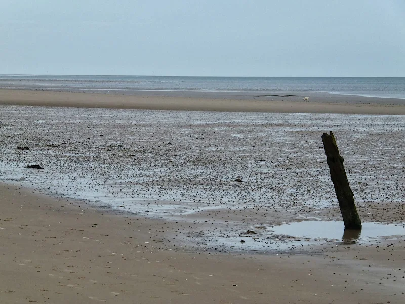
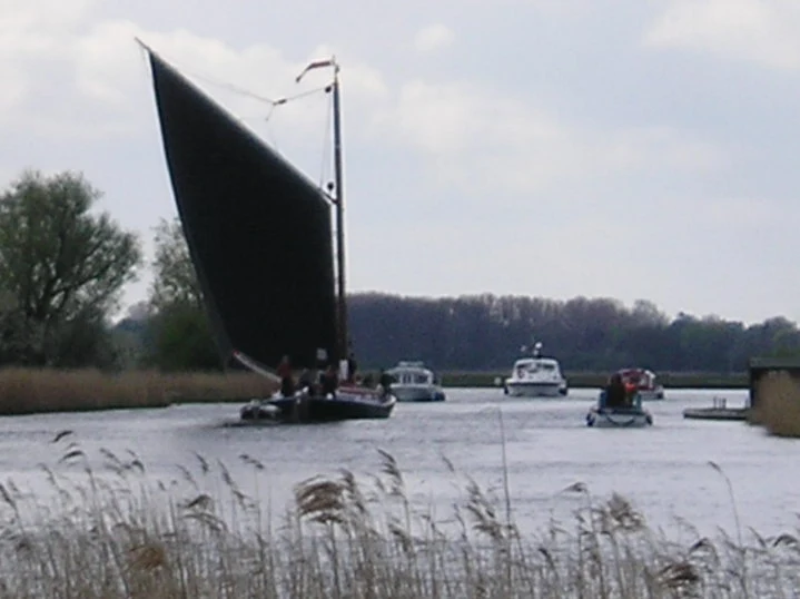
A 6 mile walk following the North Norfolk Coast Path between Burnham Overy Staithe to Brancaster

Wide open areas of marshland provide an enticing setting for this easy walk. Sailing boats, marsh, a tidal pool and the site of a Roman fort provide plenty of interest, together with three pubs, what more could one ask for of an afternoons stroll.

Tuesday, 17 December 2019

A Walk to Brancaster Beach

Brancaster Beach

A 3 mile walk out to Brancaster Beach returning across the marsh to Titchwell

Although not included in the official Norfolk Coast Path route, this simple walk is a well worth excursion to witness the expanse of sand and dune as well as a petrified forest and an old wreck. Always be mindful of tide conditions and particularly do not attempt to get across to the wreck which lies across the Harbour channel.

Thursday, 24 February 2022

Norfolk Coast Path - Heacham to Brancaster

A walk of beach, prom, dunes and marsh. A thoroughly varied landscape all told

From the cliffs of Hunstanton to the marshes of Thornham, this walk gives a variety of scenery. The Norfolk Coast Path is an excellent way to explore this part of the British Coast and what better way to start than at the westerly end. Even though Hunstanton is the official start, there is a promenade from Heacham for those wanting to go that little bit farther. There's long sandy beaches, there's multi-coloured cliffs, there's dunes, marshes, nature reserves and creeks and even a Norfolk hill from where where you can view across The Wash to Skegness on a clear day. With excellent public transport links, plenty of watering holes and accommodation, this is indeed a most thoroughly recommended walk.

Tuesday, 24 December 2019

Norfolk Coast Path - Wells-next-the-Sea to Burnham Overy Staithe

Burnham Overy Staithe

A 7 mile walk following the North Norfolk Coast Path between Wells-next-the-Sea and Burnham Overy Staithe

This amble includes some magnificent beach walking along the sands in front of the Holkham National Nature Reserve. Acres upon acres of golden sand when the tide is out with big skies and thousands upon thousands of razor shells which are washed up on the high tide mark. The walk ends at Burnham Overy Staithe, the quiet hamlet which is said to be where Nelson learnt to row and sail.

Sunday, 6 February 2022

Hunstanton to Wells Night Walk

Hunstanton to Wells Night Walk

A challenge walk along the Norfolk Coast between Hunstanton and Wells

An evening and night walk along the Norfolk Coast between Hunstanton and Wells. This coastline changes with the time of day and although many walk this during the daytime, the evening and night provides a whole new insight to the path as well as seeing very few folk about.

NOTE

This is a walk summary intended to provide the user with just the essential information in order to navigate the walk route. Fully detailed information notes, refreshment stops and walk features are not included in this. A full write up will be included in the near future.

Hunstanton to Wells Night Walk - Essential Information

Walk Statistics (calculated from GPX):

  • Start location: Hunstanton 
  • End location: Wells 
  • Distance:   miles (  km)
  • Total Gain:   ft (  metre)
  • Total Descent:   ft (  metre)
  • Min Height:   ft (  metre)
  • Max Height:   ft (  metre)
  • Walk Time:  
  • Walk Grade: Challenging
  • Terrain: Footpath

Maps:

The following maps and services can assist in navigating this route. There are links to printed maps and links to downloadable GPX route data for importing into navigational software and apps.


Route Verification Details

  • Date of Walk: 08/07/2017
  • Walk Time: 19:00:00 to 02:00:00
  • Walkers: Griff, Helen, Robert
  • Weather Conditions: Dark

Walk Notes

A word of warning on this walk, make sure you have arrangements when arriving in Wells as there is no public transport in the early hours of the morning and accommodation hosts probably would not appreciate being woken at that time of day. Food and water are essential as are torches. Despite a good moon, there are places which are shaded and without a torch a tree root can become lethal in the dark, these innate beings tend to try to catch you out.

Night walks were something I had undertaken in my earlier years and this was the first time in many many years I had undertaken such an experience. There is an exhilaration when beginning such a walk, setting out as the sun is heading downwards. Without doubt the experience is unique but there are challenges. One has to fight not only the effort of the miles but also ones body's inclination that it should be asleep. Havi9ng said this, the views and the experiences are well worth all that effort. To walk as the sun slowly s#descends to the horizon, to witness the coast in nothing more than silver moonlight, to dance through the darkness where you meet no-one and hear nothing but the call of an owl and the distant lapping of waves is unique.

On this instance we started early evening at Hunstanton after a meal at a local pub. The sunset was seen between Thornham and Brancaster. Complete darkness was experience through the woods between Holkham and Wells. We had set quite a pace on this and ended at Wells at 2am. Allow more time for a more sedate walk. Prior arrangements had been made to be picked up.

Summary of Document Changes

Last Updated: 2022-02-06

2022-02-06 : Initial publication

Images

Friday, 1 February 2019

Weavers Way - Potter Heigham to Great Yarmouth

A wherry heads down the river Thurne

A 20 mile walk through the Norfolk Broads following the rivers Thurne and Bure from Potter Heigham to Great Yarmouth

A walk that follows the rivers Thurne and Bure down to the town on Acle. There is then some challenging navigation across Halvergate marshes to end up walking along the banks of Breydon Water into great Yarmouth. This really is the epitome of what everyone imagines of the Norfolk Broads. Broad open skies and large open flat landscapes.

Wednesday, 18 December 2019

Inland Walk between Cley and Blakeney

View from Wiveton Downs

A 6 mile walk taking in the Wiveton Downs as an alternative to the coastal route between Cley and Blakeney

An alternative route to the Norfolk Coast Path between Cley and Blakeney taking in the high ground across Wiveton Downs. Spectacular views of the coastline can be had from this area and the route also includes the Shell Museum at Glandford and the dominating church at Cley

Indexes and Info

East Suffolk PRoW Access

The Public Rights of Way (PRoW) within the Suffolk Coastal area between Aldeburgh and Southwold are subject to being blocked up and diverted due to the extensive industrial projects that are currently taking place in the area including the Sizewell C development and various wind farm projects. A PRoW Access page has been written to detail known issues in the area

Walk Summaries

Latest walk summaries are basic information sheets for walks that have yet to be fully documented. These provide links to maps, public transport and walks stats, although detailed notes and features are not included.

Latest Walk Summaries

Featured Walk

In Search of Sizewell Chapel

A 10 mile walk following the southern side of the parish boundary of Leiston in Suffolk This walk follows the route of a 17th century peram...

What is GPX

All you need to know about GPX, electronic mapping and how to use modern apps and mobile devices as navigation devices

Popular Walks

Diary of a Suffolk Common

The ramblings and musing of the Griffmonster