Weavers Way - Potter Heigham to Great Yarmouth
Friday, 1 February 2019
|
No comments
|
![]()
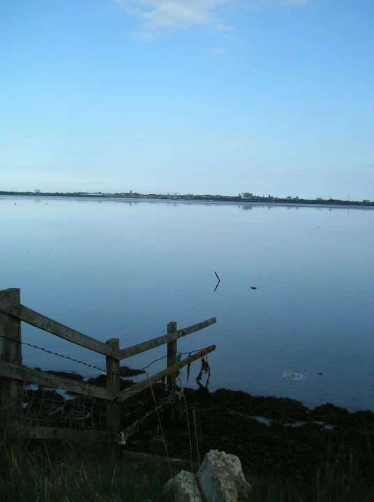
A 20 mile walk through the Norfolk Broads following the rivers Thurne and Bure from Potter Heigham to Great Yarmouth
A walk that follows the rivers Thurne and Bure down to the town on Acle. There is then some challenging navigation across Halvergate marshes to end up walking along the banks of Breydon Water into great Yarmouth. This really is the epitome of what everyone imagines of the Norfolk Broads. Broad open skies and large open flat landscapes.

Walk Statistics
- Start location: Potter Heigham
- End location: Great Yarmouth
- Distance: miles ( km)
- Total Gain: ft ( metre)
- Total Descent: ft ( metre)
- Min Height: ft ( metre)
- Max Height: ft ( metre)
- Est. Walk Time:
- Walk type: Linear
- Walk Grade: Firm hard riverbanks with some footpaths and country lanes
- Terrain: Footpaths, country lanes
- Obstacles: The section across Halvergate marshes is not clearly waymarked and an OS map, a preferably a GPS app or device should be used for navigation

Maps
The following maps and services can assist in navigating this route. There are links to printed maps and links to downloadable GPX route data for importing into navigational software and apps.
- Ordnance Survey Explorer Map
- OS Explorer 251 - Norfolk Coast Central
- GPX Route File
Accommodation
Woodhill Park CampsiteView in OS Map | View in Google Map
- Website
- https://www.woodhill-park.com/
- Description
- Located on the clifftops at East Runton, half way between Sheringham and Cromer, this highly recommended touring site is ideal for exploring North Norfolk with public transport available to many destinations from the entrance to the site.
Walk Notes
This specific walk was undertaken on an early spring day with a perfect blue sky and a whole lot of sunshine. This really does help to bring out the beauty of the broads rivers that had many pleasure craft passing along the route. The navigation is easy following the river banks with a few diversions away that are well marked.
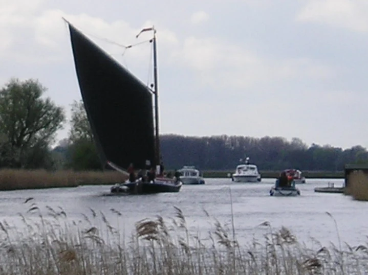
If one is lucky, as on this occasion, then you may catch a glimpse of a wherry in sail, one of the traditional working boats that plied their trade along these watercourses in days gone by. Once upon a time there was over 300 of these sailing vessels carrying up to 30 tons of goods each. There a handful of survivors that have been lovingly restored including the Albion which was heading down stream on the Thurne a hundred yards ahead of our steady pace. A mighty fine sight to witness. The craft left us as it navigate onto the upstream River Bure at Thurne.
At Acle the trail leaves the river to cut across country to Halvergate and then across the marshes to Breydon Water, the confluence point of the rivers Waveney and Yare. The marshes are a challenge to navigate with nothing but an OS map. The completely flat featureless landscape is interspersed with dykes and ditches and one has to choose the route carefully to get across each channel. In such situations GPS navigation certainly would prove it worth.
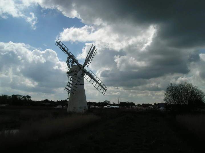
The trail meets Breydon Water at the hamlet of Berney Arms. This remote location is nothing more than a farmhouse, a windmill, one of the remotest railway stations in England, and up until 2015 a pub of the same name. This area really is the epitome of stereotypical Norfolk Broads with wide expanses of water, huge areas of flat marsh and the widest biggest skies that anyone could ever see. One cannot ever fail to be impressed. Well maybe in the puring rain with a biting wind sweeping across the marsh it may not be the best of places to stand, but in the glorious sunshine and under the deep blue skies one can only take time out and admire and then continue ones journey, being nothing more than pins slowly moving across the open landscape.
Directions
The Weavers Way is a waymarked route across Norfolk
The path leaves Potter Heigham on the southern side of the river Thurne and passes under the bridge. Keep to the river bank until it meets Thurne Staithe where it follows the Staithe to the Lion pub. From Thurne it follows the lane behind the village and then across footpaths to the church and continues across the fields until it meets South Oby Dyke and rejoins the river path. At Acle follow the waymarkers which uses footpaths and country lanes down to Halvergate Marshes. Navigation is difficult across the marshes due to the flat open landscape that is interspersed with many dykes and ditches and one needs to find the relevant flat boarded crossing points. There are waymarkers but one needs to determine the exact direction from each crossing. This can be done using an OS map but a GPS device or app is a lot more reliable method. Once at Breydon water the trail follows the river banks into Great Yarmouth.
Pubs
The Lion Inn, Thurne View in OS Map | View in Google Map
- Address
- The Street , Thurne
- Website
- https://www.thelionatthurne.com/
There is an amusement arcade and there is a large garden all catering for the families that visit this hostelry whilst cruising the Norfolk Broads. Being at the head of Thurne Dyke it is obviously a popular to moor overnight. In 2018 the pub was bought by the team who own the White Horse at Neatishead and have transformed the place. A large number of craft ales are now on offer.
Thurne, quiet when we visited but then it was early. Rewarding pint of Wherry.
Acle Bridge Inn, Acle View in OS Map | View in Google Map
- Address
- Old Road, Acle
- Website
- https://www.aclebridge.co.uk/
A popular family run pub on the banks of the River Bure adjacent to the Acle bridge. Plenty of mooring space.
an interesting and busy food pub at the side of Acle Bridge. It was very busy when we visited with a lot of boats moored alongside
Mariners Tavern, Great Yarmouth View in OS Map | View in Google Map
- Address
- Howard St, Great Yarmouth
- Website
- https://www.facebook.com/marinerstavern/
Small unassuming pub that is very much an old traditional busy local. A great selection of ales are always on offer primarily from small local breweries. An annual beer festival is held each September.
we had luckily been informed of this pub prior to our visit otherwise we probably would have frequested it. Although it looked a busy backstreet town pub that at first appeared a little intimidating, you enter to find a mighty fine selection of ales, including local breweries. Well worth hunting out, it is located on Howard Street which runs parallel to the quay. Just walk through one of the alleyways by the bridge.
Features
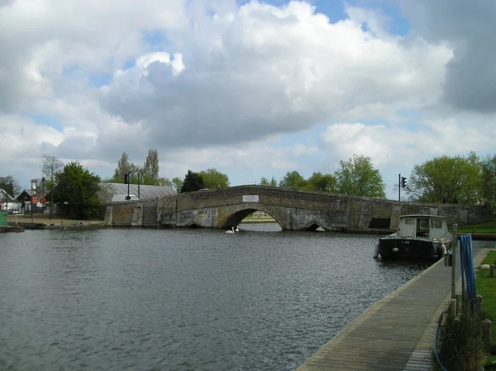
Potter Heigham Bridge GhostView in OS Map | View in Google Map
In the 18th century Lady Carew and her daughter Evelyn swore away their souls in return for a love potion to ensnare the eligible bachelor Sir Godfrey Haslitt. The love potion works and Evelyn and Haslitt are married in 1742. However,on the night of their nuptial blessing a phantom coach appears - driven by skeletons and takes the bride away. The coach bursts into flames as it crosses Potter Heigham bridge. It is said that on the anniversary of that fateful day, the 31st May, any locals foolish enough to be in the vicinity of Potter Heigham Bridge at midnight will hear the sound of horse’s hooves and the scrunch of wheels on the road. As the skins on their scalps tighten and rivers of ice course down their spine, a fiery coach comes into view careering at a great speed. It then hits the bridge and plunges into the water of the river below before vanishing.
Acle BridgeView in OS Map | View in Google Map
Acle Bridge is the setting of a famous ghost story, which tells of a pool of blood appearing on the bridge every 7th April. The story relates to a local businessman, called John Burge, who cheated his customers, beat his wife and starved his children. One day, in yet another fit of rage, John beat his wife to death. At his trial, he bribed the local doctor and was acquitted of murder. However, his wife's brother knew the real story and on the 7th April he took revenge by cutting Burge's throat from ear to ear on Acle bridge. The story then took a twist, when an innocent local man, Jack Ketch was accused, convicted and then hanged for John Burge's murder. Some time later, the brother returned and was horrified to learn of the innocent man's death. On the anniversary of his revenge murder of John Burge, the brother visited Acle Bridge to reflect on his actions. As he peered into the water, legend tells of a horrendous twisted figure appearing out of the mist. The next morning the brother was found dead in a large pool of blood on the bridge, his throat cut from side to side. Whether it is the blood of John Burge or his wife's brother, that appears every April 7th is unclear!
Image Gallery
Route Validation Cards
Validation Date - 2010-04-30
- Time of Walk: 10:00 to 18:00
- Validators: Griffmonster, Kat
- Weather Conditions: Blue skies, cool
- Notes: Initial route undertaken
Summary of Document Changes
Last Updated: 2026-04-20
- 2010-04-30 : Initial publication
- 2019-02-01 : Updated to consistent format
- 2021-03-17 : Update website improvements and removal of ViewRanger reliance
- 2021-12-01 : Removal of ViewRanger links due to its imminent demise
- 2026-01-12 : Major website update with all walks recast to the new format


0 comments:
Post a Comment