Route: From the north side of St Osyth creek a footpath leads out along the Creek then up to the main road. A little road walking is needed before a footpath can be taken back down to the creek and into Brightlingsea. Walk directly through the town to the seafront, from here a track following the former Brightlingsea railway line leads up to Alresford Creek. Although there is a ford across the creek marked on the OS map, it certainly isn't passable with many references in books and on the web attesting to there being 4-5ft of mud that you will inevitable sink into. So an excursion via Brightlingsea Hall is needed for the final stage along the old railway into Wivenhoe.
Pub: Kings Head, Brightlingsea: a nice enough looking building but unfortunately a Greene King house. It wasn't until after completing this section that I reread the chapter in Peter Catons Essex Walks where he mentioned the Railway Tavern being a microbrewery. We walked past this after visiting the Kings Head.. If only I had paid more attention to that chapter. If only. Never mind, next time.
Pub: Rose and Crown, Wivenhoe: a lovely old quayside pub that had Ridleys Boondoggler on their selection of ales, a very fine pint of ale and a very fine name as well.
Walk Feature: Batemans Tower, Brightlingsea: this is a Victorian folly built in 1883 by John Bateman for his daughter to recuperate from consumption. During The Second World War the original roof of the folly was removed so that the tower could be used as an observation post by the Royal Observer Corps. In 2005, a restoration project funded by The Heritage Lottery Fund took place to restore the tower to its original condition, including the fitting of a replica of the original roof, refurbishing the interior of the tower and also painting the outside. As we walked past the tower looked distinctly on the wonk!
Walk Feature: Wivenhoe and Brightlingsea railway: the path follows the old trackbed to Wivenhoe. Unfortunately the old swing bridge across Alresford Creek has long gone which facilitates the need to walk around the creek.
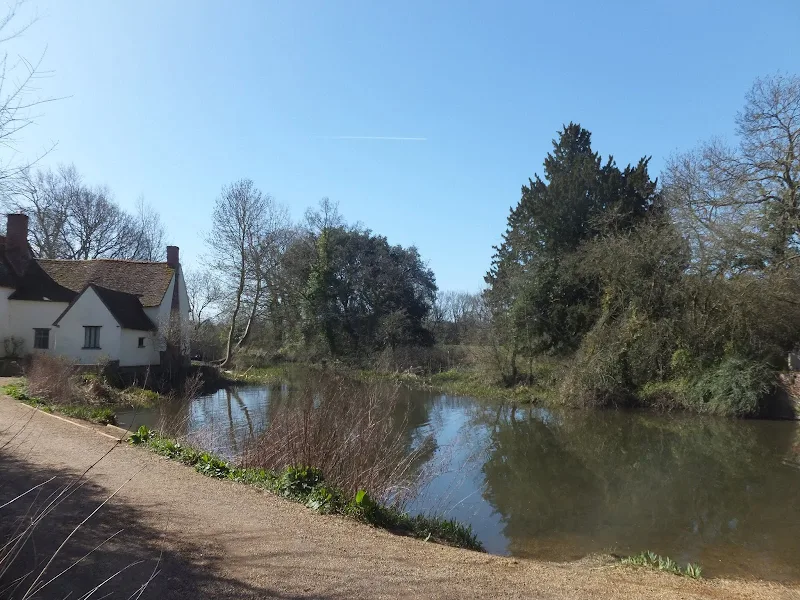
Walk Feature: Thorrington Tide Mill: a picturesque timber framed mill built in 1831.
Notes: Care should be taken as you walk down the footpath from St Osyth as it is easy to just carry on alongside the creek until the path becomes increasingly marshy - the correct route is through a hedge and up to the nature reserve. Here we were informed by some chap who had parked on the track to make sure that we kept to the footpath which is fenced off from the track as the landowner doesn't like people walking across his land. This appears to be a common problem in Essex which was mentioned in passing on numerous occasions. Another mistake was to take the roughly paved track off the main road adjacent to where the track came out, as there was no pavement along the main road - this track leads to nowhere and there is a fence that separates it from the road meaning that we had to retrace our steps. Altogether though the walk was a real treat with a variation of terrain. A most adventurous day by all means, seeing follies and creeks and industrial heritage and then arriving in the modernised waterfront at Wivenhoe which is in keeping with the area.
Accommodation: Grange Farm Camp Site, Thorpe-le-Soken - an excellent and recommended site with basic facilities and friendly staff. It is close to the railway station and has a resident owl! As mentioned at the head of this particular blog, the night was pretty stormy but the camp site appears to sit in a sheltered hollow which certainly kept us out of the worse of the wind and although we had some rather deep puddles in the main tent the sleeping compartments remained relatively dry.
Transport: First Group bus service 4 from Thorpe-le-Soken to Clacton, First Group bus service 17 to St Osyth. Return train from Wivenhoe to Thorpe-le-Soken. I know you may think I am exaggerating or seeing things or that it was merely a figment of my twisted and confused mind but we bought a ticket on Wivenhoe station from A TICKET OFFICE with a TICKET OFFICE ATTENDANT. I am sure many people will think I have lost my mind on seeing such but it is true I tell you!