Weavers Way - Potter Heigham to North Walsham
Friday, 21 December 2018
|
No comments
|
![]()
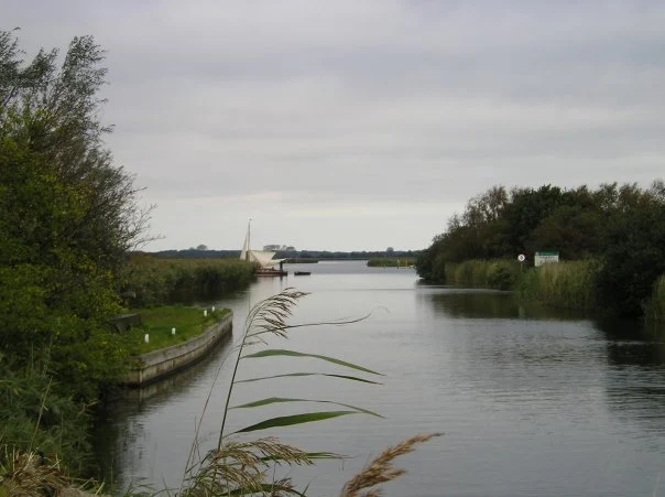
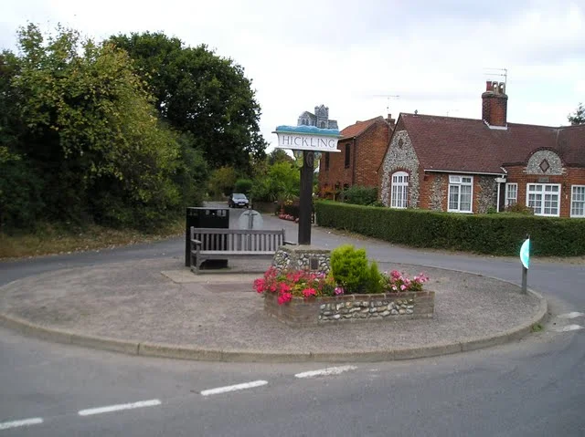
A 20 mile walk along the Weavers Way between Potter Heigham and North Walsham
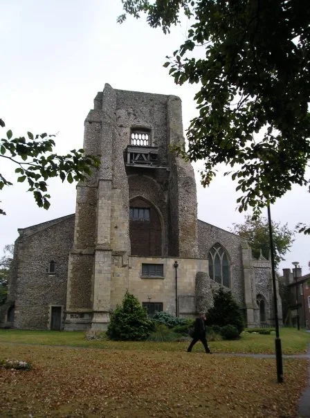
The Weavers Way winds its way along the River Thurne and then up Candle Dyke to Hickling Broad. From here it cuts across country to Stalham where it picks up the old railway trackbed through to just south of North Walsham. It is a full days walk with plenty of refreshment stops en route and plenty to see and do along the way.

Walk Statistics
- Start location: Potter Heigham
- End location: North Walsham
- Distance: miles ( km)
- Total Gain: ft ( metre)
- Total Descent: ft ( metre)
- Min Height: ft ( metre)
- Max Height: ft ( metre)
- Est. Walk Time:
- Walk type: Linear
- Walk Grade: Easy but a lot of hard surfaces!
- Terrain:

Maps
The following maps and services can assist in navigating this route. There are links to printed maps and links to downloadable GPX route data for importing into navigational software and apps.
- Ordnance Survey Explorer Map
- OS Explorer OL40 - The Broads
- GPX Route File
Transport
Sanders Coaches - bus Service
- Service Details
- 6 - Sanders Coaches Service 6 Nth Walsham - Stalham - Potter Heigham - Great Yarmouth
- Timetable
- Sanders Coaches Website
Walk Notes
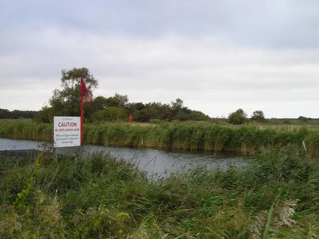
The first section of this walk is all rivers side rambles, firstly along the banks of the River Thurne and then alongside Candle Dyke to Hickling Broad. There is no getting lost on this section and the defence banks guide ones way forward. This is real broadland where time goes slow, boats drift by with all the time in the world and even the wildlife appears to have no urgency in their daily rituals. One can only witness these scene by boat or foot. A magical land.
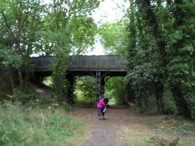
Just beyond Hickling, by Sutton Mill is an underpass. One usually associates such constructions with urban sprawl with expectations of graffiti at best and muggers at the worse. However, here we found a rural underpass by the side of the mill. There was no graffiti, there was no assailant lurking at the far reaches with a kosh ready to relieve us of any worthy possession. In fact, this underpass was a delight to walk through!
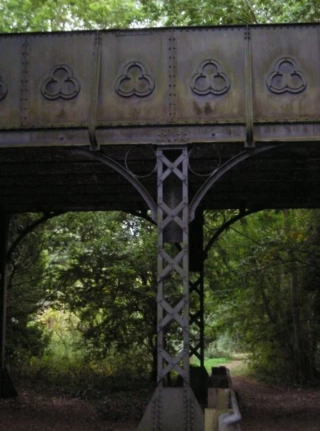
The section from Stalham to just before North Walsham follows the old M&GNR trackbed. This was a very pleasurable walk interspersed with old railway bridges, platforms and trackside apparatus. Most enjoyable.
We arrived in North Walsham as the light was fading and rush hour had started with the traffic full of headlights. It was a worthy walk though hard on the feet.
Directions
The Weavers Ways is well waymarked so it is simply a case of following them. The start is on the north side of the river at Potter Heigham, this leads behind the numerous river shacks that line the banks of the Thurne. At Candle Dyke the path turns northwards and you head up towards Hickling Broad. There is a little road walking to get into Hickling but this is along country lanes which werre not too busy. From Hickling the Weavers Way cuts across country to Stalham. There was no clear indication of the route out of Hickling but with an OS map it wasnt too difficult to pick it up. Once again most of the walk to Stalham is along country lanes with a path across the fields at Sutton Mill. After walking the length of Stalham the path enters the old Great Yarmouth to North Walsham railway track which will take you through to Bengate, just south of North Walsham. Here the main road is built on the old trackbed so the walker has to use country lanes and footpaths up through White Horse Common and into North Walsham.
Pubs
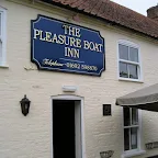
The Pleasure Boat Inn, Hickling View in OS Map | View in Google Map
- Address
- Staithe Road, Hickling
- Website
- www.thepleasureboat.com/
The Pleasure Boat Inn is situated right next to a point on the northern edge of Hickling Broad where the boats of holidaymakers tie up. The main part of the inn dates back to the 17th century with later additions. Food, including Sunday lunches, is served in a restaurant area overlooking the water. The pub offers several real ales, with guests ales from smaller local breweries.
The pub was empty of custom when we arrived, but then it was late September. No complaints about the Woodfordes Wherry. The barman seemed quite surprised to find that we were walking the Weavers Way - maybe not many people do this walk which if true is a shame as it is so easy to do!
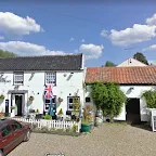
The Greyhound, Hickling View in OS Map | View in Google Map
- Address
- The Green, Hickling
- Website
- https://camra.org.uk/pubs/greyhound-inn-hickling-189476
This 17th century Inn offers both bar snacks and restaurant menus with ingrdients all locally sourced where possible. Ales include Woodfordes.
Traditional friendly old pub where you can sit around the bar and sup on a pint of Wherry and admire the roaring fire. Like it!
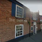
The Swan, Stalham View in OS Map | View in Google Map
- Address
- High Street, Stalham
- Website
- https://www.theswaninnstalham.com/
The pub dates from the 18th century and has endured an interesting history. A group known as 'The Stalham Savages' are said to have gnawed the paint off the door during a riot. It is uncertain when this amazing feat took place. Today the pub is an Adnams house.
Rather basic locals town pub. The usual Adnams ales and we did have a game of darts.
Features
Hickling BroadView in OS Map | View in Google Map
Hickling Broad is a National Nature Reserve established by English Nature and in the care of the Norfolk Wildlife Trust. It is also part of the Upper Thurne Broads and Marshes Site of Special Scientific Interest. In the 1990s, over £650,000 was spent on restoring the reserve, and invasive plants are kept under control by grazing hardy breeds of cattle, sheep and ponies from Eastern Europe. Water levels are managed, and the reed and sedge beds are regularly mown to encourage wildlife. It is the largest expanses of open water in East Anglia although the navigation channel is only 1.5 m deep, with much of the broad being shallower. It has the largest reed-bed in England and supports rare waterweeds such as the holly-leaved naiad and three rare species of stonewort. Amongst the rare insects is the Swallowtail Butterfly which feeds on milk-parsley, the Norfolk hawker Aeshna isosceles and emperor dragonfly. Birds that visit the reserve during the winter include cranes, goldeneyes, shovelers and teals, while bitterns, marsh harriers, pochards, water rails and Cetti’s warblers stay for most of the year.
There is an interesting ghost story about the Broad which concerns a drummer boy from Potter Heigham. In the winter before the battle of Waterloo, the boy came home on leave from the army and fell in love with a girl from the village. Unfortunately the girl's father refused to accept a soldier as a son-in-law and so the couple were forced to meet in secret at Swim Coots on Hickling Broad. Every February the drummer boy would skate across the Broad to meet his love - but one evening the ice gave way and he was drowned. Today, his ghost is said to haunt the Broad during the month of February to the accompaniment of ghostly drumming.
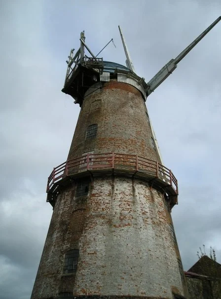
Sutton Corn MillView in OS Map | View in Google Map
Sutton mill was built in 1789 and is topped by a traditional Norfolk boat shaped cap. By 2005 it was the tallest remaining windmill in the UK. Unusually, it was built on the site of an earlier towermill that burnt down in 1789. On the sixth floor of the 9 storey building were 4 sets of stones, more than any other mill in the country. The mill suffered a serious fire in 1861 and was then hit by lightning on 4th July 1875 and again in 1940 when the sails were hit, causing a fire. The mill, which by this time had given up grinding corn and was exclusively producing animal feed, ceased to work from that time. In 1975, the mill was bought by Chris Nunn and has since been restored to become a museum in its own right, quite apart from the Broads Museum housed in the surrounding complex. The Broads Museum houses an incredible collection of artefacts from a variety of trades and collections including old domestic utensils, kitchen appliances, woodworking tools, razors, leather trades, soaps & cleaners, trade tricycles, veterinary &animal instruments, traps, historical tobacco products, large engines, marsh & water implements, early cameras, TV's and radios and a complete Victorian pharmacy.
Midland and Great Northern Joint RailwayView in OS Map | View in Google Map
The Great Yarmouth to North Walsham railway line originally opened in 1877 and was constructed and operated by the Great Yarmouth and Stalham Light Railway. In 1893 it was taken over by the Midland and Great Northern Joint Railway, and was affectionately known as the 'Muddle and Get Nowhere' to generations of passengers, enthusiasts, and other users. With the takeover it became part of the main line which ran from Peterborough to Great Yarmouth via South Lynn and Melton Constable. The line closed in 1959 but there are still artefacts to be seen along the old trackbed.
Image Gallery


Route Validation Cards
Validation Date - 2009-09-29
- Time of Walk: 10:00 to 17:30
- Validators: Griffmonster Kat
- Weather Conditions: Cool autumn day with sunny spells
- Notes: Initial route undertaken
Summary of Document Changes
Last Updated: 2026-04-20
- 2009-09-29 : Initial publication
- 2017-12-13 : general link updates, make https ready, add in pics
- 2018-12-21 : general link updates
- 2021-03-17 : Update website improvements and removal of ViewRanger reliance
- 2021-12-01 : Removal of ViewRanger links due to its imminent demise
- 2026-01-12 : Major website update with all walks recast to the new format


0 comments:
Post a Comment