Route details, maps, pubs, features, local history and folklore for a wide variety of walks focusing primarily on Norfolk and Suffolk

Devon Walks
Showing posts with label Devon. Show all posts

Tuesday 10 July 2018

Combe Martin to Lynmouth Walk Summary

Salt marsh

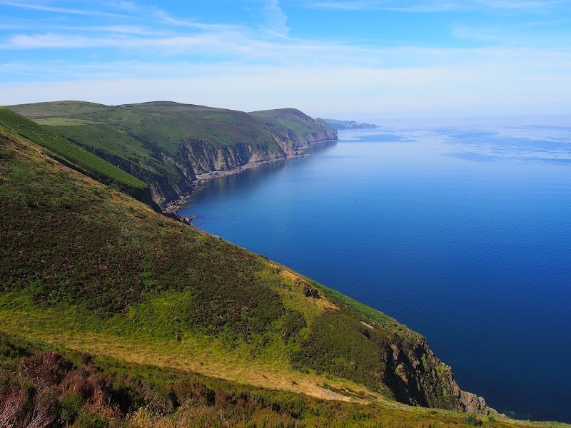
Strenuous walk from Combe Martin to Lynmouth passing over the highest point on the SWCP

A strenuous walk between Combe Martin and Lynmouth passing over Great Hangman which at 319m is the highest point on the SWCP. This specific route provides an alternative to the official SWCP path out of the Heddon Valley which does reduce the distance slightly. This does give an advantage if one needs to return to the start using public transport as there is only a limited bus survice back to Combe Martin which involves having to travel via Barnstaple.

Friday 6 July 2018

Hele Bay to Combe Martin Walk Summary

Salt marsh

Short Walk along the SWCP between Hele Bay near Ilfracombe and Combe Martin

This walk offers a few challenges but nothing untoward and is probably one of the best routes to introduce anyone to the SWCP. The views are outstanding and the numerous coves and small beaches tempting to spend a little more time in exploring. A very popular area with frequent transport links and plenty of refreshment options along the route.

Thursday 5 July 2018

Hele Bay to Braunton Walk Summary

Salt marsh

Extensive Walk along the SWCP between Hele Bay near Ilfracombe and Braunton

This route provides an alternative to the official SWCP whereby it short cuts the headland at Baggy Point and goes directly into Braunton omitting the section around Braunton Burrows. This achieves a sub 20 mile walk with bus access between Braunton and Ilfracombe. The cliffpath from Hele Bay to Woolacombe provides spectacular views and challenging walking whilst the sands of Woolacombe and Croyde make an easier terrain to navigate across.

Wednesday 4 July 2018

Saturday 16 June 2018

South West Coast Path - Westward Ho! to Barnstaple

Salt marsh

One of the few low level and flat walks on the SWCP, 12.5 miles between Westward Ho! to Barnstaple

A very easy walk that can be split into two if required. The first part navigates around Northam Burrows, the duned area that juts out into the Taw and Torridge estuary. A ferry at Appledore links across to Instow where the trail continues making use of the former Bideford and Barnstaple railway trackbed.

Walk Summaries

Latest walk summaries are basic information sheets for walks that have yet to be fully documented. These provide links to maps, public transport and walks stats, although detailed notes and features are not included.

Latest Walk Summaries

Featured Walk

In Search of Sizewell Chapel

A 10 mile walk following the southern side of the parish boundary of Leiston in Suffolk This walk follows the route of a 17th century peramb...

What is GPX

All you need to know about GPX, electronic mapping and how to use modern apps and mobile devices as navigation devices

Popular Walks

Maps