Route details, maps, pubs, features, local history and folklore for a wide variety of walks focusing primarily on Norfolk and Suffolk

Walks
Showing posts sorted by relevance for query Dunwich. Sort by date Show all posts

Tuesday, 7 January 2020

In Search of the Lost City of Dunwich

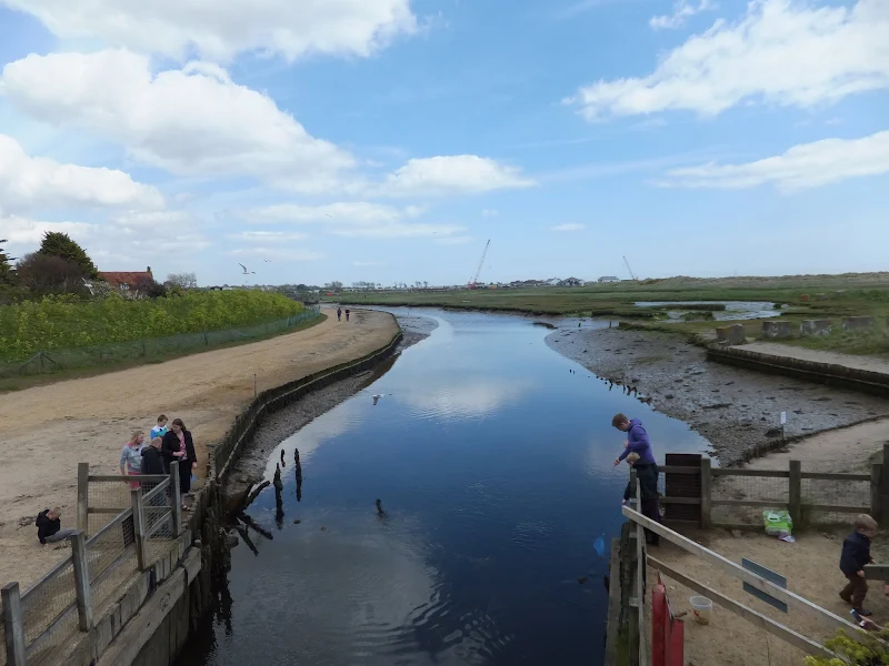
A circular walk between Leiston and DunwichThis walk uses the beach and the Sandlings Path to provide a days walk to Dunwich from Leiston via Sizewell. One should time this walk such that the beach is walked a couple of hours either side of low tide when there is a little sand to walk along. At other...

Friday, 29 November 2019

In search of the lost Suffolk village of Hethern

A 5 mile walk through Dunwich forest to the medieval site of the lost village of HethernDunwich forest is always a good place to walk and find peace amid the fora, fauna and wildlife. There are information boards that provide details of this ever changing world of nature but there is nothing about its...

Friday, 17 January 2014

The Aftermath of the 2013 Storm Surge Dunwich to Walberswick

A 8 mile beach walk to witness the damage caused by the 2013 Storm SurgeThe December 2013 Storm Surge caused widespread flooding of the marshes between Dunwich and Walberswick and along the Blyth estuary, closing the main A12 road at Blythburgh for three days. With most of the waters receded, this was...

Wednesday, 2 January 2019

A Trek Around Sole Bay

A 24 mile circular walk between Sizewell and Southwold along the Suffolk Coast Path and Sandlings Walk.Back in the 17th Century, Southwold was England's main fleet anchorage. Sole Bay (Sawolde Bay) was a bay centred on Southwold with Easton Ness to the North and Dunwich to the South. In May 1672 this...

Tuesday, 1 January 2019

Leiston to Westwood Marsh

A walk encompassing the Westwood Marshes footpath into a circular route from LeistonThe Westwood Marshes footpath is little gem of a path that links the Newdelight Walks with the Suffolk Coast Path through the Westwood marshes. The route for this walk uses this path as the ultimate destination from...

Monday, 17 December 2018

The Sandlings Walk

An overview of the Sandlings Walk, a 55 mile long distance path through the forests and heaths of East Suffolk The Sandlings is a 55 mile walk starting at Rushmere Heath on the eastern side of Ipswich with Southwold, passing through the remaining fragments of East Suffolks Sandling Heaths. The trail...

Thursday, 6 January 2022

The Sandlings Walk - Dunwich to Southwold

A 15 mile circular walk along the Sandlings footpath between Dunwich and Southwold, with an option of returning either via the beach or the Suffolk Coast Path through Dingle MarshesThis is the final stage of the Sandlings Walk from Ipswich to Southwold. Starting at Dunwich, it takes the trails through...

Monday, 7 January 2019

A Walk to the Dunwich Leper Chapel

A 14.25 mile circular walk between Leiston to DunwichA simple walk using the Suffolk Coast Path from Sizewell to Dunwich with a visit to the ruins of the 12th century Leper Chapel. The return uses the the footpath via Mount Pleasant to get onto the Sandlings Path across Dunwich Heath to return back...

Tuesday, 1 January 2019

Leiston to Walberswick Circular Walk

A 22 mile circular walk between Leiston and Walberswick incorporating sections of the Suffolk Coast Path and Sandlings Walk.This walk uses the beach at low tide to get from Sizewell to Walberswick, returning through Dunwich forest. Walberswick is said to be the most haunted place in Britain though...

Sunday, 9 February 2020

Suffolk Coast Path

An overview of the Suffolk Coast Path, a 60 mile long distance path following the coast of Suffolk A 60 mile long distance footpath from Felixstowe to Lowestoft in easy stages through some of the characteristic landscapes of the Suffolk Coast and Heaths Area of Outstanding Natural Beauty. The path also...

Thursday, 6 January 2022

Dunwich to Walberswick

A 13 mile Suffolk circular walk connecting Dunwich and WalberswickThis walk encapsulates coast, forest and marsh presenting a myriad of landscapes. Making use of both the Sandlings and Suffolk Coast Path, it is a simple and easily navigated wander to fill a days exploration...

Sunday, 22 December 2013

The Aftermath of the 2013 Storm Surge at Minsmere

A 10 mile circular walk to witness the damage caused by the 2013 Storm SurgeThe 2013 Storm Surge proved to be the highest tide in 60 years. Although much of the flooding had recede the evidence remained of where the waters reached. Viewing the changes in coastline shows just how vulnerable this stretch...

Wednesday, 2 January 2019

A Walk around Suffolk's Minsmere Bird Reserve

A 10 mile circular walk through the Suffolk Coastal Area of Outstanding Natural Beauty taking in Sizewell and the Minsmere Bird ReserveOne does not have to have an enthusiasm for ornithology to enjoy this walk. The natural surroundings of marshland and heathland are enough to inspire everyone and there...

Tuesday, 1 January 2013

Coastal Erosion at Thorpeness

A circular walk from Sizewell to Thorpeness along the Suffolk Coast PathIn recent years the Suffolk Coast Path has been rerouted in-land from Sizewell across the commons to Thorpeness due to coastal erosion. The old coast route can still be walked when the tide is right and there is always an escape...

Thursday, 28 November 2019

A Walk through the Woods on Kenton and Goose Hills

An easy 7 mile circular walk through the woodland around Sizewell on the Suffolk CoastSuffolk is not best known for its hills and Kenton Hill and Goose Hill probably would not be regarded as hills but for their name. However this wooded area offers an ever changing scenery throughout the year with the...

Sunday, 22 September 2019

In Search of Sizewell Chapel

A 10 mile walk following the southern side of the parish boundary of Leiston in Suffolk This walk follows the route of a 17th century perambulation around the southern side of the Leiston Parish boundary. The walk uses the ancient track down to Sizewell and continues down to Thorpe before turning inland...

Monday, 17 December 2018

Tales of Sundials, Witchcraft and Ghostly happenings in Saxmundham

A 2 mile circular walk around the Suffolk town of Saxmundham using the Town TrailA simple tour of Saxmundham that can be added onto the East Suffolk Line Walks or to while away a couple of hours on a lazy afternoon, including searching out the unique tombstone sundial in St Johns churchyard, and finding...

Tuesday, 17 December 2019

The Sandlings Walk - Bromeswell to Snape

A 16 mile walk along the Suffolk Sandlings Path between Bromeswell and Snape taking in Rendlesham and Tunstall forestsThe route leads across gorse covered heathland and through forest which typifies the modern landscape of the Sandlings. The forests are a modern development, set up with the founding...

Sunday, 10 December 2017

Southwold to Blythburgh along the former Southwold Railway

A linear walk along the former trackbed of the Southwold Railway to BlythburghThe Southwold Railway was a narrow gauge line that linked Halesworth and Southwold. This closed in 1929 but the track bed is still in existence to Blythburgh and makes an excellent walk. The White Hart pub offers a place for...

Thursday, 28 November 2019

A Walk to Suffolks Mystery Brampton Standing Stone

A 14 mile walk between Halesworth and Beccles along the East Suffolk Line PathThis waymarked route links the railway stations at Halesworth, Brampton and Beccles. Taking the train between these towns will provide an interesting glimpse of what is in store along the walk, including the rather curious...

Walk Summaries

Latest walk summaries are basic information sheets for walks that have yet to be fully documented. These provide links to maps, public transport and walks stats, although detailed notes and features are not included.

Latest Walk Summaries

Featured Walk

In Search of Sizewell Chapel

A 10 mile walk following the southern side of the parish boundary of Leiston in Suffolk This walk follows the route of a 17th century peramb...

What is GPX

All you need to know about GPX, electronic mapping and how to use modern apps and mobile devices as navigation devices

Popular Walks

Maps