Route details, maps, pubs, features, local history and folklore for a wide variety of walks focusing primarily on Norfolk and Suffolk

Walks
Showing posts sorted by relevance for query Snape. Sort by date Show all posts

Saturday, 15 December 2018

The Sandlings Walk - Knodishall to Snape

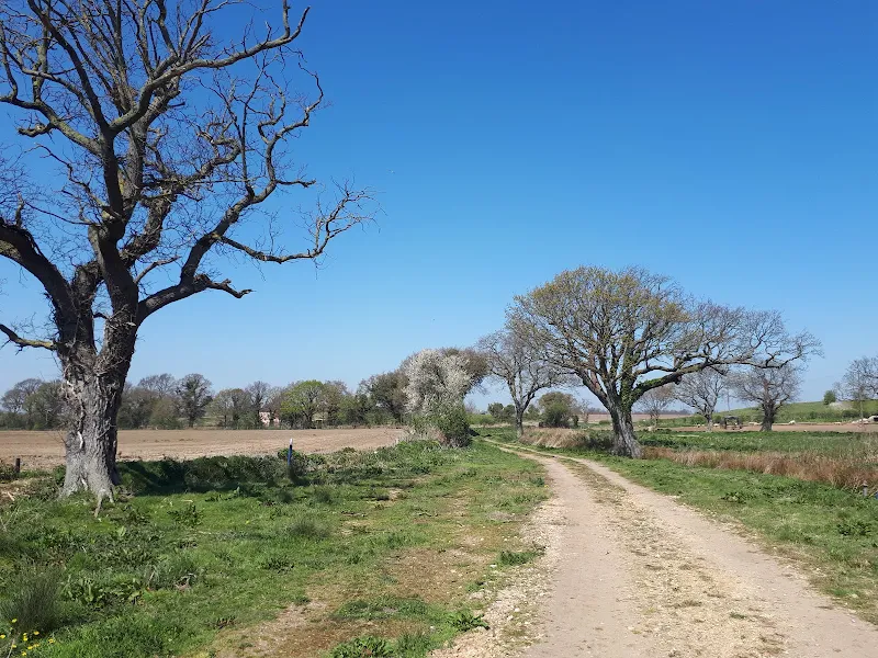
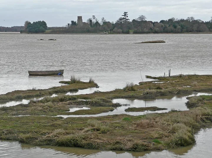
A 13 mile circular walk along the Sandlings Walk between Knodishall and SnapeWith limited public transport this walk offers a circular route to incorporate the Sandlings path from Knodishall to Snape. Starting and ending at nearby Leiston it incorporates The Sailors Path and the Suffolk Coast Path to...

Saturday, 11 May 2019

In Search of Polsborough Gate

A 9.5 mile walk following the old Snape Road to the Sailors PathThis walk links Leiston with the Sailors Path following the old traditional road that used to link the town with Snape. There is then an outstanding ramble across Black heath and Hazlewood marshes through to Aldeburgh where a regular bus...

Thursday, 3 January 2019

Tracks and lanes to Glemham

A 22 mile route that can be either walked or cycled through the Suffolk countryside around Snape, Blaxhall and Glenham A glorious route through the Suffolk countryside using a mixture of lanes, tracks, bridleways and little used country roads. This can be either walked or cycled and provides a full...

Tuesday, 17 December 2019

The Sandlings Walk - Bromeswell to Snape

A 16 mile walk along the Suffolk Sandlings Path between Bromeswell and Snape taking in Rendlesham and Tunstall forestsThe route leads across gorse covered heathland and through forest which typifies the modern landscape of the Sandlings. The forests are a modern development, set up with the founding...

Monday, 17 December 2018

The Sandlings Walk

An overview of the Sandlings Walk, a 55 mile long distance path through the forests and heaths of East Suffolk The Sandlings is a 55 mile walk starting at Rushmere Heath on the eastern side of Ipswich with Southwold, passing through the remaining fragments of East Suffolks Sandling Heaths. The trail...

Wednesday, 9 January 2019

In Search of the Mysteries and Legends of Iken and St Botolph

A 7 mile walk along the Alde estuary, following the Suffolk Coast Path from Snape to IkenThere are disputes as to whether Iken is the land of Icanho that St Botolph was granted by King Ethelmund to build his minster in the 7th century. If it was then there were marsh demons in these parts during those...

Saturday, 15 December 2018

Suffolk Coast Path - Snape to Felixstowe

A 20 mile walk along the Suffolk Coast Path between Snape and FelixstoweThis is the most remote section of the Suffolk Coast Path and follows the Butley River down to Shingle Street and then continues along the coast to the ferry at Bawdsey. There is an eerie sense of foreboding when walking this section....

Sunday, 9 February 2020

Suffolk Coast Path

An overview of the Suffolk Coast Path, a 60 mile long distance path following the coast of Suffolk A 60 mile long distance footpath from Felixstowe to Lowestoft in easy stages through some of the characteristic landscapes of the Suffolk Coast and Heaths Area of Outstanding Natural Beauty. The path also...

Saturday, 15 December 2018

A Walk through the The Vale of Slaughden

An exhilarating 4 mile walk along the defence banks of Suffolk's River Alde estuary beginning and ending at Slaughden QuayOnce known as the Vale of Slaughden, the area below Aldeburgh presents a big open landscape across the marsh with the wide estuary waters of the River Alde as it meanders alongside...

Sunday, 22 December 2013

The Aftermath of the 2013 Storm Surge at Minsmere

A 10 mile circular walk to witness the damage caused by the 2013 Storm SurgeThe 2013 Storm Surge proved to be the highest tide in 60 years. Although much of the flooding had recede the evidence remained of where the waters reached. Viewing the changes in coastline shows just how vulnerable this stretch...

Saturday, 8 December 2018

Captains Wood, Sudbourne

A 2.4 mile walk around the ancient woodland of Captains Wood just outside the hamlet of SudbourneThis is a hidden gem of a walk close to the Suffolk Coast in woodland which is currently under the management of the Suffolk Wildlife Trust. The ancient woodland is full of life, colour and a natural wildness...

Sunday, 23 October 2011

Completion of The Woodfordes Ale Trail 2011

The Woodfordes Ale Trail ended on 30th September and it was time to total up our stamps and collect our prizes. To recollect the rules, one has to visit Woodfordes outlets that are contained in their 2011 guide and on purchasing a pint of Woodfordes ale the...

Tuesday, 1 January 2019

Leiston to Westwood Marsh

A walk encompassing the Westwood Marshes footpath into a circular route from LeistonThe Westwood Marshes footpath is little gem of a path that links the Newdelight Walks with the Suffolk Coast Path through the Westwood marshes. The route for this walk uses this path as the ultimate destination from...

Saturday, 29 December 2018

Suffolk Coast Path - Orford to Butley Ferry

A 6.5 mile Suffolk circular walk along the banks of the Ore and Butley rivers between Orford and the Butley Ferry river crossing at Gedgrave.The Suffolk Coast Path Orford Loop has two routes back onto the main trail, the first returns from Orford up to Chillesford but an alternative is to follow the...

Sunday, 12 December 2021

In Search of Leiston's Ancient Pagan Sites, the Procession Rayles and Gallows

A 7 mile walk following the western parish boundary of Leiston in Suffolk, as described in a document from the middle-ages This walk attempts to follow the instructions of a perambulation around the western side of the Leiston Parish boundary that was undertaken in the year AD1620. Leiston's history...

Thursday, 7 January 2021

In Search of Leiston Gibbet, Friday Market Heath and St Andrews Green

A 6 mile walk around the heaths and commons of Coldfair GreenThis walk follows an investigation to seek out the location of the Leiston Gibbet and an area of heathland that was known in the 1600's as Friday Market Heath. The only reference to these places comes from an old book from 1910 entitled...

Friday, 4 January 2019

A Walk Around the Churches of Knodishall and Friston

An 8.4 mile circular walk around the Suffolk villages of Knodishall and FristonAn easy ramble across the Suffolk countryside, with the highlight being the hidden ruins of St Peters Church in the old parish of Buxlow, now a part of Knodishall. There's some fascinating history on this walk along paths...

Sunday, 8 December 2013

2013 Storm Surge at Sizewell and Thorpeness

A walk at high tide of the 2013 Storm Surge between Sizewell and ThorpenessThis is a photographic excursion of the 2013 Storm Surge down the Suffolk Coast. With media firmly concentrated on events in South Africa the only real way to find out was happening was to visit this destructive storm surge oneself....

Friday, 5 April 2019

The Alde Valley Walk - Leiston to Wickham Market

A 16 mile walk along the East Suffolk Line Path between Leiston and Wickham MarketAlthough the official route for the East Suffolk Line Path links the stations at Saxmundham and Campsea Ashe, this provides an alternative route using the local bus service to link the two ends. Highlights along the route...

Tuesday, 8 February 2022

Suffolk Coast Path Challenge Walk Part 1

Suffolk Coast Path Challenge Walk Part 1A 2 day challenge walk to complete the Suffolk Coast PathThe first day of a 2 day challenge walk to walk the Suffolk Coast from Languard Fort to the county boundary at Hopton. This first day terminates at approximately the half way point of Sizewe...

Walk Summaries

Latest walk summaries are basic information sheets for walks that have yet to be fully documented. These provide links to maps, public transport and walks stats, although detailed notes and features are not included.

Latest Walk Summaries

Featured Walk

In Search of Sizewell Chapel

A 10 mile walk following the southern side of the parish boundary of Leiston in Suffolk This walk follows the route of a 17th century peramb...

What is GPX

All you need to know about GPX, electronic mapping and how to use modern apps and mobile devices as navigation devices

Popular Walks

Maps