Route details, maps, pubs, features, local history and folklore for a wide variety of walks focusing primarily on Norfolk and Suffolk

Distance:Short Walks
Showing posts with label Distance:Short. Show all posts

Wednesday, 16 February 2022

Brittany - Huelgoat Explorer

Brittany - Huelgoat ExplorerA short walk around Huelgoat, a commune in the Finistère department of Brittany in northwestern FranceHuelgoat is popular tourist destination wuth an impressive ancient forest where geological curiosities provide an attraction to its many visitor...

Wednesday, 9 February 2022

Wales Coast Path - Conwy to Llandudno

Wales Coast Path - Conwy to LlandudnoA walk along the North Wales Coast Path between Conwy and LlandudnoA pleasant and easy walk following the Wales Coast Path along the Conwy River through to Llandudn...

Monday, 7 February 2022

Prestatyn to Tan-yr-allt Circular Walk

Prestatyn to Tan-yr-allt Circular walkCircular walk with to give an essence of Offas Dyke trail This is a great circular walk that follows the Offas Dyke National Trail out of Prestatyn. This climbs up into the hills to present some magnificent views across the coastline. Return is along the former...

Lowestoft to Sparrows Nest Circular Walk

Lowestoft to Sparrows Nest Circular WalkShort town walk around LowestoftShort town walk that encapsulates a wander along the prom incorporating Ness Point, England's most easterly point. The return is through Sparrows Nest gardens, which are the former gardens to a local wealthy landowner by the...

Sunday, 6 February 2022

Peasenhall Circular Walk

Peasenhall Circular WalkA walk around the countryside of the Suffolk village of PeasenhallThe village of Peasenhall is located on the A1120, some 3 miles from Yoxford and the A12. Surrounded by the glorious Suffolk countryside which this walk navigates through, landmarks include the medieval church...

Baggy Point Circular Walk

Baggy Point Circular WalkShort walk round the headland known as Baggy PointA short circular walk starting and ending at Croyde. This route uses the South West Coast Path to navigate around Baggy Point, the headland just north of the village of Croyde. Return is across the headland using footpaths...

Saturday, 5 February 2022

Hele Bay and Hillsborough

Hele Bay and HillsboroughA short but strenuous walk across Hillsborough Hill that separates Ilfracombe and Hele Bay.Hillsborough is a promontory that sits between the towns of Ilfracombe and Hele Bay to the east. With a height of some 114m, this made an ideal location for an iron age for around...

Monday, 13 December 2021

Needham Market Lakes Walk

A simple circular walk around the Needham Market LakesA popular destination for many local people with plenty of well defined footpaths around the lakes and woodland. This walk includes an extension to the Alder Carr Farm tea shop for refreshments...

Friday, 26 March 2021

Foxhall and Brookhill Wood Walk

Short circular walk around heaths and woodlands of Foxhall, IpswichA pleasant stroll around the heaths and woodlands around Foxhall, to the east of Ipswich. The walk is short but nonetheless a pleasant way to while a way an hour or two. Natural woodland, babbling stream and if you look very carefully...

Sunday, 19 July 2020

St Enodoc's Church, Trebetherick

Short walk to St Endocs Church, buried in the sands of the coastal area close to PolzeathThe church of St Endoc is located in the coastal area close to the coast path alongside the Camel estuary. The church was buried in the shifting sands for some 300 years, being unearthed in the 19th century. Whether...

South West Coast Path - Rock To Polzeath

Short walk from Rock ferry to Polzeath along the Camel EstuaryA short section of the South West Coast Path that can be undertaken either as part of a more extensive hike or merely as a return ramble from Polzeath and across to Padstow. Fairly easy by SWCP standards and stunning scenery as is always...

Thursday, 16 July 2020

Bodmin Steam Railway Walk

Route that connects the stations of Boscarne Junction and Bodmin GeneralA walk along the steam railway between Boscarne Junction and Bodmin General. Althoguh the path does not exclusively follow the railway it is nonetheless a pleasant walk for most of the distance with the attractions of the busy steam...

Wednesday, 15 July 2020

The Camel Trail - Wadebridge to Padstow

The Camel Trail - Wadebridge to PadstowA short section of The Camel Trail route that follows the former North Cornwall Railway trackbed. This doubles up as both a cyclepath and a walkway making it suitable to virtually anyone of average fitness. The scenery is glorious as the track winds its way along...

Thursday, 19 December 2019

The Aftermath of the 2013 Storm Surge - Cromer and Sheringham

A 6 mile beach walk to witness the damage caused by the 2013 Storm Surge at Cromer and SheringhamBoth Cromer and Sheringham bore the brunt of the storm surge on the night of December 5th 2013. Although repair work is well under way there are still the signs of what damage the sea can cause. There have...

Wednesday, 18 December 2019

The Aftermath of the 2013 Storm Surge - Blakeney, Cley and Salthouse

A 4 mile beach walk to witness the damage caused by the 2013 Storm Surge along the shingle bank between Cley and SalthouseThe December 2013 Storm Surge caused widespread flooding of the marshes and sea defences along the North Norfolk Coast, resulting in the closure of the Coast path between Blakeney...

Norfolk Coast Path between Blakeney and Cley - Latest Developments

The future of the 2.5 mile walk along the sea defences between Blakeney and Cley The December 2013 Storm Surge caused major damage to the sea defences along the Norfolk Coast Path that encompasses the Blakeney Freshes. Work is currently being carried out to repair the breaches, however the long term...

Tuesday, 17 December 2019

Bromeswell Village Walk

A very easy 2 mile walk around the Suffolk Village of BromeswellThe Sandlings Path avoids the busy road between Melton and the footpath across the Heathland to Rendlesham Forest by navigating around the quiet village of Bromeswell. Although only a short distance, it is worth taking ones time to explore...

A Walk to Brancaster Beach

A 3 mile walk out to Brancaster Beach returning across the marsh to TitchwellAlthough not included in the official Norfolk Coast Path route, this simple walk is a well worth excursion to witness the expanse of sand and dune as well as a petrified forest and an old wreck. Always be mindful of tide conditions...

Friday, 6 December 2019

A Country Amble between Leiston and Saxmundham

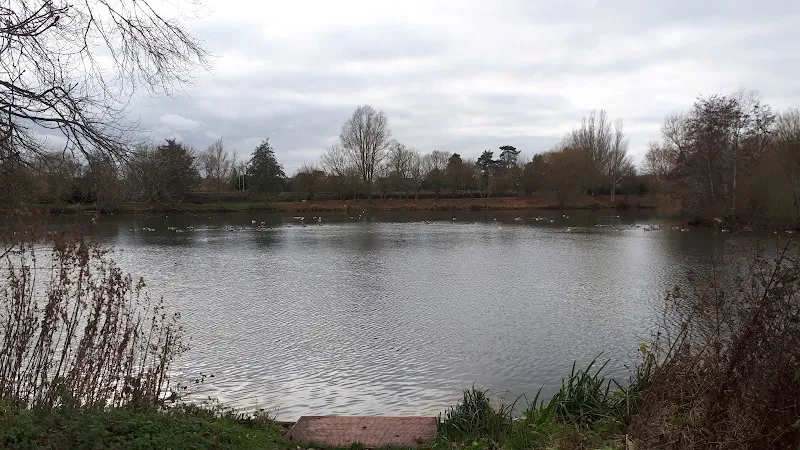
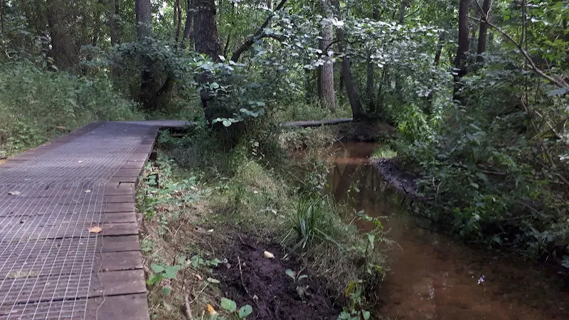
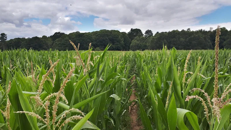
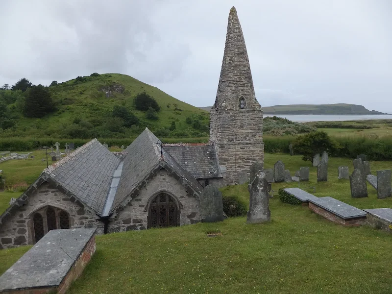
A 5 mile walk across the Coastal Suffolk landscape between Leiston and SaxmundhamThis walk searches out footpaths to connect the neighbouring towns of Leiston and Suffolk. Although there is no direct route, the paths chosen are certainly more conducive to the walker than the busy road route. With the...

Walk Summaries

Latest walk summaries are basic information sheets for walks that have yet to be fully documented. These provide links to maps, public transport and walks stats, although detailed notes and features are not included.

Latest Walk Summaries

Featured Walk

In Search of Sizewell Chapel

A 10 mile walk following the southern side of the parish boundary of Leiston in Suffolk This walk follows the route of a 17th century peramb...

What is GPX

All you need to know about GPX, electronic mapping and how to use modern apps and mobile devices as navigation devices

Popular Walks

Maps