South West Coast Path - Rock To Polzeath
Sunday, 19 July 2020
|
No comments
|
![]()
Short walk from Rock ferry to Polzeath along the Camel Estuary
A short section of the South West Coast Path that can be undertaken either as part of a more extensive hike or merely as a return ramble from Polzeath and across to Padstow. Fairly easy by SWCP standards and stunning scenery as is always the case with this Cornish coastline, and whilst taking all of this in one can contemplate the legendary Doom Bar that sits in the waters of the estuary.

Walk Statistics
- Start location: Rock Ferry
- End location: Polzeath
- Distance: miles ( km)
- Total Gain: ft ( metre)
- Total Descent: ft ( metre)
- Min Height: ft ( metre)
- Max Height: ft ( metre)
- Est. Walk Time:
- Walk type: Linear
- Walk Grade: Moderate
- Terrain: Footpaths
- Obstacles: Fairly easy walk by the standards of the South West Coast Path. Even so treat this as a proper walk not a stroll in the park

Maps
The following maps and services can assist in navigating this route. There are links to printed maps and links to downloadable GPX route data for importing into navigational software and apps.
- Ordnance Survey Explorer Map
- OS Explorer 106 - Newquay & Padstow
- GPX Route File
Accommodation
Valley Camping and Caravan Park, PolzeathView in OS Map | View in Google Map
- Website
- https://www.valleyholidaypark.co.uk/
- Description
- A friendly and welcoming family owned camp and caravan site close to the beach at polzeath
Walk Notes
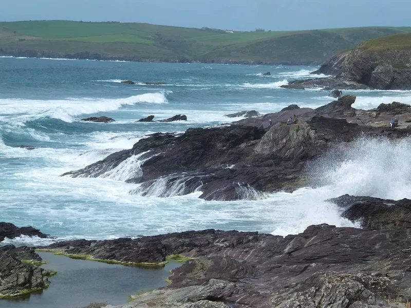
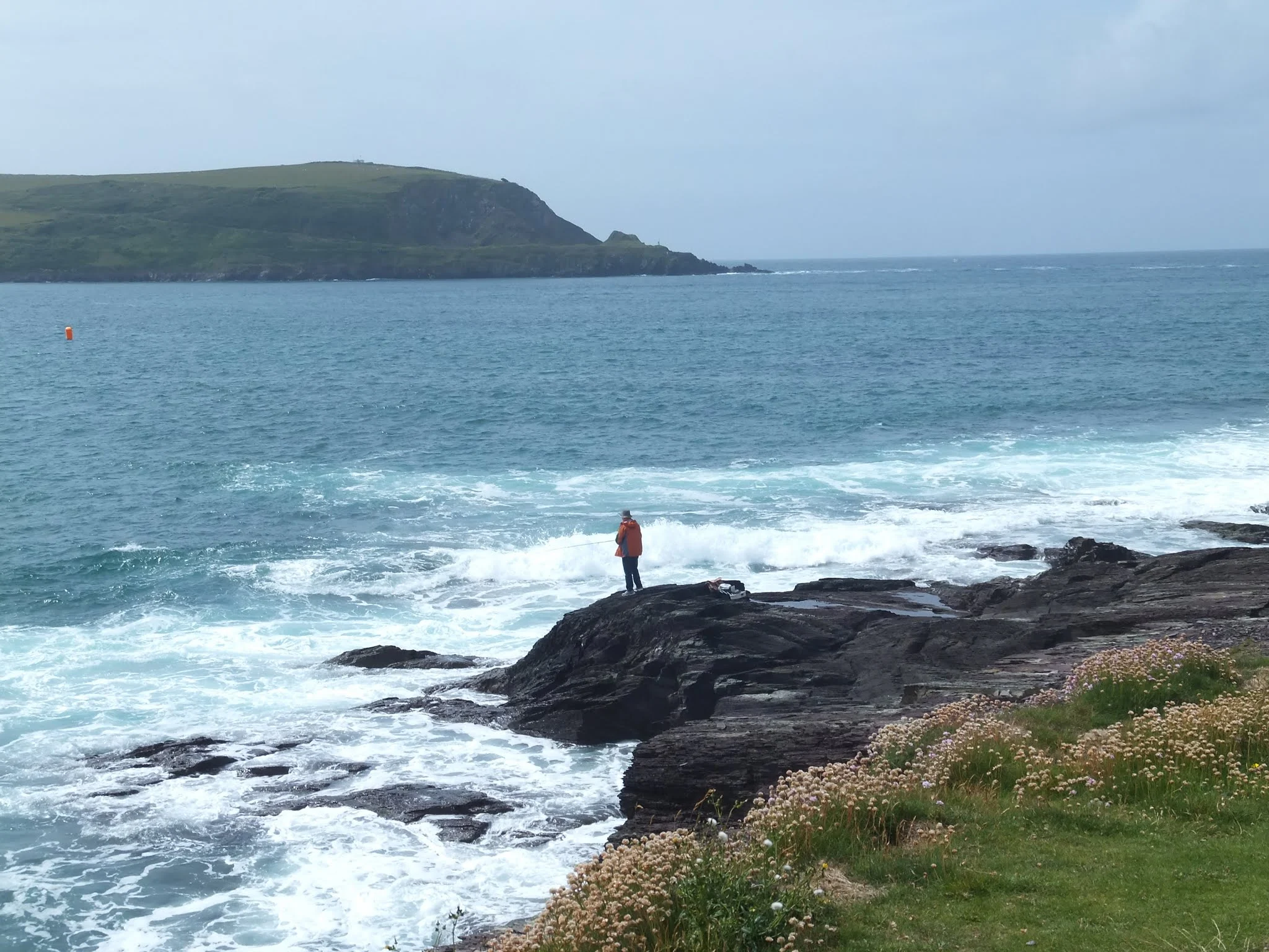
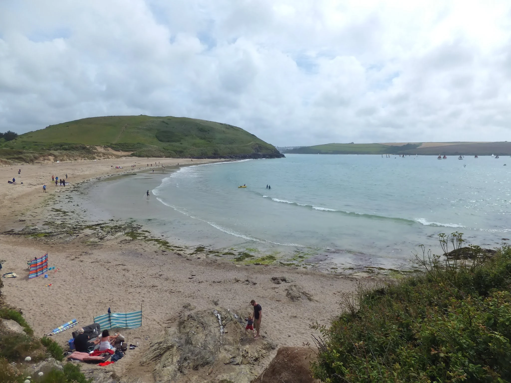
This walk was initially undertaken as the final section of a walk from Porthcothan to Polzeath but was subsequently walked on other occasions as access to the ferry across to Padstow. It is a simple wander along the Camel Estuary and for anyone staying at Polzeath makes a great way to have a day out in Padstow. The first section from the hamlet of Rock is through the dunes along a well trodden path. Beyond Daymer Bay the path is surfaced to make an easy wander into Polzeath. The views along the route which borders the River Camel Estuary are a wonder to behold and it is well worth the wander just to witness the panorama.
The wide estuary is the home of the infamous Doom Bar, the name glorified in the beer brewed by the local Rock Brewery and marketed nationally. This dangerous sandbank in the centre of the estuary has claimed the beaching and wreck as well as the lives of countless ships and vessels over the centuries. The number of wrecks since the early 19th century when records began is said to be more than 600 highlighting the danger this poses to shipping. Even today the Doom Bar still claims wreck and lives to unwary sailors.
As with many Cornish landmarks, the Doom Bar has a legend attached to it. The story is recorded in the 1906 book North Cornwall fairies and legends by Nellie Sloggett under the pseudonym of Enys Tregarthen. Born in Padstow in 1851 and being paralysed by a spinal condition at 17 years old, Nellie took to writing and recording details of the natural flora a wildlife of the Cornish coast that she observed from her bedroom window, eventually publishing book under the pseudonym of Nellie Cornwall. Later she devoted her life to recording the folklore, myths and legends of Cornwall under the name of Enys Tregarthen, from which this summary is taken.
The legend attached to the Doom Bar concerns a Padstow Mermaid. It was this Mermaid whom a tall and good looking young man named Tristram Bird encountered when out hunting seals with a newly purchased gun. He found her on a rock in Hawkers Cove, the location of the present day Lifeboat station on the Padstow side of the estuary. She was described as a beautiful young women casually sitting on the rock and brushing her hair as seems to be the case for many Cornish mermaids. That is what Cornish mermaids do, sit and brush their hair! Succumbed by her beauty Tristram offered to marry her, no bones about it, no lets go for a drink and see how we get on, he went straight for the blunt question of 'Will you marry me?' without even hesitating to determine that she was not a normal young girl but fully signed up and certified mermaid complete with fish tail. You would have thought this lack of human legs would have been a giveaway, but young Tristram was so entranced by the beauty of her upper body that the question was popped and she instantly refused his proposals. Despite much protestation and remonstration that he would be her best suitor, the blank refusals resulted in Tristram calmly pointing his gun and shooting her on the side. A bit drastic, one has to admit. It is at this point he became aware that he had shot a mermaid, the fish tail a bit of a giveaway once his eyes focused on her whole body.
As she lay there drawing her final breaths she pronounced a curse, from Hawker's Cove to Trebetherick Bay there would be a bar of sand which will be a bar of doom to many stately ship. Sure enough, that very night a terrific gale blew up, the like of which had never been seen in the living memory of the folk of Padstow. Once it had subsided the following morning, there in the middle of the estuary was a sandbank littered with wrecked ships and the bodies of drowned men. It is still said that whenever craft are wrecked on the Doom Bar, that the cry of the mermaid can be heard on the winds.
The details of this legend that were written by Nellie Sloggett are very much more an embroidered story to captivate the reader. Nonetheless the legend is part of the rich folklore of Cornwall and this story was probably handed down over the centuries by word of mouth across the generations of those who called Padstow home. Reiterated countless times by the fisherfolk of the town, told in the inns when storms were brewing. It could be said that modern science has a better explanation for the formation of the Doom Bar, being nothing more than coarse sediment deposited from the sea bed by the inflow of waters to the estuary and assisted by wave and tides. However such processes are still not fully understood, so maybe it was just the curse of a mermaid. It certainly makes a better story to tell on a dark stormy night than that of natural transportation of sediment.
Directions
Route Validation Cards
Validation Date - 2015-06-28
- Time of Walk: 14:30 to 16:00
- Validators: Griffmonster, Kat
- Weather Conditions: Warm and a little overcast
- Notes: Initial route undertaken
Summary of Document Changes
Last Updated: 2026-04-20
- 2020-07-19 : Initial Publication
- 2021-03-17 : Update website improvements and removal of ViewRanger reliance
- 2021-12-01 : Removal of ViewRanger links due to its imminent demise
- 2026-01-12 : Major website update with all walks recast to the new format


0 comments:
Post a Comment