Lincolnshire Coast Path - Cleethorpes to Mablethorpe
Wednesday, 18 December 2019
|
No comments
|
![]()

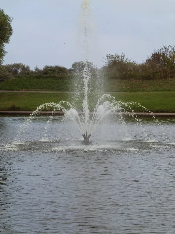
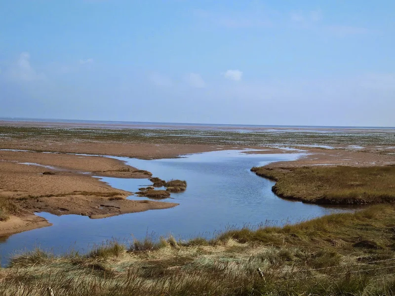
A 23 mile walk along the Lincolnshire Coast between Cleethorpes and Mablethorpe
Although a Lincolnshire Coast Path has yet to be established, this walk sets out a viable route for all budding coast walkers. This follows defence banks and permissive paths with a little road walking where necessary.

Walk Statistics
- Start location: Cleethorpes
- End location: Mablethorpe
- Distance: miles ( km)
- Total Gain: ft ( metre)
- Total Descent: ft ( metre)
- Min Height: ft ( metre)
- Max Height: ft ( metre)
- Est. Walk Time:
- Walk type: Linear
- Walk Grade: Moderate
- Terrain: Defence banks, footpaths, dunes and some road walking
- Obstacles: This walk is rated moderate down to the mileage and the hard ground which can take its toll on feet

Maps
The following maps and services can assist in navigating this route. There are links to printed maps and links to downloadable GPX route data for importing into navigational software and apps.
- Ordnance Survey Explorer Map
- OS Explorer 283 - Louth & Mablethorpe
- Ordnance Survey Explorer Map
- OS Explorer 284 - Grimsby, Cleethorpes & Immingham
- GPX Route File
Accommodation
Golden SandscampsiteView in OS Map | View in Google Map
- Website
- https://www.haven.com/parks/lincolnshire/golden-sands/
- Description
- Golden Sands is a holiday park mainly based around self catering chalets and caravans but it does include a campsite which is tucked away at the back of the site. The park is part of the Haven group and has entertainment, bars, takeways and activities on site.
Transport
Stagecoach - Bus Service
- Service Details
- 59 - Lincolnshire Interconnect Service 59, operated by Stagecoach and linking Skegness, Mablethorpe and Louth
- Timetable
- Lincs Interconnect Service 59
Stagecoach - Bus Service
- Service Details
- 51 - Lincolnshire Interconnect Service 51, operated by Stagecoach and linking Louth and Grimsby
- Timetable
- Lincs Interconnect Service 51
Stagecoach - Bus Service
- Service Details
- 4 - Stagecoach Grimsby town Services to Cleethorpes
- Timetable
- Stagecoach Grimsby Town Services
Walk Notes
This section of the Lincolnshire coast is a formidable walk. It can be broken down into two sections with North Somercotes being a central break point and if one can arrange personal transport or use of a taxi then this makes a couple of leisurely day walks. However, in this instance, with a base set up at Mablethorpe and with limited public transport then the full 23 miles was tackled in a single day.
It is an expedition in itself to get from Mablethorpe to Cleethorpes using public transport in order to start this walk with the expectation of completing it within daylight hours. This involves catching the 07:30 Interconnect 9 service out of Mablethorpe, then changing at Louth for the Grimsby bound 51 Interconnect service with local Grimsby town services to get to Cleethorpes Pier.
Louth is 15.9 miles from Mablethorpe by road. The directions using Google maps indicate such a journey, by car, should take 26 minutes without traffic. Naturally one would expect the bus journey to take a little longer. The bus runs along the same road towards Louth as directed by Google mapping, but then, a mere half a mile from the town centre, as clearly indicated by a road sign at a roundabout, things take an unexpected turn for the worse. The journey to the roundabout is achieved in just over half an hour, but the proximity of destination is nothing but a tease on this particular service, as at this point the bus heads off in a completely different direction. The unwitting passenger is treated to such Lincolnshire spectacles as the village of Manby with a fleeting glimpse of its 15th century church of St Mary, then the village of Grimoldby and its 13th century church of St Edith before heading off to South Cockerington, North Cockerington and Alvingham and then finally heading back to Louth. This detour takes a good 40 minutes but thankfully is only used by the 07.30 out of Mablethorpe whereas other services head straight to Louth.
The bus to Grimsby is a little more direct. And it was on this journey that a pub may be witnessed. Not just any old pub, although as a building it was pretty much a typical public house structure. It is the name of this hostelry that makes it so distinctive. Now, pub names are always worth looking at and many a long journey has been passed playing pub cricket where runs are scored for the number of legs that are shown on pub signs. But the name for this pub is something that would make any normal sane person have a double take. The magnificent, the unusual, the unique 'My Fathers Moustache'. Yes, that is 'My Fathers Moustache'. The pub sign sports a uniformed man, depicted waist up, so no runs scored for pub cricket, and a large handle bar moustache. But who is this man and why has he got a pub named after him. And whose father was he?
One can scour on-line sources to try to discover the origins of such a names but there is nothing revealing. There are reviews, there is news, there are websites and links but they all take the name 'My Fathers Moustache' for granted as if it was a normal everyday occurrence. Frustrated by the lack of information, an email was promptly sent to said establishment and the good people of 'My Fathers Moustache' furnished me with the much sought after details which had been told to them over the years, and I quote:
...the name came from the three Mathews Brothers who adopted the old AGM social club [which was converted] into the public house. One brother worked in South Africa for a while and the 'IN' place at the time was 'The Moustache Club' and with their father sporting a dapper moustache they decided [the pub] had to be called My Fathers Moustache.
What a great little story. Hopefully, sometime in the future, a visit to this establishment can be made. Until then, one can browse their Facebook page, which is certainly inviting. The hostelry has the motto of 'Wine, Dine, Dance' and must be the only public house to offer a bar with fine wines and real ales, a restaurant with appealing food and a dance studio all in one. Hats off to My Fathers Moustache!
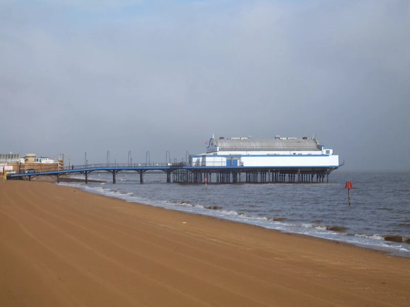
Anyway, further to this walk and post-haste to Cleethorpes. I have memories of Cleethorpes from the 1970's. Back in those distant days it was the furthest reaches of a British Rail East Midlands Rover ticket. Being railway enthusiasts, or trains-potters in local parlance, my brother and I would spend many school holidays armed with such tickets and gallivanting off on the trains to the furthest reaches of the region. Therefore, Cleethorpes being the most north easterly limits of the region, was a regular destination. Unfortunately the only memory of the town that lodged itself in my head was that of fish. To be more succinct, the smell of fish. The pungent odours of fish would linger in the air as the train creaked and whined its way past Grimsby docks to the terminus at Cleethorpes. And Cleethorpes was the little sanctuary just beyond the most nauseating of the fishy smells, although it still permeated each breath. There was the beach, and the smell of fish. There was a pier, and the smell of fish. On each visit, we would jot down a couple of train numbers then hastily make for the earliest return train back to Doncaster or some such destination, away from the fish.
Returning on this occasion, it was therefore quite a revelation to not smell fish. In fact there was not an inkling of fish on the journey from Grimsby bus station to Cleethorpes Pier. The seafront lacked all manner of fish aromas and appeared to be a rather welcoming, clean and tidy and, dare I say it, completely fish-less. In fact, it is a place which, given more time, is worth exploring a little more.
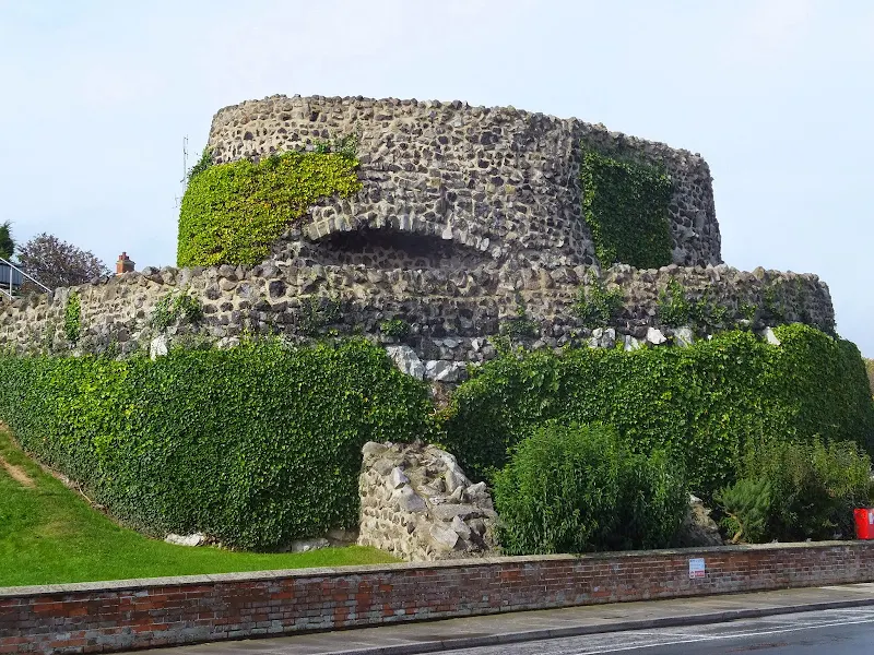
The seafront owes its creation to the Manchester, Sheffield and Lincolnshire Railway Company who brought the railway network to the town in the 1860's. They also had directors on the board of the company who built the pier in 1873, which in recent years has had a chequered history of ownership but is still surviving. The railway company also financed the well manicured gardens and seafront promenade. Even the ruins of a castle is nothing more than a folly constructed by the Railway company in 1885 and named Ross Castle after the railway company secretary, Ernest Ross. One wonders if even the sandy beach was placed there by the railway company.
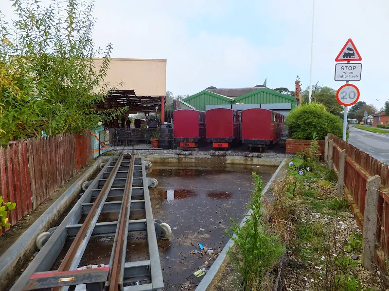
Further along the coast is the Cleethorpes Coast Light Railway, built in 1948 to a 14.5 inches gauge as a tourist attraction by Cleethorpes Borough Council. The current length of track is 2 miles and runs from the Leisure Centre, over a viaduct and along the sea wall, past the shed and museum at Lakeside station and then onwards to the Pleasure Island Family Theme Park and the Buck Beck estuary. A mixture of steam and diesel locomotives are in operation and rolling stock includes items from the former Sutton Miniature Railway in Sutton Park, Sutton Coldfield.
Unfortunately the walk to the southern end of Cleethorpes was conducted with an OS map and a little more research may have found that there is a walkway that runs along the coast through to the end of the holiday park to join the public footpath which would have been more conducive than the stretch of road past the Theme Park and then through the mass of caravans and mobile homes beyond. OS maps rarely depict permissive paths and this appears to be the case here. A further investigation is needed and will no doubt be undertaken when the section from Cleethorpes to the Humber bridge is encountered.
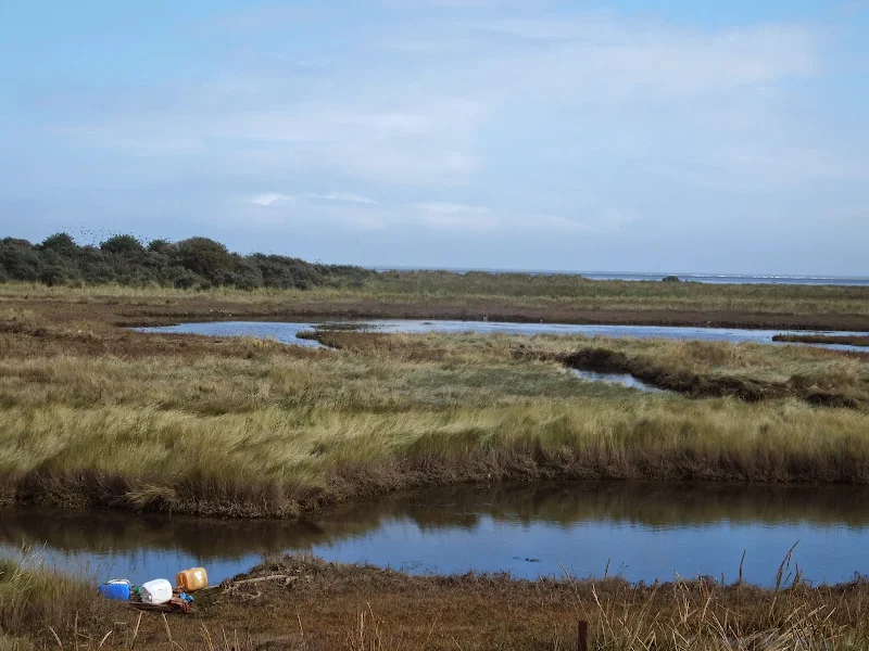
At the end of the urbanisation and the theme parks and the holiday parks is an area known as The Humberston Fitties. 'Fitties' is a local word meaning 'salt marsh', and walking along this section, one cannot help but be intrigued by the structures that dominate the view out to sea. These are the Haile Sand Fort and the Bull Sand Fort which were defences for the entrance to the estuary built in 1915 but not completed until 1919. The second world war saw them recommissioned and modernized including installation of netting across the estuary to prevent access by submarines. They were a regular target for enemy aircraft but managed to survive the hostilities and were finally abandoned by the military in 1956. They have now been given Grade II listed building status and are being restored for use as a drug rehabilitation centre.
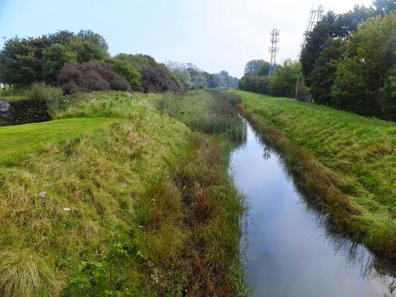
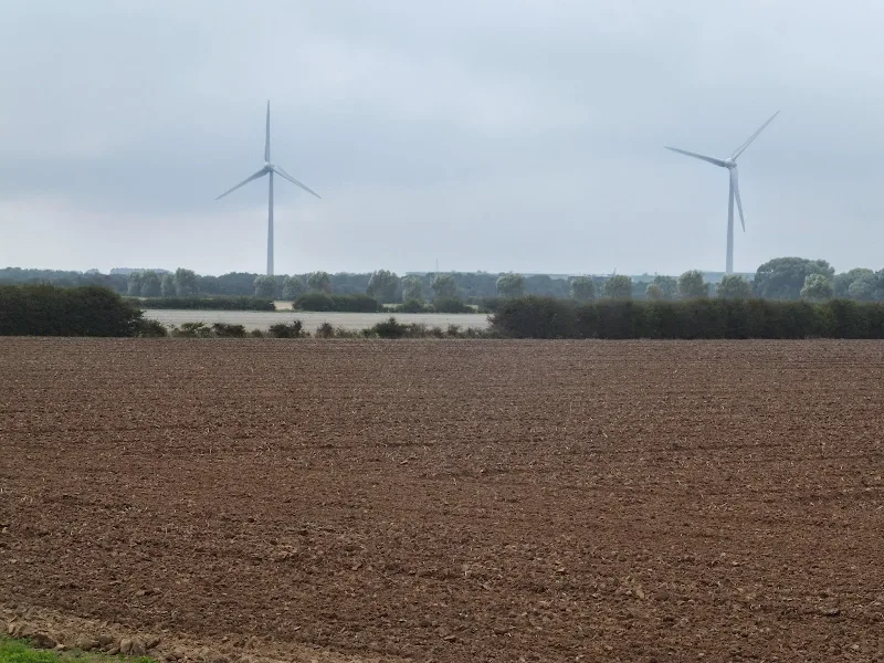
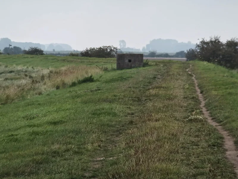
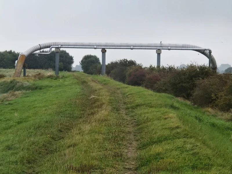
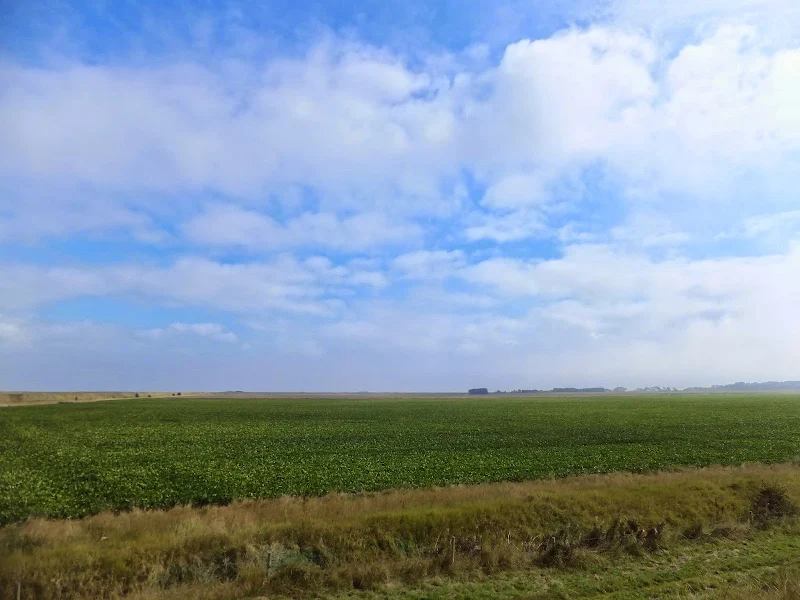
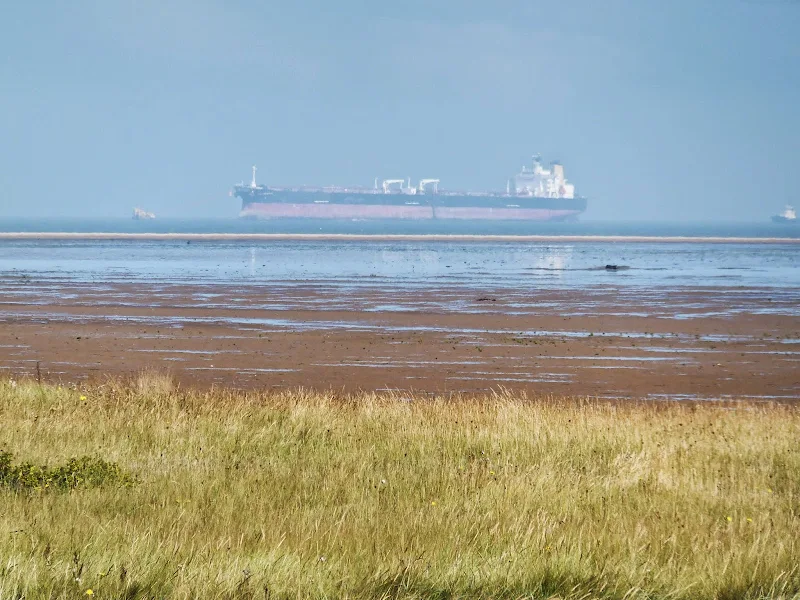
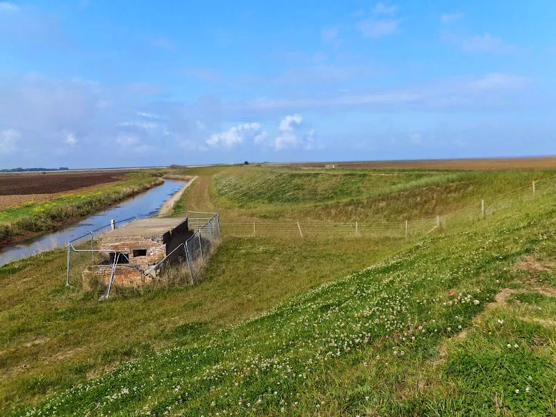
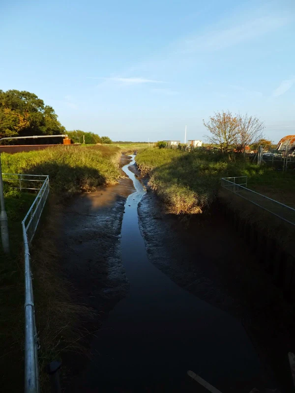
Away from the urbanisation, the walk is typified by the flat open farmland on one side, defence banks and marshland with the sea in the distance. Wide open landscapes. Big skies. The occasional WWII pill box. A crude oil pipeline that passes over the footpath and the dyke beside it before disappearing into the ground on either side. Distant merchant ships still look colossal as they head up to the Humber ports.
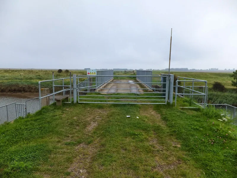
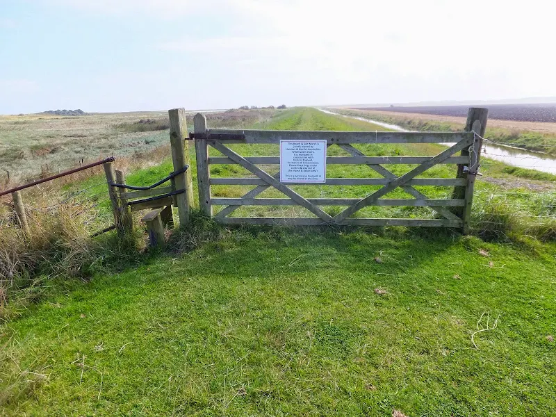
The public footpath leads along the defence bank to the Louth Canal. There is a bridge across this watercourse here but the OS map does not indicate any public rights of way other than a footpath heading inland. Nonetheless, there is a style to allow walkers across the bridge and no signage to indicate that one cannot proceed. The section from the bridge, along the seaward defence bank through to Horseshoe Point is a permissive path over land owned by the Humber and North Lincolnshire Wildfowlers Club and managed in conjunction with Natural England. Reports a few years ago detail that this section was closed to the public. This appears to have been for defence bank works but the path was certainly accessible during the time of this walk, September 2014. Beyond Horseshoe Point, a public footpath continues along the defence banks through to Donna Nook. Not indicated on current OS maps is the new defence bank that has been built on the land adjoining Pyes Farm, inland from the original defence bank. This was part of a coastal realignment project proposed in 2009 and completed in 2012. The scheme included breaching the existing defence bank in order to flood the land at high tides. There is no signage at the junction of this new defence bank although a new gate had been included. It is stressed that proceeding along the original route may find ones path blocked at the breaches during a state of high tide therefore this new route is the preferably way forward.
Beyond Donna Nook, there is currently no official public access along the coastal route which consists of dunes and marsh. A military range occupies the marshland directly in front of the Donna Nook dunes and continues around to Saltfleet. There is a small concrete observation post at Donna Nook and it was here that a Qinetiq employee was advising the public. Red flags were flying indicating the military range was in use and I guess this chap was making sure no-one strayed onto the marsh. He was a good source for access information, stating that although there is no public footpath, it is possible for the public to walk around the coastal section through to Saltfleet, even when red flags are flying. He related that the route navigates through to two more concrete observation posts and beyond this there is no clearly defined path and no landmarks and it is therefore easy to become disorientated. The main advice was keep well away from the marsh and the military areas. The chap warned that it takes care, patience and time to walk the route but it is achievable. However, on reflection that our days walk was to end in Mablethorpe, and with the limited amount of light left in the day, he strongly advised against this route and to take the lane into North Somercoates and follow the road around to Saltfleet.
The road route has a key advantage in the fact that North Somercoates boasts both a pub that is open all day and a small convenience store. This is the first opportunity that one can find refreshment and supplies after leaving Cleethorpes. It is worth noting the Bay Horse Inn, for which there is a hand written sign pointing to it at the end of the long straight featureless lane from Donna Nook, is currently closed. The Axe and Cleaver pub can be found by turning right at the end of the lane and then follow the road round and down to the junction with the main road where the pub is located directly opposite.
There is a pavement along the main road through to the Lakeside holiday park at the end of the village but then one needs to navigate along the road until a sandy track presents itself on the left. This leads through to Marsh Lane and is a convenient quiet track leading through to Saltfleet which passes an area known as Tobys Hill on the left. Currently a nature reserve, it is said to be the highest dune summit on the Lincolnshire Coast and is a remnant of a 700 year old dune system which was separated from the present-day coastline by 19th century land reclamation.
The lane emerges into a holiday park and a footpath then continues through the caravans and emerges in the centre of the village by a Boer War memorial that is fashioned in the form of a drinking pump. The Crown pub is on the opposite side of the main road, and it is said that the ghostly solders of Cromwell's Roundheads can be seen marching past the pub on dark and misty nights as testified on The BBCs Lincolnshire Unexplained website. The legend states that Cromwell had a mistress in the village and stayed at the Manor House which is opposite the villages second pub, the New Inn, on the road heads out of the village.
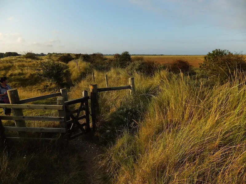
The final section of this walk is the most picturesque and pleasurable part of the entire hike. This is the Saltfleetby, Theddlethorpes dunes. Unfortunately towards the end of this section the light was fading fast and despite taking some time over the initial section, the last couple of miles was done at a frantic pace in order to find a way down to the beach and then onto Mablethorpe North End. I do have vague recollections from way back in the 1970s when a series of family holidays to Mablethorpe entailed some wanders through these dunes. They are a little natural adventure playground and are worthy of a walk in themselves. Maybe another time.
Directions
The route follows defence banks to Donna Nook then cuts inland via road to North Somercotes and Saltfleet. The end section is through the Salfleetby and Theddlethorpe dunes.
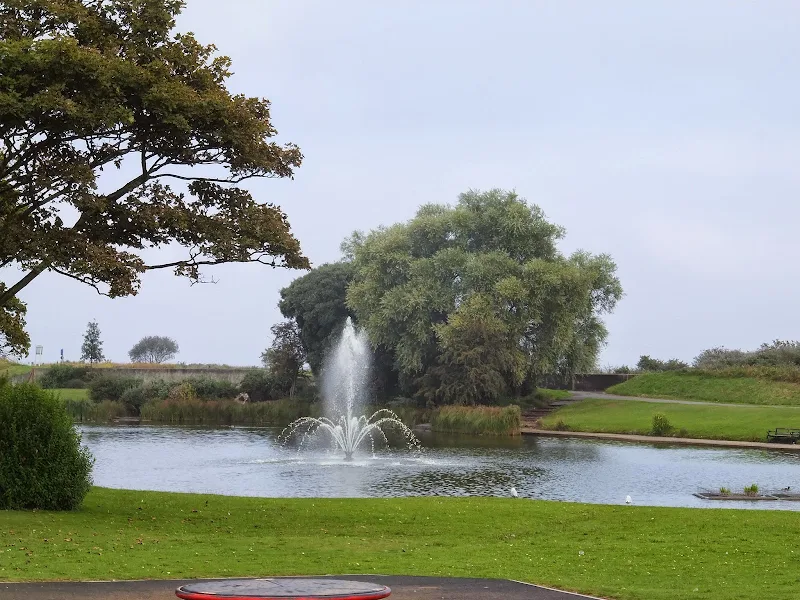
From Cleethorpes Pier, walk southwards along the promenade. Pass the Cleethorpes Leisure Centre and take the path into the park around the boating lake beyond. At the far end, by the Coast Light Railway, return to the road and follow the road down to the Pleasure Island. Continue past this to a roundabout and take the road down into the holiday Park bearing left with the road. Go over a roundabout and just beyond there is a footpath on the right.
There is an alternative to the above with a path that keeps to the seafront although there is no public access marked on the OS map. This leads continues on the seaward side of the Boating Lake and continues past the holiday park. At the far end one needs to cut in to the defence bank through the Holiday Park. It is uncertain what public access is available here alhtough it is probably a permissive route through. Unfortunately this route was not found until after the walk was undertaken.
Keep to the footpath as it leads through the holiday park. It initially follow a drainage ditch and where this bends round, cross th footbridge and continue straight ahead. The path bends round to the right and comes to the edge of the holiday park where it continues, eventually coming to a defence bank with lakes and marsh to the seaward side. Keep to this all the way through to the Louth Canal. The footpath continues inland, but there is another path that leads, via a stile, across the bridge and onto a path beyond. keep to the seaward side defence bank. This is a permissive path
At the point where the defence path turns towards the coast, there is another path through a gate. This path, and the ensuing defence banks are not indicated on current OS maps. This was part of a coastal realignment project proposed in 2009 and completed in 2012. The scheme included breaching the existing defence bank in order to flood the land at high tides. There is no signage at the junction of this new defence bank and it is stressed that proceeding along the original route may find ones path blocked at the breaches during a state of high tide therefore this new route is the preferably way forward.
The bank ends at the car park for Donna Nook. The marsh area in front is part of a military range and should not be entered. Take the road that runs inland. This is a long straight road and is pretty monotonous. At the end is a junction. turn right and follow the road around to the left. This eventually junctions at a crossroads with the Axe and Compass pub opposite. Turn left and follow the road through North Somecotes village. The road will slowly turn right with a caravan park on the left. There is no pavement or verge beyond this and one needs to walk a short distance (approx 500 yds) along the road until there is a sandy track on the left. Take the track and after 300 yards turn right onto another track that runs parallel with the road. At the end it junctions with a road into a caravan site. Go straight over and follow the public footpath through the site. This will bend round and emerge onto The Hill which leads into the centre of the Saltfleet village with the Crown Inn opposite.
Turn left and follow the road out of Saltfleet. At the bottom of the hill, as the road bends around to the left, take the track straight ahead. Cross over the river bridge. Bear to the right and keep following the footpath through the grass covered dunes. There are numerous other paths but keep straight ahead. Eventually the path meets with a wire fence. Turn seaward and follow paths through to the beach where a broad expanse of sand allows access through to the first signs of civilisation which is Mablethorpe North End. Take the path back across the dunes and onto the road. Follow the road through to Mablethorpe town, alternatively take the beach along this distance. At the town, turn right onto the High Street. The fourth road on the left is Seacroft Road which is where the buses terminate, opposite the Co-op supermarket
Pubs
Axe and Cleaver, North Somercotes View in OS Map | View in Google Map

- Address
- Keeling Street, North Somercotes
- Website
- www.axeandcleaver.com/index.html
The Axe and Cleaver dates from the late 1930s when the present building replaced an older pub which originally stood on the crossroads. A free-house under local ownership, the present pub offers two bars and conservatory area. Food is served lunchtime and evenings and weekly theme nights include curry night, pie and pint nights as well as the regular selection from the menu. Ales consist of two regular Batemans plus a weekly guest ale.
It was mid afternoon. Very quiet but pleasing to find the pub still open with only a couple of other customers. Quite understandably the lunchtime food session had ended. That meant a late liquid lunch and Batemans' Yella Belly certainly went down well with a packet of crisps.
Crown Inn, Saltfleet View in OS Map | View in Google Map

- Address
- Pump Lane, Saltfleet
This 200 year old inn offers a friendly welcoming atmosphere with a host of entertainment including music, quiz nights and bowling and skittles nights. Accommodation is available. Home cooked food is served lunchtime and evenings with roast dinners on Sunday lunchtimes. Ales include offerings from Greene King. 2019 the pub was changing hands
Early evening. The pub was starting to fill with folk preparing for a quiz night, presumably those staying on the local caravan park. Yes they had ale but unfortunately it was Greene King and not my favourite tipple by any means. Settling for Speckled Hen, there is nothing wrong with this ale but every time I drink this I cant help but think of the former notable and formidable ale that Moreland used to brew before Greene King got their mits on it.
Ferryboat Inn, Mablethorpe View in OS Map | View in Google Map
- Address
- Meers Bank, Mablethorpe
- Website
- https://www.facebook.com/theferryboat
Seaside bar at the end of the road at Mablethorpe North End that caters for holiday makers from the Golden Sands holiday camp. Only keg beers and cider.
Not sure why this is called the Ferryboat Inn. There is not a ferry in sight and I can find no history of a ferry ever having been here. I remember it being a bus terminus for the Lincolnshire Roadcar Co. back in the 1970s. I cant remember the bar being here back then but then I was too young to be supping beer. Anyway, to the beer. I am an ale enthusiast. If a pub does not have ale I would normally pass it by for some place better. This bar was an exception on account of completing 23 miles walking which needed some method of celebration. There was cider available although it was the usual large scale keg cider, but no matter what, it was thirst quenching and good to rest ones legs.
Features
Skidbrooke with Saltfleet HavenView in OS Map | View in Google Map
Saltfleet, during medieval times, was a town of considerable size and importance. Being a royal port, the town was required to provide both ships and men to the king in times of national emergency. One such recorded instance was the supply of two ships and 49 men to the navy of Edward III for the invasion of Brittany in 1359.
The significance of the parish was greatly diminished with constant erosion and incursions by the sea which destroyed much of the old town including including St. Katherine's church which succumbed in 1679. In 1821 a fisherman claimed to have caught a large bell-clapper in his nets which was thought to have been from the old church. With the opening of the Louth Canal, Saltfleet suffered from a reduction in trade, with its market finally being abandoned in 1791. By 1872, the town is described merely as a seaport and bathing place with 417 souls and Baroness Willoughby de Eresby being the lady of the manor.
Notable buildings in the town include the Manor House which dates from 1673 although it is thought a building occupied the site before this time. Records state that Oliver Cromwell had stayed here in October 1643 prior to the Battle of Winceby. The town also boasts a 18th century tower mill which is said to be one of the oldest in the country. The original mill had three pairs of milling stones and power was supplied by four roller reefing sails. The mill was rebuilt in the 1890s and it survived as a working mill until the early 1950's after which its ironwork was sold for scrap and the building left to become derelict. In more recent years it has been restored as a private residence.
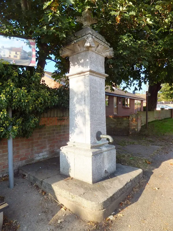
The town also includes an ornate water pump constructed from Portland stone known as the Freshney Memorial Pump commemorating Frederick Alan Freshney a trooper of the Imperial Light Horse. Born locally, Fred Freshney went on to study engineering in Lincoln before heading off to South Africa where he first worked in the gold mines before volunteering for service in the Boer War. As stated on the memorial, he was severely wounded at Colenso on December 15th 1899, when a bullet hit him in his right eye, passing through his face, neck and shoulder and finally embedding itself in his lower back causing paralysis of his body from the shoulder down. After spending time in hospital he was brought back to England to recuperate. Despite his injuries he still managed to write a book entitled 'My experiences in the South African War 1899-1900' He eventually died at the early age of only 32, on May 20th 1906. The epitaph ends with Brave in action, patient in suffering.
The towns surviving church, dedicated to St Botolph, is located in a remote field to the west of the parish and dates from the 14th century and has the distinguishing feature of a tomb in the chancel floor of a vicar who died in 1413. The church, as a place of worship, has been redundant since 1973 and although the building is in the care of The Churches Conversation Trust, its empty shell has been desecrated by Satanists. The building and immediate surrounding area has obtained a reputation as being one of the most haunted locations in Lincolnshire with reports of ghostly lights and sounds of phantom footsteps that crunch on the stone floor. Behind the church are the ruins of an old Abbey where apparitions of hooded monks have been reported. Local folklore abounds with tales of witchcraft and curses on the church. An investigation in 2004 by the Bassetlaw Ghost Research Group reported a gloomy oppressive atmosphere, strange noises and flashes in the sky even though the weather was calm. The head of the group, parapsychologist David Wharmby, also related that 'We saw small babies among the gravestones and grass'
References
- Freshney Memorial details
- My Experiences in the South african War by F Freshney
- Louth leader article on Saltfleet
- History, Gazetteer and Directory of Lincolnshire, and the City and Diocese of Lincoln, W. White, 1872
- BBC news article about desecration of St Botolphs church
- Records for Saltfleet windmill
- Louth Leader article on St Botolph church
- Rod Collins' blog article on St Botolphs church
Image Gallery


Route Validation Cards
Validation Date - 2014-09-15
- Time of Walk: 10:30 to 20:00
- Validators: Griffmonster, Kat
- Weather Conditions: Damp start but rain clearing to leave a bright sunny day
- Notes: Initial route undertaken
Summary of Document Changes
Last Updated: 2026-04-20
- 2015-11-07 : initial publication
- 2017-12-22 : general maintenance updates
- 2019-01-26 : general maintenance updates
- 2019-12-18 : general maintenance updates
- 2021-03-17 : Update website improvements and removal of ViewRanger reliance
- 2021-12-01 : Removal of ViewRanger links due to its imminent demise
- 2026-01-12 : Major website update with all walks recast to the new format


0 comments:
Post a Comment