Route details, maps, pubs, features, local history and folklore for a wide variety of walks focusing primarily on Norfolk and Suffolk

Norfolk Coast Path Walks
Showing posts with label Norfolk Coast Path. Show all posts

Tuesday 27 November 2018

In Search of the myths and legends of Stiffkey

Freshes creek

An 8.5 mile walk along a section of the Norfolk Coast Path between Wells-next-the-Sea and Morston, with a diversion through the village of Stiffkey.

Stiffkey (locally pronounced Stewkey) is referred to as Stivecai in the Domesday Book, which means "island of tree stumps". This is thought to relate to the remains of an ancient wooden structure dating back 8,000 years, that was found on the marsh. Today it is a sleepy little village on the North Norfolk Coast Road renowned for its topiary including a line of elephants all trunk to tail at Nellie's Cottage, a guitar sitting proudly atop a hedge at the home of a guitar teacher and a fox by the gate post of the Fox family's house. It does, nevertheless, have an intriguing recent history with stories of Black Shuck, the ghostly devil dog, and the tale of the infamous Reverend Harold Davidson, Rector of Stiffkey who was defrocked in a national scandal involving ladies of the night and ended up being mauled by a lion.

Wednesday 21 November 2018

Winterton to Great Yarmouth Beach Walk

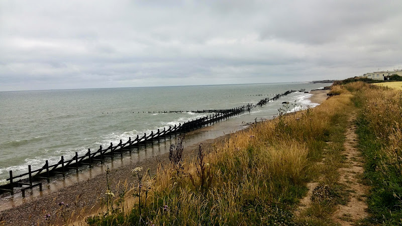
Hemsby

A 9 mile beach walk between along the Norfolk coast from Winterton to Great Yarmouth

This walk is probably better known as Robinson Crusoe's walk since this is where Daniel Defoe places his character, in the novel of the same name, after being shipwrecked with a resulting walk to Great Yarmouth. Although such a stormy day would not make the best of walks, when the sun shines and the tide is out this really is a great walk.

Wednesday 14 November 2018

Norfolk/Suffolk Coast - Gorleston to Kessingland

A 14 mile coastal walk between Gorleston and Kessingland crossing the border from Norfolk to Suffolk

This mighty fine walk takes the avid rambler to the most easterly point of the British Isles, Ness Point that is located in front of Lowestoft. The point is marked with a large circular ground compass with distances and direction to well known landmarks around the globe. The route uses cliff top paths, proms and beaches and makes for a great days walking.

Saturday 28 July 2018

Cromer to Hopton 40 mile Challenge Walk

Salt marsh

Extensive full day hike around the eastern section of the Norfolk Coast Path

This walk should only be undertaken by experienced long distance walkers or those who have specifically trained for such a feat. This specific route was undertaken from 5am with a high tide around 6am. This allowed for a beach walk from Waxham through to Caister as an alternative to the official dunes paths. A support car was employed to provide the return journey and offer assistance in case of emergency.

Monday 26 February 2018

A Norfolk Ramble around the Burnhams

Holkham Hall lake

A 16 mile circular walk from Wells-next-the-sea taking in Burnham Thorpe, Burnham Market and Burnham Norton

This full days walk has everything to offer the adventurous rambler. There is a wander through the stately grounds of Holkham Hall in order to reach the humble church at Burnham Thorpe with its tributes to Norfolk's most famous son, Lord Nelson who was born and grew up in the area. Country lanes lead down to Burnham Market and the church of the old parish of Burnham Ulph. Heading down to the coast there is the church of Burnham Norton with its resplendent medieval paintings. The ramble returns along the vast expansive beaches in front of Holkham.

Tuesday 30 September 2014

Proposed Route for the Norfolk Coast Path from Hopton to Sea Palling Released

Proppsed route through the Winterton dunes

Details of the proposed route for the 19.2 miles of the Norfolk Coast Path between Hopton and Sea Palling

Details have been published for the proposed route of the Norfolk leg of English Coastal Footpath between Hopton to Sea Palling. Much of the proposed route is along existing footpaths and walked routes as well as beach sections. The entire distance can be walked at present either following the proposed route or just using the beach, given the right tide conditions. This proposal, if adopted, will extend the Norfolk Coast Path from Hunstanton to Hopton.

Tuesday 16 October 2012

Norfolk Coast Path Proposed Route

Proppsed route through the Winterton dunes

Details of the proposed route for the 19.2 miles of the Norfolk Coast Path between Hopton and Sea Palling

Details have been published for the proposed route of the Norfolk leg of English Coastal Footpath between Hopton to Sea Palling. Much of the proposed route is along existing footpaths and walked routes as well as beach sections. The entire distance can be walked at present either following the proposed route or just using the beach, given the right tide conditions. This proposal, if adopted, will extend the Norfolk Coast Path from Hunstanton to Hopton.

Walk Summaries

Latest walk summaries are basic information sheets for walks that have yet to be fully documented. These provide links to maps, public transport and walks stats, although detailed notes and features are not included.

Latest Walk Summaries

Featured Walk

In Search of Sizewell Chapel

A 10 mile walk following the southern side of the parish boundary of Leiston in Suffolk This walk follows the route of a 17th century peramb...

What is GPX

All you need to know about GPX, electronic mapping and how to use modern apps and mobile devices as navigation devices

Popular Walks

Maps