Route details, maps, pubs, features, local history and folklore for a wide variety of walks focusing primarily on Norfolk and Suffolk

find_in_page

Keyword Search Results

In search of the Becks and Ponds of Beeston Regis

View from foot of Incleborough Hill

A 7 mile walk between East Runton and Sheringham in Norfolk, searching out a couple of good pubs and following Beeston Beck across Beeston Common.

This picturesque trail follows the foot of Inkleborough Hill to West Runton then navigates down to the northern end of Beeston Back Common where it follows the stream known as Beeston Beck down into Sheringham, past the site of an old watermill, now replaced by terraces of housing. Return is via West Runton with a stop at the Village Inn. At only 7 miles, this is a simple and easy afternoons stroll.

The Aftermath of the 2013 Storm Surge - Cromer and Sheringham

Damaged Beach huts

A 6 mile beach walk to witness the damage caused by the 2013 Storm Surge at Cromer and Sheringham

Both Cromer and Sheringham bore the brunt of the storm surge on the night of December 5th 2013. Although repair work is well under way there are still the signs of what damage the sea can cause. There have also been many cliff falls along this length of coastline with the cliff faces providing a fascinating view sculptured by the weather and tides and offering multi coloured strata.

Folklore Trail around East Runton

Railway bridge at the end of Thains Lane with Inclborough Hill in the background

A 4 mile walk between East Runton and Cromer searching out old folklore

Using country lanes and tracks, this circular trail navigates around a East Runton to visit the various locations in Runtons history and folklore. Woodhill House is the location of an unidentified skeleton found during road widening. Thains Lane has the village's old smithy. The old Windmill sets the scene for the emanation of ghostly lights that crossed over to a copse. With a pub stop at Cromer and return via the redefined course of the Norfolk Coast Path, this makes for an excellent short walk on a spooky Autumn evening.

Runton and Incleborough Hill Walk Sumary

Salt marsh

Short circular walk over Incleborough Hill in North Norfolk

Incleborough Hill stands above the villages of East and West Runton on the North Norfolk Coast. At 260 feet in height and covered with low level gorse bushes it provides magnificent unobstructed views across the coast from Cromer to Sheringhamm and beyond. One cannot help but be impressed and in awe at the sight.

The walk is not arduous and apart from a short climb up steps it is achievable by most able bodied folk. The return is down a much gentler slope to West Runton and to the coast to follow the Norfolk Coast path back to East Runton.

Old Coast Path Route - Cromer to Sheringham

Beeston Bump

A 6 mile walk along the original route of the Norfolk Coast Path between Cromer and Sheringham

Up until December 2014 the official route of the Norfolk Coast Path from its start at Cromer Pier through to Sheringham navigated inland along the hills of the Cromer Ridge, the highest ground in Norfolk. This original route can still be walked and contrasts with the cliff-top route of the realigned path which is now part of the England Coast Path. With shady lanes and tracks through the woodland, spectacular views from the summit of Beacon Hill and the challenging ascent to the iconic Beeston Bump, this walk is a worthwhile excursion from the coastal route.

North Norfolk Railway Beer Festival 2011

The 10th North Norfolk Railway beer festival

There was a selection of 120 ales from around the country plus a range of ciders and perrys all for the price of £2.80 a pint. Entertainment and food was available throughout the weekend together with both diesel and steam train workings to make a truly unique event. Even the rain throughout the weekend could not dampen the enthusiasm of those attending, with plenty of shelter available in the carriages alongside Platform 2 where the beer tent was situated. This was an excellent weekend with ample opportunity for some walking along the picturesque coast to Cromer. There was also a late bus between Sheringham and Cromer calling at Woodhill saving us the walk across Beeston Bump in the dark back to the campstie at East Runton. When it comes to beer festivals you cannot beat this one.

North Norfolk Railway Beer Festival 2012

Beer Festival

The 11th North Norfolk Railway beer festival

Once again the North Norfolk Railway came up with another outstanding beer festival. Over 100 ales plus ciders were on offer in the perfect surroundings of a working steam railway together with live music. Carriages on platform 2 gave ample seating and cover for the few times when rain began to fall and a bbq in a wagon offered hotdogs and burgers. In my opinion the best beer festival around!

East Runton to Aldborough Circular Walk

Aldborough

A 17 mile circular walk through the countryside of North Norfolk linking East Runton and Aldborough

Aldborough is the quintessential English village with a pub facing the large village green where the sound of willow on leather can be heard from the afternoon games of cricket that are frequently staged during lazy summer afternoons. You cannot get a more stereotypically English village than Aldborough.

Sheringham to Cromer Circular Walk

An easy 8 mile Norfolk coastal walk along beach and clifftops between Sheringham and Cromer

The Norfolk Coast Path was rerouted in 2014 as part of its inclusion to the England Coast Path. It now navigate alogn the cliff tops for most of the distance along what used to be permissive paths that have now become public. This walk uses both coast path and beach to create a delightful walk along this awe-inspiring section of the North Norfolk coast. Do check tide times and make sure the beach walk is undertaken 2 hours either side of low tide.

Cromer to Mundesley Beach Walk

Cromer

A beach walk along the Norfolk Coast between Mundesley and Cromer including a clifftop stroll from Cromer to Overstrand.

This section of the Norfolk Coast can only be walked when the tide allows as high tide reaches the foot of the cliffs and is impassable at Overstrand. There is frequent erosion all along the route so the scenery changes from year to year. The beach is predominantly sand with numerous groynes that present frequent obstacles to get past - sometimes decaying steps assist getting over the groynes and sometimes, at low tide or with boots and socks off, it is possible to get around the end of some of the groynes. Mostly, it involves clambering as best as you can over these eroded, seaweed covered, mussel encrusted defences but that is half the fun of it! Although there is a cliff top path from Cromer to Overstrand, which has some outstanding views, beyond this there is no official right of way and a full circular walk would involve heading inland, using the Paston Way. However, a frequent bus service links Overstrand and Mundesley to make a good and easy days coast walking.

Ale Trail - Mundesley to Cromer

Cromer

A beach walk along the Norfolk Coast between Mundesley and Cromer including a clifftop stroll from Cromer to Overstrand.

This section of the Norfolk Coast can only be walked when the tide allows as high tide reaches the foot of the cliffs and is impassable at Overstrand. There is frequent erosion all along the route so the scenery changes from year to year. The beach is predominantly sand with numerous groynes that present frequent obstacles to get past - sometimes decaying steps assist getting over the groynes and sometimes, at low tide or with boots and socks off, it is possible to get around the end of some of the groynes. Mostly, it involves clambering as best as you can over these eroded, seaweed covered, mussel encrusted defences but that is half the fun of it! Although there is a cliff top path from Cromer to Overstrand, which has some outstanding views, beyond this there is no official right of way and a full circular walk would involve heading inland, using the Paston Way. However, a frequent bus service links Overstrand and Mundesley to make a good and easy days coast walking.

Salthouse Sculpture Trail

Pond at Kelling Heath

A 14 mile walk around the Salthouse Sculpture Trail

Inaugurated in 2008 by The North Norfolk Exhibition Projects, this trail across Kelling and Salthouse heaths was set out to exhibit both the natural beauty of North Norfolk alongside examples of contemporary Norfolk art. Although most of the sculptures have now gone, the walk nonetheless provides a peaceful route around this part of the county.

Norfolk Coast Path Extension

Coastline from Mundesley to Happisburgh

A 21 mile extension has recently been completed to the Norfolk Coast Path taking it through to Sea Palling

As part of the English Coast Path project, the Norfolk Coast path has now been extended to Sea Palling with waymarkers and direction signs being added during the first half of July. This includes a redirected section between Beeston and Cromer that now follows the coast rather than its original route which headed inland through the hills above Cromer.

Norfolk Coast Path Extension - Essential Information

Walk Statistics:

  • Start location: Sheringham 
  • End location: Sea Palling 
  • Distance:   miles (  km)
  • Total Gain:   ft (  metre)
  • Total Descent:   ft (  metre)
  • Min Height:   ft (  metre)
  • Max Height:   ft (  metre)
  • Walk Time:  
  • Walk type: Linear
  • Walk Grade: A mixture of cliff top footpaths and beach walking. A small amount of roadside walking
  • Terrain: Sandy Beaches plus well used cliff top paths

Maps:

The following maps and services can assist in navigating this route. There are links to printed maps and links to downloadable GPX route data for importing into navigational software and apps.


Walk Notes

It has been known for sometime now that one of the first stages of the All England Coast Path would be the Norfolk coast. Well, it has started to happen. Without any fanfare or announcement the waymarker and sign posts have appeared along the Norfolk Coast declaring Norfolk Coast Path and enabling the walker to continue from Cromer all the way through to Sea Palling. This does not officially open until the winter of 2014 as detailed by the Norfolk Trails website. Even so, it is still currently accessible to the would be coast walker.

The response from the Secretary of State to the petitions and objections for the path can be viewed at www.gov.uk.

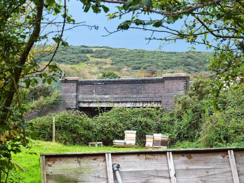
The route has used a mixture of existing public and permissive footpaths and the legislation will enable the path to recede landwards with any ensuing erosion. Some of this can already be seen between Overstrand and Trimmingham where erosion has already taken some of the existing footpath forcing the walker to rightfully take a route at a safe distance from the cliff.

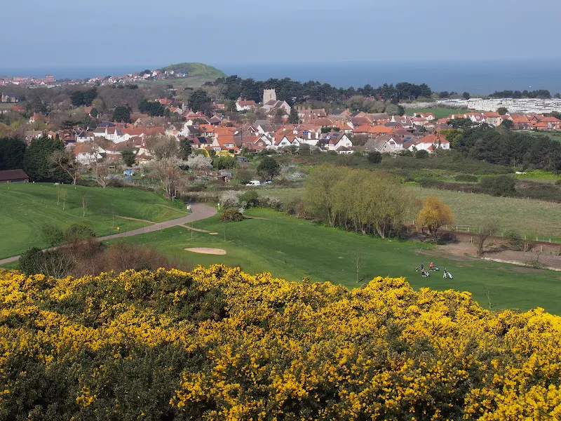
In addition the route taken from Sheringham to Cromer has now been altered to take a coast route rather than diverting away from the cliff top and up to Roman Camp before coming back down to Cromer. This certainly is more in keeping with the coast path status.

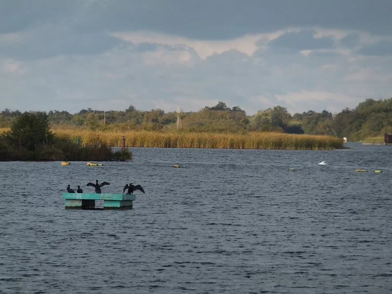
The extension provides a contrast to the North Norfolk section which is typified by salt marsh and flood defences. From Sheringham the scenery changes to tall cliffs and broad beaches. Beyond Happisburgh the cliffs recede and the final section is low level dunes with acres of sandy beach. Although the path uses a mixture of both cliff top paths and beach, it can nonetheless be completed along the beach throughout providing the tides are suitable.

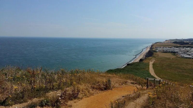
The sections where the official route does take to the beach there are also alternative permissive paths along the cliff top. These can be used when high tides prevent access, especially the section in front of Bacton which is regularly cut off by tides. Walks on this site provide details of both cliff top paths and beach routes.

Transport Connections

The route from Hunstanton through to Cromer continues to be served by Norfolk Greens Coasthopper service. Beyond this there is a regular service that links Cromer, Overstrand and Mundesley served by Sanders Coaches. The far reaches of the new path out to Sea Palling are unfortunately not currently well served at all. There is a bare bones service that offers just two weekday journeys between Happisburgh and Sea Palling during the morning and two in the opposite direction during the evening. Saturdays , this is reduced to a single journey in each direction. There is no service that connects Mundesley to Happisburgh which would necessitate a connection with other services from North Walsham.

Beyond Sea Palling

Consultations are already underway to extend the coast path through to Hopton with the expectation of this being opened during 2015. This section can already be walked by both beach or navigating along the low cliffs and through the housing and holiday camps that adorn the seafronts of Caister and Scratby.

Path at Mundesley
Path at Mundesley

Directions

The Norfolk Coast Path extension is well defined throughout with the usual acorn symbol waymarkers that typify a national trail

Beeston to Cromer

This section follows the original route over Beeston Bump although new steps and hand rails have been implemented for this climb. Beyond this the new route uses the old permissive paths in front of Beeston Campsite and along the clifftop, past the beach road at West Runton and on to Woodhill Park campsite. It then follows the western and southern perimeter of the campsite before exiting onto the pavement to continue into East Runton village. As the road leaves East Runton there is a track on the left between two caravan sites. The path follows this for several hundred yards before returning to the road via a footpath on the right. There is a short distance along the pavement past a terrace of cottages and the Wyndham Caravan Park before it cuts across a grassed area to the clifftop where it continues down into Cromer. There is currently no additional marker on the waymarker post in front of the pier. However the path does continue onwards along the promenade towards Happy Valley.

Cromer to Overstrand

The path proceeds along the prom and then up to the path that leads along the cliff tops to Happy Valley. Opposite an octagonal shelter is a waymarker pointing down the cliffs via a set of steps. The path then continues along the beach to Overstrand following the route of the Paston Way. It is unknown why negotiation with the golf club to use the permissive path beyond the Cromer Lighthouse was not undertaken as this would have been a much more favourable route with some spectacular views. The beach route is accessible during most states of tide but given an unusually high tide the route will be unpassable and this permissive path can act as a viable alternative route through to Overstrand.

Overstrand to Trimingham

The path follows Overstrand Prom until its end where it then ascends the steep roadway into the Eastern end of the village. This leads out onto the main coast road where there is a pavement through to a track just beyond Manor Farm. This leads up to an old permissive footpath along the cliff tops through to Trimmingham.

Trimingham to Mundesley

The route follows the coast road out of Trimingham. After a couple of field boundaries, a country lane bears off to the right. The signage here is a little poor as there is no clear indication that this lane should be taken but this is most certainly the correct route. Proceeding along the coast road is hazardous as there is no verge or pavement throughout the double bends in front of the radar station. Not far down the lane there is footpath on the right that leads around the back of the radar station and back to the main coast road. From here a high verge has been trimmed down to allow walking access alongside the road through to a junction with another lane. Opposite this junction is the entrance to the Trimingham House Holiday Park where a Coast Path waymarker directs down the entrance road. Continue on the access road, beyond the barrier and follow the road through the holiday park. At the far end another waymarker confirms that this is the correct route. The path continues along the cliff top, crosses a beach road to continue along the cliffs, in front of another holiday park. Eventually the way ahead is barred by a low wooden fence, but a path leads into the holiday park and then out to the main Coast Road where finger posts once again confirm this is the correct route. Follow the road down into Mundesley village where a waymarker then directs down to the prom adjacent to the Mundesley Maritime Museum.

Mundesley to Bacton

This is a beach walk following the route of the Paston Way. This can be blocked at the Bacton end by high tides, therefore tide times need to be consulted. The adoption of this route appears to have been taken as the making a public right of way from the permissive path that runs along the clifftops in front of the Bacton Gas Terminal is deemed a security risk for the site. Nonetheless if the tide is not right then the permissive path can be a viable alternative. This can be found by following the road out of Mundesley and just past the sharp turn inland take the left hand lane and follow this to its end where it leads into a path along the cliff tops through to Bacton.

Bacton to Happisburgh

This follows the concrete defences in front of Walcott then negotiates its way thorough Bush Estate at Ostend to the clifftop path to Happisburgh

Happisburgh to Sea Palling

The route continues along the cliff top path to Eccles and then follows Doggetts Lane behind the chalets to Cart Gap where the beach is followed to Sea Palling. An alternative route here is the track that is on the landward side of the dunes.

Summary of Document Changes

Last Updated: 2021-12-07

2021-03-17 : Update website improvements and removal of ViewRanger reliance
2021-12-01 : Removal of ViewRanger links due to its imminent demise

Dads Army Weekend 2015

Dont panic Mr Mainwaring

An easy 9 mile Norfolk coastal walk to visit the Dads Army weekend hosted on the North Norfolk Railway

The third episode of the sixth series of the popular British comedy series Dad's Army was titled 'The Royal Train' in which King George VI was due to pass through Walmington-on-Sea and the platoon were to form a guard of honour. The location chosen to film this episode was Weybourne station on the North Norfolk Railway and each year this is celebrated with a Dad's Army weekend where a group of enthusiasts from the Dads Army Museum in Thetford re-enact this memorable episode.

Paston Way to Gunton - Pubs, Churches and Wartime Conspiracies

Northrepps from the lane to Overstrand

A 7 mile walk along Norfolk's Paston Way from Cromer to Gunton.

The Paston Way has a few alternative paths that stray from its main route between North Walsham and Cromer, and this walk takes the optional route out to Gunton from where a train can be taken back to Cromer. There are some worthy country pubs along this simple walk so a good old English pub crawl can also be had along with taking in the sights of the impressive churches at Northrepps and Southrepps plus local tales of wartime German conspiracies!

A Norfolk Broads Walk from Neatishead to Horning

Cormorants on Barton Broad

An easy 6 mile walk following the River Ant down to the Bure at Horning.

The Norfolk Broads are full of ghostly stories and this walk brings a few to life. From the spooky lights of Hoards Hole, encounters with Black Shuck and the curious transformation of Horning's riverside houses to Saxon days when it was just a grassy bank, there is plenty to reflect upon as one wanders the footpaths and quiet country lanes that make up this route. And maybe, who may tell, given the right conditions, you may even glimpse a spectral view from another dimension.

A Walk along the Bure Valley Path

A 9 mile walk along Norfolk's Bure Valley Path between Aylsham and Wroxham

The Bure Valley Path follows the former Great Eastern Railway trackbed alongside the Bure Valley Narrow Gauge Railway. There are outstanding views of the river Bure and stops on route at Brampton, Buxton and Coltishall. Being a former trackbed gives a well drained path so the route is suitable for all weathers.

Leiston to Middleton Mill Circular Walk

General Representative Walk Image from this walk

A walk across the coastal Suffolk countryside to the village of Middleton

A splendid way to spend a days walking, cross fields and countryside and heading to the location of the Middleton Watermill. There are churches to stop and investigate on the way.

diversity_3

Popular Walks