Route details, maps, pubs, features, local history and folklore for a wide variety of walks focusing primarily on Norfolk and Suffolk

Walks
Showing posts sorted by date for query Woodbridge. Sort by relevance Show all posts

Tuesday 19 November 2019

Sweffling Circular Walk 2

Salt marsh

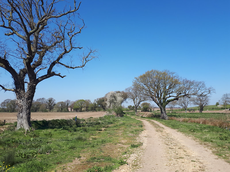
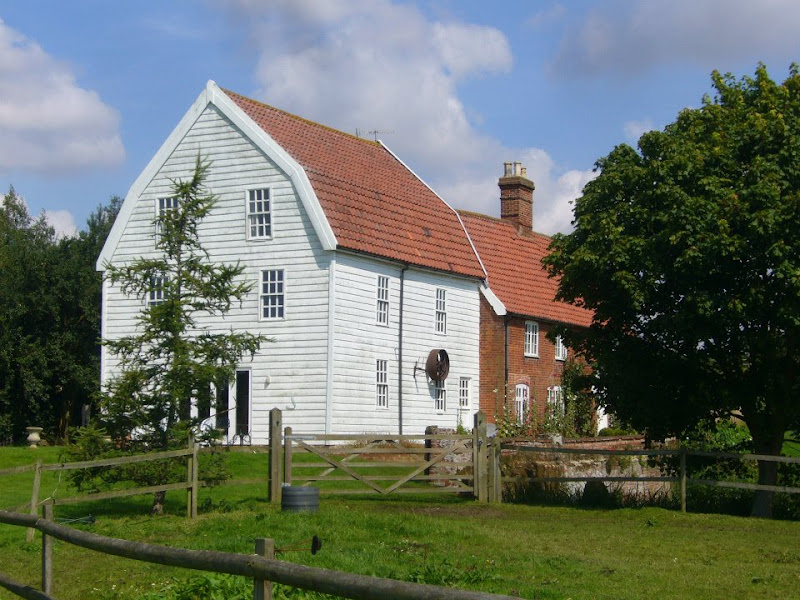
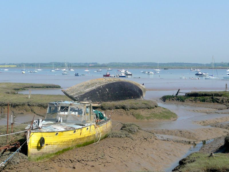
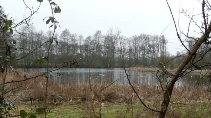
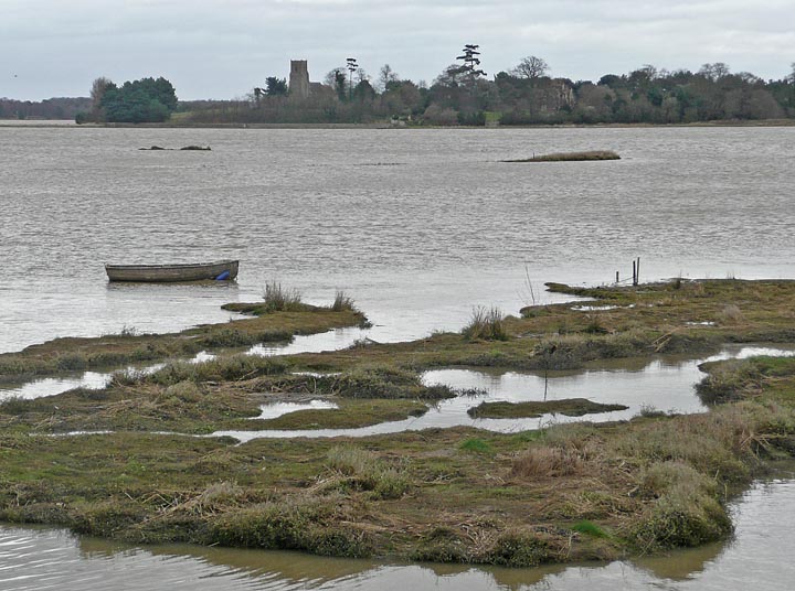
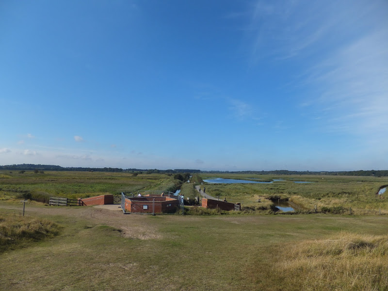
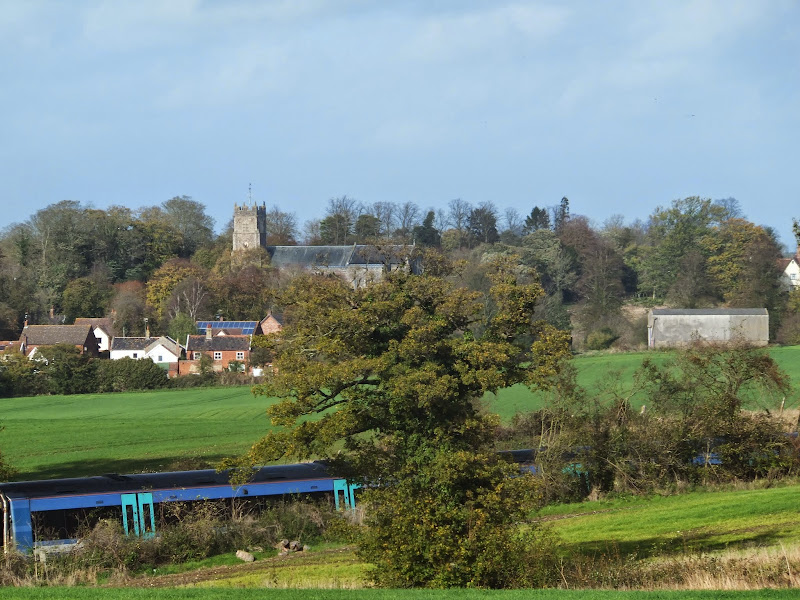
Short circular walk through the Suffolk countryside around the village of Sweffling

The second circular walk that starts and ends at the Sweffling White Horse pub. This leads the rambler across river valley, woodland and some amazing Suffolk countryside. This is a perfect way to spend a Sunday morning, ending up with a pint and some lunch at the pub which really is a traditional old local with a tap room full of local ales.

Sunday 22 September 2019

In Search of Sizewell Chapel

Broom Covert

A 10 mile walk following the southern side of the parish boundary of Leiston in Suffolk

This walk follows the route of a 17th century perambulation around the southern side of the Leiston Parish boundary. The walk uses the ancient track down to Sizewell and continues down to Thorpe before turning inland to follow the River Hundred through to Cold Fair Green. The details are contained in two articles, this being the first, focusing on the medieval history of Sizewell.

Saturday 11 May 2019

In Search of Polsborough Gate

track to Aldeburgh Road

A 9.5 mile walk following the old Snape Road to the Sailors Path

This walk links Leiston with the Sailors Path following the old traditional road that used to link the town with Snape. There is then an outstanding ramble across Black heath and Hazlewood marshes through to Aldeburgh where a regular bus service links back with the start. Along this route was what in the 1700s was known as Polsborough Gate, a landmark whose position and derivation is unknown but with a little research some information about it can be determined

Friday 5 April 2019

The Alde Valley Walk - Leiston to Wickham Market

Beversham Mill

A 16 mile walk along the East Suffolk Line Path between Leiston and Wickham Market

Although the official route for the East Suffolk Line Path links the stations at Saxmundham and Campsea Ashe, this provides an alternative route using the local bus service to link the two ends. Highlights along the route include the picturesque Beversham Mill and the legendary Blaxhall Stone which is said to progressively grow in size.

Saturday 26 January 2019

An Extended Walk around the Rendlesham UFO Trail

A 12 mile circular walk starting at Eyke and incorporating the UFO Trail in Suffolk's Rendlesham Forest

The Rendlesham UFO trail is a waymarked 3 mile trail around the eastern end of Rendlesham Forest that navigates around the key areas that were involved in the Rendlesham Forest Incident of 1980 in which both civilian and military personnel witnessed unexplained craft land within the forest. Although this can be walked by parking up at the visitor car-park in the forest, a longer alternative is to take the footpaths from Eyke, and make a day of this most wonderful and intriguing part of Suffolk.

Monday 21 January 2019

An Amble up the Deben Estuary

Felixstowe Ferry

A 13 mile walk along the River Deben in Suffolk, starting at Felixstowe and ending in Martlesham

The lovely walk along the Deben estuary. Although parts are inaccessible due to breaches of the flood banks, the mix of riverside paths, country lanes and footpaths provides an ideal mix of landscapes to keep any walker fascinated. The May bush pub offers a perfect place to take a rest and refreshment, its riverside location unbeatable.

Friday 18 January 2019

A Walk through the Garden of Suffolk

A 14 mile walk between Saxmundham and Darsham along the East Suffolk Line Walk.

It is Yoxford that gives us the name of this walk which is part of the East Suffolk Line Walks and this specific ramble extends the line walk to return to Leiston where a regular bus service connects the two ends. Yoxford sits on the banks of the River Yox surrounded by three country house parks; Sibton Park that contains large well stocked fishing lake; Grove Park situated in the village; and Rookery Park on the Leiston road. This has earned Yoxford the name of the 'Garden of Suffolk'. The whole route of this walk is a pleasant amble through the rural fields of Suffolk with a return journey through the pretty country lanes following the Minsmere river through to Middleton, Theberton and finally Leiston.

Saturday 12 January 2019

Down the Blyth Valley in Pursuit of Black Shuck

River Blyth near Halesworth

An 18 mile walk down the Blyth Valley in Suffolk from Halesworth to Blythburgh, then across the heaths and commons to Leiston.

It was the legendary hell hound that supposedly came this way in 1577 and terrified parishioners of Blythbrugh church after doing a similar job at Bungay. This walk is in two sections, the first section follows the River Blyth along the Waveney Way to Blythburgh with the option to continue on to Southwold. The Waveney Way is a Ramblers Association walk and does not have waymarkers along the route. An optional second section cuts across to Westleton and onto Leiston. Both Southwold and Leiston have public transport links to Halesworth making the walk achievable as a linear route without the requirement of assistance of a taxi.

Wednesday 9 January 2019

In Search of the Mysteries and Legends of Iken and St Botolph

A 7 mile walk along the Alde estuary, following the Suffolk Coast Path from Snape to Iken

There are disputes as to whether Iken is the land of Icanho that St Botolph was granted by King Ethelmund to build his minster in the 7th century. If it was then there were marsh demons in these parts during those time and one can still feel the eeriness of the area with the mysterious Yarn Hill where Botolph reputedly drove away the ghosts and marsh demons in order to build his minster. It was eventually completed on the site of the historic church at Iken which still bears his name. The church is a fascinating place to visit - be sure to spend a little time here and see St Botolphs stone cross which was unearthed in 1977 and is on display within the church.

Monday 7 January 2019

A Walk to the Dunwich Leper Chapel

Leper Chapel

A 14.25 mile circular walk between Leiston to Dunwich

A simple walk using the Suffolk Coast Path from Sizewell to Dunwich with a visit to the ruins of the 12th century Leper Chapel. The return uses the the footpath via Mount Pleasant to get onto the Sandlings Path across Dunwich Heath to return back to Leiston.

Friday 4 January 2019

A Walk Around the Churches of Knodishall and Friston

An 8.4 mile circular walk around the Suffolk villages of Knodishall and Friston

An easy ramble across the Suffolk countryside, with the highlight being the hidden ruins of St Peters Church in the old parish of Buxlow, now a part of Knodishall. There's some fascinating history on this walk along paths that are off the beaten track but nonetheless well maintained.

Thursday 3 January 2019

Tracks and lanes to Glemham

Benhall Ford

A 22 mile route that can be either walked or cycled through the Suffolk countryside around Snape, Blaxhall and Glenham

A glorious route through the Suffolk countryside using a mixture of lanes, tracks, bridleways and little used country roads. This can be either walked or cycled and provides a full days outing taking in the picturesque villages of Snape, Blaxhall, Little Glemham, Great Glemham and Benhall which these days is split into two with the A12 separating Benhall Low Street from Benhall Green. Along the route is the Parham Airfield Museum, although this is only open on Sundays between April to October.

Wednesday 2 January 2019

A Walk around Suffolk's Minsmere Bird Reserve

Minsmere sluice

A 10 mile circular walk through the Suffolk Coastal Area of Outstanding Natural Beauty taking in Sizewell and the Minsmere Bird Reserve

One does not have to have an enthusiasm for ornithology to enjoy this walk. The natural surroundings of marshland and heathland are enough to inspire everyone and there is a lot of associated history along this route which dates back to the 12th century when Leiston Abbey once occupied an island in the marshes. Note that charges apply to the Minsmere section.

A Trek Around Sole Bay

Sole Bay

A 24 mile circular walk between Sizewell and Southwold along the Suffolk Coast Path and Sandlings Walk.

Back in the 17th Century, Southwold was England's main fleet anchorage. Sole Bay (Sawolde Bay) was a bay centred on Southwold with Easton Ness to the North and Dunwich to the South. In May 1672 this bay was the scene of a fierce sea battle when a fleet of 75 Dutch ships took an Anglo-French fleet by surprise. There were heavy losses on both sides in this, the first naval battle of the third Anglo Dutch War, but luckily for the English fleet the wind turned to their favour resulting in their success in the battle. Today coastal erosion has straightened the coastline of the former bay and all that remains of the battle are the stories and the cannons pointing out to sea on Gun Hill.

Tuesday 1 January 2019

Leiston to Walberswick Circular Walk

Sole Bay

A 22 mile circular walk between Leiston and Walberswick incorporating sections of the Suffolk Coast Path and Sandlings Walk.

This walk uses the beach at low tide to get from Sizewell to Walberswick, returning through Dunwich forest. Walberswick is said to be the most haunted place in Britain though one would not think it from its relaxed and laid back character, famous for its crabbing pastimes.

Saturday 29 December 2018

Deben Estuary - Melton to Bawdsey

View across the Deben estuary

A 15 mile river side walk along the Deben Estuary in Suffolk between the villages of Melton and Bawdsey

This walk follows river side footpaths with spectacular views across the estuary. Unfortunately at Ramsholt there is no public access and one needs to divert through to the village of Alderton with a road walk for the last few miles to Bawdsey. A ferry crossing an a short walk into Felixstowe provides public transport access back to Melton

Suffolk Coast Path - Orford to Butley Ferry

A 6.5 mile Suffolk circular walk along the banks of the Ore and Butley rivers between Orford and the Butley Ferry river crossing at Gedgrave.

The Suffolk Coast Path Orford Loop has two routes back onto the main trail, the first returns from Orford up to Chillesford but an alternative is to follow the lane from Orford to Gedrgrave and down to Butley Ferry. Although this crossing only operates from April to October, a pleasant and easy circular walk can be made from Orford returning along the top of the river defences.

Thursday 20 December 2018

The Sandlings Walk - Martlesham to Rushmere Heath

Martlesham Heath Control Tower Museum

A 4.5 mile walk across heathland from Martlesham to Rushmere Heath on the eastern fringes of Ipswich

Like most modern towns, Ipswich is suffering from a seemingly endless amount of urban sprawl that envelops the traditional villages that once surrounded it. However, this walk follows heathland that is hidden behind the housing estates all the way from Martlesham through to Rushmere Heath and Ipswich Hospital

Monday 17 December 2018

Saxmundham, Kelsale and Carlton Circular Walk

Kelsale church from the other side of the railway

A 4 mile walk around Saxmundham, Kelsale and Carlton

Using footpaths an country lanes, this short walk provides some fine views, historic churches and even a ghostly tale of an apparition of phantom dancers. A worthy candidate for an afternoons exploration of this hidden corner of East Suffolk.

Tales of Sundials, Witchcraft and Ghostly happenings in Saxmundham

A 2 mile circular walk around the Suffolk town of Saxmundham using the Town Trail

A simple tour of Saxmundham that can be added onto the East Suffolk Line Walks or to while away a couple of hours on a lazy afternoon, including searching out the unique tombstone sundial in St Johns churchyard, and finding the haunted Monks Cottages.

Walk Summaries

Latest walk summaries are basic information sheets for walks that have yet to be fully documented. These provide links to maps, public transport and walks stats, although detailed notes and features are not included.

Latest Walk Summaries

Featured Walk

In Search of Sizewell Chapel

A 10 mile walk following the southern side of the parish boundary of Leiston in Suffolk This walk follows the route of a 17th century peramb...

What is GPX

All you need to know about GPX, electronic mapping and how to use modern apps and mobile devices as navigation devices

Popular Walks

Maps