The Orford Loop, Tales of Castles and Mermen
Wednesday, 5 December 2018
|
No comments
|
![]()

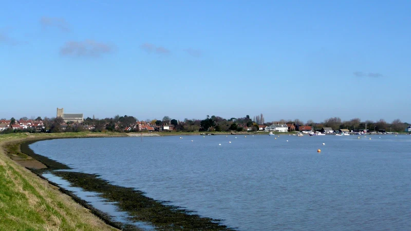
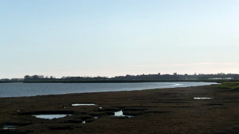
A 16 mile walk around the Orford Loop section of the Suffolk Coast Path.
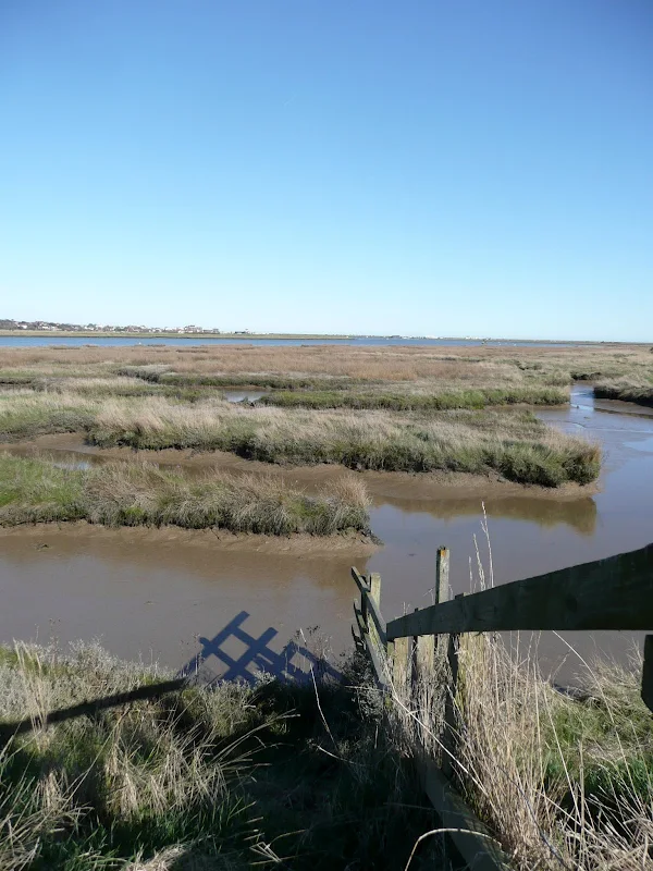
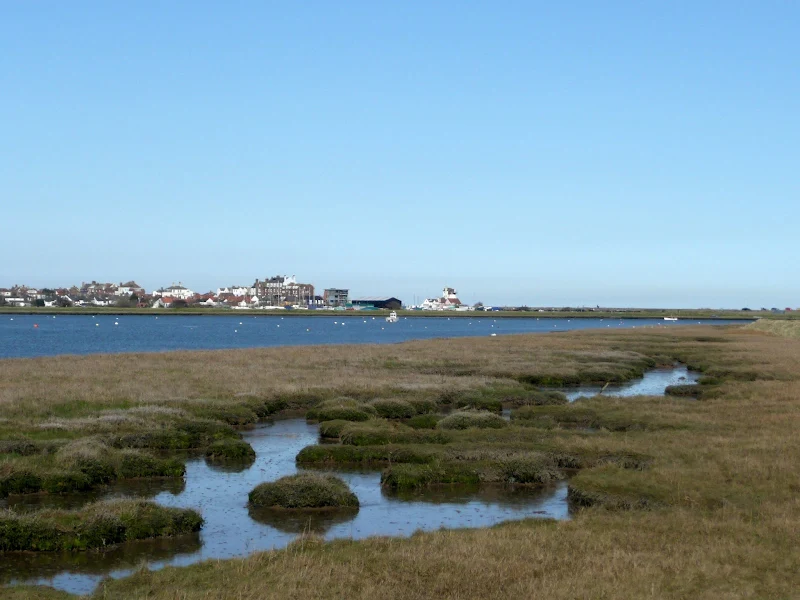
The main Suffolk Coast Path cuts through Tunstall Forest from Iken Cliff to Chillesford. However, more recently, a path has been added which allows access to Orford by following the Alde estuary. This then cuts back across Gedgrave marshes and Sudbourne Hall to return to the main path at Chillesford.

Walk Statistics
- Start location: Orford Quay
- Distance: miles ( km)
- Total Gain: ft ( metre)
- Total Descent: ft ( metre)
- Min Height: ft ( metre)
- Max Height: ft ( metre)
- Est. Walk Time:
- Walk type: Circular
- Walk Grade: Easy
- Terrain: Footpaths and defence banks
- Obstacles: Some of the marshes can be flooded, particularly around the High Street area

Maps
The following maps and services can assist in navigating this route. There are links to printed maps and links to downloadable GPX route data for importing into navigational software and apps.
- Ordnance Survey Explorer Map
- OS Explorer 212 - Woodbridge & Saxmundham
- GPX Route File
Walk Notes
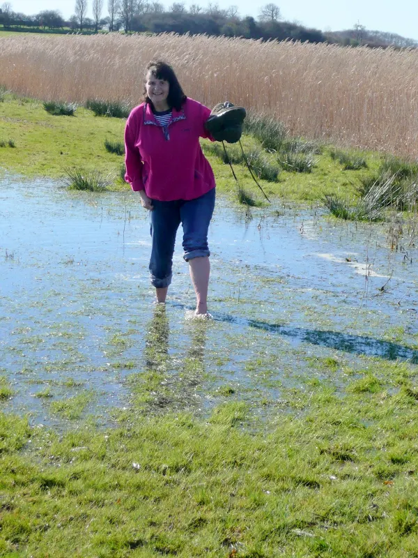
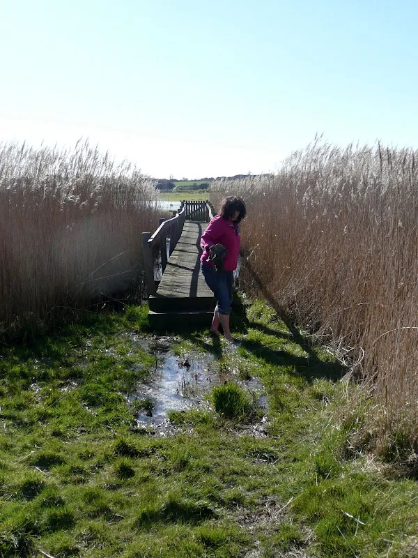
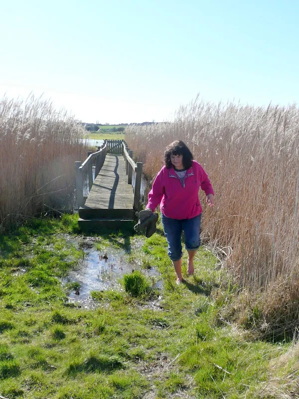
This path is not shown on OS maps and there is little, if any, documentation about it. However, the route is clearly waymarked with the distinctive yellow and blue waymarkers though it does become a little confusing at Sudbourne Hall where you need to veer off to the right through a little wood. If this is missed, there is a track just beyond the Hall which meets back with the path as it heads across the fields. Another site that is confusing is at the little hamlet of High Street. There is a sharp right turn in the lane with no waymarker directing around this. We carried straight on, which took us down to the marshes. This connects up with the path along the river flood defences but on this occasion the meadows in front of the defences were flooded and we had to take off boots and socks to wade through them. The actual route continues along the lane where there is another track on the left. This provides a better drained route to the defences.
The going along the river defences can be a little telling on the feet. This ground is very hard and after several miles your feet know certainly about it. It was interesting to note a group of girls heading northwards along the defences. Not sure where they were heading for and with less than 2 hours of light left in the day it would take them this long just to get to the nearest civilisation at Iken. Maybe they were heading for some the makeshift structure we witnessed which was cobbled together out of debris and tree trunks complete with a fridge and appeared to be some makeshift isolated bar!
Directions
The majority of the path is clearly marked with the distinctive circular blue 'Suffolk Coast Path' way markers. From Orford Quay take the riverside path south to the Chantry Marshes. Just before Chantry Point the path descends from the river defences and cuts across the marsh to southerly side. Rejoin the river defences until the river bends where a track heads inland to small country lane. Turn right and continue up to Richmond Farm.
The official loop returns to Orford and then heads back out of the town north-westwards. An alternative is to take the sandy track opposite Richmond Farm up to Gedgrave Broom, then follow the tree boundary and continue until the Orford Loop crosses this track. Turn left and follow the track to Sudbourne Hall. At the far end of the large lawn beside the Hall there is a white footpath marker pointing to the right alongside a small wood. This will then lead through the trees on a path locally known as the Friars Path and continues across fields to join the B1084 at Chillesford. Here it joins the main Suffolk Coast Path.
The Froize pub is a few yards along the road from where a track heads up the hill to a group of cottages. At the cottages turn right and follow the track which turns left and heads up into Tunstall Forest. Keep to the main track through the forest, crossing over the B1078 and continue until it soon joins a broad track. When this broad track branches off to the left continue straight on along a smaller path which comes out at the edge of the forest on the B1084. Cross the road and follow the trees to the end of the field.
The main route turns left here but a short-cut through to Iken can be made by continuing straight on following the edge of a small wood and then down to a lane. As the footpath comes out onto the lane continue straight ahead until it comes to a T-junction at Iken. Turn right following the lane up the hill where some fantastic views can be had of Yarn Hill and the Alde estuary. When the lane turns a sharp right at High Street you can continue and a footpath will lead you down to the rivers edge - although the marshes here are liable to flooding which will involve taking shoes and socks off and wading! Alternatively you can follow the lane around to the right and take the next left turn. Keep to lane until it meets with the river. Return to Orford is now merely a case of following the River defences. Be wary of a waymarker pointing across a meadow as you head to the river turn at Slaughden. This path, as depicted on OS maps leads across the meadow and rejoins the river edge at the tip of the turn in the river - however, the footbridge across the ditch is no longer there, so keep to the River defences throughout.
Pubs
The Froize Inn, Chillesford View in OS Map | View in Google Map

- Address
- The Street, Chillesford
- Website
- https://froize.co.uk/
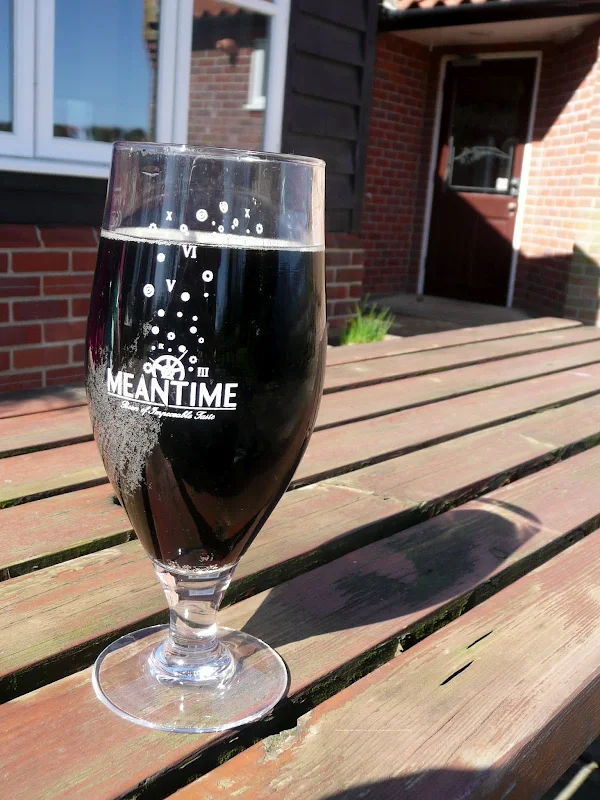
Owned by locally born and bred Suffolk Chef David Grimwood this Inn has gained a reputation for his quality 'rustic' English and French food predominantly made from locally sourced food. The Froize has only been a public house since the 1970's, having originally been a pair of gamekeepers cottages. There is debate over the origin of the name of the Froize but it is likely that it derives from a medieval Suffolk word for a friar as the Inn is located on the Friars Walk which links Sudbourne Hall with Butley Priory. The distinctive Inn Sign features a mural of a friar. The Inn is very finely decorated and furnished but walkers are welcome and there are benches on the patio at the side of the building. This is a freehouse with Adnams ales on offer along with London Stout from the Meantime brewery.
We arrived at the same time as guests from a wedding anniversary party which soon had the pub very busy. It is very smart establishment so, being walkers, we elected to sit outside on the patio. The staff were polite and attentive. I am not usually keen on drinking keg beers, but my interest was aroused by the Meantime Stout that was on offer. A very pleasing pint and nothing like Guinness.
The Jolly Sailor, Orford View in OS Map | View in Google Map

- Address
- Quay Street, Orford
- Website
- https://www.jollysailororford.co.uk/
Charming 16th century pub on Quay Street in Orford offering freshly caught fish landed at Orford Quay and home smoked hams and hand made sausages and a full compliment of Adnams ales. An array of pastimes are available including dominoes and shove-ha’penny as well as newspapers and during winter months there is a roaring log fire. A sign outside the pub advertises 'Children, Dogs, Parrots and Horse are welcome, humans by appointment!' Legend has it that the pub was built from the timbers of wrecked ships and is said to have been a smugglers haunt. A 'wanted' poster for an escaped lady horsethief is displayed on the walls of the pub. This was a certain 18-year-old Margaret Catchpole whom was captured at the pub and subsequently transported to Australia. Accommodation available as well as a campsite amidst the orchard at the rear of the pub.
Features
The Orford Merman: View in OS Map | View in Google Map
A curious tale from that originates from the 12th century AD about Orford fisherman capturing a wild man of the sea in their nets
A curious Orford tale is that of the Orford Merman. The story was first recorded by Ralph of Coggeshall, an English chronicler and monk, who wrote the tale of the Wild Man of Orford, in the Chronicon Anglicanum in 1200, some years after the events. In this chronicle he states that in or around 1167 Orford fisherman caught a wildman in their nets. He was said to be naked and was 'like a man in all his members, covered with hair and with a long shaggy beard'. Local caricatures also depict him with a bald head. Attempts to communicate with him failed so the fishermen took him to the castle where the custodian, Bartholomew de Gladville, kept him prisoner. Many attempts were made to speak with the merman but the only response was a mixture of grunts and strange noises. Frustrated with the merman's lack of speech Bartholomew de Gladville ordered his torture by hanging him him upside down from his ankles. Even this did not reciprocate a response.
He was taken to church but shown no signs of a belief in God. He took to his bed at sunset and always remained there until sunrise. He would only eat fish and had the unusual habit of squeezing the water from raw fish and drinking it. Then one day the merman was taken down to the harbour where the fisherman had strung nets across the entrance, and he was allowed into the water. He immediately swam under the nets and headed out to sea, bobbing up and down as if teasing the onlookers on shore. Unexpectedly he returned a few days later to resume his life on land but then escaped a second time and swam off never to be seen again.
Who this merman was we will never know but it is reputed that his ghost still haunts the castle.
References
Orford Castle: View in OS Map | View in Google Map
A well preserved example of a polygonal towered castle
Prior to the building of the Castle, the area around Orford was dominated by the Bigod family who held the hereditary title of Earl of Norfolk and owned Framlingham Castle. Hugh Bigod, 1st Earl of Norfolk was one of a group of dissenting barons and King Henry wanted to regain his authority in the region. Henry drained the marshes and turned Orford into a sheltered port and built the castle and church between 1165 and 1173
In 1173, Henry's eldest son rebelled against him and was backed by a number of barons including Bigod and also a number of Flemish mercenaries who landed near Orford. Upon the collapse of the rebellion, Henry ordered the confiscation of Framlingham Castle. Orford Castle was not as important after Henry's death in 1189. The castle was captured by Prince Louis of France who invaded England in 1216 at the invitation of the English barons who were disillusioned by King John
In 1280 under the rule of Edward I Orford Castle was granted out and eventually sold. This marked the beginning of the end of Orford Castle, as the estuary of the River Alde silted up and trade declined, reducing the importance of the castle as the centre of local government. Orford was a borough from 1579 to 1886 with parliamentary representation between 1483 and its abolition under the Reform Act 1832. There was also an Earldom of Orford, the most notable of whom was Sir Robert Walpole, the first Prime Minister of Great Britain.
Today, Orford Castle is unique with its well preserved polygonal tower keep and is the earliest castle whose entire building accounts survive which are held in the Public Records Office in London. Inside there is a basement, lower and upper halls and access to the roof where there are magnificent views seaward to Orford Ness. Around the rooms is a maze of passages leading to the chapel, kitchen and other chambers in the turrets.
References
Links and Bibliography:
Image Gallery


Route Validation Cards
Validation Date - 2011-03-19
- Time of Walk: 10:00 to 17:00
- Validators: Griffmonster, Kat
- Weather Conditions: Clear blue skies, bright sunshine with a fresh southerly breeze.
- Notes: Initial route undertaken
Summary of Document Changes
Last Updated: 2026-04-20
- 2011-03-20 : initial publication
- 2018-12-05 : general website updates
- 2021-03-17 : Update website improvements and removal of ViewRanger reliance
- 2021-12-01 : Removal of ViewRanger links due to its imminent demise
- 2025-10-27 : address link issues
- 2026-01-12 : Major website update with all walks recast to the new format


0 comments:
Post a Comment