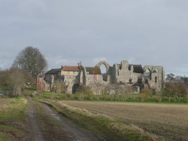
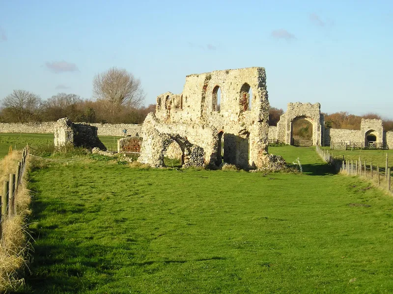
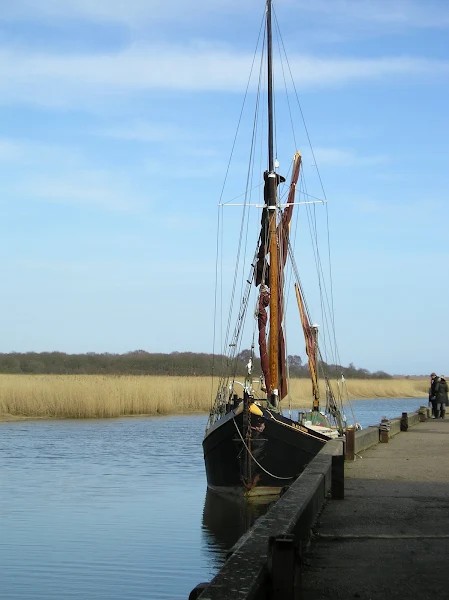
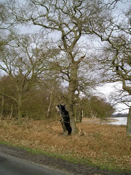
Route details, maps, pubs, features, local history and folklore for a wide variety of walks focusing primarily on Norfolk and Suffolk

find_in_page

Keyword Search Results

Walks
Showing posts sorted by date for query Dunwich. Sort by relevance Show all posts

Suffolk Coast Path

Martello Tower at Bawdsey

An overview of the Suffolk Coast Path, a 60 mile long distance path following the coast of Suffolk

A 60 mile long distance footpath from Felixstowe to Lowestoft in easy stages through some of the characteristic landscapes of the Suffolk Coast and Heaths Area of Outstanding Natural Beauty. The path also includes the Orford Loop which provides access through to Orford and the Butley Ferry. Alternative beach walks, providing the tide is right, can be undertaken throughout.

In Search of Sizewell and Thorpe Beacons

Sizewell

A 10 mile walk following the southern side of the parish boundary of Leiston in coastal Suffolk.

This is the second article devoted to the walk following the route of a 17th century perambulation around the southern side of the Leiston Parish boundary. This article concentrates on two landmarks from the past, namely Sizewell and Thorpe Beacons, which are thought to have been part of the Armada early warning system.

In Search of the ruins of Leiston Abbey (Diversion in Place)

A 10 mile circular walk around Leiston and Eastbridge in Suffolk

Leiston Abbey was originally founded in the late 12th century by Ranulf de Glanville. The original building was constructed on an island in the Minsmere marshes. Two centuries later, due to the inhospitable conditions on the marsh and constant flooding the Abbey was moved inland, lock stock and stone to a site close to Leiston. Despite a great fire in 1367 and much demolition following the dissolution of the monasteries there still remains some impressive ruins. There is still a remnant of the old Abbey, with the former chapel building sitting in its island position above the marsh, decaying into the landscape and containing a WWII pill box. This walk visits both sites making a well worthwhile walk.

The Sandlings Walk - Dunwich to Southwold

Aldborough

A 15 mile circular walk along the Sandlings footpath between Dunwich and Southwold, with an option of returning either via the beach or the Suffolk Coast Path through Dingle Marshes

This is the final stage of the Sandlings Walk from Ipswich to Southwold. Starting at Dunwich, it takes the trails through Dunwich Forest and heads over Walberswick Heath to Southwold. The woods are full of mushrooms and nuts and berries this time of year... and hops! This is a lovely walk through the woods and well worth the effort. To make the route circular, the return is either via Dingle Marshes, or the Suffolk Coast Path or if the tide is out then its an easy walk along the beach.

Dunwich to Walberswick

Aldborough

A 13 mile Suffolk circular walk connecting Dunwich and Walberswick

This walk encapsulates coast, forest and marsh presenting a myriad of landscapes. Making use of both the Sandlings and Suffolk Coast Path, it is a simple and easily navigated wander to fill a days exploration

In Search of the Lost City of Dunwich (Diversion in Place)

A circular walk between Leiston and Dunwich

This walk uses the beach and the Sandlings Path to provide a days walk to Dunwich from Leiston via Sizewell. One should time this walk such that the beach is walked a couple of hours either side of low tide when there is a little sand to walk along. At other times the beach is predominantly shingle and the walker may find it easier to follow the Suffolk Coast Path which is waymarked from the north side of Minsmere where it continues up onto the cliffs.

The Sandlings Walk - Bromeswell to Snape

Wantisden church

A 16 mile walk along the Suffolk Sandlings Path between Bromeswell and Snape taking in Rendlesham and Tunstall forests

The route leads across gorse covered heathland and through forest which typifies the modern landscape of the Sandlings. The forests are a modern development, set up with the founding of Forestry Commission during the 1920's to provide Britain with a sustainable source of timber. One cannot fail to notice the twin airbases of Woodbridge and Bentwaters, the scene of a infamous military encounter with a UFO during December 1980.

Walk Statistics

  • Start location: Bromeswell 
  • End location: Snape Maltings 
  • Distance:   miles (  km)
  • Total Gain:   ft (  metre)
  • Total Descent:   ft (  metre)
  • Min Height:   ft (  metre)
  • Max Height:   ft (  metre)
  • Est. Walk Time:  
  • Walk type: Linear
  • Walk Grade: Easy
  • Terrain:

Maps

The following maps and services can assist in navigating this route. There are links to printed maps and links to downloadable GPX route data for importing into navigational software and apps.


Transport

Service
Service Details
Unfortunately there is no longer a regular bus service that serves Snape Maltings therefore there is no public transport to connect the two ends of this walk. The nearest bus service by continuing along the Sandlings path would be Friston, but this would involve a change at Saxmundham. At the other end, the 800 service links Bromeswell, Melton and Woodbridge but is not very regular so it is beneficial to start the walk from Melton. It is always worth using the Traveline website in case any service becomes available
Timetable

View in OS Map | View in Google Map

Image of pub
Address
Woodbridge Rd, Butley
Website

This village inn dates back to 12th Century and still retains many old features such as oak beams, and a cast iron fire surround which allegedly dates from the 1700's and the walls are adorned with local photos and articles. Tax records show that the pub was known as The Great Oyster in 1617

After over four years of closure the pub reopened in March 2017 and is a charming, warm, rustic old pub, unspoilt by the rigours of age. The owners added an on-site shop and a microbrewery but despite this in 2019 the pub once again closed its doors. The future is currently uncertain with possible change of ownership or purchase by the local community.

Review (2010-04-03)

Adnams ales on offer, a roaring fire to sit in front of and some old locals telling us about the history of the old inn. Perfect.

Plough and Sail, Snape View in OS Map | View in Google Map

Image of pub
Address
Snape Maltings, Snape
Website

There has been a pub here since the 16th century, when it was a smugglers inn at the head of navigation on the River Alde. Throughout this period and right up until 1965 the pub was also the focus for the sailors who traded barley on the Thames Barges that berthed on the quayside.

The pub was taken over in April 2012 by twin brothers Alex and Oliver Burnside. They offer quality seasonal food produced from local suppliers as well as local ales. There is a spacious restaurant, a cosy bar and intimate balcomny area. Seating is provided in front of the pub and there is a courtyard at the back.

Review (2010-04-03)

A final pint of Adams Explorer before the bus home. Although the air was cool it was still warm enough to sit on the bench outside and reflect on the great days walk.

Features

Gobblecock CottageView in OS Map | View in Google Map

This somewhat amusing name is probably derived from the old Suffolk name for a turkey-cock which was known as a gobble-cock and could reflect the keeping of turkeys in days gone by. This 19th century rubble flint thatched cottage is a grade II listed building. This cottage is the sole surviving intact example of a gamekeeper's cottage on this shooting estate.

The Sandlings ForestsView in OS Map | View in Google Map

The area of East Suffolk known as The Sandlings is characterised by extensive unfertile sandy soils. This is the domain of hardy plants that can survive this habitat: gorse, bracken and heather are abundant throughout this area.

The first world war brought realisation of how much timber was imported into this country and after hostilities ceased The Forestry Commission was set up to provide a home grown timber resource. Naturally the farmers and landowners from the Sandlings area were eager to sell their poor quality land to this new organisation and thus in 1921 the forests were set up at Rendlesham, Tunstall and Dunwich.

The combined forests cover about 8648 acres of the former Sandlings. The great storm of 1987 devastated much of Rendlesham forest with over a million trees being blown down. Since then the forest has been replanted with a more varied mix of trees to include both conifer and broadleaved varieties intersected with clearings, wetland and heath to provide a varied habitat that encourages wildlife and fauna.

Each forest area has public access. Rendlesham Forest has been enhanced with cycle and walking trails including the UFO Trail to commemorate the landing and encounter with a UFO by USAF Servicemen in 1980. Sometimes referred to as The British Roswell, this event happened over several days of the Christmas period of 1980 and witnessed by dozens of military servicemen as well as civilians. The UFO Trail navigates from The East Gate of RAF Woodbridge, where the UFO was initially witnessed landing in the forest, and leads through the forest on the alleged route the servicemen travelled to where they found the unknown craft landed, and which is now marked by a sculpture. Full details of a walk incorporating this trail can be found at An Extended Walk around the Rendlesham UFO Trail.

The forest also includes activity areas and regularly hosts events including Theatre in the Forest. A camping area provides access for those who want to stay over in these delightful surroundings.

Staverton ParkView in OS Map | View in Google Map

The area north of RAF Woodbridge, to the east of Rendlesham forest is known as Staverton Park. It is thought that this was originally a deer park created between the 11th and 13th centuries. Records show that during this time that the abundant oak was used in a wide variety of manners. This included bark for tanning leather, acorns for pig feed as well as the usual timber and fuel.

Later, during the 16th century the oaks started to be pollarded which was done on a 50 year cycle. During this period there was also Staverton Hall located to the south west of the present woodland in what is now Rendlesham Forest

Today the site, described in 1986 as 'a famous and awesome place of Tolkienesque wonder and beauty' is a Special Area for Conservation (SAC) and a Site of Special Scientific Interest (SSSI). The ancient woodland consists of oak and birch with some holly trees which are said to be the largest in Britain. It has an awesome woodland of ancient oak and birch, and part of the site has holly trees reputed to be the largest in the UK. It may have been a deer park in the Middle Ages and there is a fenced-off area for these mammals now. Privately managed.

Wantisden ChurchView in OS Map | View in Google Map

Wantisden church, dedicated to John the Baptist, can be found on the track that leads around the eastern perimeter of RAF Bentwaters. There is no road access to this remote church and up until the 1950's it was positioned within the enclosure of the military area. This necessitated a military escort for those who wanted to visit the church.

The significant feature of the church is the coralline crag tower of which there are only two examples in the county, the other being at nearby Chillesford. The tower dates from the 15th century and is curious by the fact that it has no battlements.

Route Validation Cards

Validation Date - 2010-04-03

  • Time of Walk: 09:30 to 16:00
  • Validators: Griffmonster, Kat
  • Weather Conditions: Cool but bright. Odd threat of a shower but nothing eventually occurring
  • Notes: Initial route undertaken

Validation Date - 2014-12-19

  • Time of Walk: 07:00 - 14:00
  • Validators: Griff
  • Conditions: Clear day after previous days rain
  • Notes: As ever, I got a little lost in Rendlesham Forest
Summary of Document Changes

Last Updated: 2026-01-12

  • 2021-03-17 : Update website improvements and removal of ViewRanger reliance
  • 2021-12-01 : Removal of ViewRanger links due to its imminent demise
diversity_3

Popular Walks