Route details, maps, pubs, features, local history and folklore for a wide variety of walks focusing primarily on Norfolk and Suffolk

Walks
Showing posts sorted by relevance for query Bungay. Sort by date Show all posts

Thursday 28 November 2019

A Walk to Suffolks Mystery Brampton Standing Stone

A 14 mile walk between Halesworth and Beccles along the East Suffolk Line Path

This waymarked route links the railway stations at Halesworth, Brampton and Beccles. Taking the train between these towns will provide an interesting glimpse of what is in store along the walk, including the rather curious Belle Grove Farm looking as if it is out of some fantasy movie and the mysterious Brampton Standing Stone just south of Brampton Station.
Sunday 30 December 2018

Suffolk Coast Path - Lowestoft to Southwold Inland Route

Covehithe church

A 17 mile walk using the official inland route of the Suffolk Coast Path from Lowestoft to Southwold

Due to erosion and tides the Suffolk Coast Path takes an inland diversion for the section between Lowestoft and Southwold. Although the alternative beach route can be accessed providing the tides are right, this route nonetheless has its worth especially for the picturesque section around Frostenden.

Thursday 19 December 2019

The Angles Way - Diss to Wortwell

Millpond near Weybread House, Harleston

A 17 mile walk along the Angles Way from Diss to Harleston and onto Wortwell

There is plenty of history along this section of the Angles Way as it follows the course of the River Waveney. Numerous archaeological finds have been found along the route dating from prehistoric times through roman pottery and remnants of the middle ages. There are lost villages, halls and churches to provide ample opportunity for exploration as the path meanders across the Norfolk Suffolk border.

Saturday 15 December 2018

A Walk through the The Vale of Slaughden

Thames barge heading down river

An exhilarating 4 mile walk along the defence banks of Suffolk's River Alde estuary beginning and ending at Slaughden Quay

Once known as the Vale of Slaughden, the area below Aldeburgh presents a big open landscape across the marsh with the wide estuary waters of the River Alde as it meanders alongside the coast. Once upon a time Slaughden was a bustling fishing village but in present day it is all under the waves and a narrow spit of shingle is all that divides the North Sea from the gentle waters of the river.

Thursday 13 December 2018

Southwold Circular Walk

An 5.5 mile circular walk around Southwold

This walk navigates from Southwold Harbour around the northern part of the Blyth estuary known as Buss Creek, returning via the seafront to the harbour. One cannot miss out on a wander around the pier to take in the amazing sights of the quirky The Under the Pier show, the creation of Tim Hunkin and typical British eccentricity at its best.

Friday 14 December 2018

Southwold to Covehithe Circular Walk

Beach at Easton Bavents

An 11 mile circular walk along the Suffolk Coast Path between Southwold and Covehithe

A walk along the beach route of the Suffolk Coast Path to the tiny hamlet of Covehithe with its impressive ruins of St Andrews church. Return is along the inland route of the Coast Path. This walk is dependant upon tides and consultation of tide times is vital in order to negotiate the beach route.

Wednesday 2 January 2019

A Trek Around Sole Bay

Sole Bay

A 24 mile circular walk between Sizewell and Southwold along the Suffolk Coast Path and Sandlings Walk.

Back in the 17th Century, Southwold was England's main fleet anchorage. Sole Bay (Sawolde Bay) was a bay centred on Southwold with Easton Ness to the North and Dunwich to the South. In May 1672 this bay was the scene of a fierce sea battle when a fleet of 75 Dutch ships took an Anglo-French fleet by surprise. There were heavy losses on both sides in this, the first naval battle of the third Anglo Dutch War, but luckily for the English fleet the wind turned to their favour resulting in their success in the battle. Today coastal erosion has straightened the coastline of the former bay and all that remains of the battle are the stories and the cannons pointing out to sea on Gun Hill.

Sunday 23 February 2020

The Angles Way - Wortwell to Earsham

Lakes at wortwell

An 8.75 mile walk along the Angles Way from Wortwell to Earsham

It is not often that a country ramble coincides with a Brewery visit. On this route there are two, the historic St Peters brewery and the Waveney Brewing Company based at the Queens Head pub in Earsham. Although St Peters is a little off route a visit to this exquisite old building is thoroughly recommended. Also just off route is the village of Flixton where there is the remains of Flixton Priory and a church with a unique tower plus the setting for a spooky story.

Friday 28 December 2018

Angles Way - Oulton Broad to Beccles

Beccles

A 9 mile walk along the Angles Way between Oulton Broad and Beccles in Suffolk

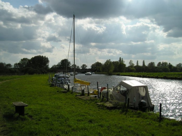
The path between Oulton Broad and Beccles doubles up as both The Angles Way and the East Suffolk Coast Line walk. There is not much to this walk other than following the winding path alongside the River Waveney. It is a pleasant enough stroll but without much activity on the river it can become a little monotonous until Beccles approaches. Nonetheless, what a better way than to spend a sunny afternoon other than ambling alongside the river.

Sunday 9 February 2020

Suffolk Coast Path

Martello Tower at Bawdsey

An overview of the Suffolk Coast Path, a 60 mile long distance path following the coast of Suffolk

A 60 mile long distance footpath from Felixstowe to Lowestoft in easy stages through some of the characteristic landscapes of the Suffolk Coast and Heaths Area of Outstanding Natural Beauty. The path also includes the Orford Loop which provides access through to Orford and the Butley Ferry. Alternative beach walks, providing the tide is right, can be undertaken throughout.

Friday 6 December 2019

The Wensum Way - Dereham to Lenwade

River Wensum near Bylaugh

A 13 mile walk through the Norfolk countryside following the Wensum Way

Opened in 2012, the Wensum Way was the connecting link between the Nar Valley Way and The Marriott's Way to enable a Cross Norfolk Trail from Kings Lynn to Great Yarmouth. The name of the trail is taken from the River Wensum which it follows from Swanton Morley through to Lenwade. This is a picturesque ramble through the Norfolk countryside.

Walk Summaries

Latest walk summaries are basic information sheets for walks that have yet to be fully documented. These provide links to maps, public transport and walks stats, although detailed notes and features are not included.

Latest Walk Summaries

Featured Walk

In Search of Sizewell Chapel

A 10 mile walk following the southern side of the parish boundary of Leiston in Suffolk This walk follows the route of a 17th century peramb...

What is GPX

All you need to know about GPX, electronic mapping and how to use modern apps and mobile devices as navigation devices

Popular Walks

Maps