Route details, maps, pubs, features, local history and folklore for a wide variety of walks focusing primarily on Norfolk and Suffolk

Griffmonsters Great Walks - Get Out and Explore

Welcome to Griffmonster's Great Walks. Set yourself free and explore the great British countryside. There are hundreds of walks on this site that offer guidance and inspiration to get out there and explore. Although this site focuses predominantly on East Anglia, it does offer walks from other areas of the UK including trails such as the South West Coast Path and the Cleveland Way. Take some time out and peruse through some of the walks listed below, or use the indexes and maps to find a specific walk to meet your ability, geographic location or particular interest. We do hope you find this information both informative and inspiring.

Latest Fully Detailed Walks

Fully detailed walks offer full and complete information including transport details, pubs on route and maps of the walk. These also provide some in-depth research of a specific topic that is featured on the walk. Such features can range from local folklore, local history or just information on key features that are encountered along the route.

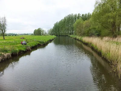
A Circular walk to Geldeston Locks from Beccles

Riverside walk to the Geldeston Locks pub A scenic riverside walk linking Beccles with the historic Geldeston Locks pub, this route offers meadow paths, peaceful stretches of the River Waveney, and glimpses of Norfolk’s rich folklore and heritage. Perfect for an afternoon outing, it combines gentle countryside walking with a memorable stop at one of the...
 

In Search of Sizewell and Thorpe Beacons

A 10 mile walk following the southern side of the parish boundary of Leiston in coastal Suffolk. This is the second article devoted to the walk following the route of a 17th century perambulation around the southern side of the Leiston Parish boundary. This article concentrates on two landmarks from the past, namely Sizewell and Thorpe Beacons, which are...
 

A Hike along the Marriotts Way

The Marriott's Way links Aylsham and Norwich following the former trackbed of the Midland and Great Northern Railway. ...
 

Latest Walk Summaries

Latest walk summaries are basic information sheets for walks that have yet to be fully documented. These provide links to maps, public transport and walks stats, although detailed notes and features are not included.

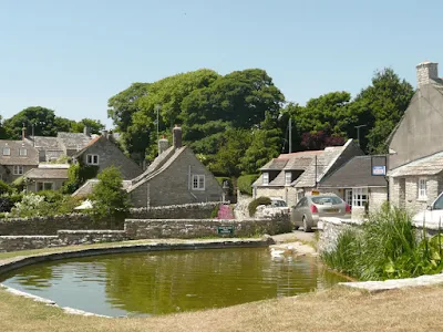
South West Coast Path - Langton Matravers to Swanage

A challenging walk along the South West Coast Path between Langton Matravers to Swanage Not quite a circular walk, with bus to connect the missing distance between Langton Matravers to Swanage. Some amzing coastline with a memorable climb to the top of St Adhelms Head....
 

Melton to Woodbridge

Simple walk along the river Deben. ...
 

Hele Bay to Berrynarbor Circular Walk

A 7 mile walk around coastal North Devon from Hele Bay to Berrynarbor This walk takes inland footpaths and tracks to navigate from the village of Hele Bay through to Berrynarbor, which, with its whitewashed stone walls takes on the guise of a Mediterranean village. The village plays host to numerous flower pot men in comical poses which makes an...
 

Latest Suffolk Walks

Suffolk offers some great landscapes to explore that is rich in both history and folklore. There are the coastal areas known as the Sandlings which offer open access, there's a multitude of charming villages and medieval towns and ancient castles and churches and quirky summer festivals. There is certainly a lot more to Suffolk than most folk realise.

WARNING!

It should be noted that public rights-of-way around the Suffolk Coastal area between Aldeburgh and Southwold are subject to being blocked up and diverted due to the extensive industrial projects that are currently taking place in the area including Sizewell C and various wind farm projects. Please see East Suffolk Public Rights of Way Access for more details.

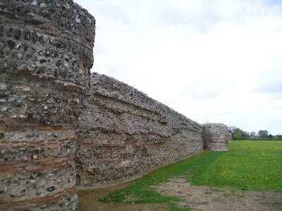
England Coast Path - Shotley Gate to Orwell Bridge

A walk linking the Bittern Line stations of Worstead and Wroxham ...
 

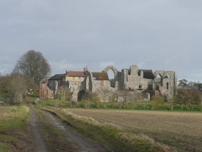
In Search of the ruins of Leiston Abbey

A 10 mile circular walk around Leiston and Eastbridge in Suffolk Leiston Abbey was originally founded in the late 12th century by Ranulf de Glanville. The original building was constructed on an island in the Minsmere marshes. Two centuries later, due to the inhospitable conditions on the marsh and constant flooding the Abbey was moved inland, lock stock...
 

The Sandlings Walk - Knodishall to Snape

A 13 mile circular walk along the Sandlings Walk between Knodishall and Snape With limited public transport this walk offers a circular route to incorporate the Sandlings path from Knodishall to Snape. Starting and ending at nearby Leiston it incorporates The Sailors Path and the Suffolk Coast Path to make a worthwhile day walk. The route passes Friston...
 

Latest Norfolk Walks

Despite the stereotype that Norfolk is flat, there is much more to it with a rich history and some great pubs that offer ales from the numerous Norfolk small breweries. It is true that the area around the broads offers wide expansive open landscapes but to the north there are hills and high cliffs with fantastic coastal views. Norfolk offers many long distance trails to assist in exploring the country including the Norfolk Coast Path, the Peddars Way.

Angles Way - Belton to Great Yarmouth

An 8 mile walk along the Angles Way from its start at Great Yarmouth to Belton The journey along the Angles Ways begins with a walk along the banks of Breydon Water to Belton. Along this route can be seen the impressive remains of the Roman fort Gariannonum at Burgh Castle. This is a simple afternoons walk with a frequent bus service linking Great...
 

Dilham and Honing Circular Walk

A circular walk taking in the Weavers Way, Honing and Dilham ...
 

East Runton to Aylmerton and Felbrigg Circular Walk

A ramble through the North Norfolk countryside ...
 

Other Walks

Although Griffmonster Walks is based in East Anglia, focusing primarily on Norfolk and Suffolk, there are nonetheless more distance trails and paths that have been undertaken over the years. From the South West Coastpath and other National Trails through to coastal sections of both England and Wales, there is much to choose from. It should be recognised that these are more a travelogue of the instance when these were walked and readers should be aware that paths may change and public transport services may have been subsequently alter. Click on the links below, have a read of the adventures and hopefully it will inspire you to get your walking boots on your feet, and head out in search of your own adventure.

Indexes and Info

East Suffolk PRoW Access

The Public Rights of Way (PRoW) within the Suffolk Coastal area between Aldeburgh and Southwold are subject to being blocked up and diverted due to the extensive industrial projects that are currently taking place in the area including the Sizewell C development and various wind farm projects. A PRoW Access page details known issues in the area. There is also a link to the Works Tracker that contains details of known Blocking Up and Diversion Orders

Featured Walk

In Search of Sizewell Chapel

A 10 mile walk following the southern side of the parish boundary of Leiston in Suffolk This walk follows the route of a 17th century peram...

What is GPX

All you need to know about GPX, electronic mapping and how to use modern apps and mobile devices as navigation devices

Popular Walks

Diary of a Suffolk Common

The ramblings and musing of the Griffmonster