Route details, maps, pubs, features, local history and folklore for a wide variety of walks focusing primarily on Norfolk and Suffolk

Walks
Showing posts sorted by relevance for query Cromer. Sort by date Show all posts

Thursday 10 January 2019

Happisburgh to Winterton Beach Walk

Happisburgh from Eccles

An 11 mile beach walk between along the Norfolk coast from Happisburgh to Winterton

Providing the tide is right, this is a fantastic beach walk with miles of golden sand and, if you are lucky, the sight of seals basking in the sunshine. Probably one of the best beach walks on this coastline.

Wednesday 9 January 2019

Holt to Mannngton Circular Walk

An 18 mile circular walk using footpaths and bridleways through the attractive Norfolk countryside between Holt Country Park and the Mannington Estate.

This trail takes in woodland, open countryside, lanes and even a stream which one has to jump across to provide a variety of landscape. The majority of the route is clearly waymarked although the start in Holt country park lacks initial direction as does the section around the Mannington Estate. The only disappointment was the lack of pubs, the Hare and Hounds at Baconsthorpe having last closed its doors in 2010.

Thursday 19 December 2019

In search of the Becks and Ponds of Beeston Regis

View from foot of Incleborough Hill

A 7 mile walk between East Runton and Sheringham in Norfolk, searching out a couple of good pubs and following Beeston Beck across Beeston Common.

This picturesque trail follows the foot of Inkleborough Hill to West Runton then navigates down to the northern end of Beeston Back Common where it follows the stream known as Beeston Beck down into Sheringham, past the site of an old watermill, now replaced by terraces of housing. Return is via West Runton with a stop at the Village Inn. At only 7 miles, this is a simple and easy afternoons stroll.

Friday 11 January 2019

A visit to the rather curious Happisburgh

Happisburgh lighthouse

A simple 3 mile circular walk along the Norfolk Coast between Happisburgh and Eccles

Happisburgh is curious - it is slowly being taken by the sea, its houses slowly falling victim to the tides. The pub gardens boast a signal box to a railway line that never got built. A lighthouse stands guard to the south and its lifeboat is located at the next village of Eccles. In recent times the tide has uncovered prehistoric human footprints. And there is local folklore of ghostly smugglers and misdeeds. Very curious indeed.

Wednesday 18 December 2019

Bure River Walk from Coltishall to Brampton

Buxton Mill

An easy and captivating walk along Norfolks River Bure

Not only does this walk provide some classic Norfolk scenery and historic features but it also traces the route said to be taken by the phantom carriage of Sir Thomas Boleyn in his annual act of penance for betraying his daughter Anne when she was sentenced to be executed. The walk is then made into a circular route by returning via the Bure Valley Path alongside the narrow gauge Bure Valley railway.

Friday 1 February 2019

Weavers Way - Potter Heigham to Great Yarmouth

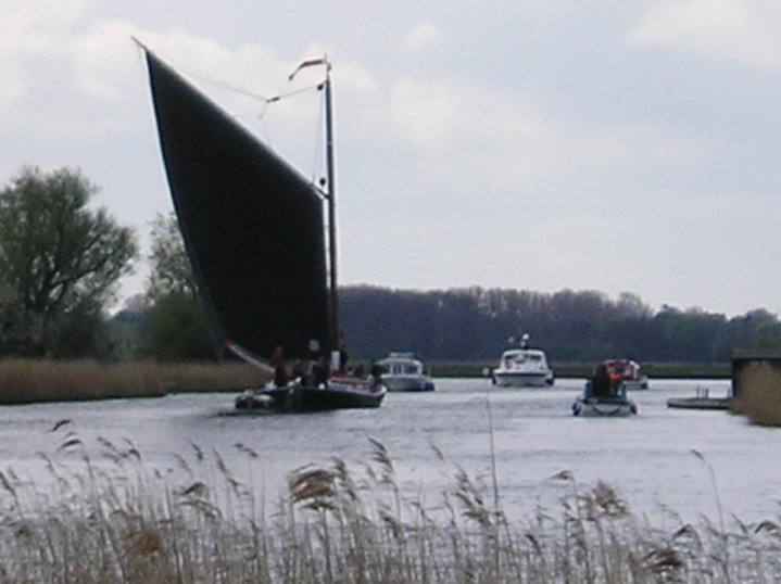
A wherry heads down the river Thurne

A 20 mile walk through the Norfolk Broads following the rivers Thurne and Bure from Potter Heigham to Great Yarmouth

A walk that follows the rivers Thurne and Bure down to the town on Acle. There is then some challenging navigation across Halvergate marshes to end up walking along the banks of Breydon Water into great Yarmouth. This really is the epitome of what everyone imagines of the Norfolk Broads. Broad open skies and large open flat landscapes.

Sunday 8 December 2013

2013 Storm Surge at Sizewell and Thorpeness

The strange egg-shaped object on the left is most likely a piece of fallen cliff

A walk at high tide of the 2013 Storm Surge between Sizewell and Thorpeness

This is a photographic excursion of the 2013 Storm Surge down the Suffolk Coast. With media firmly concentrated on events in South Africa the only real way to find out was happening was to visit this destructive storm surge oneself. Although this part of Suffolk was relatively unscathed it still presented awe-inspiring seas and crashing waves.

Tuesday 31 July 2018

A Walk to Baconsthorpe Castle Walk Summary

Salt marsh

An easy walk to view the ruins of Baconsthorpe Castle with return route to Sheringham

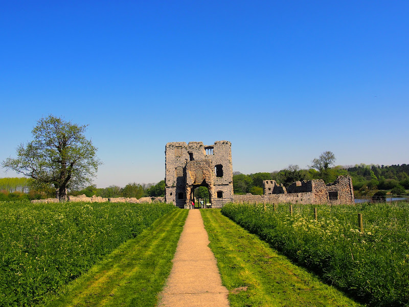
The remarkable ruins of the moated and fortified 15th century manor house known as Baconsthorpe Castle lie to the south of the village of Bodham on the main A148 road close to Holt. Footpaths and lanes provide access through to this isolated wonder that lie hidden in the Norfolk landscape. The Castle is currently under the tenure of English Heritage and entry is totally free. The landscaped area is surrounded by a picturesque moat and information boards document the history of the ruin. This really is something worth visiting so allow at least an hour to peruse this piece of Norfolk history.

In order to get to the start of the walk, there is a frequent seven day a week bus service linking Sheringham and Bodham. After navigation to the ruins, the return is via the village of West Beckham where there is the Wheatsheaf pub for lunches and refreshment. A footpath leads down to the main road from where permissive paths through Sheringham Park provide an interesting and pleasant route through to Upper Sheringham. This route follows the parks Temple Walk and then continues onto Park Road to emerge back on the road at Upper Sheringham. The park is open from dawn to dusk and outside of these hours one is required to walk down the B1157 which has no pavement making a hazardous route, particularly during holiday periods.

There are pavements between Upper Sheringham and the main town and the walk ends at the bus stop adjacent to the North Norfolk Railway station.
Saturday 29 December 2018

Mundesley to Happisburgh Circular Walk

Coastline from Mundesley to Happisburgh

A 13 mile walk between the Norfolk coastal villages of Mundesley and Happisburgh

This walk comprises of a circular route taking in both the beach and the cliff-top paths between the two Norfolk coastal villages of Mundesley and Happisburgh. The centre of this walk is at Walcott where the cliffs recede and access to the beach is obtainable. This enables the walker to customise this route according to tidal conditions as both Happisburgh and Bacton beaches can be cut off by high tides.

Tuesday 27 November 2018

In Search of the myths and legends of Stiffkey

Freshes creek

An 8.5 mile walk along a section of the Norfolk Coast Path between Wells-next-the-Sea and Morston, with a diversion through the village of Stiffkey.

Stiffkey (locally pronounced Stewkey) is referred to as Stivecai in the Domesday Book, which means "island of tree stumps". This is thought to relate to the remains of an ancient wooden structure dating back 8,000 years, that was found on the marsh. Today it is a sleepy little village on the North Norfolk Coast Road renowned for its topiary including a line of elephants all trunk to tail at Nellie's Cottage, a guitar sitting proudly atop a hedge at the home of a guitar teacher and a fox by the gate post of the Fox family's house. It does, nevertheless, have an intriguing recent history with stories of Black Shuck, the ghostly devil dog, and the tale of the infamous Reverend Harold Davidson, Rector of Stiffkey who was defrocked in a national scandal involving ladies of the night and ended up being mauled by a lion.

Thursday 10 January 2019

Holkham to Wells Circular Walk

A 9 mile circular walk along the North Norfolk Coast between Holkham and Wells-next-the-sea

An alternative to the North Norfolk Coast Path, which follows the landward side of the large belt of pine trees known as Holkham Pines, is to walk along the glorious sandy Holkham beach. This was such a well worth experience with acres upon acres of sandy beach and dunes. With clear blue skies and a little sunshine this makes for a superb walk at any time of the year. The Albatros, a sailing ship that is permanently moored at Wells Quay provides some fine and simple lunches including fresh mussels which provide a fitting half way point to this walk. The return uses the tracks around the Holkham estate taking in views of the hall, the lake and obelisk.

Friday 6 December 2019

The Wensum Way - Dereham to Lenwade

River Wensum near Bylaugh

A 13 mile walk through the Norfolk countryside following the Wensum Way

Opened in 2012, the Wensum Way was the connecting link between the Nar Valley Way and The Marriott's Way to enable a Cross Norfolk Trail from Kings Lynn to Great Yarmouth. The name of the trail is taken from the River Wensum which it follows from Swanton Morley through to Lenwade. This is a picturesque ramble through the Norfolk countryside.

Wednesday 27 November 2019

A Hike along the Marriotts Way

Sculpture that marks the start of the Marriotts Way at Norwich

The Marriott's Way links Aylsham and Norwich following the former trackbed of the Midland and Great Northern Railway.

The Marriott's Way is a footpath, bridleway and cycle route, which follows the routes of two disused railway lines, and runs between the historic market town of Aylsham and the medieval city of Norwich. Along with the mileage markers which are created from old rails complete with a metal rubbing plaque, there are numerous concrete sculptures, village markers, interactive sound boxes and benches which all provide added interest and information along the route.

Wednesday 18 December 2019

Inland Walk between Cley and Blakeney

View from Wiveton Downs

A 6 mile walk taking in the Wiveton Downs as an alternative to the coastal route between Cley and Blakeney

An alternative route to the Norfolk Coast Path between Cley and Blakeney taking in the high ground across Wiveton Downs. Spectacular views of the coastline can be had from this area and the route also includes the Shell Museum at Glandford and the dominating church at Cley

Walk Summaries

Latest walk summaries are basic information sheets for walks that have yet to be fully documented. These provide links to maps, public transport and walks stats, although detailed notes and features are not included.

Latest Walk Summaries

Featured Walk

In Search of Sizewell Chapel

A 10 mile walk following the southern side of the parish boundary of Leiston in Suffolk This walk follows the route of a 17th century peramb...

What is GPX

All you need to know about GPX, electronic mapping and how to use modern apps and mobile devices as navigation devices

Popular Walks

Maps