Route details, maps, pubs, features, local history and folklore for a wide variety of walks focusing primarily on Norfolk and Suffolk

Walks
Showing posts sorted by relevance for query Woodbridge. Sort by date Show all posts

Tuesday 7 January 2020

Kenton Hills and Broom Covert Circular Walk

Broom Covert

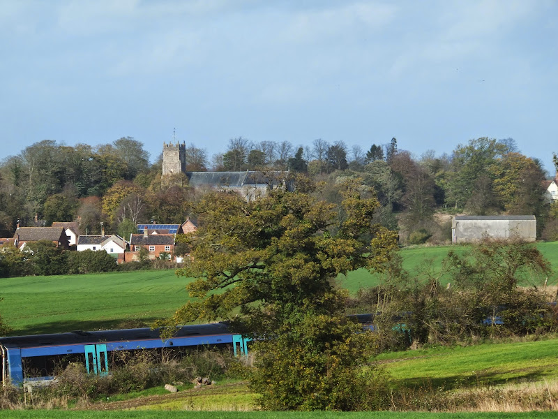
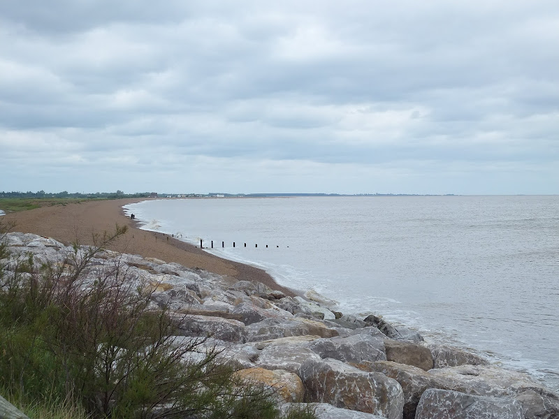
A circular walk around the Area of Outstanding Natural Beauty at Sizewell

This walk has a diverse landscape that has something for everyone. Woodland, coast and beach, freshwater marsh and Sandlings Heath which is a delight to any visitor and worthy of its status as an Area of Outstanding Natural Beauty. The walk heads out of Leiston alongside the man-made Aldhurst Farm nature reserve, an area of wetland, heath and grassland created in 2015 as a sweetener for the local folk should the proposed Sizewell C Power Station get approval. It isn't presently accessible to the public other than the established footpath that runs along the valley and a new path running adjacent to Valley Road. The north side of the reserve was once known as Winters Heath, common land that was enclosed in the early 19th century. Therefore this is not so much as giving something to the community as returning the access rights to the people that such common land once afforded.

Views across the marsh to minsmere, an area that will be covered with spoil heaps from the construction of Sizewell C

Moving on up to the top of the hill on Lovers Lane where we take the track off to the right as the road bends around to the left. An interesting feature on the OS maps at this location is an area marked as Fiscal Policy. This is thought to be a so called Trap Street, a fictitious location that is used as a copyright marker for the cartographers work. This specific fictitious location has been added to OS maps since the 1920s and has varied its exact location over the decades, although keeping within the general area of the western side of Kenton Hills. It is certainly not a location known to locals and appears on no other maps of the area other than the Ordnance Survey. It is notable that there are many references to the area of Fiscal Policy made in modern documentation written by both Suffolk Council and EDF, the Power Station operators. This goes to show the lack of local knowledge these bureaucrats and business managers have which may account for their scant respect for the surrounding landscape.

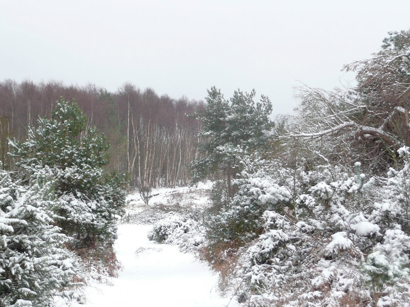
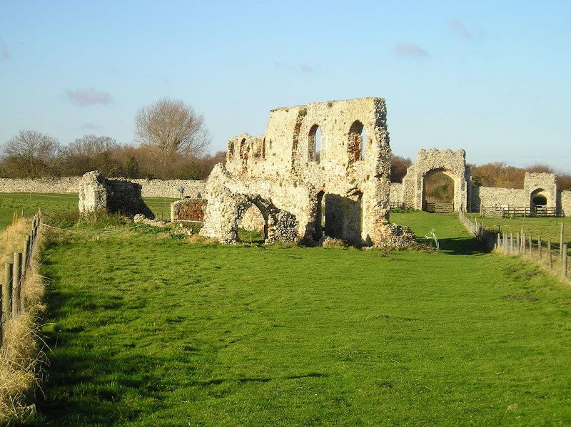
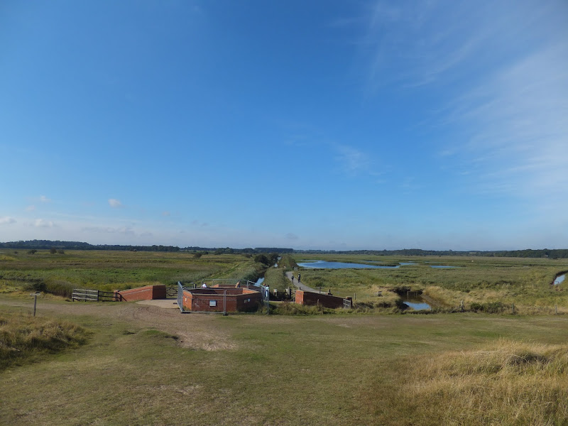
The route then heads through a car park and into the woodland through the areas known as Kenton (marked as Tenton on 19th century OS maps) and Goose Hills. The naming of the area as Hills is not self evident from the tree covered landscape. It has to be said that there is a triangulation station in the depths of Goose Hill but this is only at an altitude of 9m with the surrounding landscape no less than 5m. I guess a mere 4m high piece of land surrounded by marsh may look like a hill but it certainly is not self evident within the dense forest. The names of Kenton Hill and Goose Hill date back from long before the forest was planted, when the area was Sandlings heathland. It wasn't until the 1960s, with the coming of Sizewell Nuclear Power Station, that the heath was planted with a managed forest. Going back further in history the area is thought to have been parkland attached with the 14th century Leiston Abbey, some documents describing it as a deer park.

There are many tracks through the woods including a section of the The Sandlings long distance trail as well as specific colour coded way-marked trails. This particular route takes the unmarked perimeter paths out to the extremities of Goose Hill where there are views onto the marshes to the south of Minsmere and a purpose built hide for those who want to spend some time discovering the wildlife of the marsh. Whatever route one takes, navigating to the eastern edge one will find two footbridges which provide access across to the coastal section of this walk.

Goose Hill and Kenton Hill Woodland

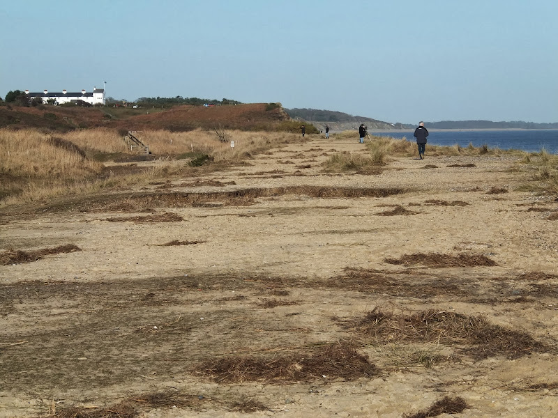
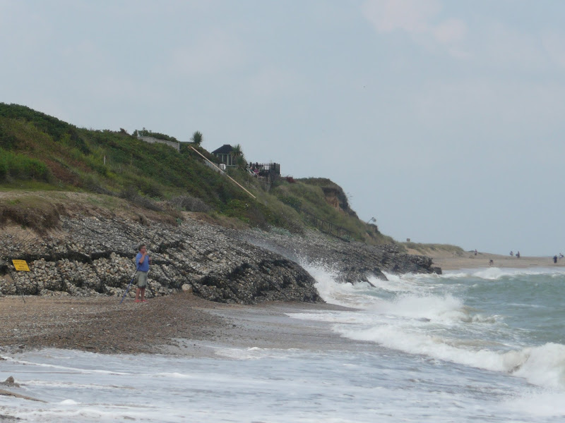
Sizewell beach offers both coastal heath and a shingle beach to walk along. The northern section at the point where the path emerges from the woods, was once a 19th century rifle range which I believe was also used during WWI as target practice for the troops. The beach and heath paths pass in the front of the two power stations at Sizewell and is a very popular for both tourists and locals walking through to Minsmere Sluice and beyond. For those wanting refreshments there is the Vulcan Arms pub at Sizewell as well as the Sizewell T cafe although this is closed over the winter months.

Return uses the medieval track through to Broom Covert. This was the original route between Leiston and Sizewell before the modern road was introduced in the 19th century. Broom Covert is an area of ancient Sandlings heath that is a delight to walk through and is another highlight of this walk, its contoured grassland hinting at hidden earthworks that may lie beneath. It is thought that this area was extensively used for troop training during WWII and there may be hidden structures dating from this period lying beneath the surface.

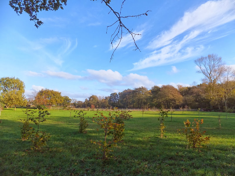
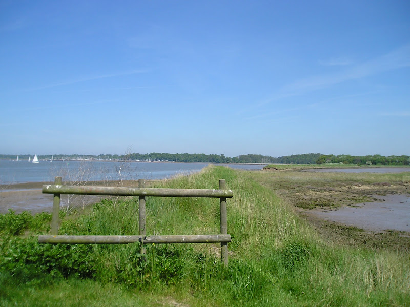
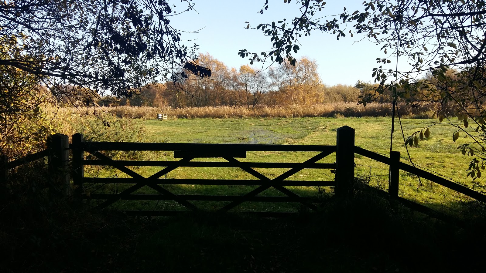
A permissive path leads across the meadow at Round Covert to Reckham Pits Wood which was originally part of Leiston Common, the woodland growing up in the early 20th century after it had been used for aggregate excavation. The mixed woodland is a much wilder landscape than that of Kenton Hills, with a cacophony of trees, foliage and fauna all competing for space, a blaze of colour and light in all seasons. Above the woodland is what is left of Leiston Common, correctly known as Leiston Dry Common to distinguish it from Leiston Wet Common which once occupied part of the marshes. The Common features in many local tales and stories of 18th century smugglers who would stash their booty in holes dug into the sandy soils of the common. There is a permissive path on the north side of the common that leads down to the marsh known as Sizewell Belts and across to Kenton Hill woods. The public footpath leads out onto Lovers Lane with a new footpath adjacent to Valley Road to take the walker back into Leiston.

Broom Covert, natural Sandlings heathland

It has to be stated that much of the landscape this route passes through may disappear in the next decade due to industrial usage despite its status as an Area of Outstanding Natural Beauty. The proposed Sizewell C power station will claim some of the woodland, specifically much of Goose Hill which will be replaced by an access road to the construction site and a railhead. The route of the proposed railway will run adjacent to Kenton Hills and may well devastate the fictitious area known as Fiscal Policy!. No doubt Goose Hill will be flattened with the introduction of the road, its trig point no longer applicable with the tallest structures becoming the 20-30m high spoil heaps which will dominate the landscape from the present site of Sizewell B through to Minsmere sluice and across to Eastbridge.

Public access to the woodland may become limited with no access through to the beach. The coastal access will be restricted during the construction of a loading jetty and sea defences, and the coast path may be blocked up for the duration of the build depending upon the design of the pier head that is chosen. The long distance routes of the Coast Path and the Sandlings Path will get diverted along Lovers lane and then taking the roads through to Eastbridge, a lengthy diversion along asphalt which is not conducive to committed walkers and hikers. There will no doubt be contention between road users and pedestrians, such confrontations already occur when walking the local roads so this will only get worse with the increased traffic. This re-routing is a big concern as many walkers make use of the coastal section from Sizewell through to Minsmere which makes the local area an attraction for outside visitors who may well be put off by such unpleasant walking diversions.

On the southern side of the route, Broom Covert was set to be requisitioned for the construction of Proposed East Anglia One/Two Windfarm Substations which were set to dominate the area, its buildings being some 18m in height. There was much opposition to this, the land being a prime example of Sandlings Heath and deserving of its Area of Outstanding Natural Beauty status. Fortunately it seems this threat has abated in preference to a site at Friston which itself is gaining significant opposition. The coastal land between Thorpeness and Sizewell is still threatened to be torn up and footpaths blocked up. Considering that this area is popular with both locals and visitors alike, it demonstrates the lack of local knowledge these corporations have of the area and just how much it attracts visitors. When, at a recent exhibition of the proposed development, the question about the blocking up of footpaths was put to ScottishPower Renewables, the rep seemed honestly aghast that we had walked two miles to get to the exhibition in Thorpeness. This demonstrates their lack of knowledge of the area. We walk. Two miles is around the corner. We do not want to be forced into cars. These footpaths are our access along the coast.

There are already two windfarm substations constructed at Sizewell. The big issue with all of this is each Power company appears to want their own substations whereas a more holistic and integrated policy would cause less development, less disruption and benefit all. Probably the best idea would be to have an off-shore ring main to connect all of these power sources rather than bringing the lines to a separate substations for every single wind farm that is built. However the power companies do not appear to be interested in such solutions. Cooperation appears to be a dirty word to these monolithic corporations.

To cap it all, there is an idea being put about to market this section of natural heath, marsh and sandling coastline as The Energy Coast. This is a gimmick to put a cosy name to what will be no more than industrialisation of the Suffolk Coastline. There are a lot of people out there, both local and from further afield who would prefer this to stay as a natural coast, a coast that harbours wildlife, where one can seek solace and peace, where one can sit or stand and admire the landscape, not a huge construction site under the marketed guise of The Energy Coast.

Finally, jumping the gun with the assumption that the construction of Sizewell C is a foregone conclusion, EDF have been given the permission to extend Sizewell B, destroying the 100 year old Coronation Wood in the proceess in order to accommodate a car park. This is currently being opposed by a local groups who have succeeded in forcing a judicial review in the High Court to challenge the planning decision.

Without a doubt this landscape will change drastically in the near future. Therefore if you want to enjoy this natural beauty, do so sooner rather than later or you will probably never get to see it due to the plethora of industrial constructions that are being proposed to completely devastate this area for the next 20 years and probably beyond. Gone the marsh. Gone the sandlings. Gone the peace. Gone the landscape. However, if you are into concrete landscapes, massive industrial constructions, busy roads, endless traffic, hoards of lorries then you will be in your element.

Monday 17 December 2018

Saxmundham, Kelsale and Carlton Circular Walk

Kelsale church from the other side of the railway

A 4 mile walk around Saxmundham, Kelsale and Carlton

Using footpaths an country lanes, this short walk provides some fine views, historic churches and even a ghostly tale of an apparition of phantom dancers. A worthy candidate for an afternoons exploration of this hidden corner of East Suffolk.

Saturday 29 December 2018

Suffolk Coast Path - Orford to Butley Ferry

A 6.5 mile Suffolk circular walk along the banks of the Ore and Butley rivers between Orford and the Butley Ferry river crossing at Gedgrave.

The Suffolk Coast Path Orford Loop has two routes back onto the main trail, the first returns from Orford up to Chillesford but an alternative is to follow the lane from Orford to Gedrgrave and down to Butley Ferry. Although this crossing only operates from April to October, a pleasant and easy circular walk can be made from Orford returning along the top of the river defences.

Monday 7 January 2019

A Walk to the Dunwich Leper Chapel

Leper Chapel

A 14.25 mile circular walk between Leiston to Dunwich

A simple walk using the Suffolk Coast Path from Sizewell to Dunwich with a visit to the ruins of the 12th century Leper Chapel. The return uses the the footpath via Mount Pleasant to get onto the Sandlings Path across Dunwich Heath to return back to Leiston.

Thursday 29 September 2011

An Amazing Adventure to Westleton Barrel Fair 2011

Barrel Race

A simple 11 mile walk across the Suffolk heaths and woodland from Leiston to attend the annual Westleton Barrel Fair.

For the second year on the trot we made our way through the lanes, tracks and footpaths to experience the unique adventures of Westleton Barrel Fair. This year there was the usual barrel races across the village green, open to residents and all-comers, together with straight sprints and sack races providing a full days entertainment in the August sunshine. Music was provided on the outdoor stage from the Bruisyard Light Orchestra performing a mixture of blues and pop cover versions in their unique style, together with performances by Rumburgh Morris Men. Other attractions included Punch and Judy shows, Donkey rides, Owls and exotic creatures on display, Coconut Shy, hog roast and various stalls offering local crafts. Adnams ales were available from the White Horse pub and their outside bar by the duck pond though unfortunately the Crown beer tent wasn't here this year so for guest ales we had to resort to wandering down to the Crown. An excellent day out and well worth the walk!

Sunday 12 December 2021

In Search of Leiston's Ancient Pagan Sites, the Procession Rayles and Gallows

Harrow Lane

A 7 mile walk following the western parish boundary of Leiston in Suffolk, as described in a document from the middle-ages

This walk attempts to follow the instructions of a perambulation around the western side of the Leiston Parish boundary that was undertaken in the year AD1620. Leiston's history is renowned for its Abbey and the Garret's works, but this walk also discovers the site of a possible ancient pre-Christian shrine or temple, the location of the Leiston gallows and the procession route taken by those attending this gruesome public spectacle.

Monday 17 February 2020

Alde Valley Walk - Sweffling to Badingham

more Suffolk countryside

A circular walk through the quintessential Suffolk countryside following the River Alde

A circular walk following country lanes with a few footpaths along the Alde Valley. This is typical Suffolk countryside where one can take a lazy stroll. There are pubs to visit, three to be precise and all named the White Horse, along with three churches that are not named the White Horse!

Sunday 22 December 2013

The Aftermath of the 2013 Storm Surge at Minsmere

Flattened dunes by the Northern Sea Wall to Minsmere

A 10 mile circular walk to witness the damage caused by the 2013 Storm Surge

The 2013 Storm Surge proved to be the highest tide in 60 years. Although much of the flooding had recede the evidence remained of where the waters reached. Viewing the changes in coastline shows just how vulnerable this stretch of the Suffolk coast really is, especially in view of the fact that such storms appear to be increasing in frequency. The walk returns through the heath and forest via Dunwich Heath and Eastbridge where the results of Octobers St Jude storm are evident from the many fallen trees.

Wednesday 15 February 2012

Winter Snows on Thorpeness Common

Snow on the common

An 7 mile circular walk across The Walks and Thorpeness Common.

The winter snows finally arrived in February this year creating a wonderful winters scene across the Aldringham and Thorpeness Commons, enticing folk out to witness the scene and encouraging local kids to take advantage of sledging down the slopes of the marl pit.

Thursday 7 January 2021

In Search of Leiston Gibbet, Friday Market Heath and St Andrews Green

Land by the River Hundred at Aldringham

A 6 mile walk around the heaths and commons of Coldfair Green

This walk follows an investigation to seek out the location of the Leiston Gibbet and an area of heathland that was known in the 1600's as Friday Market Heath. The only reference to these places comes from an old book from 1910 entitled 'The Chronicles of Theberton' which details the route past the gibbet. This walk attempts to retrace this route by navigating along the heathland and footpaths around the River Hundred which marks the boundary between the hundreds of Blything and Plomestead. Extensive research which has been undertaken and documented in the feature of this walk with some revealing insights to long forgotten places.

Friday 4 January 2019

A Walk Around the Churches of Knodishall and Friston

An 8.4 mile circular walk around the Suffolk villages of Knodishall and Friston

An easy ramble across the Suffolk countryside, with the highlight being the hidden ruins of St Peters Church in the old parish of Buxlow, now a part of Knodishall. There's some fascinating history on this walk along paths that are off the beaten track but nonetheless well maintained.

Saturday 15 December 2018

Suffolk Coast Path - Snape to Felixstowe

Looking bck towards Shingle Street from Bawdsey

A 20 mile walk along the Suffolk Coast Path between Snape and Felixstowe

This is the most remote section of the Suffolk Coast Path and follows the Butley River down to Shingle Street and then continues along the coast to the ferry at Bawdsey. There is an eerie sense of foreboding when walking this section. The solitude. The windswept landscape. The distant silhouettes of the Orfordness Pagodas. The lonely river. One can walk virtually the entire distance without seeing a soul and the only company is the decaying remains of WWII defences and the looming martello towers from Napoleonic times.

Tuesday 7 January 2020

In Search of the Lost City of Dunwich

A circular walk between Leiston and Dunwich

This walk uses the beach and the Sandlings Path to provide a days walk to Dunwich from Leiston via Sizewell. One should time this walk such that the beach is walked a couple of hours either side of low tide when there is a little sand to walk along. At other times the beach is predominantly shingle and the walker may find it easier to follow the Suffolk Coast Path which is waymarked from the north side of Minsmere where it continues up onto the cliffs.

Sunday 4 February 2018

In Search of Sizewell and Thorpe Beacons

Sizewell

A 10 mile walk following the southern side of the parish boundary of Leiston in Suffolk

This is the second article devoted to the walk following the route of a 17th century perambulation around the southern side of the Leiston Parish boundary. This article is concentrates on two landmarks from the past, namely Sizewell and Thorpe Beacons, which are thought to have been part of the Armada warning system.

Tuesday 27 November 2018

Ufford Heritage Trail

Smock Meadow floods

A 3 mile walk around the village of Ufford

Ufford is rich in heritage and well worth exploring. The Heritage Trail was created in 2006 and leads the walker around the historic features of the village including the village stocks, water meadows and the many listed buildings. The Highlight of the trail has to be the church which has the unusual dedication to St Mary of the Assumption and contains the second largest font cover in England which is a sight to behold.

Tuesday 1 January 2013

Coastal Erosion at Thorpeness

Erosion at Thorpeness

A circular walk from Sizewell to Thorpeness along the Suffolk Coast Path

In recent years the Suffolk Coast Path has been rerouted in-land from Sizewell across the commons to Thorpeness due to coastal erosion. The old coast route can still be walked when the tide is right and there is always an escape up the cliffs to Thorpeness Common just before the Thorpeness cliffs where the tide cuts off access to the beach.

Saturday 8 December 2018

Captains Wood, Sudbourne

Captains Wood

A 2.4 mile walk around the ancient woodland of Captains Wood just outside the hamlet of Sudbourne

This is a hidden gem of a walk close to the Suffolk Coast in woodland which is currently under the management of the Suffolk Wildlife Trust. The ancient woodland is full of life, colour and a natural wildness that is a pleasure to behold. A waymarked path provides easy access around the wood so one cannot get lost. Just take ones time and take it all in.

Wednesday 15 January 2020

Stour and Orwell Walk - Felixstowe to Ipswich

A 17 mile walk along the banks of the Orwell River in Suffolk starting at Felixstowe and ending in the centre of Ipswich

The Stour and Orwell path is an extension to the southern end of the Suffolk Coast Path and follows the coast along the estuaries of the Orwell and the Stour. The start of the walk is characterised by the earthen river defences along which the footpath navigates. From Levington Creek an alternative route is used to pay a visit to the 13th century Ship Inn before proceeding through Broke Hall Woods to rejoin the official route through to Ipswich.

Wednesday 2 January 2019

A Walk around Suffolk's Minsmere Bird Reserve

Minsmere sluice

A 10 mile circular walk through the Suffolk Coastal Area of Outstanding Natural Beauty taking in Sizewell and the Minsmere Bird Reserve

One does not have to have an enthusiasm for ornithology to enjoy this walk. The natural surroundings of marshland and heathland are enough to inspire everyone and there is a lot of associated history along this route which dates back to the 12th century when Leiston Abbey once occupied an island in the marshes. Note that charges apply to the Minsmere section.

Sunday 8 December 2013

2013 Storm Surge at Sizewell and Thorpeness

The strange egg-shaped object on the left is most likely a piece of fallen cliff

A walk at high tide of the 2013 Storm Surge between Sizewell and Thorpeness

This is a photographic excursion of the 2013 Storm Surge down the Suffolk Coast. With media firmly concentrated on events in South Africa the only real way to find out was happening was to visit this destructive storm surge oneself. Although this part of Suffolk was relatively unscathed it still presented awe-inspiring seas and crashing waves.

Walk Summaries

Latest walk summaries are basic information sheets for walks that have yet to be fully documented. These provide links to maps, public transport and walks stats, although detailed notes and features are not included.

Latest Walk Summaries

Featured Walk

In Search of Sizewell Chapel

A 10 mile walk following the southern side of the parish boundary of Leiston in Suffolk This walk follows the route of a 17th century peramb...

What is GPX

All you need to know about GPX, electronic mapping and how to use modern apps and mobile devices as navigation devices

Popular Walks

Maps