Route details, maps, pubs, features, local history and folklore for a wide variety of walks focusing primarily on Norfolk and Suffolk

Walks
Showing posts sorted by date for query Eastbridge. Sort by relevance Show all posts

Thursday, 7 January 2021

In Search of Leiston Gibbet, Friday Market Heath and St Andrews Green

Land by the River Hundred at Aldringham

A 6 mile walk around the heaths and commons of Coldfair Green

This walk follows an investigation to seek out the location of the Leiston Gibbet and an area of heathland that was known in the 1600's as Friday Market Heath. The only reference to these places comes from an old book from 1910 entitled 'The Chronicles of Theberton' which details the route past the gibbet. This walk attempts to retrace this route by navigating along the heathland and footpaths around the River Hundred which marks the boundary between the hundreds of Blything and Plomestead. Extensive research which has been undertaken and documented in the feature of this walk with some revealing insights to long forgotten places.

Sunday, 9 February 2020

Suffolk Coast Path

Martello Tower at Bawdsey

An overview of the Suffolk Coast Path, a 60 mile long distance path following the coast of Suffolk

A 60 mile long distance footpath from Felixstowe to Lowestoft in easy stages through some of the characteristic landscapes of the Suffolk Coast and Heaths Area of Outstanding Natural Beauty. The path also includes the Orford Loop which provides access through to Orford and the Butley Ferry. Alternative beach walks, providing the tide is right, can be undertaken throughout.

Tuesday, 7 January 2020

In Search of the Lost City of Dunwich

A circular walk between Leiston and Dunwich

This walk uses the beach and the Sandlings Path to provide a days walk to Dunwich from Leiston via Sizewell. One should time this walk such that the beach is walked a couple of hours either side of low tide when there is a little sand to walk along. At other times the beach is predominantly shingle and the walker may find it easier to follow the Suffolk Coast Path which is waymarked from the north side of Minsmere where it continues up onto the cliffs.

Kenton Hills and Broom Covert Circular Walk - BLOCKED UP

WARNING

THIS WALK USES BLOCKED UP PATHS AND IS CURRENTLY INACCESSIBLE.

PLEASE CHOOSE ANOTHER WALK.

Broom Covert

A circular walk around the Area of Outstanding Natural Beauty at Sizewell

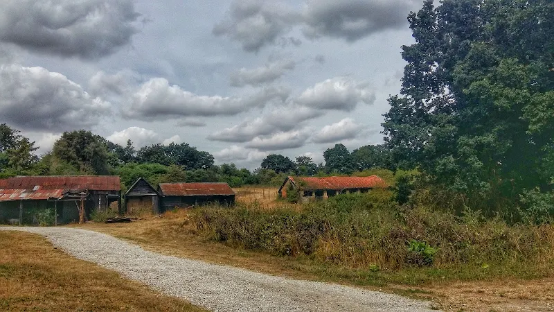
This walk uses blocked up paths and is currently inaccessible. There is no access through Goose Hill and down to the beach. Some parts of Kenton hills are accessible. The path across Broom Covert is lined with metal fencing and the path across the meadow to Reckham Pits has been directed. This is due to construction works linked to Sizewell C.

This walk has a diverse landscape that has something for everyone. Woodland, coast and beach, freshwater marsh and Sandlings Heath which is a delight to any visitor and worthy of its status as an Area of Outstanding Natural Beauty. The walk heads out of Leiston alongside the man-made Aldhurst Farm nature reserve, an area of wetland, heath and grassland created in 2015 as a sweetener for the local folk should the proposed Sizewell C Power Station get approval. It isn't presently accessible to the public other than the established footpath that runs along the valley and a new path running adjacent to Valley Road. The north side of the reserve was once known as Winters Heath, common land that was enclosed in the early 19th century. Therefore this is not so much as giving something to the community as returning the access rights to the people that such common land once afforded.

Sunday, 22 September 2019

In Search of Sizewell Chapel

Broom Covert

A 10 mile walk following the southern side of the parish boundary of Leiston in Suffolk

This walk follows the route of a 17th century perambulation around the southern side of the Leiston Parish boundary. The walk uses the ancient track down to Sizewell and continues down to Thorpe before turning inland to follow the River Hundred through to Cold Fair Green. The details are contained in two articles, this being the first, focusing on the medieval history of Sizewell.

Saturday, 12 January 2019

Down the Blyth Valley in Pursuit of Black Shuck

River Blyth near Halesworth

An 18 mile walk down the Blyth Valley in Suffolk from Halesworth to Blythburgh, then across the heaths and commons to Leiston.

It was the legendary hell hound that supposedly came this way in 1577 and terrified parishioners of Blythbrugh church after doing a similar job at Bungay. This walk is in two sections, the first section follows the River Blyth along the Waveney Way to Blythburgh with the option to continue on to Southwold. The Waveney Way is a Ramblers Association walk and does not have waymarkers along the route. An optional second section cuts across to Westleton and onto Leiston. Both Southwold and Leiston have public transport links to Halesworth making the walk achievable as a linear route without the requirement of assistance of a taxi.

Monday, 7 January 2019

A Walk to the Dunwich Leper Chapel

Leper Chapel

A 14.25 mile circular walk between Leiston to Dunwich

A simple walk using the Suffolk Coast Path from Sizewell to Dunwich with a visit to the ruins of the 12th century Leper Chapel. The return uses the the footpath via Mount Pleasant to get onto the Sandlings Path across Dunwich Heath to return back to Leiston.

Wednesday, 2 January 2019

A Walk around Suffolk's Minsmere Bird Reserve

Minsmere sluice

A 10 mile circular walk through the Suffolk Coastal Area of Outstanding Natural Beauty taking in Sizewell and the Minsmere Bird Reserve

One does not have to have an enthusiasm for ornithology to enjoy this walk. The natural surroundings of marshland and heathland are enough to inspire everyone and there is a lot of associated history along this route which dates back to the 12th century when Leiston Abbey once occupied an island in the marshes. Note that charges apply to the Minsmere section.

A Trek Around Sole Bay

Sole Bay

A 24 mile circular walk between Sizewell and Southwold along the Suffolk Coast Path and Sandlings Walk.

Back in the 17th Century, Southwold was England's main fleet anchorage. Sole Bay (Sawolde Bay) was a bay centred on Southwold with Easton Ness to the North and Dunwich to the South. In May 1672 this bay was the scene of a fierce sea battle when a fleet of 75 Dutch ships took an Anglo-French fleet by surprise. There were heavy losses on both sides in this, the first naval battle of the third Anglo Dutch War, but luckily for the English fleet the wind turned to their favour resulting in their success in the battle. Today coastal erosion has straightened the coastline of the former bay and all that remains of the battle are the stories and the cannons pointing out to sea on Gun Hill.

Tuesday, 1 January 2019

Leiston to Walberswick Circular Walk

Sole Bay

A 22 mile circular walk between Leiston and Walberswick incorporating sections of the Suffolk Coast Path and Sandlings Walk.

This walk uses the beach at low tide to get from Sizewell to Walberswick, returning through Dunwich forest. Walberswick is said to be the most haunted place in Britain though one would not think it from its relaxed and laid back character, famous for its crabbing pastimes.

Leiston to Westwood Marsh

The old Westwood Marsh Pumping Mill

A walk encompassing the Westwood Marshes footpath into a circular route from Leiston

The Westwood Marshes footpath is little gem of a path that links the Newdelight Walks with the Suffolk Coast Path through the Westwood marshes. The route for this walk uses this path as the ultimate destination from Leiston but shorter alternatives to include this path are also detailed.

Monday, 17 December 2018

The Sandlings Walk

The Sandlings Waymarker

An overview of the Sandlings Walk, a 55 mile long distance path through the forests and heaths of East Suffolk

The Sandlings is a 55 mile walk starting at Rushmere Heath on the eastern side of Ipswich with Southwold, passing through the remaining fragments of East Suffolks Sandling Heaths. The trail leads through Rendlesham, Tunstall and Dunwich forests and also includes riverside walks at Woodbridge and heathland walks across Rushmere Heath, Sutton Heath, Thorpeness Common and Dunwich Heath..

Saturday, 18 August 2018

The Sandlings Walk - Knodishall to Sizewell Belts

Sizewell Belts

A 9 mile circular walk that links Knodishall and Sizewell Belts along Suffolk's Sandlings Trail

An easy walk across the typical heaths and commons of Coastal East Suffolk that make up the Sandlings. There is woodland, marsh, and rambling sandy heath full of flora fauna and wildlife.

NOTE: The section from Sizewell through to Leiston Common, Sizewell Belts is no longer part of the official Sandlings path. It has been rerouted along the beach in front of the power station and then through Kenton Hill woods. This Sizewell Belts walk as described here is still accessible using permissive paths.

Thursday, 9 August 2018

Leiston to Reckford Circular Walk Summary

Salt marsh

A circular walk encapsulating Leiston Airfield, Theberton woods and the Minsmere River

Few may have heard of Reckford and indeed as a location it is pretty much lost in the landscape. There is a Reckford Road in the neighbouring village and there is a 16th century Reckford Farmhouse and there is the Reckford Bridge but to all intents and purposes the community of Reckford is not recognised, just a small area of the village of Middleton. Whether the area was ever judged to be a village is unknown. Nonetheless we will make it the destination of this circular walk.

The walk has much to feast ones eyes upon. The former WWII Leiston airbase commonly known as RAF Leiston hosted the USAF 357th Fighter Group who were locally known as the Yoxford Boys. Little is left although there is a memorial that pays homage to the US crews that flew out of this airfield and never returned. There are some hidden remnants in the landscape, a broken up runway that crosses the farmland, old buildings that have camoflaged themselves in the undergrowth and now either lie redundant of have been put to use as farm buildings.

The walk continues onto the broadleaved woodland known as Theberton Woods before navigating down the quiet country lanes and tracks to Reckford.

Return is along the banks of the Minsmere river to Eastbridge then back to Leiston via the Abbey ruins.

Sunday, 22 December 2013

The Aftermath of the 2013 Storm Surge at Minsmere

Flattened dunes by the Northern Sea Wall to Minsmere

A 10 mile circular walk to witness the damage caused by the 2013 Storm Surge

The 2013 Storm Surge proved to be the highest tide in 60 years. Although much of the flooding had recede the evidence remained of where the waters reached. Viewing the changes in coastline shows just how vulnerable this stretch of the Suffolk coast really is, especially in view of the fact that such storms appear to be increasing in frequency. The walk returns through the heath and forest via Dunwich Heath and Eastbridge where the results of Octobers St Jude storm are evident from the many fallen trees.

Monday, 27 August 2012

An Amazing Adventure to Westleton Barrel Fair 2012

Barrel Race

A simple 11 mile walk across the Suffolk heaths and woodland from Leiston to attend the annual Westleton Barrel Fair.

Despite a brief thunderstorm, a fantastic Summers day was had at the Westleton Barrel Fair 2012 living up to its expectations with all the usual fun and merriment. This years event featured music from Westleton's Doc Cox and Leiston's Random Blues Company, morris dancing from the Rumburgh Morris Dancers, outside bars from the White Horse and the Westleton Crown and, of course, the ever popular, chaotic, breath-taking and entertaining barrel races. This is a unique annual Suffolk event and well worth taking the time out to visit.

Thursday, 24 November 2011

The Rather Curious Herring Festival 2011

An 8.8 mile circular walk through the Suffolk countryside to attend the 2011 Suffolk Herring Festival at Middleton.

I have been to music festivals and folk festivals and country fairs and even the novel barrel fair, but I can honestly say that I have never ever attended a Herring Festival until this walk. Held on the grounds of the Farm Shop in the village of Middleton this two day event features food and drink, exhibitions, music and games, competitions, and demonstrations of herring preservation and preparation.

Thursday, 29 September 2011

An Amazing Adventure to Westleton Barrel Fair 2011

Barrel Race

A simple 11 mile walk across the Suffolk heaths and woodland from Leiston to attend the annual Westleton Barrel Fair.

For the second year on the trot we made our way through the lanes, tracks and footpaths to experience the unique adventures of Westleton Barrel Fair. This year there was the usual barrel races across the village green, open to residents and all-comers, together with straight sprints and sack races providing a full days entertainment in the August sunshine. Music was provided on the outdoor stage from the Bruisyard Light Orchestra performing a mixture of blues and pop cover versions in their unique style, together with performances by Rumburgh Morris Men. Other attractions included Punch and Judy shows, Donkey rides, Owls and exotic creatures on display, Coconut Shy, hog roast and various stalls offering local crafts. Adnams ales were available from the White Horse pub and their outside bar by the duck pond though unfortunately the Crown beer tent wasn't here this year so for guest ales we had to resort to wandering down to the Crown. An excellent day out and well worth the walk!

Monday, 3 January 2011

In Search of the ruins of Leiston Abbey

A 10 mile circular walk around Leiston and Eastbridge in Suffolk

Leiston Abbey was originally founded in the late 12th century by Ranulf de Glanville. The original building was constructed on an island in the Minsmere marshes. Two centuries later, due to the inhospitable conditions on the marsh and constant flooding the Abbey was moved inland, lock stock and stone to a site close to Leiston. Despite a great fire in 1367 and much demolition following the dissolution of the monasteries there still remains some impressive ruins. There is still a remnant of the old Abbey, with the former chapel building sitting in its island position above the marsh, decaying into the landscape and containing a WWII pill box. This walk visits both sites making a well worthwhile walk.

Sunday, 15 August 2010

An Amazing Adventure to Westleton Barrel Fair 2010

An Amazing Adventure to Westleton Barrel Fair 2010
A 9 mile return Suffolk walk from Leiston to Westleton to attend the annual Westleton Barrel Fair
This isnt a walk that I would normally include as it is not really a true circular walk, but Westleton Barrel Fayre is worth the mention in itself! Each year Westleton Village organises the mid-August fayre and rather than driving to the event it is just as easy to walk the 4.5 miles. You can walk down the lanes from Leiston to Eastbridge, but as there had been so much rain in recent days, we decided to keep to the road. There is a pavement out of Leiston, then the road to Eastbridge is a one lane track with little traffic. Then it is a pleasant walk through the woods. Westleton Barrel Fayre was a most excellent adventure

Walk Summaries

Latest walk summaries are basic information sheets for walks that have yet to be fully documented. These provide links to maps, public transport and walks stats, although detailed notes and features are not included.

Latest Walk Summaries

Featured Walk

In Search of Sizewell Chapel

A 10 mile walk following the southern side of the parish boundary of Leiston in Suffolk This walk follows the route of a 17th century peramb...

What is GPX

All you need to know about GPX, electronic mapping and how to use modern apps and mobile devices as navigation devices

Popular Walks

Maps

Diary of a Suffolk Common

The ramblings and musing of the Griffmonster