Route details, maps, pubs, features, local history and folklore for a wide variety of walks focusing primarily on Norfolk and Suffolk

Walks
Showing posts sorted by relevance for query Leiston. Sort by date Show all posts

Monday 27 August 2012

An Amazing Adventure to Westleton Barrel Fair 2012

Barrel Race

A simple 11 mile walk across the Suffolk heaths and woodland from Leiston to attend the annual Westleton Barrel Fair.

Despite a brief thunderstorm, a fantastic Summers day was had at the Westleton Barrel Fair 2012 living up to its expectations with all the usual fun and merriment. This years event featured music from Westleton's Doc Cox and Leiston's Random Blues Company, morris dancing from the Rumburgh Morris Dancers, outside bars from the White Horse and the Westleton Crown and, of course, the ever popular, chaotic, breath-taking and entertaining barrel races. This is a unique annual Suffolk event and well worth taking the time out to visit.

Saturday 11 May 2019

In Search of Polsborough Gate

track to Aldeburgh Road

A 9.5 mile walk following the old Snape Road to the Sailors Path

This walk links Leiston with the Sailors Path following the old traditional road that used to link the town with Snape. There is then an outstanding ramble across Black heath and Hazlewood marshes through to Aldeburgh where a regular bus service links back with the start. Along this route was what in the 1700s was known as Polsborough Gate, a landmark whose position and derivation is unknown but with a little research some information about it can be determined

Thursday 3 January 2019

Tracks and lanes to Glemham

Benhall Ford

A 22 mile route that can be either walked or cycled through the Suffolk countryside around Snape, Blaxhall and Glenham

A glorious route through the Suffolk countryside using a mixture of lanes, tracks, bridleways and little used country roads. This can be either walked or cycled and provides a full days outing taking in the picturesque villages of Snape, Blaxhall, Little Glemham, Great Glemham and Benhall which these days is split into two with the A12 separating Benhall Low Street from Benhall Green. Along the route is the Parham Airfield Museum, although this is only open on Sundays between April to October.

Thursday 24 November 2011

The Rather Curious Herring Festival 2011

An 8.8 mile circular walk through the Suffolk countryside to attend the 2011 Suffolk Herring Festival at Middleton.

I have been to music festivals and folk festivals and country fairs and even the novel barrel fair, but I can honestly say that I have never ever attended a Herring Festival until this walk. Held on the grounds of the Farm Shop in the village of Middleton this two day event features food and drink, exhibitions, music and games, competitions, and demonstrations of herring preservation and preparation.

Friday 5 April 2019

The Alde Valley Walk - Leiston to Wickham Market

Beversham Mill

A 16 mile walk along the East Suffolk Line Path between Leiston and Wickham Market

Although the official route for the East Suffolk Line Path links the stations at Saxmundham and Campsea Ashe, this provides an alternative route using the local bus service to link the two ends. Highlights along the route include the picturesque Beversham Mill and the legendary Blaxhall Stone which is said to progressively grow in size.

Thursday 29 September 2011

An Amazing Adventure to Westleton Barrel Fair 2011

Barrel Race

A simple 11 mile walk across the Suffolk heaths and woodland from Leiston to attend the annual Westleton Barrel Fair.

For the second year on the trot we made our way through the lanes, tracks and footpaths to experience the unique adventures of Westleton Barrel Fair. This year there was the usual barrel races across the village green, open to residents and all-comers, together with straight sprints and sack races providing a full days entertainment in the August sunshine. Music was provided on the outdoor stage from the Bruisyard Light Orchestra performing a mixture of blues and pop cover versions in their unique style, together with performances by Rumburgh Morris Men. Other attractions included Punch and Judy shows, Donkey rides, Owls and exotic creatures on display, Coconut Shy, hog roast and various stalls offering local crafts. Adnams ales were available from the White Horse pub and their outside bar by the duck pond though unfortunately the Crown beer tent wasn't here this year so for guest ales we had to resort to wandering down to the Crown. An excellent day out and well worth the walk!

Tuesday 7 January 2020

In Search of the Lost City of Dunwich

A circular walk between Leiston and Dunwich

This walk uses the beach and the Sandlings Path to provide a days walk to Dunwich from Leiston via Sizewell. One should time this walk such that the beach is walked a couple of hours either side of low tide when there is a little sand to walk along. At other times the beach is predominantly shingle and the walker may find it easier to follow the Suffolk Coast Path which is waymarked from the north side of Minsmere where it continues up onto the cliffs.

Saturday 12 January 2019

Down the Blyth Valley in Pursuit of Black Shuck

River Blyth near Halesworth

An 18 mile walk down the Blyth Valley in Suffolk from Halesworth to Blythburgh, then across the heaths and commons to Leiston.

It was the legendary hell hound that supposedly came this way in 1577 and terrified parishioners of Blythbrugh church after doing a similar job at Bungay. This walk is in two sections, the first section follows the River Blyth along the Waveney Way to Blythburgh with the option to continue on to Southwold. The Waveney Way is a Ramblers Association walk and does not have waymarkers along the route. An optional second section cuts across to Westleton and onto Leiston. Both Southwold and Leiston have public transport links to Halesworth making the walk achievable as a linear route without the requirement of assistance of a taxi.

Wednesday 2 January 2019

A Trek Around Sole Bay

Sole Bay

A 24 mile circular walk between Sizewell and Southwold along the Suffolk Coast Path and Sandlings Walk.

Back in the 17th Century, Southwold was England's main fleet anchorage. Sole Bay (Sawolde Bay) was a bay centred on Southwold with Easton Ness to the North and Dunwich to the South. In May 1672 this bay was the scene of a fierce sea battle when a fleet of 75 Dutch ships took an Anglo-French fleet by surprise. There were heavy losses on both sides in this, the first naval battle of the third Anglo Dutch War, but luckily for the English fleet the wind turned to their favour resulting in their success in the battle. Today coastal erosion has straightened the coastline of the former bay and all that remains of the battle are the stories and the cannons pointing out to sea on Gun Hill.

Thursday 15 December 2011

Autumn on Thorpeness Common

A 6 mile circular walk across the commons of the East Suffolk Coastal area linking Leiston, Thorpeness and Sizewell.

Autumn on Thorpeness Common is a great time to hunt out mushrooms, harvest sloes and admire the changing of the seasons. I am not expert on mushrooms and certainly would not even dare to pick a wild mushroom to eat without specific advice from a fungi expert, nonetheless, it is always good to view them. The sloes are a different matter though, for a second year running we have gathered copious quantities of this bitter fruit in order to get some sloe gin ready for Christmas. There were so many this year we ended up giving much of our labours away!

Sunday 8 December 2013

2013 Storm Surge at Sizewell and Thorpeness

The strange egg-shaped object on the left is most likely a piece of fallen cliff

A walk at high tide of the 2013 Storm Surge between Sizewell and Thorpeness

This is a photographic excursion of the 2013 Storm Surge down the Suffolk Coast. With media firmly concentrated on events in South Africa the only real way to find out was happening was to visit this destructive storm surge oneself. Although this part of Suffolk was relatively unscathed it still presented awe-inspiring seas and crashing waves.

Tuesday 1 January 2019

Leiston to Walberswick Circular Walk

Sole Bay

A 22 mile circular walk between Leiston and Walberswick incorporating sections of the Suffolk Coast Path and Sandlings Walk.

This walk uses the beach at low tide to get from Sizewell to Walberswick, returning through Dunwich forest. Walberswick is said to be the most haunted place in Britain though one would not think it from its relaxed and laid back character, famous for its crabbing pastimes.

Sunday 29 July 2018

Leiston to Hazlewood Circular Walk Summary

Salt marsh

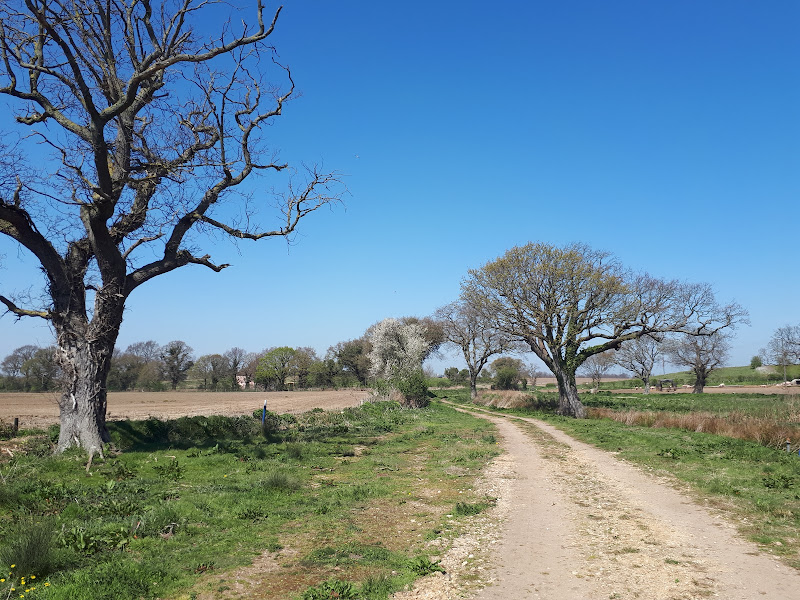
A somewhat challenging circular walk to Suffolks ancient parish of Hazlewood

Hazlewood was an ancient parish that bordered the River Alde in the Plomsgate Hundred of Suffolk. In 1934 it was annexed with the neighbouring parishes of Friston and Aldeburgh although names in the landscape still bear testament to its existence, including Hazlewood Common, the ultimate destination of this walk.

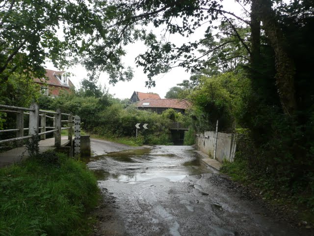
This is a challenging walk in respect of 20 yards of jungle to navigate through in order to get to The Grange farmhouse. Navigation of this neglected footpath does involve crawling on all fours as well as climbing across fallen trees. Not a walk for the feint hearted.

This challenge borders a field which was part of a WWI airfield that was in operation between October 1915 and September 1919. Known locally as Hazlewood Aerodrome, this grass airstrip was one of several support sites for RNAS Great Yarmouth and served as a night landing ground. It was also used by aircraft responding to Zeppelin raids. Little remains of the site as all support buildings have now either been demolished or collapsed although there is reputedly some concrete footings that can still be seen.

Other features on this route are the ancient Great Wood and some post medieval quarries. Return is across Aldringham Common where the former Aldringham Providence Baptist Chapel can be seen. Built in 1812, this chapel hidden away on the common was replaced in 1915 with a design by the Suffolk architect, poet and artist, Cecil Howard Lay. It has since been converted into a private residence.

Thursday 17 March 2022

Leiston to Middleton Mill Circular Walk

Leiston to Middleton Mill Circular Walk

A walk across the coastal Suffolk countryside to the village of Middleton

A splendid way to spend a days walking, cross fields and countryside and heading to the location of the Middleton Watermill. There are churches to stop and investigate on the way.

Friday 10 August 2018

Leiston to Buxlow Church Ruins - Walk Summary

Salt marsh

A country ramble to the lost parish of Buxlow

This walk provides a days ramble to view the ruins of Buxlow church. Many may have never heard of the parish of Buxlow, even those local to the area, and they can be forgiven for their ignorance since the parish was consolidated with Knodishall on 22nd February 1721.

Little is left of Buxlow church, which was dedicated to St Peter. There is merely a remnant of a wall from the old round tower that now rests in the garden of a domestic house which is viewable from the track that runs between the two houses. There are suggestions that the church was one of those recorded for Knodishall in the Domesday book and records certainly show there was a rector of the parish from 1301 onwards. By the middle of the 17th century it was reported to be 'decayed and ruinated tyme out of mind' although a rectors of the parish were still being recorded up to 1716 when Robert Witchingham held the honour.

Whilst admiring this piece of history the lady from the adjacent house engaged us in conversation stating that there have been many archaeological finds in the fields to front of the ruins. She even remarked of the many Roman coins that were constantly being unearthed. This is certainly not recorded on the Suffolk Heritage website so this is merely word of mouth. This does spark the imagination as the nearby hamlet of East Green is one of the suggestions of the long lost Roman station of Sitomagus. Maybe there was a connection from East Green to Aldringham which local folklore states was was a Roman port, the river Hundred in those days said to be navigable to sea going ships.

Note that a similar walk is described on this site with an alterntive route. This can be found on the page titled A Walk Around the Churches of Knodishall and Friston.

Tuesday 27 November 2018

Ufford Heritage Trail

Smock Meadow floods

A 3 mile walk around the village of Ufford

Ufford is rich in heritage and well worth exploring. The Heritage Trail was created in 2006 and leads the walker around the historic features of the village including the village stocks, water meadows and the many listed buildings. The Highlight of the trail has to be the church which has the unusual dedication to St Mary of the Assumption and contains the second largest font cover in England which is a sight to behold.

Sunday 9 February 2020

Suffolk Coast Path

Martello Tower at Bawdsey

An overview of the Suffolk Coast Path, a 60 mile long distance path following the coast of Suffolk

A 60 mile long distance footpath from Felixstowe to Lowestoft in easy stages through some of the characteristic landscapes of the Suffolk Coast and Heaths Area of Outstanding Natural Beauty. The path also includes the Orford Loop which provides access through to Orford and the Butley Ferry. Alternative beach walks, providing the tide is right, can be undertaken throughout.

Tuesday 1 January 2013

Coastal Erosion at Thorpeness

Erosion at Thorpeness

A circular walk from Sizewell to Thorpeness along the Suffolk Coast Path

In recent years the Suffolk Coast Path has been rerouted in-land from Sizewell across the commons to Thorpeness due to coastal erosion. The old coast route can still be walked when the tide is right and there is always an escape up the cliffs to Thorpeness Common just before the Thorpeness cliffs where the tide cuts off access to the beach.

Wednesday 15 February 2012

Winter Snows on Thorpeness Common

Snow on the common

An 7 mile circular walk across The Walks and Thorpeness Common.

The winter snows finally arrived in February this year creating a wonderful winters scene across the Aldringham and Thorpeness Commons, enticing folk out to witness the scene and encouraging local kids to take advantage of sledging down the slopes of the marl pit.

Sunday 22 December 2013

The Aftermath of the 2013 Storm Surge at Minsmere

Flattened dunes by the Northern Sea Wall to Minsmere

A 10 mile circular walk to witness the damage caused by the 2013 Storm Surge

The 2013 Storm Surge proved to be the highest tide in 60 years. Although much of the flooding had recede the evidence remained of where the waters reached. Viewing the changes in coastline shows just how vulnerable this stretch of the Suffolk coast really is, especially in view of the fact that such storms appear to be increasing in frequency. The walk returns through the heath and forest via Dunwich Heath and Eastbridge where the results of Octobers St Jude storm are evident from the many fallen trees.

Walk Summaries

Latest walk summaries are basic information sheets for walks that have yet to be fully documented. These provide links to maps, public transport and walks stats, although detailed notes and features are not included.

Latest Walk Summaries

Featured Walk

In Search of Sizewell Chapel

A 10 mile walk following the southern side of the parish boundary of Leiston in Suffolk This walk follows the route of a 17th century peramb...

What is GPX

All you need to know about GPX, electronic mapping and how to use modern apps and mobile devices as navigation devices

Popular Walks

Maps