The Peddars Way - Thetford to Knetishall Heath
|
Wednesday 23 February 2022
|
3 comments |
![]()

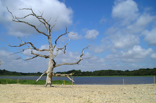
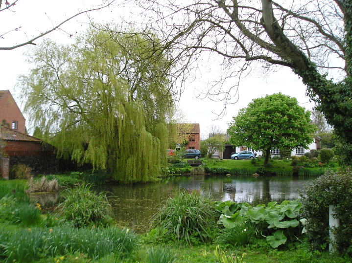
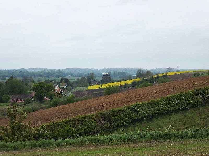
Thetford to Knetishall Heath
A trek from Thetford to the start of the Peddars Way
|
Wednesday 23 February 2022
|
3 comments |
![]()
A trek from Thetford to the start of the Peddars Way
|
|
No comments |
![]()
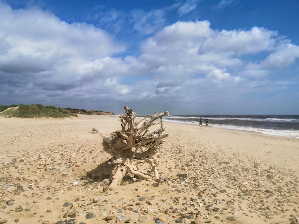
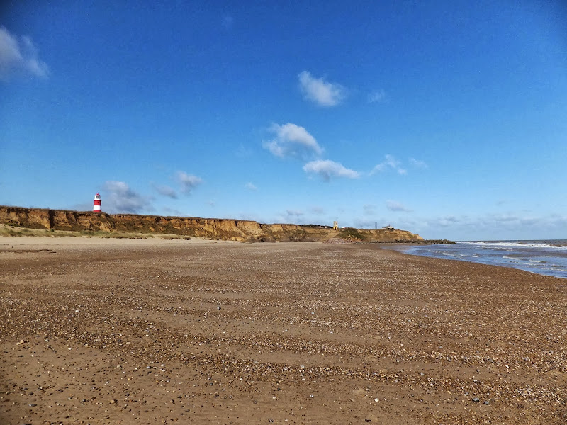
An exhilarating 12 mile coastal walk along the Suffolk Coast.
|
Tuesday 8 February 2022
|
No comments |
![]()
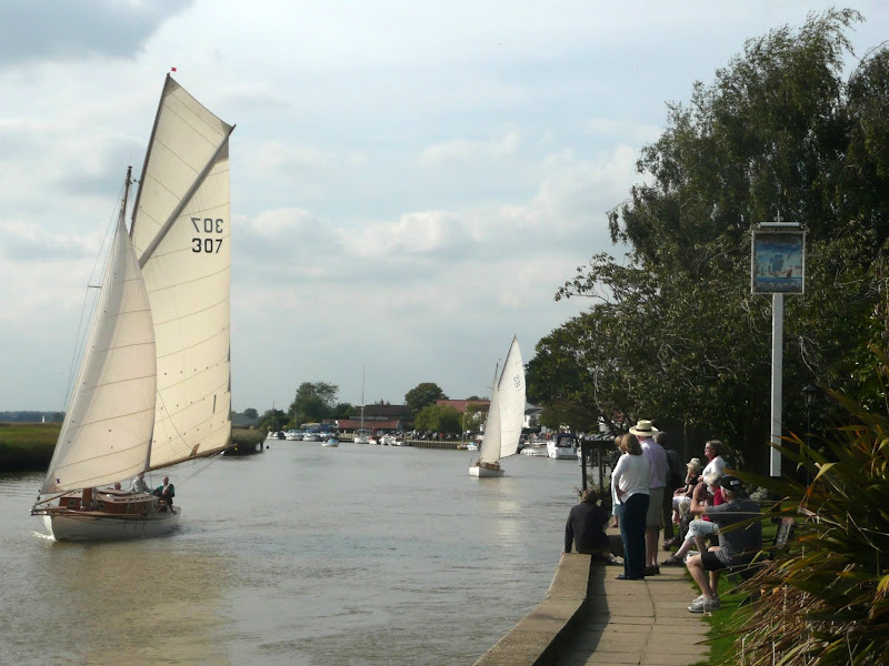
A 2 day challenge walk to complete the Suffolk Coast Path
|
Monday 7 February 2022
|
No comments |
![]()

Short town walk around Lowestoft
|
Sunday 9 February 2020
|
No comments |
![]()

An overview of the Suffolk Coast Path, a 60 mile long distance path following the coast of Suffolk
A 60 mile long distance footpath from Felixstowe to Lowestoft in easy stages through some of the characteristic landscapes of the Suffolk Coast and Heaths Area of Outstanding Natural Beauty. The path also includes the Orford Loop which provides access through to Orford and the Butley Ferry. Alternative beach walks, providing the tide is right, can be undertaken throughout.
|
Saturday 25 January 2020
|
No comments |
![]()
Circular Walk between Saxmundham and the village of Rendham
Six mile circular walk across the Suffolk countryside with a worthy stop off at the White Horse pub at Rendham. Woodland, open fields, babbling brooks make this typical of this part of Suffolk. And there is history to, with the Roman bronze head being discovered in the river at Rendham back in 1907. How did it get there?
|
Wednesday 18 December 2019
|
No comments |
![]()
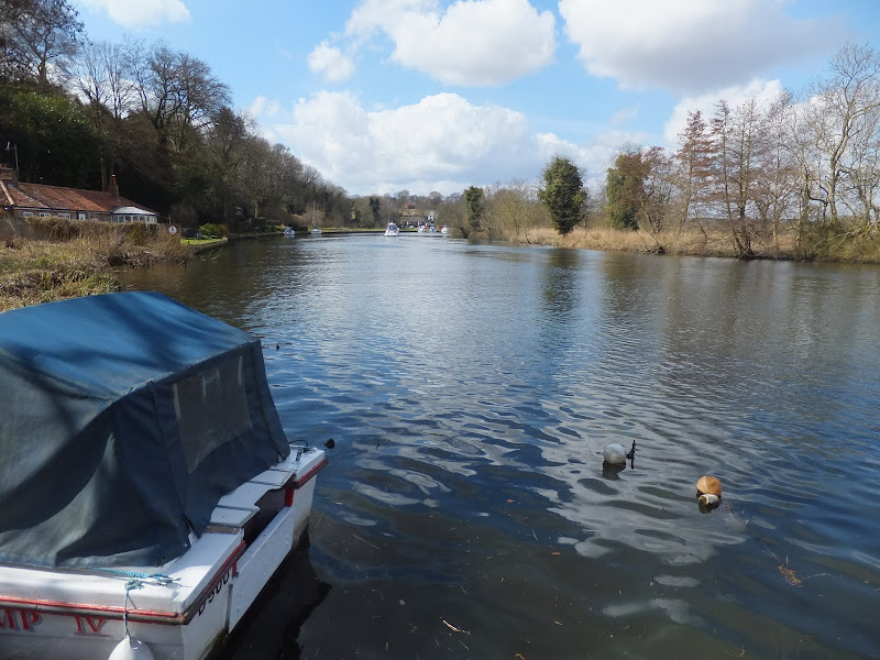
An easy and captivating walk along Norfolks River Bure
Not only does this walk provide some classic Norfolk scenery and historic features but it also traces the route said to be taken by the phantom carriage of Sir Thomas Boleyn in his annual act of penance for betraying his daughter Anne when she was sentenced to be executed. The walk is then made into a circular route by returning via the Bure Valley Path alongside the narrow gauge Bure Valley railway.
|
Tuesday 10 December 2019
|
1 comment |
![]()
A 14 mile walk along the Angles Way between Belton and Oulton Broad, crossing the border from Norfolk to Suffolk
The Angles Way roughly follows the River Waveney down to Oulton Broad from Belton although there are very few locations where the river can be viewed. Most of the route is across fields, along country lanes and through little bits of woodland. It is a pleasant full afternoons walk with a couple of pubs en route for refreshment. The main place of interest is Somerleyton, named after a peace loving Viking, Sumarlithi, who arrived in the 10th century. It is now a sleepy little village, famed for being the home to Christopher Cockerell, the inventor of the hovercraft, but more renowned for its connection with Gradabor, a giant who once ransacked the area. Some say his ghost still returns to re-enact this destruction.
|
|
6 comments |
![]()
A 7 mile circular walk along the Angles Way from Beccles to Geldeston Locks
A recommended short walk along the Angles Way to the outstanding Geldeston Locks pub, returning via the riverside path to Beccles. This walk passes the location of the historic Barsham Hall, source of the ghostly legend of Old Blunderhazard who is said to ride in his coach drawn by four fire breathing headless horses to Norwich and back each Christmas Eve.
|
Thursday 28 November 2019
|
No comments |
![]()
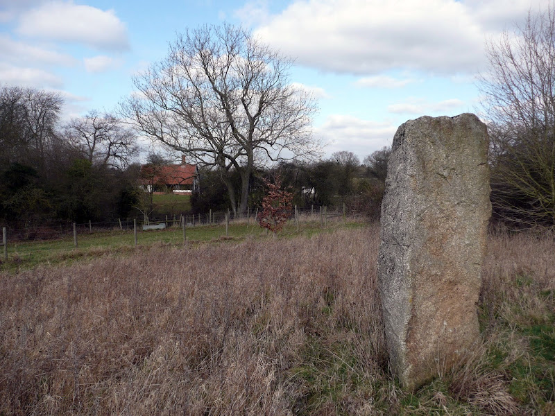
A 14 mile walk between Halesworth and Beccles along the East Suffolk Line Path
This waymarked route links the railway stations at Halesworth, Brampton and Beccles. Taking the train between these towns will provide an interesting glimpse of what is in store along the walk, including the rather curious Belle Grove Farm looking as if it is out of some fantasy movie and the mysterious Brampton Standing Stone just south of Brampton Station.
|
Friday 5 April 2019
|
No comments |
![]()
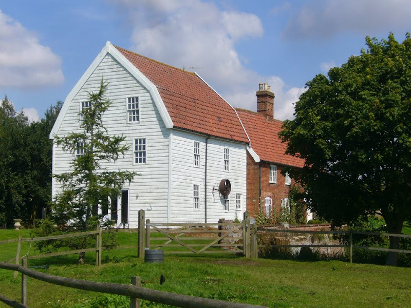
A 16 mile walk along the East Suffolk Line Path between Leiston and Wickham Market
Although the official route for the East Suffolk Line Path links the stations at Saxmundham and Campsea Ashe, this provides an alternative route using the local bus service to link the two ends. Highlights along the route include the picturesque Beversham Mill and the legendary Blaxhall Stone which is said to progressively grow in size.
|
Thursday 24 January 2019
|
No comments |
![]()
A 12 mile walk along the Angles Way between Earsham and Beccles
The walk starts by heading up the hills that overlook Outney Common. This is a really rewarding start to an easy ramble that continues across the Waveney Valley to Mettingham before continuing down the Waveney Valley. Although Geldeston is on the opposite side of the river to The Angles Way the excursion across the Shipmeadow marshes is well worth the effort to visit the unique Geldeston Locks Inn.
|
Friday 18 January 2019
|
No comments |
![]()
A 14 mile walk between Saxmundham and Darsham along the East Suffolk Line Walk.
It is Yoxford that gives us the name of this walk which is part of the East Suffolk Line Walks and this specific ramble extends the line walk to return to Leiston where a regular bus service connects the two ends. Yoxford sits on the banks of the River Yox surrounded by three country house parks; Sibton Park that contains large well stocked fishing lake; Grove Park situated in the village; and Rookery Park on the Leiston road. This has earned Yoxford the name of the 'Garden of Suffolk'. The whole route of this walk is a pleasant amble through the rural fields of Suffolk with a return journey through the pretty country lanes following the Minsmere river through to Middleton, Theberton and finally Leiston.
|
Sunday 13 January 2019
|
No comments |
![]()

A 10 mile walk along the East Suffolk Line Trail between Halesworth and Darsham
Great views are to be had along the Blyth valley before footpaths head over to the Yox valley. The village of Bramfield is at the half way point where is an old pub for refreshments as well as a distinctive church with a detached tower and a fine example of a Crinkle Crankle Wall, not to mention the legendary Bramfield Oak.
|
Saturday 12 January 2019
|
No comments |
![]()

An 18 mile walk down the Blyth Valley in Suffolk from Halesworth to Blythburgh, then across the heaths and commons to Leiston.
It was the legendary hell hound that supposedly came this way in 1577 and terrified parishioners of Blythbrugh church after doing a similar job at Bungay. This walk is in two sections, the first section follows the River Blyth along the Waveney Way to Blythburgh with the option to continue on to Southwold. The Waveney Way is a Ramblers Association walk and does not have waymarkers along the route. An optional second section cuts across to Westleton and onto Leiston. Both Southwold and Leiston have public transport links to Halesworth making the walk achievable as a linear route without the requirement of assistance of a taxi.
|
Thursday 10 January 2019
|
No comments |
![]()
An 11 mile beach walk between along the Norfolk coast from Happisburgh to Winterton
Providing the tide is right, this is a fantastic beach walk with miles of golden sand and, if you are lucky, the sight of seals basking in the sunshine. Probably one of the best beach walks on this coastline.
|
Sunday 30 December 2018
|
No comments |
![]()
An 11 mile walk from Loddon to Reedham along the Wherrymans Way, returning along the same route.
There is no public transport linking Loddon and Reedham, and few other footpaths in the area which is predominately marshland around the river Yare. Therefore this walk requires one to return along the same route. This should not detract one from walking this as it is a very pleasant ramble along the Wherrymans Way with pubs at Reedham making a veritable half way refreshment stop.
|
|
No comments |
![]()

A 17 mile walk using the official inland route of the Suffolk Coast Path from Lowestoft to Southwold
Due to erosion and tides the Suffolk Coast Path takes an inland diversion for the section between Lowestoft and Southwold. Although the alternative beach route can be accessed providing the tides are right, this route nonetheless has its worth especially for the picturesque section around Frostenden.
|
Saturday 29 December 2018
|
No comments |
![]()
A 12.5 mile walk along Norfolk's Wherryman's Way
This is a delightful riverside walk following the River Yare out of Norwich and through to Rockland St Mary. Public transport can link the start and end by navigating down quiet country lanes to Thurton. Whitlingham Country Park provides an easy route to start and there's refreshment stops at Woods End and the Ferry Inn at Surlingham.
|
|
No comments |
![]()

A 12 mile walk roughly following Norfolk's Boudicca Way
This walk uses the Boudicca Way to navigate from Norwich to Shotesham, with an excursion away from the official route to the ruins of the Roman town Venta Icenorum. Shotesham forms the furtherest reaches of the Boudicca Way on this route, from where country lanes cuts across country to the A140 where there is a frequent bus service back into Norwich.
A 10 mile walk following the southern side of the parish boundary of Leiston in Suffolk This walk follows the route of a 17th century peramb...


