Route details, maps, pubs, features, local history and folklore for a wide variety of walks focusing primarily on Norfolk and Suffolk

Walks
Showing posts sorted by relevance for query Thorpeness. Sort by date Show all posts

Tuesday, 1 January 2013

Coastal Erosion at Thorpeness

Erosion at Thorpeness

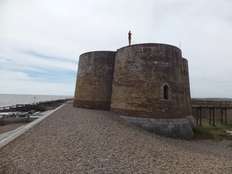
A circular walk from Sizewell to Thorpeness along the Suffolk Coast Path

In recent years the Suffolk Coast Path has been rerouted in-land from Sizewell across the commons to Thorpeness due to coastal erosion. The old coast route can still be walked when the tide is right and there is always an escape up the cliffs to Thorpeness Common just before the Thorpeness cliffs where the tide cuts off access to the beach.

Thursday, 7 May 2015

Aldeburghs Martello Tower Now Boasts an Anthony Gormley Sculpture

Martello Tower

A 7 mile walk from Thorpeness to Aldeburghs Martello Tower

For a period of 12 months starting in May 2015, a life size sculpture of a human figure will look out across the sea atop Aldeburghs Martello Tower. This is the work of Anthony Gormley, the artist who is renowned for creating the iconic Angel of the North sculpture, and is part of the celebrations to mark 50 years of the Landmark Trust.

Tuesday, 3 May 2011

Sun, Sea, Beer and Chips

Fishing shacks at Aldeburgh

A circular walk from Sizewell to Aldeburgh along the Suffolk Coast Path

The Suffolk Coast Path does not go into Aldeburgh but it is a simple excursion to continue along the beach all the way down to the unique clover leafed Martello Tower at the vanished village of Slaughden using the old railway track to make a circular walk.

Walk Statistics

  • Start location: Leiston 
  • End location: Aldeburgh 
  • Distance:   miles (  km)
  • Total Gain:   ft (  metre)
  • Total Descent:   ft (  metre)
  • Min Height:   ft (  metre)
  • Max Height:   ft (  metre)
  • Est. Walk Time:  
  • Walk type: Linear
  • Walk Grade: Easy
  • Terrain:

Maps

The following maps and services can assist in navigating this route. There are links to printed maps and links to downloadable GPX route data for importing into navigational software and apps.

 
Walk Notes

This is a regular walk that we undertake here at Griffmonsters Walks. Coast, heath, old railway track. There is always something new to see no matter how many times we walk it, spring, summer, autumn or winter.

Directions

Inland walk across the tracks, heaths and the old railway line to Aldeburgh. Return via the coast.

Sizewell to Aldeburgh

Take the road out of Sizewell village and turn left onto the lane towards Sizewell Hall. Continue along this lane. It turns into no more than a sandy track. Ignore all other paths. Eventually it will turn onto a hard surface which emerges onto the Thorpeness road. Continue straight across following the Sandlings waymarkers. This leads alongside the golf course and then joins the former railway track through to Aldeburgh. At Aldeburgh, pass the caravan park where the broad path narrows and comes out onto a road. Go straight across and there is a short section of path before you meet the main road into Aldeburgh. Cross this and go onto the private road down the side of the library. Walk through until the road bears right where a track on the left. Take this and continue straight on as it junctions with a road. When this road bears sharp right the town steps lead down into central Aldebrugh. Turn right and walk through to the southern end of Aldeburgh. The houses give way to a shingle track with boatyards. Continue along this to the Martello tower which is a landmark in the distance.

Aldeburgh to Sizewell

Follow the coast path through to Thorpeness. At low tide it should be possible to continue along the beach here but at high tide , due to recent erosion, access is not possible. In this case walk through to the private road and up onto Thorpeness Common. Walk across the common to the far end where there is a sandy slope back down to the beach. The Suffolk Coast Path continues along the base of the cliff but soon navigates back to the top through to Sizewell

Pubs

White Hart, Aldeburgh View in OS Map | View in Google Map

Image of pub
Address
High Street, Aldeburgh
Website

This Grade II listed building dating from the 18th century, is a single roomed bar with wood panelling and decorated with nautical memorabilia. Originally a reading room, it bacame an alehouse during the early 1800s. The pub offers Adnams ales plus guests and has occasional music and basic pub food.

Review (2010-08-14)

The White Hart had three guest ales on this visit; these were Gales HSB, Nethergates Suffolk County and Puritys Pure Ubu. We opted for the Purity as we had not heard of this brewery before. Apparently it comes from Warwickshire. An excellent ale, with a sweetish finish balanced by a lingering bitterness. Very enjoyable indeed.

The Dolphin, Thorpenes View in OS Map | View in Google Map

Image of pub
Address
Peace Place, Thorpenes
Website

Formally known as the Crown Inn, the original building used to be attached to six cottages known as West Terrace. The inn was renamed when the cottages were demolished and the building extended with bedrooms to become the Dolphin Inn. Parts of the village, then known as Aldringham-cum-Thorpe, date back to Tudor times, but in 1910 the village was renamed Thorpeness when landowner, Stuart Ogilvie, began realising his plan to create a unique seaside holiday village on the site. The Dolphin Inn was consumed by fire in September 1995 and was rebuilt and re-opened in 1998 by Thorpeness and Aldeburgh Hotels. Friendly service, good food using local producers and an extensive choice of beverages including Adnams and a guest ale.

Review (2010-08-14)

The Dolphin always has a guest ale on, in this instance the excellent Brewers Gold by Crouch Vale brewery.

Route Validation Cards

Validation Date - 2010-08-14

  • Time of Walk: 11:00 to 17:30
  • Validators: Griffmonster, Kat
  • Weather Conditions: Sunny spells, warm but a haze along the coast
  • Notes: Initial route undertaken
Summary of Document Changes

Last Updated: 2026-01-12

  • 2021-03-17 : Update website improvements and removal of ViewRanger reliance
  • 2021-12-01 : Removal of ViewRanger links due to its imminent demise

Monday, 23 December 2019

Suffolk Coast Path - Sizewell to Aldeburgh Circular Walk

Fishing shacks at Aldeburgh

A circular walk from Sizewell to Aldeburgh along the Suffolk Coast Path

The Suffolk Coast Path does not go into Aldeburgh but it is a simple excursion to continue along the beach all the way down to the unique clover leafed Martello Tower at the vanished village of Slaughden using the old railway track to make a circular walk.

Sunday, 8 December 2013

2013 Storm Surge at Sizewell and Thorpeness

The strange egg-shaped object on the left is most likely a piece of fallen cliff

A walk at high tide of the 2013 Storm Surge between Sizewell and Thorpeness

This is a photographic excursion of the 2013 Storm Surge down the Suffolk Coast. With media firmly concentrated on events in South Africa the only real way to find out was happening was to visit this destructive storm surge oneself. Although this part of Suffolk was relatively unscathed it still presented awe-inspiring seas and crashing waves.

Thursday, 15 December 2011

Autumn on Thorpeness Common

A 6 mile circular walk across the commons of the East Suffolk Coastal area linking Leiston, Thorpeness and Sizewell.

Autumn on Thorpeness Common is a great time to hunt out mushrooms, harvest sloes and admire the changing of the seasons. I am not expert on mushrooms and certainly would not even dare to pick a wild mushroom to eat without specific advice from a fungi expert, nonetheless, it is always good to view them. The sloes are a different matter though, for a second year running we have gathered copious quantities of this bitter fruit in order to get some sloe gin ready for Christmas. There were so many this year we ended up giving much of our labours away!

Wednesday, 15 February 2012

Winter Snows on Thorpeness Common

Snow on the common

An 7 mile circular walk across The Walks and Thorpeness Common.

The winter snows finally arrived in February this year creating a wonderful winters scene across the Aldringham and Thorpeness Commons, enticing folk out to witness the scene and encouraging local kids to take advantage of sledging down the slopes of the marl pit.

Sunday, 9 February 2020

Suffolk Coast Path

Martello Tower at Bawdsey

An overview of the Suffolk Coast Path, a 60 mile long distance path following the coast of Suffolk

A 60 mile long distance footpath from Felixstowe to Lowestoft in easy stages through some of the characteristic landscapes of the Suffolk Coast and Heaths Area of Outstanding Natural Beauty. The path also includes the Orford Loop which provides access through to Orford and the Butley Ferry. Alternative beach walks, providing the tide is right, can be undertaken throughout.

Sunday, 26 October 2025

In Search of Sizewell and Thorpe Beacons

Sizewell

A 10 mile walk following the southern side of the parish boundary of Leiston in coastal Suffolk.

This is the second article devoted to the walk following the route of a 17th century perambulation around the southern side of the Leiston Parish boundary. This article concentrates on two landmarks from the past, namely Sizewell and Thorpe Beacons, which are thought to have been part of the Armada early warning system.

Wednesday, 15 August 2018

Aldringham Fen Walk Summary (Diversion in Place)

Salt marsh

A Short Circular Walk around Aldringham Fen

This is one of Suffolk's little secrets, hidden away from roads and off the beaten track. Tranquillity is guaranteed and there are some times of the year when one can walk around the entire route without seeing a soul. The area known as Aldringham Fens is a secluded haven of nature and wildlife, an area of marsh and reed-bed fed by the Hundred river which passes to the southern side of the fens.

Sunday, 24 July 2011

New Sandlings Waymarker Design

The Suffolk Coast and Heaths Area of Outstanding Natural Beauty (AONB) Unit has started to replace the old Sandlings Waymarkers with a new design. These green plastic plaques have been mounted over the previous logo on existing fingerposts. The new plaques carry a nightjar logo and are part of resigning process that is being carried out throughout the long distance walk that links Ipswich and Southwold. During the resigning process damaged fingerposts are being replaced.

Sunday, 22 September 2019

In Search of Sizewell Chapel

Broom Covert

A 10 mile walk following the southern side of the parish boundary of Leiston in Suffolk

This walk follows the route of a 17th century perambulation around the southern side of the Leiston Parish boundary. The walk uses the ancient track down to Sizewell and continues down to Thorpe before turning inland to follow the River Hundred through to Cold Fair Green. The details are contained in two articles, this being the first, focusing on the medieval history of Sizewell.

Tuesday, 2 September 2025

The Sandlings Walk - Knodishall to Snape (Diversion in Place)

A 13 mile circular walk along the Sandlings Walk between Knodishall and Snape

With limited public transport this walk offers a circular route to incorporate the Sandlings path from Knodishall to Snape. Starting and ending at nearby Leiston it incorporates The Sailors Path and the Suffolk Coast Path to make a worthwhile day walk. The route passes Friston mill and Hall and the burial grounds where a Saxon burial ship was discovered. With pubs at Friston and Snape it provides for a great days ramble.

Indexes and Info

East Suffolk PRoW Access

The Public Rights of Way (PRoW) within the Suffolk Coastal area between Aldeburgh and Southwold are subject to being blocked up and diverted due to the extensive industrial projects that are currently taking place in the area including the Sizewell C development and various wind farm projects. A PRoW Access page details known issues in the area. There is also a link to the Works Tracker that contains details of known Blocking Up and Diversion Orders

Featured Walk

In Search of Sizewell Chapel

A 10 mile walk following the southern side of the parish boundary of Leiston in Suffolk This walk follows the route of a 17th century peram...

What is GPX

All you need to know about GPX, electronic mapping and how to use modern apps and mobile devices as navigation devices

Popular Walks

Diary of a Suffolk Common

The ramblings and musing of the Griffmonster