Route details, maps, pubs, features, local history and folklore for a wide variety of walks focusing primarily on Norfolk and Suffolk

full-detail Walks
Showing posts with label full-detail. Show all posts

Thursday 19 December 2019

The Aftermath of the 2013 Storm Surge - Cromer and Sheringham

Damaged Beach huts

A 6 mile beach walk to witness the damage caused by the 2013 Storm Surge at Cromer and Sheringham

Both Cromer and Sheringham bore the brunt of the storm surge on the night of December 5th 2013. Although repair work is well under way there are still the signs of what damage the sea can cause. There have also been many cliff falls along this length of coastline with the cliff faces providing a fascinating view sculptured by the weather and tides and offering multi coloured strata.
Wednesday 18 December 2019

Paston Way to Gunton - Pubs, Churches and Wartime Conspiracies

Northrepps from the lane to Overstrand

A 7 mile walk along Norfolk's Paston Way from Cromer to Gunton.

The Paston Way has a few alternative paths that stray from its main route between North Walsham and Cromer, and this walk takes the optional route out to Gunton from where a train can be taken back to Cromer. There are some worthy country pubs along this simple walk so a good old English pub crawl can also be had along with taking in the sights of the impressive churches at Northrepps and Southrepps plus local tales of wartime German conspiracies!

Weavers Way - Cromer to Aylsham

Felbrigg Hall

A 17 mile walk along Norfolk's Weavers Way from Cromer to Aylsham

Historic halls, stately homes and ancient commons and villages are what typifies this northern section of the Weavers Way. This really is a typical old English scene throughout making a most pleasurable all day walk. There are numerous pubs along the route which serve both ale and food.

South West Coast Path - Coverack to The Lizard

View to The Lizard

An 11 mile walk along the South West Coast Path between Coverack and The Lizard

A challenging but rewarding walk along the south West Coast path. There are spectacular views along the coastline with The Lizard being in view virtually the entire distance. The picture postcard village of Cadgwith is a worthy resting point before embarking on the final few miles that include the rock formation known as The Devil's Frying Pan.

The Aftermath of the 2013 Storm Surge - Blakeney, Cley and Salthouse

Salthouse marshes

A 4 mile beach walk to witness the damage caused by the 2013 Storm Surge along the shingle bank between Cley and Salthouse

The December 2013 Storm Surge caused widespread flooding of the marshes and sea defences along the North Norfolk Coast, resulting in the closure of the Coast path between Blakeney and Cley. It is still possible to walk out to the beach from Cley village via the road where a walk along the shingle will astound those who have walked this section prior to the December storm. The shingle ridge has been levelled, with the excess cast across the marshes.

Bure River Walk from Coltishall to Brampton

Buxton Mill

An easy and captivating walk along Norfolks River Bure

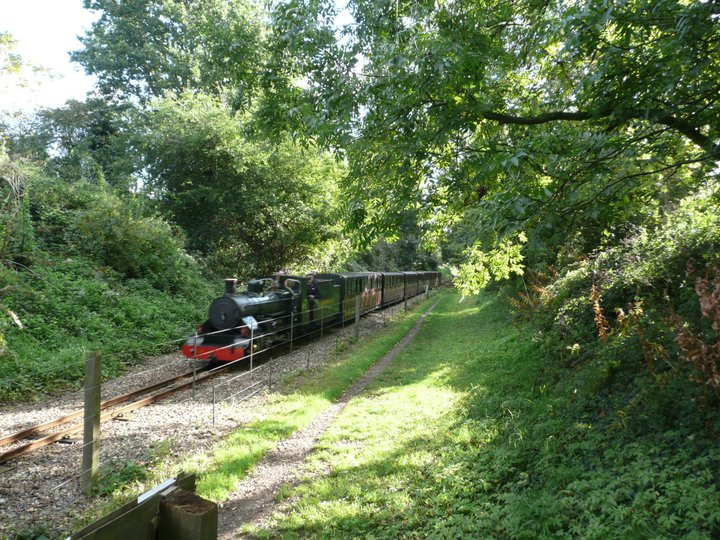
Not only does this walk provide some classic Norfolk scenery and historic features but it also traces the route said to be taken by the phantom carriage of Sir Thomas Boleyn in his annual act of penance for betraying his daughter Anne when she was sentenced to be executed. The walk is then made into a circular route by returning via the Bure Valley Path alongside the narrow gauge Bure Valley railway.

Norfolk Coast Path between Blakeney and Cley - Latest Developments

Repaired defence bank close to Blakeney

The future of the 2.5 mile walk along the sea defences between Blakeney and Cley

The December 2013 Storm Surge caused major damage to the sea defences along the Norfolk Coast Path that encompasses the Blakeney Freshes. Work is currently being carried out to repair the breaches, however the long term future of both the Freshes and the coast path at this point is uncertain.

Inland Walk between Cley and Blakeney

View from Wiveton Downs

A 6 mile walk taking in the Wiveton Downs as an alternative to the coastal route between Cley and Blakeney

An alternative route to the Norfolk Coast Path between Cley and Blakeney taking in the high ground across Wiveton Downs. Spectacular views of the coastline can be had from this area and the route also includes the Shell Museum at Glandford and the dominating church at Cley

Flatford Mill Circular Walk

View of Constables Haywain

An 11 mile Walk along the River Stour incorporating sections of the Stour Valley Path, the Essex Way and St Edmund's Way

Flatford Mill is the idyllic English country scene encapsulated by John Constables renowned paintings including the instantly recognizable 'Haywain'. This circular route is an exceptional walk by all accounts and the perfect way to engross oneself in this landscape that sits on the Suffolk and Essex border.

South West Coast Path - Avon Estuary to Salcombe

Hope Coast

A 17 mile walk along the South West Coast Path between Churchstow and Salcombe.

This walk heads out from Churchstow through country lanes down to the South West Coast Path at Bantham on the Avon estuary. The Coast Path starts with easy walking along the low cliffs past Thurlestone and includes an 80 yard footbridge across South Milton Ley before it arrives at Hope Cove, a picturesque little fishing village. The section from Bolt Tail to Bolt Head is a little more strenuous with the path tracking up and down the cliffs and around a few craggy sections with steps built out of the stone. At Bolt Head the coast bears round to the north passing Sharp Tor which is cut out of the cliff-face, before it heads down into the pretty village of Salcombe.

Norfolk Coast Path - Burnham Overy Staithe to Brancaster

Brancaster Staithe Quay

A 6 mile walk following the North Norfolk Coast Path between Burnham Overy Staithe to Brancaster

Wide open areas of marshland provide an enticing setting for this easy walk. Sailing boats, marsh, a tidal pool and the site of a Roman fort provide plenty of interest, together with three pubs, what more could one ask for of an afternoons stroll.

Lincolnshire Coast Path - Cleethorpes to Mablethorpe

North Coates Marshes

A 23 mile walk along the Lincolnshire Coast between Cleethorpes and Mablethorpe

Although a Lincolnshire Coast Path has yet to be established, this walk sets out a viable route for all budding coast walkers. This follows defence banks and permissive paths with a little road walking where necessary.

Tuesday 17 December 2019

A Walk along the Bure Valley Path

A 9 mile walk along Norfolk's Bure Valley Path between Aylsham and Wroxham

The Bure Valley Path follows the former Great Eastern Railway trackbed alongside the Bure Valley Narrow Gauge Railway. There are outstanding views of the river Bure and stops on route at Brampton, Buxton and Coltishall. Being a former trackbed gives a well drained path so the route is suitable for all weathers.

South West Coast Path - Bucks Cross to Hartland

Blockchurch rock

An 16 mile walk along the South West Coast Path between Bucks Cross and Hartland

An easy start to a walk through the tree covered cliff-tops makes a pleasant ramble through to Clovelly. There follows a couple of challenging valleys to cross and then broad open meadows for more easy walking through to Hartland Point. At this stage the coast turns South to reveal a coastline that can only be described as truly spectacular.

South West Coast Path - Bucks Cross to Westward Ho!

Babbacombe

An 8 mile walk along the South West Coast Path between Bucks Cross to Westward Ho!

A moderate walk along the cliffs to Westward Ho!, the town renowned for being the only place in Britain to have an exclamation mark in its name. This walk presents a good introduction to the South West Coast Path being under 10 miles and with few difficult or strenuous ascents and descents. There are amazing panoramas of the coastline throughout with views to Hartland in the west and Westward Ho! and north Devon to the East and North.

South West Coast Path - Bude to Boscastle

View from Buckator

An 16 mile walk along the South West Coast Path between Bude and Boscastle

A challenging walk along a spectacular part of the South West Coast Path. Although this can be achieved in a single day there is the village of Crackington haven near to the half way mark which allows one to cut the walk into two smaller options. Waterfalls to see, steep valleys to cross and some amazing views of the coastline.

Bromeswell Village Walk

St Edmunds church

A very easy 2 mile walk around the Suffolk Village of Bromeswell

The Sandlings Path avoids the busy road between Melton and the footpath across the Heathland to Rendlesham Forest by navigating around the quiet village of Bromeswell. Although only a short distance, it is worth taking ones time to explore this quiet village with its typically East Anglian church of St Edmund.

South West Coast Path - Brixham to Paignton

Paignton Harbour

A 12 mile walk along the South West Coast Path between Brixham and Paignton.

There are a few moderately strenuous sections to this walk but nothing too arduous. The walk starts by heading out to Berry Head, the site of a an iron age fort, although most of this has been destroyed by late 18th century fortification for the Napoleonic Wars. The path then descends down into Brixham town where there are refreshment houses and shops set around the harbour. Brixham is much more of a heritage fishing town rather than its commercialized holiday resort neighbours of Paignton and Torquay. Out of Brixham, the path makes its way across the cliffs descending to Broad Sands and Goodrington Sands before reaching Paignton.

The Sandlings Walk - Bromeswell to Snape

Wantisden church

A 16 mile walk along the Suffolk Sandlings Path between Bromeswell and Snape taking in Rendlesham and Tunstall forests

The route leads across gorse covered heathland and through forest which typifies the modern landscape of the Sandlings. The forests are a modern development, set up with the founding of Forestry Commission during the 1920's to provide Britain with a sustainable source of timber. One cannot fail to notice the twin airbases of Woodbridge and Bentwaters, the scene of a infamous military encounter with a UFO during December 1980.

A Walk to Brancaster Beach

Brancaster Beach

A 3 mile walk out to Brancaster Beach returning across the marsh to Titchwell

Although not included in the official Norfolk Coast Path route, this simple walk is a well worth excursion to witness the expanse of sand and dune as well as a petrified forest and an old wreck. Always be mindful of tide conditions and particularly do not attempt to get across to the wreck which lies across the Harbour channel.

Walk Summaries

Latest walk summaries are basic information sheets for walks that have yet to be fully documented. These provide links to maps, public transport and walks stats, although detailed notes and features are not included.

Latest Walk Summaries

Featured Walk

In Search of Sizewell Chapel

A 10 mile walk following the southern side of the parish boundary of Leiston in Suffolk This walk follows the route of a 17th century peramb...

What is GPX

All you need to know about GPX, electronic mapping and how to use modern apps and mobile devices as navigation devices

Popular Walks

Maps