Suffolk Coast Path Challenge Walk Part 1
|
Tuesday 8 February 2022
|
No comments |
![]()
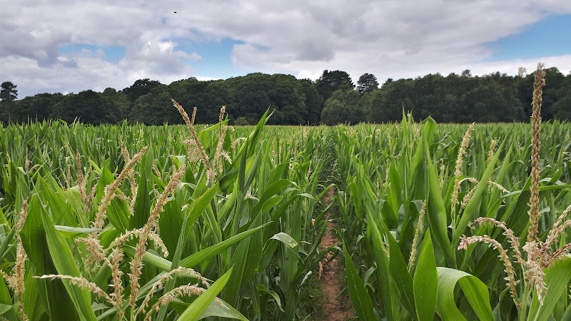
Suffolk Coast Path Challenge Walk Part 1
A 2 day challenge walk to complete the Suffolk Coast Path
|
Tuesday 8 February 2022
|
No comments |
![]()
A 2 day challenge walk to complete the Suffolk Coast Path
|
Thursday 6 January 2022
|
No comments |
![]()

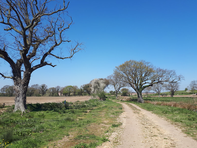
A 15 mile circular walk along the Sandlings footpath between Dunwich and Southwold, with an option of returning either via the beach or the Suffolk Coast Path through Dingle Marshes
This is the final stage of the Sandlings Walk from Ipswich to Southwold. Starting at Dunwich, it takes the trails through Dunwich Forest and heads over Walberswick Heath to Southwold. The woods are full of mushrooms and nuts and berries this time of year... and hops! This is a lovely walk through the woods and well worth the effort. To make the route circular, the return is either via Dingle Marshes, or the Suffolk Coast Path or if the tide is out then its an easy walk along the beach.
|
Monday 13 December 2021
|
No comments |
![]()
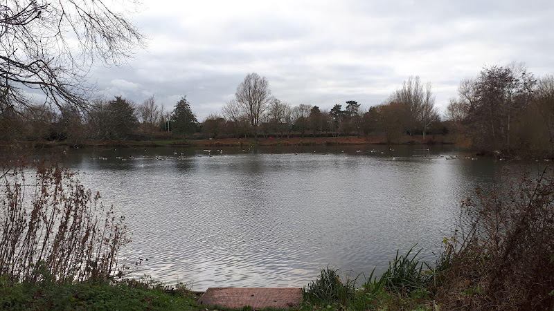
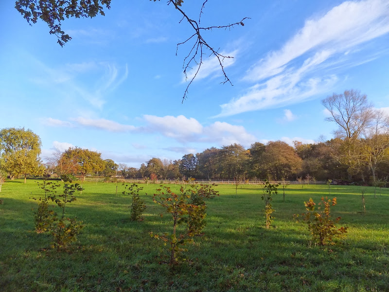
A simple circular walk around the Needham Market Lakes
A popular destination for many local people with plenty of well defined footpaths around the lakes and woodland. This walk includes an extension to the Alder Carr Farm tea shop for refreshments
|
Tuesday 4 May 2021
|
No comments |
![]()
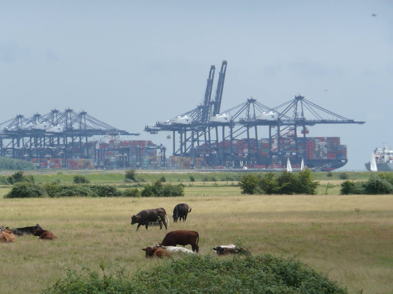
A 14 mile walk along the banks of the River Orwell in Suffolk between Ipswich and Shotley Gate
The Stour and Orwell path is an extension to the southern end of the Suffolk Coast Path and follows the coast and heaths along the estuaries of the Orwell and the Stour rivers. This particular walk focuses on the section between Ipswich and Shotley Gate following the river Orwell along the Shotley peninsular.
|
Saturday 27 March 2021
|
No comments |
![]()
Short circular walk following the Mill Stream through Foxhall, Ipswich
One branch of The Sandlings Path that leads into Ipswich, follows a route across Foxhall Heath. This small walk uses the path as the basis of a circular walk through this natural woodland location.
|
Friday 26 March 2021
|
No comments |
![]()
Short circular walk around heaths and woodlands of Foxhall, Ipswich
A pleasant stroll around the heaths and woodlands around Foxhall, to the east of Ipswich. The walk is short but nonetheless a pleasant way to while a way an hour or two. Natural woodland, babbling stream and if you look very carefully you may even see what remains of Foxhalls All Saints Church
|
Thursday 7 January 2021
|
No comments |
![]()
A 6 mile walk around the heaths and commons of Coldfair Green
This walk follows an investigation to seek out the location of the Leiston Gibbet and an area of heathland that was known in the 1600's as Friday Market Heath. The only reference to these places comes from an old book from 1910 entitled 'The Chronicles of Theberton' which details the route past the gibbet. This walk attempts to retrace this route by navigating along the heathland and footpaths around the River Hundred which marks the boundary between the hundreds of Blything and Plomestead. Extensive research which has been undertaken and documented in the feature of this walk with some revealing insights to long forgotten places.
|
Sunday 9 February 2020
|
No comments |
![]()

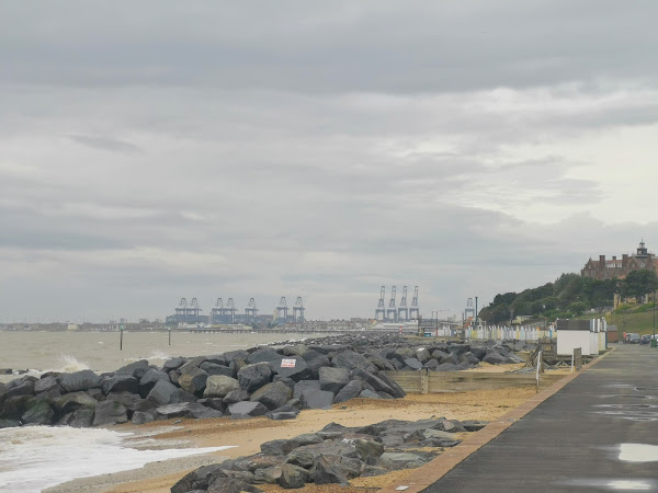
An overview of the Suffolk Coast Path, a 60 mile long distance path following the coast of Suffolk
A 60 mile long distance footpath from Felixstowe to Lowestoft in easy stages through some of the characteristic landscapes of the Suffolk Coast and Heaths Area of Outstanding Natural Beauty. The path also includes the Orford Loop which provides access through to Orford and the Butley Ferry. Alternative beach walks, providing the tide is right, can be undertaken throughout.
|
Saturday 25 January 2020
|
No comments |
![]()
Circular Walk between Saxmundham and the village of Rendham
Six mile circular walk across the Suffolk countryside with a worthy stop off at the White Horse pub at Rendham. Woodland, open fields, babbling brooks make this typical of this part of Suffolk. And there is history to, with the Roman bronze head being discovered in the river at Rendham back in 1907. How did it get there?
|
Wednesday 15 January 2020
|
1 comment |
![]()
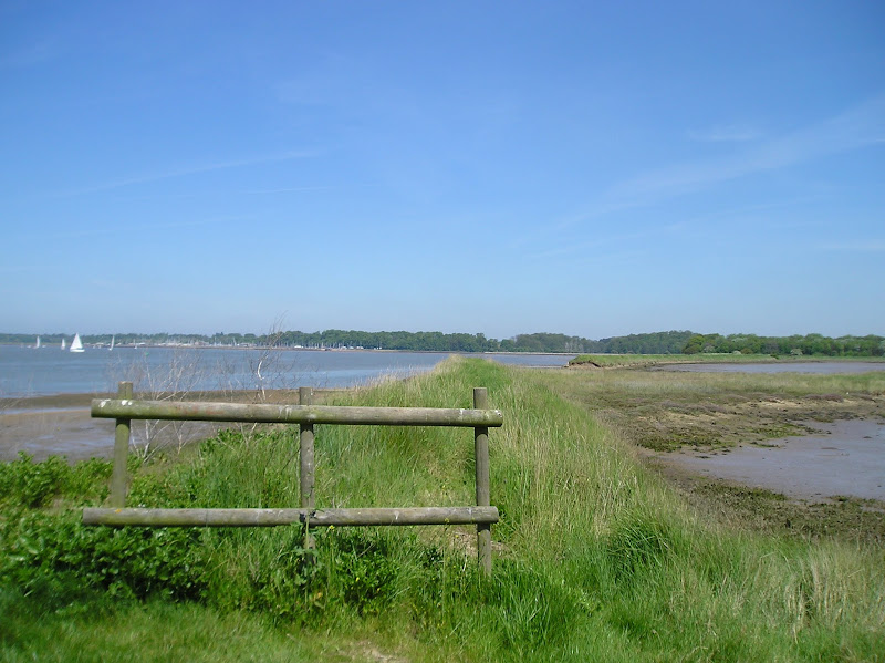
A 17 mile walk along the banks of the Orwell River in Suffolk starting at Felixstowe and ending in the centre of Ipswich
The Stour and Orwell path is an extension to the southern end of the Suffolk Coast Path and follows the coast along the estuaries of the Orwell and the Stour. The start of the walk is characterised by the earthen river defences along which the footpath navigates. From Levington Creek an alternative route is used to pay a visit to the 13th century Ship Inn before proceeding through Broke Hall Woods to rejoin the official route through to Ipswich.
|
Tuesday 17 December 2019
|
No comments |
![]()
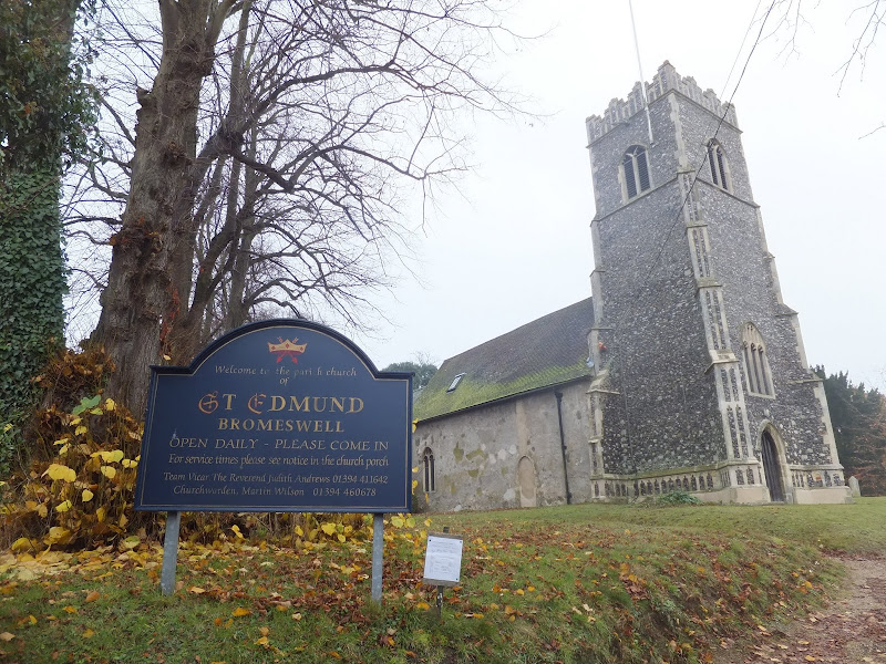
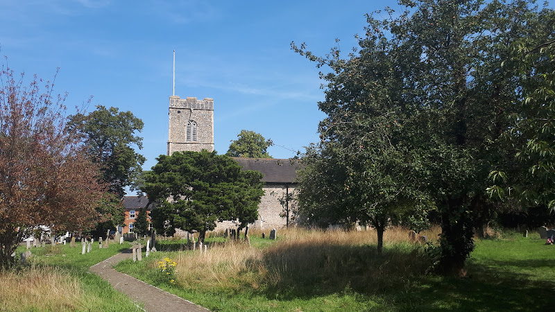
A very easy 2 mile walk around the Suffolk Village of Bromeswell
The Sandlings Path avoids the busy road between Melton and the footpath across the Heathland to Rendlesham Forest by navigating around the quiet village of Bromeswell. Although only a short distance, it is worth taking ones time to explore this quiet village with its typically East Anglian church of St Edmund.
|
|
No comments |
![]()

A 16 mile walk along the Suffolk Sandlings Path between Bromeswell and Snape taking in Rendlesham and Tunstall forests
The route leads across gorse covered heathland and through forest which typifies the modern landscape of the Sandlings. The forests are a modern development, set up with the founding of Forestry Commission during the 1920's to provide Britain with a sustainable source of timber. One cannot fail to notice the twin airbases of Woodbridge and Bentwaters, the scene of a infamous military encounter with a UFO during December 1980.
|
Tuesday 10 December 2019
|
No comments |
![]()
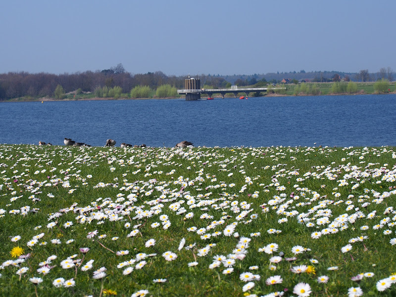
An 8 mile walk around Suffolk's Alton Water Reservoir
Located on the Shotley peninsular, the Alton Water Reservoir provides an easy walk around its water. A self contained circular route that needs little in the way of maps. Just keep the water on your left and keep walking! The mixed variety of landscapes of open meadow, woods and even the hills on the northern side of the reservoir provide a constant changing scenery throughout the walk.
|
Friday 6 December 2019
|
No comments |
![]()
A 5 mile walk across the Coastal Suffolk landscape between Leiston and Saxmundham
This walk searches out footpaths to connect the neighbouring towns of Leiston and Suffolk. Although there is no direct route, the paths chosen are certainly more conducive to the walker than the busy road route. With the churches of Leiston and Knodishall on the route, plus the mysterious Harris's Pit in the parish of Sternfield there is enough to interest the avid rambler. Sternfield also has the notoriety of being the village from which the last woman to be burnt at the stake in England came.
|
Friday 29 November 2019
|
1 comment |
![]()
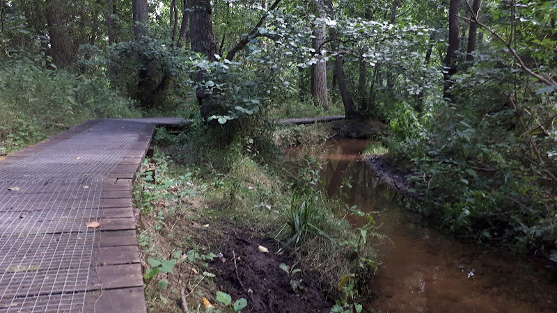
A 5 mile walk through Dunwich forest to the medieval site of the lost village of Hethern
Dunwich forest is always a good place to walk and find peace amid the fora, fauna and wildlife. There are information boards that provide details of this ever changing world of nature but there is nothing about its history. Little is known of the medieval village of Hethern or the landmarks of Stonehill Bridge and Stonehill Castle which are recorded in the 15th century Westleton Extents. This document records that they stood aside a now lost road directly linking Dunwich to Blythburgh and which cut across the marshes.
|
Thursday 28 November 2019
|
No comments |
![]()
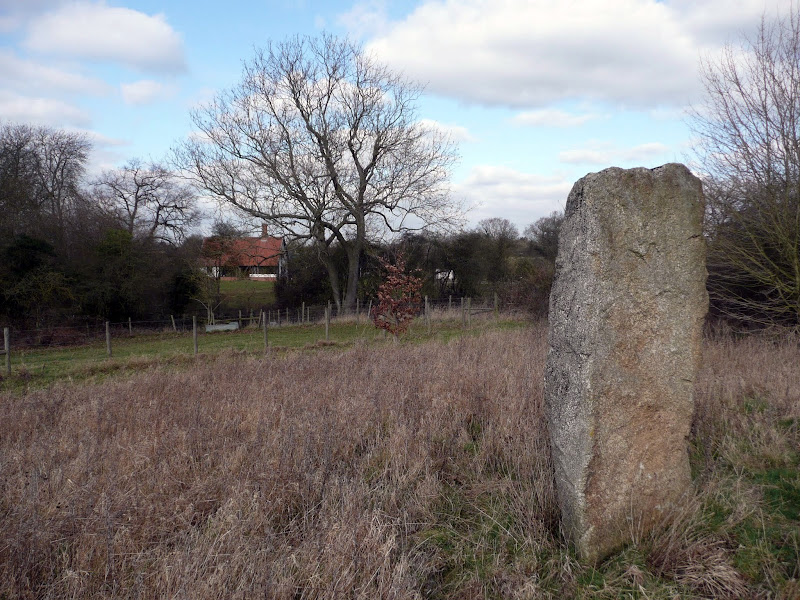
A 14 mile walk between Halesworth and Beccles along the East Suffolk Line Path
This waymarked route links the railway stations at Halesworth, Brampton and Beccles. Taking the train between these towns will provide an interesting glimpse of what is in store along the walk, including the rather curious Belle Grove Farm looking as if it is out of some fantasy movie and the mysterious Brampton Standing Stone just south of Brampton Station.
|
Saturday 11 May 2019
|
4 comments |
![]()
A 9.5 mile walk following the old Snape Road to the Sailors Path
This walk links Leiston with the Sailors Path following the old traditional road that used to link the town with Snape. There is then an outstanding ramble across Black heath and Hazlewood marshes through to Aldeburgh where a regular bus service links back with the start. Along this route was what in the 1700s was known as Polsborough Gate, a landmark whose position and derivation is unknown but with a little research some information about it can be determined
|
Friday 5 April 2019
|
No comments |
![]()
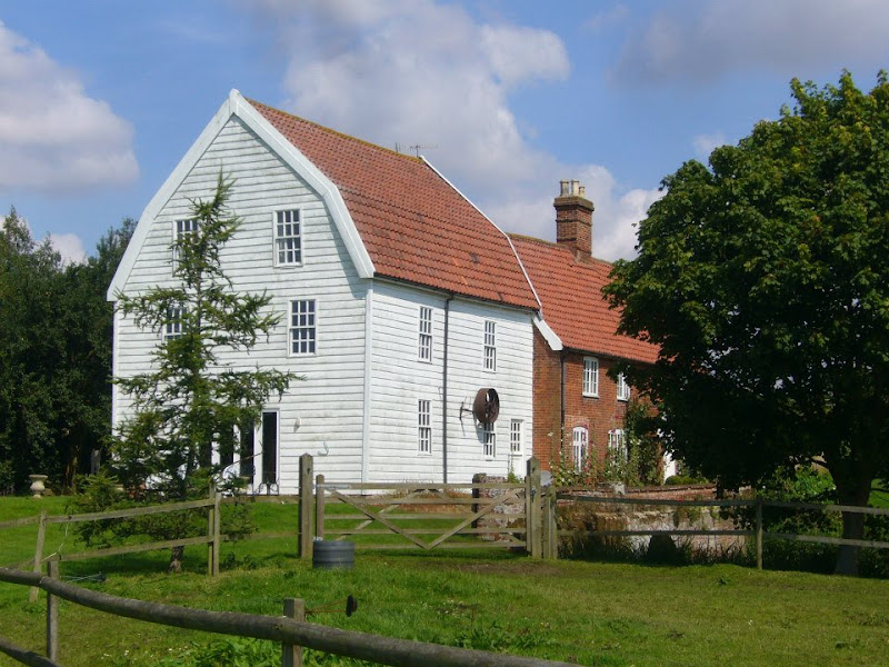
A 16 mile walk along the East Suffolk Line Path between Leiston and Wickham Market
Although the official route for the East Suffolk Line Path links the stations at Saxmundham and Campsea Ashe, this provides an alternative route using the local bus service to link the two ends. Highlights along the route include the picturesque Beversham Mill and the legendary Blaxhall Stone which is said to progressively grow in size.
|
Saturday 26 January 2019
|
6 comments |
![]()

A 12 mile circular walk starting at Eyke and incorporating the UFO Trail in Suffolk's Rendlesham Forest
The Rendlesham UFO trail is a waymarked 3 mile trail around the eastern end of Rendlesham Forest that navigates around the key areas that were involved in the Rendlesham Forest Incident of 1980 in which both civilian and military personnel witnessed unexplained craft land within the forest. Although this can be walked by parking up at the visitor car-park in the forest, a longer alternative is to take the footpaths from Eyke, and make a day of this most wonderful and intriguing part of Suffolk.
|
Monday 21 January 2019
|
1 comment |
![]()
A 13 mile walk along the River Deben in Suffolk, starting at Felixstowe and ending in Martlesham
The lovely walk along the Deben estuary. Although parts are inaccessible due to breaches of the flood banks, the mix of riverside paths, country lanes and footpaths provides an ideal mix of landscapes to keep any walker fascinated. The May bush pub offers a perfect place to take a rest and refreshment, its riverside location unbeatable.
A 10 mile walk following the southern side of the parish boundary of Leiston in Suffolk This walk follows the route of a 17th century peramb...


