Route details, maps, pubs, features, local history and folklore for a wide variety of walks focusing primarily on Norfolk and Suffolk

Walks
Showing posts sorted by relevance for query Aldeburgh. Sort by date Show all posts

Wednesday 5 December 2018

The Orford Loop, Tales of Castles and Mermen

A 16 mile walk around the Orford Loop section of the Suffolk Coast Path

The main Suffolk Coast Path cuts through Tunstall Forest from Iken Cliff to Chillesford. However, more recently, a path has been added which allows access to Orford by following the Alde estuary. This then cuts back across Gedgrave marshes and Sudbourne Hall to return to the main path at Chillesford.

Monday 21 January 2019

An Amble up the Deben Estuary

Felixstowe Ferry

A 13 mile walk along the River Deben in Suffolk, starting at Felixstowe and ending in Martlesham

The lovely walk along the Deben estuary. Although parts are inaccessible due to breaches of the flood banks, the mix of riverside paths, country lanes and footpaths provides an ideal mix of landscapes to keep any walker fascinated. The May bush pub offers a perfect place to take a rest and refreshment, its riverside location unbeatable.

Friday 20 July 2012

North Norfolk Railway Beer Festival 2012

Beer Festival

The 11th North Norfolk Railway beer festival

Once again the North Norfolk Railway came up with another outstanding beer festival. Over 100 ales plus ciders were on offer in the perfect surroundings of a working steam railway together with live music. Carriages on platform 2 gave ample seating and cover for the few times when rain began to fall and a bbq in a wagon offered hotdogs and burgers. In my opinion the best beer festival around!

Monday 9 May 2016

Seaside Walk Week

Seaside Walk Week

It will soon be 2016 Seaside Walk Week. From Sunday 29 May to Sunday 5 June, this event, which is in its second year and organized by the charity Family Holiday Association, is dedicated to getting everyone outside to enjoy some fresh air and the beauty of the Great British seaside. The event will launch with an official walk in Scarborough, Britain’s first seaside resort, and end with another official walk as part of a grand finale weekend in Weston-super-Mare. Full details are available from their website page for Seaside Walk Week.

Thursday 24 November 2011

The Rather Curious Herring Festival 2011

An 8.8 mile circular walk through the Suffolk countryside to attend the 2011 Suffolk Herring Festival at Middleton.

I have been to music festivals and folk festivals and country fairs and even the novel barrel fair, but I can honestly say that I have never ever attended a Herring Festival until this walk. Held on the grounds of the Farm Shop in the village of Middleton this two day event features food and drink, exhibitions, music and games, competitions, and demonstrations of herring preservation and preparation.

Tuesday 17 December 2019

South West Coast Path - Brixham to Paignton

Paignton Harbour

A 12 mile walk along the South West Coast Path between Brixham and Paignton.

There are a few moderately strenuous sections to this walk but nothing too arduous. The walk starts by heading out to Berry Head, the site of a an iron age fort, although most of this has been destroyed by late 18th century fortification for the Napoleonic Wars. The path then descends down into Brixham town where there are refreshment houses and shops set around the harbour. Brixham is much more of a heritage fishing town rather than its commercialized holiday resort neighbours of Paignton and Torquay. Out of Brixham, the path makes its way across the cliffs descending to Broad Sands and Goodrington Sands before reaching Paignton.

Sunday 26 August 2018

Sandlings Walk - Rushmere to Melton Walk Summary

Salt marsh

The Suffolk Sandlings path between Rushmere, on the eastern side of Ipswich, and Melton

The Sandlings is a long distance path linking Ipswich and Southwold through the Suffolk Coast and Heaths Area of Outstanding Natural Beauty.

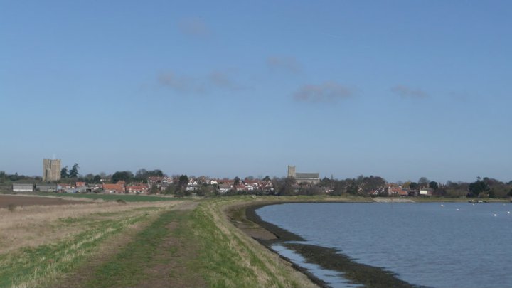
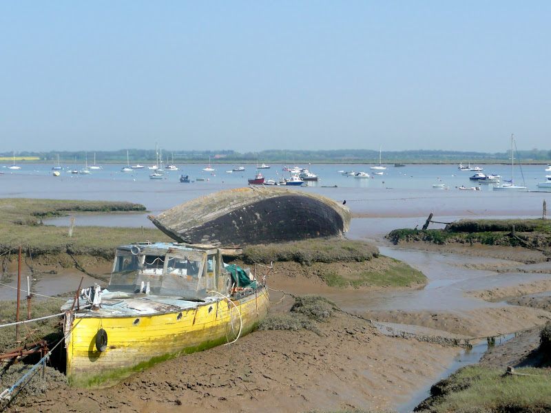
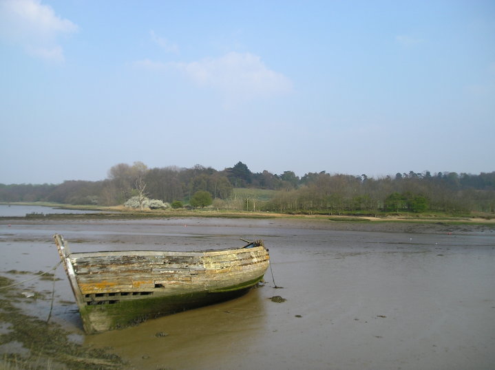
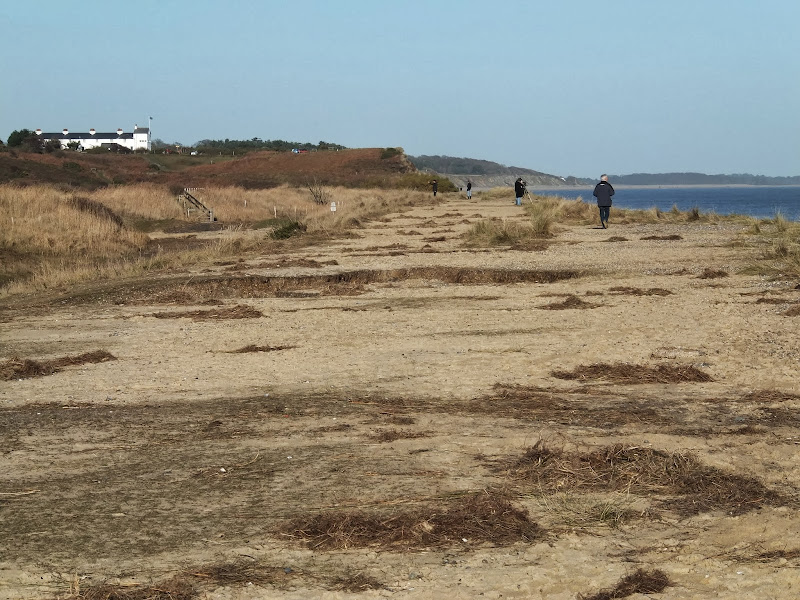
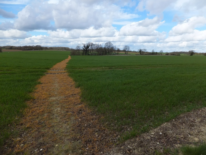
A starting point is provided at Rushmere Heath, close to Ipswich Hospital and takes a rural route out behind Kesgrave and through to Martlesham. The trail then heads down to Martlesham Creek, a sizeable creek off of the River Deben that creek was said to be used in 18th century smuggling days as a discreet place to offload contraband. A riverside path then provides access all the way through to Melton. This is the highlight of the walk, a true delight to wander no matter what time of the year.

Although there are no specific pubs along the route, a short diversion gives access to The Black Tiles at roughly the half way point. There is public transport linking the two ends with 800 First Group bus service departing from outside Melton railway station. The 64 service follows a similar route and departs from The Street in Melton. There is no Sunday service.

Features along the route include an anonymous grave on Martlesham Heath known as Dobbs' Grave, reputedly the resting place of a shepherd boy named Dobbs who committed suicide. The area is purported to be haunted some saying it to be the ghost of Brainy Dobbs, an airman from Martlesham Heath airfield.

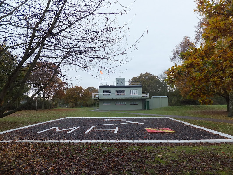
Martlesham Heath Control Tower Museum is located a little further along and pays homage to RAF Martlesham Heath, which contributed to the development of aviation as well as being a key airfield during two world wars. Open on Sundays from Easter to October.

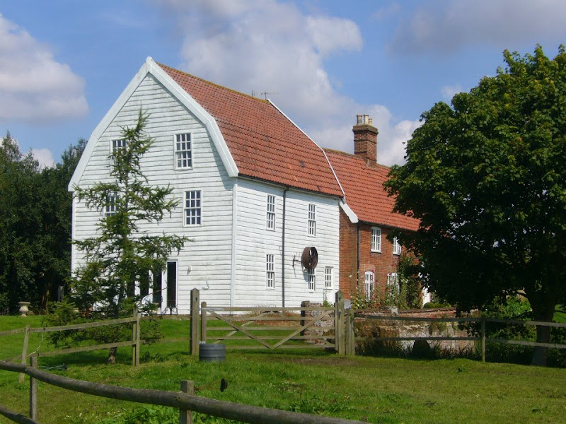
The impressive renovated Tide Mill sits on the banks of the Deben at Woodbridge and is a worthwhile attraction to take time out and visit. The mill, over 800 years old, is said to be the oldest in the country.

Sunday 30 December 2018

Suffolk Coast Path - Lowestoft to Southwold Inland Route

Covehithe church

A 17 mile walk using the official inland route of the Suffolk Coast Path from Lowestoft to Southwold

Due to erosion and tides the Suffolk Coast Path takes an inland diversion for the section between Lowestoft and Southwold. Although the alternative beach route can be accessed providing the tides are right, this route nonetheless has its worth especially for the picturesque section around Frostenden.

Sunday 22 December 2013

The Aftermath of the 2013 Storm Surge at Minsmere

Flattened dunes by the Northern Sea Wall to Minsmere

A 10 mile circular walk to witness the damage caused by the 2013 Storm Surge

The 2013 Storm Surge proved to be the highest tide in 60 years. Although much of the flooding had recede the evidence remained of where the waters reached. Viewing the changes in coastline shows just how vulnerable this stretch of the Suffolk coast really is, especially in view of the fact that such storms appear to be increasing in frequency. The walk returns through the heath and forest via Dunwich Heath and Eastbridge where the results of Octobers St Jude storm are evident from the many fallen trees.

Wednesday 15 February 2012

Winter Snows on Thorpeness Common

Snow on the common

An 7 mile circular walk across The Walks and Thorpeness Common.

The winter snows finally arrived in February this year creating a wonderful winters scene across the Aldringham and Thorpeness Commons, enticing folk out to witness the scene and encouraging local kids to take advantage of sledging down the slopes of the marl pit.

Wednesday 21 November 2018

The Fonnereau Way to Ipswich

Christchurch Park

A 12 mile walk between Woodbridge and Ipswich incorporating sections from the Fonnereau Way, the Sandlings and the Fynn Valley Way

This walk links the railway stations of Woodbridge, Westerfield and Ipswich with scenic views along the estuary at Woodbridge and the Fynn Valley before entering Ipswich from the west through the historic parkland known as Christchurch park which dates from the 12th century which includes many historic features and a mansion that is open to the public.

Thursday 7 January 2021

In Search of Leiston Gibbet, Friday Market Heath and St Andrews Green

Land by the River Hundred at Aldringham

A 6 mile walk around the heaths and commons of Coldfair Green

This walk follows an investigation to seek out the location of the Leiston Gibbet and an area of heathland that was known in the 1600's as Friday Market Heath. The only reference to these places comes from an old book from 1910 entitled 'The Chronicles of Theberton' which details the route past the gibbet. This walk attempts to retrace this route by navigating along the heathland and footpaths around the River Hundred which marks the boundary between the hundreds of Blything and Plomestead. Extensive research which has been undertaken and documented in the feature of this walk with some revealing insights to long forgotten places.

Friday 4 January 2019

A Walk Around the Churches of Knodishall and Friston

An 8.4 mile circular walk around the Suffolk villages of Knodishall and Friston

An easy ramble across the Suffolk countryside, with the highlight being the hidden ruins of St Peters Church in the old parish of Buxlow, now a part of Knodishall. There's some fascinating history on this walk along paths that are off the beaten track but nonetheless well maintained.

Saturday 15 December 2018

Suffolk Coast Path - Snape to Felixstowe

Looking bck towards Shingle Street from Bawdsey

A 20 mile walk along the Suffolk Coast Path between Snape and Felixstowe

This is the most remote section of the Suffolk Coast Path and follows the Butley River down to Shingle Street and then continues along the coast to the ferry at Bawdsey. There is an eerie sense of foreboding when walking this section. The solitude. The windswept landscape. The distant silhouettes of the Orfordness Pagodas. The lonely river. One can walk virtually the entire distance without seeing a soul and the only company is the decaying remains of WWII defences and the looming martello towers from Napoleonic times.

Thursday 20 December 2018

The Sandlings Walk - Martlesham to Rushmere Heath

Martlesham Heath Control Tower Museum

A 4.5 mile walk across heathland from Martlesham to Rushmere Heath on the eastern fringes of Ipswich

Like most modern towns, Ipswich is suffering from a seemingly endless amount of urban sprawl that envelops the traditional villages that once surrounded it. However, this walk follows heathland that is hidden behind the housing estates all the way from Martlesham through to Rushmere Heath and Ipswich Hospital

Saturday 29 December 2018

Deben Estuary - Melton to Bawdsey

View across the Deben estuary

A 15 mile river side walk along the Deben Estuary in Suffolk between the villages of Melton and Bawdsey

This walk follows river side footpaths with spectacular views across the estuary. Unfortunately at Ramsholt there is no public access and one needs to divert through to the village of Alderton with a road walk for the last few miles to Bawdsey. A ferry crossing an a short walk into Felixstowe provides public transport access back to Melton

Friday 6 December 2019

A Country Amble between Leiston and Saxmundham

Broad footpath marked out across the fields to Saxmundham

A 5 mile walk across the Coastal Suffolk landscape between Leiston and Saxmundham

This walk searches out footpaths to connect the neighbouring towns of Leiston and Suffolk. Although there is no direct route, the paths chosen are certainly more conducive to the walker than the busy road route. With the churches of Leiston and Knodishall on the route, plus the mysterious Harris's Pit in the parish of Sternfield there is enough to interest the avid rambler. Sternfield also has the notoriety of being the village from which the last woman to be burnt at the stake in England came.

Friday 5 April 2019

The Alde Valley Walk - Leiston to Wickham Market

Beversham Mill

A 16 mile walk along the East Suffolk Line Path between Leiston and Wickham Market

Although the official route for the East Suffolk Line Path links the stations at Saxmundham and Campsea Ashe, this provides an alternative route using the local bus service to link the two ends. Highlights along the route include the picturesque Beversham Mill and the legendary Blaxhall Stone which is said to progressively grow in size.

Thursday 15 December 2011

Autumn on Thorpeness Common

A 6 mile circular walk across the commons of the East Suffolk Coastal area linking Leiston, Thorpeness and Sizewell.

Autumn on Thorpeness Common is a great time to hunt out mushrooms, harvest sloes and admire the changing of the seasons. I am not expert on mushrooms and certainly would not even dare to pick a wild mushroom to eat without specific advice from a fungi expert, nonetheless, it is always good to view them. The sloes are a different matter though, for a second year running we have gathered copious quantities of this bitter fruit in order to get some sloe gin ready for Christmas. There were so many this year we ended up giving much of our labours away!

Wednesday 21 November 2018

Fynn Valley Circular Walk

A 16 mile walk along the Suffolk Fynn Valley between Woodbridge and Witnesham, with a return route via Grundisburgh and Hasketon.

The Fynn Valley Walk is an official waymarked route following the course of the River Fynn from Witnesham to Martlesham then continuing through to Woodbridge along the banks of the River Deben. For this walk, the Fynn Valley route is walked in reverse then public footpaths are used across the fields to Grundisburgh and Hasketon and back down into Woodbridge to make a circular walk.

Walk Summaries

Latest walk summaries are basic information sheets for walks that have yet to be fully documented. These provide links to maps, public transport and walks stats, although detailed notes and features are not included.

Latest Walk Summaries

Featured Walk

In Search of Sizewell Chapel

A 10 mile walk following the southern side of the parish boundary of Leiston in Suffolk This walk follows the route of a 17th century peramb...

What is GPX

All you need to know about GPX, electronic mapping and how to use modern apps and mobile devices as navigation devices

Popular Walks

Maps