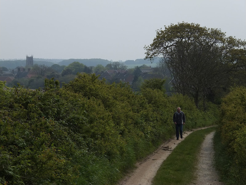
The Ridgeway - Great Kimble to Aston Rowant
|
Wednesday 9 February 2022
|
No comments |
![]()

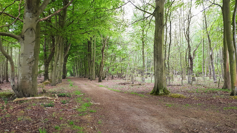
The Ridgeway - Great Kimble to Aston Rowant
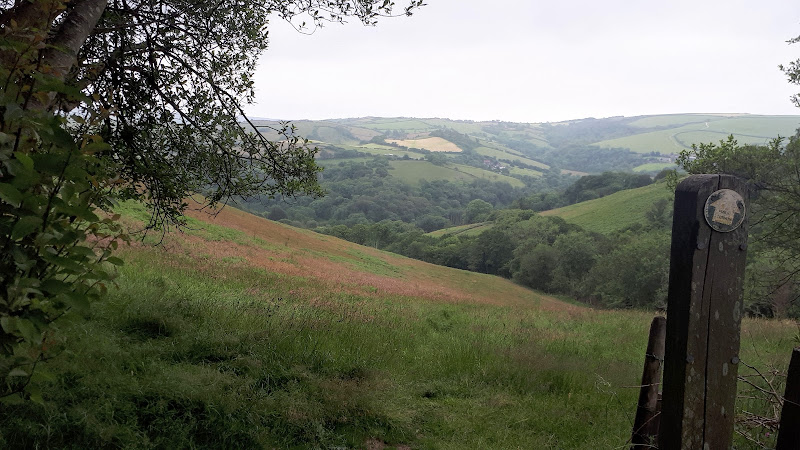
The second walk of a multi day hike along the Ridgeway going East to West
|
Wednesday 9 February 2022
|
No comments |
![]()
The second walk of a multi day hike along the Ridgeway going East to West
|
Saturday 5 February 2022
|
No comments |
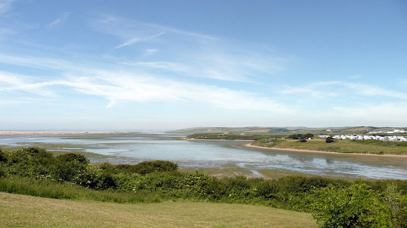
![]()
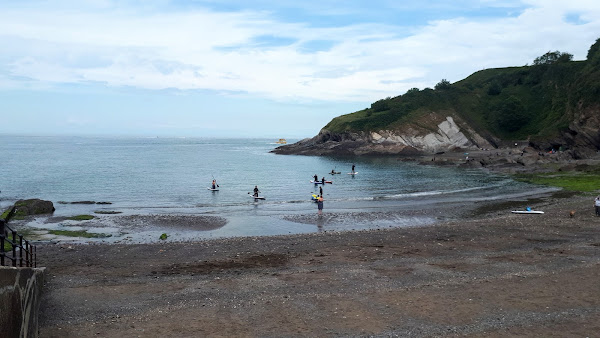
A short but strenuous walk across Hillsborough Hill that separates Ilfracombe and Hele Bay.
|
Wednesday 15 December 2021
|
No comments |
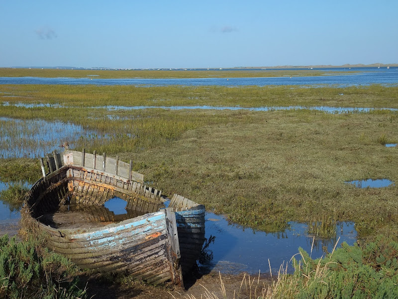
![]()
A 7 mile walk around coastal North Devon from Hele Bay to Berrynarbor
This walk takes inland footpaths and tracks to navigate from the village of Hele Bay through to Berrynarbor, which, with its whitewashed stone walls takes on the guise of a Mediterranean village. The village plays host to numerous flower pot men in comical poses which makes an intriguing spectacle as one wanders through the streets. Return is along the South West Coast Path
|
Tuesday 4 May 2021
|
No comments |
![]()
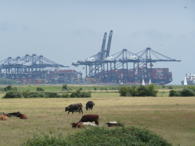
A 14 mile walk along the banks of the River Orwell in Suffolk between Ipswich and Shotley Gate
The Stour and Orwell path is an extension to the southern end of the Suffolk Coast Path and follows the coast and heaths along the estuaries of the Orwell and the Stour rivers. This particular walk focuses on the section between Ipswich and Shotley Gate following the river Orwell along the Shotley peninsular.
|
Monday 26 April 2021
|
No comments |
![]()
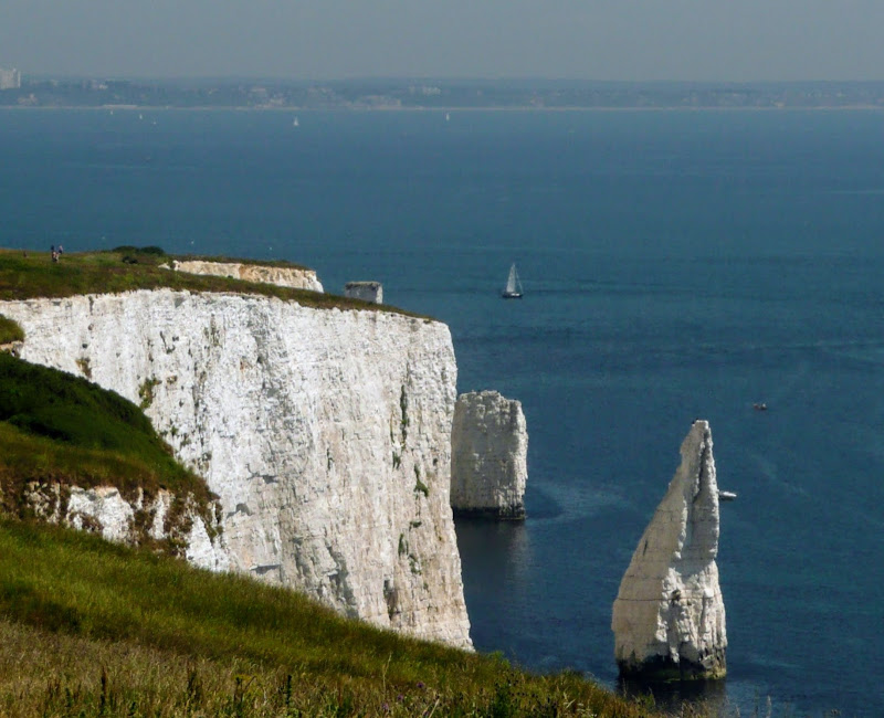
An moderately easy walk to the end of the South West Coast Path at South Haven Point
Old Harry Rocks is the highlight of this walk, and the ascent to Handfast Point, off of which the rocks are located, is the only real effort that has to be expended during the duration of this walk.The rest of the walk is easy all the way through to the end of the South West Coast Path at South Haven Point.
|
Sunday 24 January 2021
|
No comments |
![]()
An 11 mile walk linking the Bittern Line stations of North Walsham and Wroxham
A rewarding days walk through the Norfolk countryside that links the railway stations of North Walsham and Wroxham. The route passes across an historic battleground, through woodland, encountering picturesque hamlets and village churches along the way. The end section uses the Bure Valley Railway path that follows the narrow gauge steam railway past Coltishall and down to Wroxham station.
|
Wednesday 22 July 2020
|
No comments |
![]()
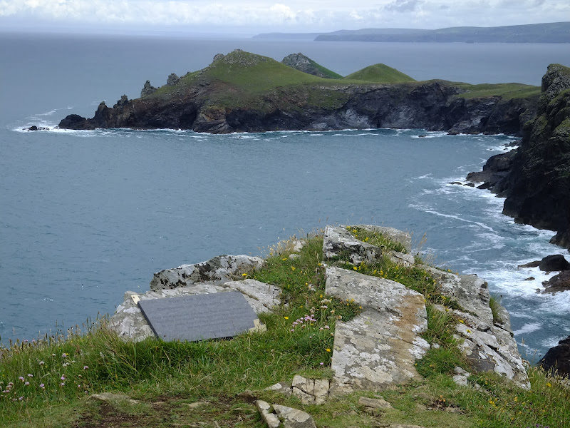
Short circular walk around the headland that fronts Pozeath
An awesome wander around Pentire Point from the village of Polzeath. This is a must for anyone who visits this classic piece of Cornish coastline. A few challenges but nothing that an average walker can muster
|
Tuesday 24 December 2019
|
No comments |
![]()
A 13 mile North Bedfordshire walk along the Ouse Valley Way between Oakley and Carlton taking in the charming villages of Pavenham, Sharnbrook, and Odell.
Although the Ouse Valley Way does not actually go into Oakley, there is a convenient bus stop here that links the two ends to this walk. The bus stop is a mile or so from the river, from where there is a footpath which joins the official route at Stevington and then winds its way through the rolling Bedfordshire countryside. There's plenty to see and explore along the route with medieval river bridges, the Holywell at Stevington, the ghostly tales of Odell and the picturesque villages of Pavenham, Radwell, Sharnbrook, and Harrold. Although many of the villages pubs have finally closed their doors for good in recent years, there are still convenient refreshment stops on route.
|
Thursday 19 December 2019
|
No comments |
![]()
A 17 mile walk along the Angles Way from Diss to Harleston and onto Wortwell
There is plenty of history along this section of the Angles Way as it follows the course of the River Waveney. Numerous archaeological finds have been found along the route dating from prehistoric times through roman pottery and remnants of the middle ages. There are lost villages, halls and churches to provide ample opportunity for exploration as the path meanders across the Norfolk Suffolk border.
|
Wednesday 18 December 2019
|
No comments |
![]()
A 7 mile walk along Norfolk's Paston Way from Cromer to Gunton.
The Paston Way has a few alternative paths that stray from its main route between North Walsham and Cromer, and this walk takes the optional route out to Gunton from where a train can be taken back to Cromer. There are some worthy country pubs along this simple walk so a good old English pub crawl can also be had along with taking in the sights of the impressive churches at Northrepps and Southrepps plus local tales of wartime German conspiracies!
|
|
2 comments |
![]()

A 4 mile beach walk to witness the damage caused by the 2013 Storm Surge along the shingle bank between Cley and Salthouse
The December 2013 Storm Surge caused widespread flooding of the marshes and sea defences along the North Norfolk Coast, resulting in the closure of the Coast path between Blakeney and Cley. It is still possible to walk out to the beach from Cley village via the road where a walk along the shingle will astound those who have walked this section prior to the December storm. The shingle ridge has been levelled, with the excess cast across the marshes.
|
|
2 comments |
![]()
The future of the 2.5 mile walk along the sea defences between Blakeney and Cley
The December 2013 Storm Surge caused major damage to the sea defences along the Norfolk Coast Path that encompasses the Blakeney Freshes. Work is currently being carried out to repair the breaches, however the long term future of both the Freshes and the coast path at this point is uncertain.
|
|
No comments |
![]()
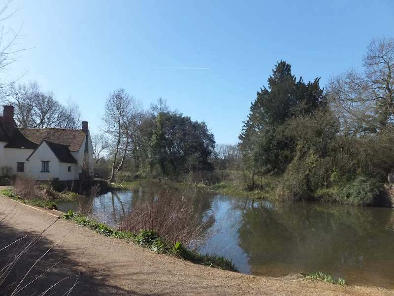
An 11 mile Walk along the River Stour incorporating sections of the Stour Valley Path, the Essex Way and St Edmund's Way
Flatford Mill is the idyllic English country scene encapsulated by John Constables renowned paintings including the instantly recognizable 'Haywain'. This circular route is an exceptional walk by all accounts and the perfect way to engross oneself in this landscape that sits on the Suffolk and Essex border.
|
|
No comments |
![]()

A 23 mile walk along the Lincolnshire Coast between Cleethorpes and Mablethorpe
Although a Lincolnshire Coast Path has yet to be established, this walk sets out a viable route for all budding coast walkers. This follows defence banks and permissive paths with a little road walking where necessary.
|
Tuesday 17 December 2019
|
No comments |
![]()

An 8 mile walk along the South West Coast Path between Bucks Cross to Westward Ho!
A moderate walk along the cliffs to Westward Ho!, the town renowned for being the only place in Britain to have an exclamation mark in its name. This walk presents a good introduction to the South West Coast Path being under 10 miles and with few difficult or strenuous ascents and descents. There are amazing panoramas of the coastline throughout with views to Hartland in the west and Westward Ho! and north Devon to the East and North.
|
Saturday 7 December 2019
|
No comments |
![]()

An 11 mile walk along the South West Coast Path between Perranporth and Newquay
By South West Coast Path standards this is an easy walk along the low level cliffs with no particularly difficult climbs with the usual spectacular coastal views. The main obstacle on this section is crossing the River Gannel estuary. There are three footbridges but these are all dependant upon the state of the tide so tide tables need to be consulted and the walk planned appropriately.
|
Friday 6 December 2019
|
No comments |
![]()
A 5 mile walk across the Coastal Suffolk landscape between Leiston and Saxmundham
This walk searches out footpaths to connect the neighbouring towns of Leiston and Suffolk. Although there is no direct route, the paths chosen are certainly more conducive to the walker than the busy road route. With the churches of Leiston and Knodishall on the route, plus the mysterious Harris's Pit in the parish of Sternfield there is enough to interest the avid rambler. Sternfield also has the notoriety of being the village from which the last woman to be burnt at the stake in England came.
|
Wednesday 13 February 2019
|
No comments |
![]()
A 10 mile walk along the South West Coast Path between Langton Herring and Weymouth
An easy walk following Chesil Beach through to Weymouth. The path follows the contours of the land keeping close to the shore. At Weymouth the eastern coastline spreads out eastwards presenting the next challenge.
This section of the South West Coast Path was set around a base camp at the Bagwell touring site at Langton Herring. This site is close to the road into Weymouth providing easy access to public transport and close to the Coast Path with footpaths leading down to the trail just below Langton Herring village. The path follows the waterline of the Fleet, the enclosed waters that sit between the mainland and Chesil Beach, the large shingle Bank that stretches all the way through to Portland, the island at the southern tip of Weymouth.
The path cuts across a small headland known as Herbury and then past Moonfleet Manor House a large 30 room Georgian building used as a hotel and spa. The house is the central location for the namesake novel by J. Mead Faulkner set in times when piracy and smuggling abounded. The name of the house is derived from Maximillion Mohune who built the house, literally Mohunes of Fleet which was corrupted to Moonfleet.
The walk is easy and relaxed with no real challenges, more like an amble in the park rather than a hike along the South West Coast Path. Given a glorious sunny day such as that when this instance of the walk was undertaken, it really is an utter pleasure to wander.
The path on this section ends at Ferry Bridge, the connecting point between the mainland and Portland where a road leads across to the island via the Ferry Bridge. The Ferry Bridge Inn stood here, in a prominent position with views across to Portland and westwards along the Fleet. One would have thought such a position would deem it to be a busy pub but certainly this was not the case on visiting during this walk when we were the only patrons. The pub has since closed and has subsequently been demolished.
The coast path continues with a circular walk around Portland. That is a section left for another walk day and detailed on Portland Circular Walk. For this walk we continue into Weymouth town, following the route of the former Portland Branch Line. The path diverges from the old trackbed at the Nothe Peninsular where a 19th century fort sits at its head. This peninsular forms a natural harbour on its northern side where the River Wey drains into the sea. One one can walk up to the Town Bridge to cross the river, but it is much more fun to take the ferry and witness the numerous sailing craft moored on either side. A fish eye view of the river. Well a sailors eye view anyway. On this expedition the Pelican sailing ship was moored in the harbour. Built in 1948 this tall ship made its living as an arctic trawler before being restored in 2007 and subsequently used as a sail training ship. A magnificent sight.
The town of Weymouth sits on a sheltered bay at the mouth of the River Wey. It was built as a prominent seaport whose trade dates back to medieval times. In these modern times it thrives on tourism and is an unabashed, unashamed English seaside resort with all the connotations that one expects from such. Kiss me quick hats. Ice Cream. Sandy Beaches where holidaymakers soak up the sun. Not the place for the rural aficionado such as myself but nonetheless it still presents that sense of arrival. After walking the coast path from Exmouth, this is the first major town and such civilisation marks an arrival, a completion of a major section. Because Weymouth and Portland jut out into the English Channel the coast eastwards is always hidden from view when walking from the west. From Weymouth a whole new challenge is presented ahead with the coastline stretching around to Lulworth and Kimmeridge and beyond.
There are buses from Weymouth back to the campsite including the Jurassic Coast service which runs past the site entrance. Later buses run through to Chickerell which is a short one mile walk back to the campsite. On this occasion a later bus was caught which did present the unwitting passenger to the less salubrious side of the town where Feral youths stand in the road purposefully forcing the bus to stop with scowls on their faces and abusive words from their mouths and sign language that did not take someone who was proficient in such skills to interpret. It is a sad fact that such reprobates fail to see the beauty that is around them. This coast is a glory with so much to explore yet they appear to restrict themselves to the concrete urbanisation.
|
Saturday 26 January 2019
|
No comments |
![]()
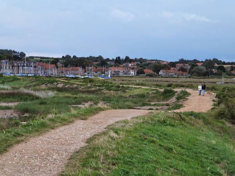
A 10 mile walk following the Norfolk Coast Path between Cley and Wells-next-the-Sea
An easy walk along the Norfolk Coast Path navigating out across the marshes to Blakeney then along the marsh perimeter to Wells. Blakeney is a worthy stopping point to explore Mariners Hill and the Guildhall and take in the legends of the Blakeney tunnels and the tragic story of the Blakeney Fiddler who is depicted on the village sign.
|
|
6 comments |
![]()

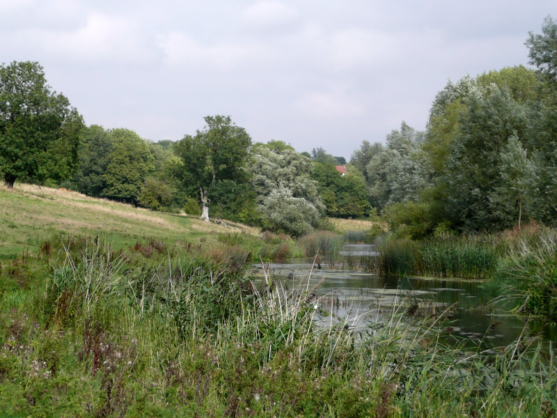
A 12 mile circular walk starting at Eyke and incorporating the UFO Trail in Suffolk's Rendlesham Forest
The Rendlesham UFO trail is a waymarked 3 mile trail around the eastern end of Rendlesham Forest that navigates around the key areas that were involved in the Rendlesham Forest Incident of 1980 in which both civilian and military personnel witnessed unexplained craft land within the forest. Although this can be walked by parking up at the visitor car-park in the forest, a longer alternative is to take the footpaths from Eyke, and make a day of this most wonderful and intriguing part of Suffolk.
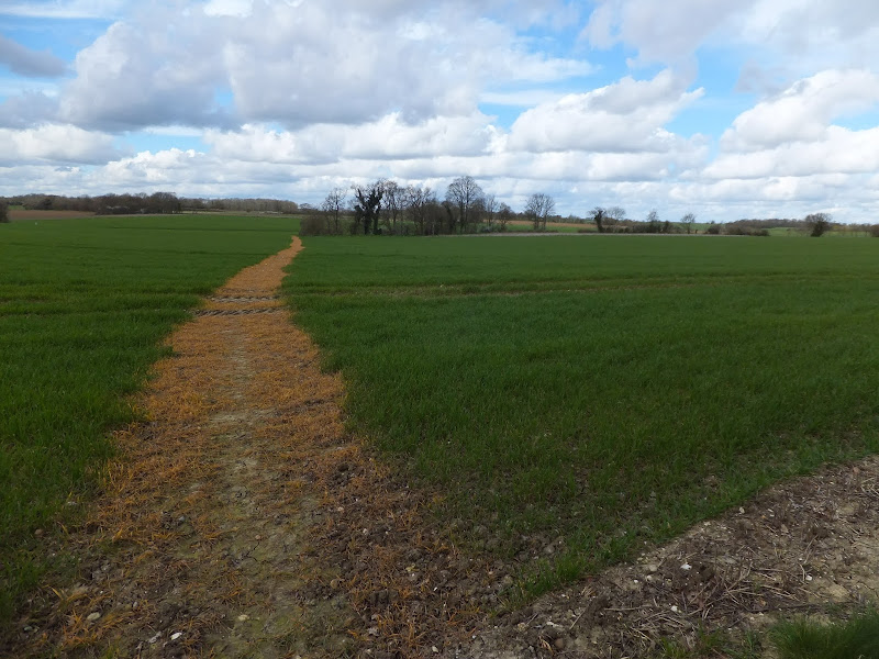
A 10 mile walk following the southern side of the parish boundary of Leiston in Suffolk This walk follows the route of a 17th century peramb...


