Route details, maps, pubs, features, local history and folklore for a wide variety of walks focusing primarily on Norfolk and Suffolk

Walks
Showing posts sorted by date for query Great Yarmouth. Sort by relevance Show all posts

Friday 28 December 2018

Angles Way - Oulton Broad to Beccles

Beccles

A 9 mile walk along the Angles Way between Oulton Broad and Beccles in Suffolk

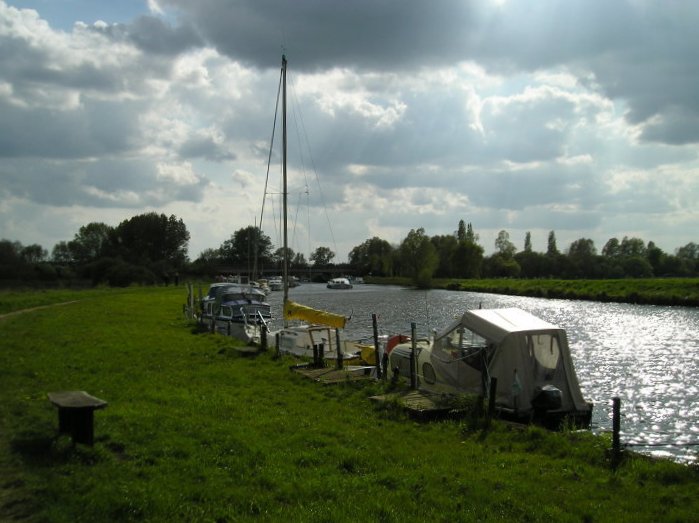
The path between Oulton Broad and Beccles doubles up as both The Angles Way and the East Suffolk Coast Line walk. There is not much to this walk other than following the winding path alongside the River Waveney. It is a pleasant enough stroll but without much activity on the river it can become a little monotonous until Beccles approaches. Nonetheless, what a better way than to spend a sunny afternoon other than ambling alongside the river.

Friday 21 December 2018

Weavers Way - Potter Heigham to North Walsham

A 20 mile walk along the Weavers Way between Potter Heigham and North Walsham

The Weavers Way winds its way along the River Thurne and then up Candle Dyke to Hickling Broad. From here it cuts across country to Stalham where it picks up the old railway trackbed through to just south of North Walsham. It is a full days walk with plenty of refreshment stops en route and plenty to see and do along the way.

Saturday 15 December 2018

Lincolnshire Coast Path - Skegness to Gibraltar Point

Beach looking towards Gibraltar Point

A 7.5 mile beach walk from Skegness to Gibraltar Point

Gibraltar Point, with its Nature Reserve, Visitor Centre and Wash Study Centre can be accessed via a dedicated road from Skegness town centre. This walk attempts to access the Point by way of the beach. It is imperative that one heeds the tide times in order to walk this route, but those doing so will be treated to some outstanding beach views and the solitude that this deserted area brings with it.

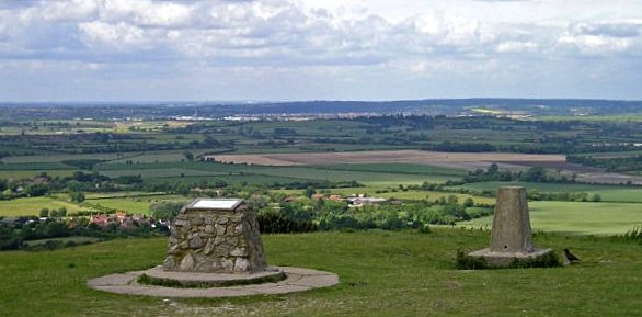
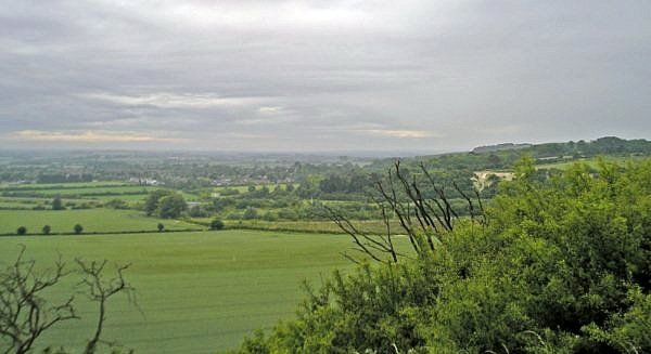
The Icknield Way - Tring to Sundon

The start of the Icknield Way linking Tring and Sundon taking in the Dunstable Downs

Some exhilarating walking through the Dunstable Downs with accompanying magnificent views. The Icknield Way has now been routed around the urban sprawl around Dustable and Luton so although urbanisation is never far away it is sufficient to keep a very much rural setting.

Thursday 13 December 2018

Southwold Circular Walk

An 5.5 mile circular walk around Southwold

This walk navigates from Southwold Harbour around the northern part of the Blyth estuary known as Buss Creek, returning via the seafront to the harbour. One cannot miss out on a wander around the pier to take in the amazing sights of the quirky The Under the Pier show, the creation of Tim Hunkin and typical British eccentricity at its best.

Friday 7 December 2018

The Icknield Way - Sundon to Baldock

A 20 mile walk along the Icknield Way between Sundon and Baldock

The modern route of the Icknield Way from Dunstable to Luton diverts from the traditional route which has to negotiate the urban sprawl. The modern route is now takes a more pleasant path through the Chiltern Hills, rejoining the priginal route to the north of Luton. In doing so villages and countryside are the order of the day all the way through to Letchworth and Baldock.

Wednesday 5 December 2018

The Wherrymans Way - Rockland to Loddon

Hardley Drainage Mill

A 15 mile walk along Norfolks Wherrymans Way

The only way one can see the sights of the River Yare is to either sail the river or walk the Wherrymans Way. Even in a boat one cannot get as good a view as the path along the heightened defence banks. This is stereotypical Norfolk in all its glory and although it is a lengthy section of walking, it is well worth the effort.

Tuesday 27 November 2018

The Weavers Way

Weavers Way Marker

An overview of the The Weavers Way, a 60 mile long distance footpath through Norfolk linking Cromer and Great Yarmouth.

The Weavers Way takes its name from the cottage weaving industry that established itself during Middle Ages around the North Walsham area. The path is characterised by the various sections that it passes through on route, firstly historic halls, then old railways followed by river walks before the final section across the lowland Norfolk landscape with its characteristic big skies.

Thursday 22 November 2018

Wells, Wareham, Wighton and Railways

River Stiffkey

A 9 miles circular walk that follows the Walsingham light railway from Wells-next-the-sea to Wighton with a return along tracks that make up National Cycle Route 1

This is a short circular walk taking in the villages of Warham and Wighton just inland from Wells and following the route of the Wells and Walsingham light railway. There is plenty to see along the route including paying a visit to the old Wells-next-the-sea Railway Station, which is now a fascinating second hand book shop and pottery studio. There is an iron age fort known as Warham Camp in the fields between Warham and Wighton and return is via the curiously named Gallow Hill on the Holkham estate. There are two pubs on route, the Carpenters Arms at Wighton and the Three Horseshoes at Warham, a pub with real old world character full of curiosities which is worth the walk alone.

Wednesday 21 November 2018

Winterton to Great Yarmouth Beach Walk

Hemsby

A 9 mile beach walk between along the Norfolk coast from Winterton to Great Yarmouth

This walk is probably better known as Robinson Crusoe's walk since this is where Daniel Defoe places his character, in the novel of the same name, after being shipwrecked with a resulting walk to Great Yarmouth. Although such a stormy day would not make the best of walks, when the sun shines and the tide is out this really is a great walk.

Wednesday 14 November 2018

Norfolk/Suffolk Coast - Gorleston to Kessingland

A 14 mile coastal walk between Gorleston and Kessingland crossing the border from Norfolk to Suffolk

This mighty fine walk takes the avid rambler to the most easterly point of the British Isles, Ness Point that is located in front of Lowestoft. The point is marked with a large circular ground compass with distances and direction to well known landmarks around the globe. The route uses cliff top paths, proms and beaches and makes for a great days walking.

Saturday 27 October 2018

Angles Way - Belton to Great Yarmouth

An 8 mile walk along the Angles Way from its start at Great Yarmouth to Belton

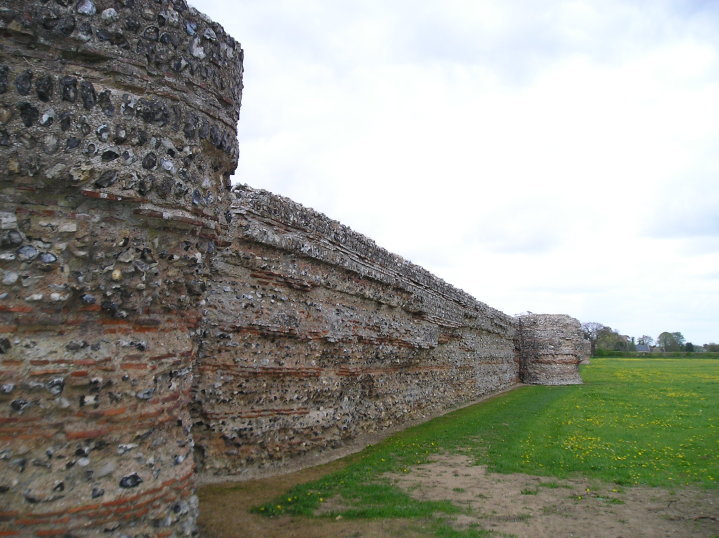
The Angles Ways journey begins with a walk along the banks of Breydon Water to Belton. Along this route can be seen the impressive remains of the Roman fort Gariannonum at Burgh Castle. This is a simple afternoons walk with a frequent bus service linking Great Yarmouth and Belton for the return journey. On this occasion we walked the path in reverse having set up camp at Belton.

Saturday 4 August 2018

Weavers Way - Stalham to Aylsham Walk Summary

Salt marsh

A walk along the dismantled M&GN railway from Stalham to Aylsham

This walk is the Railway section of the Weavers Way, a 60 mile long distance trail through the eastern side of Norfolk. This section follows the former M&GN railway trackbed from Stalham to Aylsham and there is plenty of evidence of the former railway with the stations of Honing and Felmingham still retaining their platforms and some structures and many typical railway style bridges throughout the trail.

Originally named as the Great Yarmouth and Stalham Light Railway when the first section was constructed in 1876, it changed its name to the Yarmouth and North Norfolk Light Railway with the extension to North Walsham in 1878. In 1881, in conjunction with the Lynn and Fakenham Railway a link between Melton Constable and North Walsham via Aylsham was added together with the light railway being converted to a full standard gauge line.

The 20th century saw this railway amalgamated into the Midland and Great Northern Railway, before combining into the LNER grouping. Post war saw its merger into the nationalised British Rail.

The line lasted until 1959 when it was deemed to be loss making and, along with many of Norfolk's railways, it closed down for good. The former railway line has now become part of the Weavers Way long distance trail as well as a designated county wildlife site and the cutting close to Felmingham has become a butterfly nature reserve.

The former railway has to be left at North Walsham where the modern road uses its route through the town. This provides a half way point of this walk and enables the hiker to peruse North Walsham as well as provide plenty of places to rest and refresh oneself before continuing onto Aylsham. The Hop Inn is always a recommended place to visit for those who like their ale. This micro pub serves six ever changing ales along with simple snacks and is always a hub of activity with conversation being the main entertainment of its customers.

There is no direct public transport link between the two ends of this walk and one requires to either use Cromer or Norwich as a link. In this instance Sanders Buses offers the number 6 service from Cromer to Stalham and to return there is the 44 servcie from Aylsham to Cromer.
Sunday 29 July 2018

Leiston to Hazlewood Circular Walk Summary

Salt marsh

A somewhat challenging circular walk to Suffolks ancient parish of Hazlewood

Hazlewood was an ancient parish that bordered the River Alde in the Plomsgate Hundred of Suffolk. In 1934 it was annexed with the neighbouring parishes of Friston and Aldeburgh although names in the landscape still bear testament to its existence, including Hazlewood Common, the ultimate destination of this walk.

This is a challenging walk in respect of 20 yards of jungle to navigate through in order to get to The Grange farmhouse. Navigation of this neglected footpath does involve crawling on all fours as well as climbing across fallen trees. Not a walk for the feint hearted.

This challenge borders a field which was part of a WWI airfield that was in operation between October 1915 and September 1919. Known locally as Hazlewood Aerodrome, this grass airstrip was one of several support sites for RNAS Great Yarmouth and served as a night landing ground. It was also used by aircraft responding to Zeppelin raids. Little remains of the site as all support buildings have now either been demolished or collapsed although there is reputedly some concrete footings that can still be seen.

Other features on this route are the ancient Great Wood and some post medieval quarries. Return is across Aldringham Common where the former Aldringham Providence Baptist Chapel can be seen. Built in 1812, this chapel hidden away on the common was replaced in 1915 with a design by the Suffolk architect, poet and artist, Cecil Howard Lay. It has since been converted into a private residence.

Saturday 28 April 2018

Norwich Riverside Walk

View to Whitefriars bridge

A simple 2.5 mile walk alongside the River Wensum through Norwich.

This picturesque walk through the centre of Norwich links the Marriott's Way at Barn Road roundabout on the inner ring road with The Wherryman's Way and Boudicca Way at Norwich Railway Station. There is a lot of history to the bridges over the River Wensom and associated folklore which is detailed in the features to this walk.

Monday 9 May 2016

Seaside Walk Week

Seaside Walk Week

It will soon be 2016 Seaside Walk Week. From Sunday 29 May to Sunday 5 June, this event, which is in its second year and organized by the charity Family Holiday Association, is dedicated to getting everyone outside to enjoy some fresh air and the beauty of the Great British seaside. The event will launch with an official walk in Scarborough, Britain’s first seaside resort, and end with another official walk as part of a grand finale weekend in Weston-super-Mare. Full details are available from their website page for Seaside Walk Week.

Tuesday 30 September 2014

Proposed Route for the Norfolk Coast Path from Hopton to Sea Palling Released

Proppsed route through the Winterton dunes

Details of the proposed route for the 19.2 miles of the Norfolk Coast Path between Hopton and Sea Palling

Details have been published for the proposed route of the Norfolk leg of English Coastal Footpath between Hopton to Sea Palling. Much of the proposed route is along existing footpaths and walked routes as well as beach sections. The entire distance can be walked at present either following the proposed route or just using the beach, given the right tide conditions. This proposal, if adopted, will extend the Norfolk Coast Path from Hunstanton to Hopton.

Sunday 8 December 2013

2013 Storm Surge at Sizewell and Thorpeness

The strange egg-shaped object on the left is most likely a piece of fallen cliff

A walk at high tide of the 2013 Storm Surge between Sizewell and Thorpeness

This is a photographic excursion of the 2013 Storm Surge down the Suffolk Coast. With media firmly concentrated on events in South Africa the only real way to find out was happening was to visit this destructive storm surge oneself. Although this part of Suffolk was relatively unscathed it still presented awe-inspiring seas and crashing waves.

Tuesday 16 October 2012

Norfolk Coast Path Proposed Route

Proppsed route through the Winterton dunes

Details of the proposed route for the 19.2 miles of the Norfolk Coast Path between Hopton and Sea Palling

Details have been published for the proposed route of the Norfolk leg of English Coastal Footpath between Hopton to Sea Palling. Much of the proposed route is along existing footpaths and walked routes as well as beach sections. The entire distance can be walked at present either following the proposed route or just using the beach, given the right tide conditions. This proposal, if adopted, will extend the Norfolk Coast Path from Hunstanton to Hopton.

Wednesday 15 February 2012

Winter Snows on Thorpeness Common

Snow on the common

An 7 mile circular walk across The Walks and Thorpeness Common.

The winter snows finally arrived in February this year creating a wonderful winters scene across the Aldringham and Thorpeness Commons, enticing folk out to witness the scene and encouraging local kids to take advantage of sledging down the slopes of the marl pit.

Walk Summaries

Latest walk summaries are basic information sheets for walks that have yet to be fully documented. These provide links to maps, public transport and walks stats, although detailed notes and features are not included.

Latest Walk Summaries

Featured Walk

In Search of Sizewell Chapel

A 10 mile walk following the southern side of the parish boundary of Leiston in Suffolk This walk follows the route of a 17th century peramb...

What is GPX

All you need to know about GPX, electronic mapping and how to use modern apps and mobile devices as navigation devices

Popular Walks

Maps