Route details, maps, pubs, features, local history and folklore for a wide variety of walks focusing primarily on Norfolk and Suffolk

Walks
Showing posts sorted by relevance for query Sheringham. Sort by date Show all posts

Saturday 29 December 2018

A Norfolk Broads Walk from Neatishead to Horning

Cormorants on Barton Broad

An easy 6 mile walk following the River Ant down to the Bure at Horning.

The Norfolk Broads are full of ghostly stories and this walk brings a few to life. From the spooky lights of Hoards Hole, encounters with Black Shuck and the curious transformation of Horning's riverside houses to Saxon days when it was just a grassy bank, there is plenty to reflect upon as one wanders the footpaths and quiet country lanes that make up this route. And maybe, who may tell, given the right conditions, you may even glimpse a spectral view from another dimension.

Paston Way - North Walsham to Mundesley

Edingthorpe church

An 11 mile walk along Norfolk's Paston Way between North Walsham and Mundesley

The Paston Way is a veritable Trail around some of East Norfolk's medieval churches. This section includes the delights of North Walsham, Edingthorpe, Knapton, Paston and Bacton. Although all are impressive, it it the small church at Edingthorpe which must not be missed, a treasure to behold.

Mundesley to Happisburgh Circular Walk

Coastline from Mundesley to Happisburgh

A 13 mile walk between the Norfolk coastal villages of Mundesley and Happisburgh

This walk comprises of a circular route taking in both the beach and the cliff-top paths between the two Norfolk coastal villages of Mundesley and Happisburgh. The centre of this walk is at Walcott where the cliffs recede and access to the beach is obtainable. This enables the walker to customise this route according to tidal conditions as both Happisburgh and Bacton beaches can be cut off by high tides.

Thursday 19 December 2019

Cromer to Mundesley Beach Walk

Cromer

A beach walk along the Norfolk Coast between Mundesley and Cromer including a clifftop stroll from Cromer to Overstrand.

This section of the Norfolk Coast can only be walked when the tide allows as high tide reaches the foot of the cliffs and is impassable at Overstrand. There is frequent erosion all along the route so the scenery changes from year to year. The beach is predominantly sand with numerous groynes that present frequent obstacles to get past - sometimes decaying steps assist getting over the groynes and sometimes, at low tide or with boots and socks off, it is possible to get around the end of some of the groynes. Mostly, it involves clambering as best as you can over these eroded, seaweed covered, mussel encrusted defences but that is half the fun of it! Although there is a cliff top path from Cromer to Overstrand, which has some outstanding views, beyond this there is no official right of way and a full circular walk would involve heading inland, using the Paston Way. However, a frequent bus service links Overstrand and Mundesley to make a good and easy days coast walking.

Wednesday 18 December 2019

Weavers Way - Cromer to Aylsham

Felbrigg Hall

A 17 mile walk along Norfolk's Weavers Way from Cromer to Aylsham

Historic halls, stately homes and ancient commons and villages are what typifies this northern section of the Weavers Way. This really is a typical old English scene throughout making a most pleasurable all day walk. There are numerous pubs along the route which serve both ale and food.

Wednesday 7 September 2011

Ale Trail - Mundesley to Cromer

Cromer

A beach walk along the Norfolk Coast between Mundesley and Cromer including a clifftop stroll from Cromer to Overstrand.

This section of the Norfolk Coast can only be walked when the tide allows as high tide reaches the foot of the cliffs and is impassable at Overstrand. There is frequent erosion all along the route so the scenery changes from year to year. The beach is predominantly sand with numerous groynes that present frequent obstacles to get past - sometimes decaying steps assist getting over the groynes and sometimes, at low tide or with boots and socks off, it is possible to get around the end of some of the groynes. Mostly, it involves clambering as best as you can over these eroded, seaweed covered, mussel encrusted defences but that is half the fun of it! Although there is a cliff top path from Cromer to Overstrand, which has some outstanding views, beyond this there is no official right of way and a full circular walk would involve heading inland, using the Paston Way. However, a frequent bus service links Overstrand and Mundesley to make a good and easy days coast walking.

Wednesday 18 December 2019

The Aftermath of the 2013 Storm Surge - Blakeney, Cley and Salthouse

Salthouse marshes

A 4 mile beach walk to witness the damage caused by the 2013 Storm Surge along the shingle bank between Cley and Salthouse

The December 2013 Storm Surge caused widespread flooding of the marshes and sea defences along the North Norfolk Coast, resulting in the closure of the Coast path between Blakeney and Cley. It is still possible to walk out to the beach from Cley village via the road where a walk along the shingle will astound those who have walked this section prior to the December storm. The shingle ridge has been levelled, with the excess cast across the marshes.

Saturday 26 January 2019

Norfolk Coast Path - Cley to Wells-next-the-Sea

Marshes near Blakeney

A 10 mile walk following the Norfolk Coast Path between Cley and Wells-next-the-Sea

An easy walk along the Norfolk Coast Path navigating out across the marshes to Blakeney then along the marsh perimeter to Wells. Blakeney is a worthy stopping point to explore Mariners Hill and the Guildhall and take in the legends of the Blakeney tunnels and the tragic story of the Blakeney Fiddler who is depicted on the village sign.

Tuesday 24 December 2019

Norfolk Coast Path - Wells-next-the-Sea to Burnham Overy Staithe

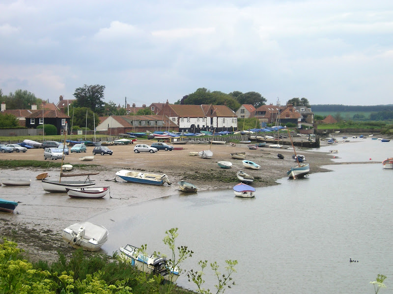
Burnham Overy Staithe

A 7 mile walk following the North Norfolk Coast Path between Wells-next-the-Sea and Burnham Overy Staithe

This amble includes some magnificent beach walking along the sands in front of the Holkham National Nature Reserve. Acres upon acres of golden sand when the tide is out with big skies and thousands upon thousands of razor shells which are washed up on the high tide mark. The walk ends at Burnham Overy Staithe, the quiet hamlet which is said to be where Nelson learnt to row and sail.

Monday 9 May 2016

Seaside Walk Week

Seaside Walk Week

It will soon be 2016 Seaside Walk Week. From Sunday 29 May to Sunday 5 June, this event, which is in its second year and organized by the charity Family Holiday Association, is dedicated to getting everyone outside to enjoy some fresh air and the beauty of the Great British seaside. The event will launch with an official walk in Scarborough, Britain’s first seaside resort, and end with another official walk as part of a grand finale weekend in Weston-super-Mare. Full details are available from their website page for Seaside Walk Week.

Thursday 30 August 2018

Runton and Incleborough Hill Walk Sumary

Salt marsh

Short circular walk over Incleborough Hill in North Norfolk

Incleborough Hill stands above the villages of East and West Runton on the North Norfolk Coast. At 260 feet in height and covered with low level gorse bushes it provides magnificent unobstructed views across the coast from Cromer to Sheringhamm and beyond. One cannot help but be impressed and in awe at the sight.

The walk is not arduous and apart from a short climb up steps it is achievable by most able bodied folk. The return is down a much gentler slope to West Runton and to the coast to follow the Norfolk Coast path back to East Runton.

Thursday 21 March 2019

Bittern Line Walk - Cromer to North Walsham

Antingham Pounds

A 11.5 mile walk following the Bittern Line between Cromer and North Walsham

The Bittern Line provides the rail gateway to North East Norfolk from Norwich. Although there are no officially documented walks that link its stations, this walk seeks to rectify this and links Cromer and North Walsham using country lanes, footpaths and tracks. Stunning countryside, typical Norfolk villages and always something new to discover.

Tuesday 17 December 2019

A Walk to Brancaster Beach

Brancaster Beach

A 3 mile walk out to Brancaster Beach returning across the marsh to Titchwell

Although not included in the official Norfolk Coast Path route, this simple walk is a well worth excursion to witness the expanse of sand and dune as well as a petrified forest and an old wreck. Always be mindful of tide conditions and particularly do not attempt to get across to the wreck which lies across the Harbour channel.

Thursday 10 January 2019

Happisburgh to Winterton Beach Walk

Happisburgh from Eccles

An 11 mile beach walk between along the Norfolk coast from Happisburgh to Winterton

Providing the tide is right, this is a fantastic beach walk with miles of golden sand and, if you are lucky, the sight of seals basking in the sunshine. Probably one of the best beach walks on this coastline.

Saturday 4 August 2018

Weavers Way - Stalham to Aylsham Walk Summary

Salt marsh

A walk along the dismantled M&GN railway from Stalham to Aylsham

This walk is the Railway section of the Weavers Way, a 60 mile long distance trail through the eastern side of Norfolk. This section follows the former M&GN railway trackbed from Stalham to Aylsham and there is plenty of evidence of the former railway with the stations of Honing and Felmingham still retaining their platforms and some structures and many typical railway style bridges throughout the trail.

Originally named as the Great Yarmouth and Stalham Light Railway when the first section was constructed in 1876, it changed its name to the Yarmouth and North Norfolk Light Railway with the extension to North Walsham in 1878. In 1881, in conjunction with the Lynn and Fakenham Railway a link between Melton Constable and North Walsham via Aylsham was added together with the light railway being converted to a full standard gauge line.

The 20th century saw this railway amalgamated into the Midland and Great Northern Railway, before combining into the LNER grouping. Post war saw its merger into the nationalised British Rail.

The line lasted until 1959 when it was deemed to be loss making and, along with many of Norfolk's railways, it closed down for good. The former railway line has now become part of the Weavers Way long distance trail as well as a designated county wildlife site and the cutting close to Felmingham has become a butterfly nature reserve.

The former railway has to be left at North Walsham where the modern road uses its route through the town. This provides a half way point of this walk and enables the hiker to peruse North Walsham as well as provide plenty of places to rest and refresh oneself before continuing onto Aylsham. The Hop Inn is always a recommended place to visit for those who like their ale. This micro pub serves six ever changing ales along with simple snacks and is always a hub of activity with conversation being the main entertainment of its customers.

There is no direct public transport link between the two ends of this walk and one requires to either use Cromer or Norwich as a link. In this instance Sanders Buses offers the number 6 service from Cromer to Stalham and to return there is the 44 servcie from Aylsham to Cromer.
Friday 1 February 2019

Weavers Way - Potter Heigham to Great Yarmouth

A wherry heads down the river Thurne

A 20 mile walk through the Norfolk Broads following the rivers Thurne and Bure from Potter Heigham to Great Yarmouth

A walk that follows the rivers Thurne and Bure down to the town on Acle. There is then some challenging navigation across Halvergate marshes to end up walking along the banks of Breydon Water into great Yarmouth. This really is the epitome of what everyone imagines of the Norfolk Broads. Broad open skies and large open flat landscapes.

Sunday 8 December 2013

2013 Storm Surge at Sizewell and Thorpeness

The strange egg-shaped object on the left is most likely a piece of fallen cliff

A walk at high tide of the 2013 Storm Surge between Sizewell and Thorpeness

This is a photographic excursion of the 2013 Storm Surge down the Suffolk Coast. With media firmly concentrated on events in South Africa the only real way to find out was happening was to visit this destructive storm surge oneself. Although this part of Suffolk was relatively unscathed it still presented awe-inspiring seas and crashing waves.

Saturday 28 July 2018

Cromer to Hopton 40 mile Challenge Walk

Salt marsh

Extensive full day hike around the eastern section of the Norfolk Coast Path

This walk should only be undertaken by experienced long distance walkers or those who have specifically trained for such a feat. This specific route was undertaken from 5am with a high tide around 6am. This allowed for a beach walk from Waxham through to Caister as an alternative to the official dunes paths. A support car was employed to provide the return journey and offer assistance in case of emergency.

Sunday 12 December 2021

East Runton to Aldborough Circular Walk

Aldborough

A 17 mile circular walk through the countryside of North Norfolk linking East Runton and Aldborough

Aldborough is the quintessential English village with a pub facing the large village green where the sound of willow on leather can be heard from the afternoon games of cricket that are frequently staged during lazy summer afternoons. You cannot get a more stereotypically English village than Aldborough.

Thursday 10 January 2019

Holkham to Wells Circular Walk

A 9 mile circular walk along the North Norfolk Coast between Holkham and Wells-next-the-sea

An alternative to the North Norfolk Coast Path, which follows the landward side of the large belt of pine trees known as Holkham Pines, is to walk along the glorious sandy Holkham beach. This was such a well worth experience with acres upon acres of sandy beach and dunes. With clear blue skies and a little sunshine this makes for a superb walk at any time of the year. The Albatros, a sailing ship that is permanently moored at Wells Quay provides some fine and simple lunches including fresh mussels which provide a fitting half way point to this walk. The return uses the tracks around the Holkham estate taking in views of the hall, the lake and obelisk.

Walk Summaries

Latest walk summaries are basic information sheets for walks that have yet to be fully documented. These provide links to maps, public transport and walks stats, although detailed notes and features are not included.

Latest Walk Summaries

Featured Walk

In Search of Sizewell Chapel

A 10 mile walk following the southern side of the parish boundary of Leiston in Suffolk This walk follows the route of a 17th century peramb...

What is GPX

All you need to know about GPX, electronic mapping and how to use modern apps and mobile devices as navigation devices

Popular Walks

Maps