Route details, maps, pubs, features, local history and folklore for a wide variety of walks focusing primarily on Norfolk and Suffolk

Walks
Showing posts sorted by relevance for query Runton. Sort by date Show all posts

Saturday 26 January 2019

Norfolk Coast Path - Cley to Wells-next-the-Sea

Marshes near Blakeney

A 10 mile walk following the Norfolk Coast Path between Cley and Wells-next-the-Sea

An easy walk along the Norfolk Coast Path navigating out across the marshes to Blakeney then along the marsh perimeter to Wells. Blakeney is a worthy stopping point to explore Mariners Hill and the Guildhall and take in the legends of the Blakeney tunnels and the tragic story of the Blakeney Fiddler who is depicted on the village sign.

Sunday 5 January 2020

Wroxham to Norwich via Spixworth

View of the River Bure heading out of Wroxham

A 10 mile linear walk between Wroxham and Norwich

Walk linking the Bittern Railway Line stations of Wroxham and Norwich. The route cuts across to Spixworth using tracks and country lanes from where there is pedestrian access through to the centre of Norwich. Spixworth has an interesting history of folklore which is discussed in the features of this walk.

Sunday 16 December 2018

Alternative Coast Path Route from Sheringham to Cley

View from the hillside between Salthouse and Cley

A 10 mile alternative route for the North Norfolk Coast Path between Sheringham and Cley

This walk takes diversions from the official route of the North Norfolk Coast Path via the North Norfolk Railway and the Weybourne Priory Ruins. A further alternative is then used to navigate away from the strenuous shingle walk along the coast to a more gentle amble up to the village of Salthouse and across the hills to Cley. This provides a scenic and interesting alternative to the official route of the North Norfolk Coast Path and gives some spectacular views across the marshes from the hillside between Salthouse and Cley.

Tuesday 24 December 2019

Norfolk Coast Path - Wells-next-the-Sea to Burnham Overy Staithe

Burnham Overy Staithe

A 7 mile walk following the North Norfolk Coast Path between Wells-next-the-Sea and Burnham Overy Staithe

This amble includes some magnificent beach walking along the sands in front of the Holkham National Nature Reserve. Acres upon acres of golden sand when the tide is out with big skies and thousands upon thousands of razor shells which are washed up on the high tide mark. The walk ends at Burnham Overy Staithe, the quiet hamlet which is said to be where Nelson learnt to row and sail.

Tuesday 4 December 2018

Paston Way - Trimingham to Cromer

St Botolphs church, Trunch

A 13 mile walk along Norfolk's Paston Way from Trimingham to Cromer.

This is a customised walk linking sections of the Paston Way to provide a route passing the churches of Trimingham, Trunch, Bradfield and Southrepps as well as the local village pubs which are obligingly open all day on a Sunday. The final section from Northrepps offers an alternative wander past Sally Beans Cottage, renowned for being the lookout from the old Smuggling days of the 17th century, into Cromer.

Sunday 24 January 2021

Bittern Line Walk - North Walsham to Wroxham

North Walsham woods, site of the Battle of North Walsham

An 11 mile walk linking the Bittern Line stations of North Walsham and Wroxham

A rewarding days walk through the Norfolk countryside that links the railway stations of North Walsham and Wroxham. The route passes across an historic battleground, through woodland, encountering picturesque hamlets and village churches along the way. The end section uses the Bure Valley Railway path that follows the narrow gauge steam railway past Coltishall and down to Wroxham station.

Tuesday 17 December 2019

A Walk to Brancaster Beach

Brancaster Beach

A 3 mile walk out to Brancaster Beach returning across the marsh to Titchwell

Although not included in the official Norfolk Coast Path route, this simple walk is a well worth excursion to witness the expanse of sand and dune as well as a petrified forest and an old wreck. Always be mindful of tide conditions and particularly do not attempt to get across to the wreck which lies across the Harbour channel.

Thursday 10 January 2019

Happisburgh to Winterton Beach Walk

Happisburgh from Eccles

An 11 mile beach walk between along the Norfolk coast from Happisburgh to Winterton

Providing the tide is right, this is a fantastic beach walk with miles of golden sand and, if you are lucky, the sight of seals basking in the sunshine. Probably one of the best beach walks on this coastline.

Wednesday 9 January 2019

Holt to Mannngton Circular Walk

An 18 mile circular walk using footpaths and bridleways through the attractive Norfolk countryside between Holt Country Park and the Mannington Estate.

This trail takes in woodland, open countryside, lanes and even a stream which one has to jump across to provide a variety of landscape. The majority of the route is clearly waymarked although the start in Holt country park lacks initial direction as does the section around the Mannington Estate. The only disappointment was the lack of pubs, the Hare and Hounds at Baconsthorpe having last closed its doors in 2010.

Saturday 29 December 2018

Paston Way - North Walsham to Mundesley

Edingthorpe church

An 11 mile walk along Norfolk's Paston Way between North Walsham and Mundesley

The Paston Way is a veritable Trail around some of East Norfolk's medieval churches. This section includes the delights of North Walsham, Edingthorpe, Knapton, Paston and Bacton. Although all are impressive, it it the small church at Edingthorpe which must not be missed, a treasure to behold.

Saturday 4 August 2018

Weavers Way - Stalham to Aylsham Walk Summary

Salt marsh

A walk along the dismantled M&GN railway from Stalham to Aylsham

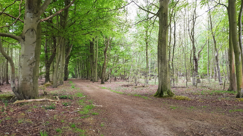
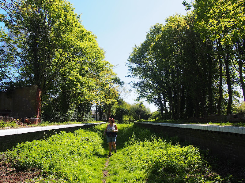
This walk is the Railway section of the Weavers Way, a 60 mile long distance trail through the eastern side of Norfolk. This section follows the former M&GN railway trackbed from Stalham to Aylsham and there is plenty of evidence of the former railway with the stations of Honing and Felmingham still retaining their platforms and some structures and many typical railway style bridges throughout the trail.

Originally named as the Great Yarmouth and Stalham Light Railway when the first section was constructed in 1876, it changed its name to the Yarmouth and North Norfolk Light Railway with the extension to North Walsham in 1878. In 1881, in conjunction with the Lynn and Fakenham Railway a link between Melton Constable and North Walsham via Aylsham was added together with the light railway being converted to a full standard gauge line.

The 20th century saw this railway amalgamated into the Midland and Great Northern Railway, before combining into the LNER grouping. Post war saw its merger into the nationalised British Rail.

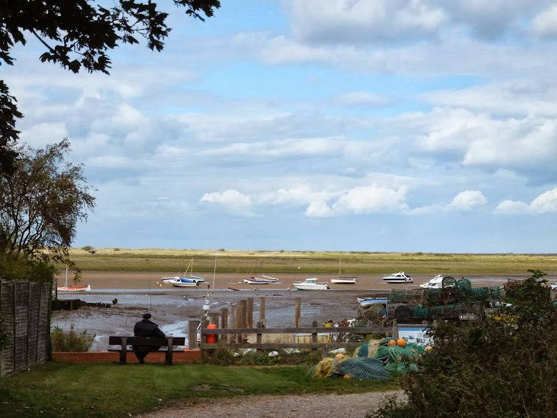
The line lasted until 1959 when it was deemed to be loss making and, along with many of Norfolk's railways, it closed down for good. The former railway line has now become part of the Weavers Way long distance trail as well as a designated county wildlife site and the cutting close to Felmingham has become a butterfly nature reserve.

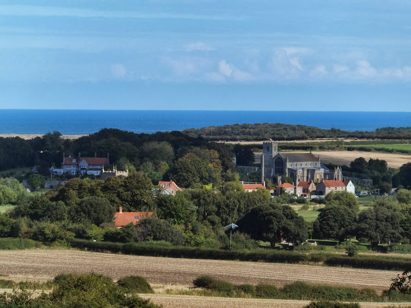
The former railway has to be left at North Walsham where the modern road uses its route through the town. This provides a half way point of this walk and enables the hiker to peruse North Walsham as well as provide plenty of places to rest and refresh oneself before continuing onto Aylsham. The Hop Inn is always a recommended place to visit for those who like their ale. This micro pub serves six ever changing ales along with simple snacks and is always a hub of activity with conversation being the main entertainment of its customers.

There is no direct public transport link between the two ends of this walk and one requires to either use Cromer or Norwich as a link. In this instance Sanders Buses offers the number 6 service from Cromer to Stalham and to return there is the 44 servcie from Aylsham to Cromer.

Friday 1 February 2019

Weavers Way - Potter Heigham to Great Yarmouth

A wherry heads down the river Thurne

A 20 mile walk through the Norfolk Broads following the rivers Thurne and Bure from Potter Heigham to Great Yarmouth

A walk that follows the rivers Thurne and Bure down to the town on Acle. There is then some challenging navigation across Halvergate marshes to end up walking along the banks of Breydon Water into great Yarmouth. This really is the epitome of what everyone imagines of the Norfolk Broads. Broad open skies and large open flat landscapes.

Tuesday 31 July 2018

A Walk to Baconsthorpe Castle Walk Summary

Salt marsh

An easy walk to view the ruins of Baconsthorpe Castle with return route to Sheringham

The remarkable ruins of the moated and fortified 15th century manor house known as Baconsthorpe Castle lie to the south of the village of Bodham on the main A148 road close to Holt. Footpaths and lanes provide access through to this isolated wonder that lie hidden in the Norfolk landscape. The Castle is currently under the tenure of English Heritage and entry is totally free. The landscaped area is surrounded by a picturesque moat and information boards document the history of the ruin. This really is something worth visiting so allow at least an hour to peruse this piece of Norfolk history.

In order to get to the start of the walk, there is a frequent seven day a week bus service linking Sheringham and Bodham. After navigation to the ruins, the return is via the village of West Beckham where there is the Wheatsheaf pub for lunches and refreshment. A footpath leads down to the main road from where permissive paths through Sheringham Park provide an interesting and pleasant route through to Upper Sheringham. This route follows the parks Temple Walk and then continues onto Park Road to emerge back on the road at Upper Sheringham. The park is open from dawn to dusk and outside of these hours one is required to walk down the B1157 which has no pavement making a hazardous route, particularly during holiday periods.

There are pavements between Upper Sheringham and the main town and the walk ends at the bus stop adjacent to the North Norfolk Railway station.

Saturday 28 July 2018

Cromer to Hopton 40 mile Challenge Walk

Salt marsh

Extensive full day hike around the eastern section of the Norfolk Coast Path

This walk should only be undertaken by experienced long distance walkers or those who have specifically trained for such a feat. This specific route was undertaken from 5am with a high tide around 6am. This allowed for a beach walk from Waxham through to Caister as an alternative to the official dunes paths. A support car was employed to provide the return journey and offer assistance in case of emergency.

Saturday 29 December 2018

Mundesley to Happisburgh Circular Walk

Coastline from Mundesley to Happisburgh

A 13 mile walk between the Norfolk coastal villages of Mundesley and Happisburgh

This walk comprises of a circular route taking in both the beach and the cliff-top paths between the two Norfolk coastal villages of Mundesley and Happisburgh. The centre of this walk is at Walcott where the cliffs recede and access to the beach is obtainable. This enables the walker to customise this route according to tidal conditions as both Happisburgh and Bacton beaches can be cut off by high tides.

Thursday 10 January 2019

Holkham to Wells Circular Walk

A 9 mile circular walk along the North Norfolk Coast between Holkham and Wells-next-the-sea

An alternative to the North Norfolk Coast Path, which follows the landward side of the large belt of pine trees known as Holkham Pines, is to walk along the glorious sandy Holkham beach. This was such a well worth experience with acres upon acres of sandy beach and dunes. With clear blue skies and a little sunshine this makes for a superb walk at any time of the year. The Albatros, a sailing ship that is permanently moored at Wells Quay provides some fine and simple lunches including fresh mussels which provide a fitting half way point to this walk. The return uses the tracks around the Holkham estate taking in views of the hall, the lake and obelisk.

Wednesday 18 December 2019

Norfolk Coast Path - Burnham Overy Staithe to Brancaster

Brancaster Staithe Quay

A 6 mile walk following the North Norfolk Coast Path between Burnham Overy Staithe to Brancaster

Wide open areas of marshland provide an enticing setting for this easy walk. Sailing boats, marsh, a tidal pool and the site of a Roman fort provide plenty of interest, together with three pubs, what more could one ask for of an afternoons stroll.

Weavers Way - Cromer to Aylsham

Felbrigg Hall

A 17 mile walk along Norfolk's Weavers Way from Cromer to Aylsham

Historic halls, stately homes and ancient commons and villages are what typifies this northern section of the Weavers Way. This really is a typical old English scene throughout making a most pleasurable all day walk. There are numerous pubs along the route which serve both ale and food.

Wednesday 27 November 2019

A Hike along the Marriotts Way

Sculpture that marks the start of the Marriotts Way at Norwich

The Marriott's Way links Aylsham and Norwich following the former trackbed of the Midland and Great Northern Railway.

The Marriott's Way is a footpath, bridleway and cycle route, which follows the routes of two disused railway lines, and runs between the historic market town of Aylsham and the medieval city of Norwich. Along with the mileage markers which are created from old rails complete with a metal rubbing plaque, there are numerous concrete sculptures, village markers, interactive sound boxes and benches which all provide added interest and information along the route.

Wednesday 18 December 2019

Inland Walk between Cley and Blakeney

View from Wiveton Downs

A 6 mile walk taking in the Wiveton Downs as an alternative to the coastal route between Cley and Blakeney

An alternative route to the Norfolk Coast Path between Cley and Blakeney taking in the high ground across Wiveton Downs. Spectacular views of the coastline can be had from this area and the route also includes the Shell Museum at Glandford and the dominating church at Cley

Walk Summaries

Latest walk summaries are basic information sheets for walks that have yet to be fully documented. These provide links to maps, public transport and walks stats, although detailed notes and features are not included.

Latest Walk Summaries

Featured Walk

In Search of Sizewell Chapel

A 10 mile walk following the southern side of the parish boundary of Leiston in Suffolk This walk follows the route of a 17th century peramb...

What is GPX

All you need to know about GPX, electronic mapping and how to use modern apps and mobile devices as navigation devices

Popular Walks

Maps