Route details, maps, pubs, features, local history and folklore for a wide variety of walks focusing primarily on Norfolk and Suffolk

Walks
Showing posts sorted by relevance for query Eye. Sort by date Show all posts

Thursday 19 December 2019

The Angles Way - Diss to Wortwell

Millpond near Weybread House, Harleston

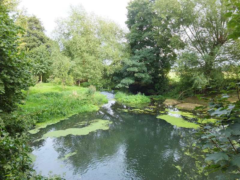
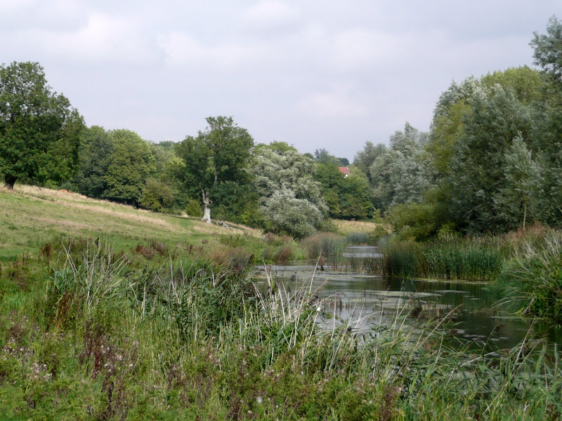
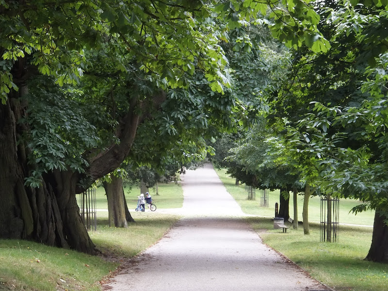
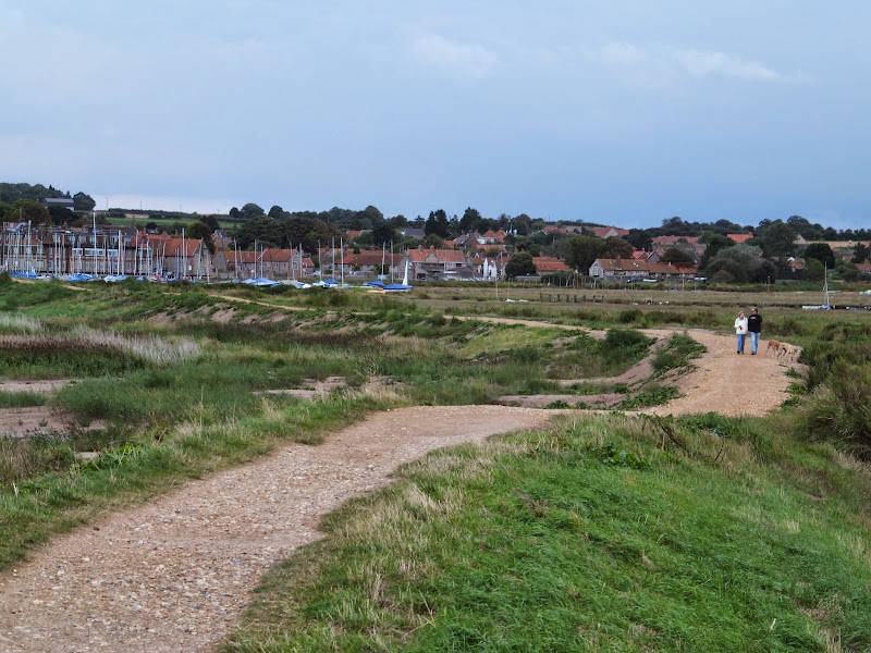
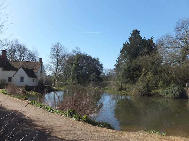
A 17 mile walk along the Angles Way from Diss to Harleston and onto Wortwell

There is plenty of history along this section of the Angles Way as it follows the course of the River Waveney. Numerous archaeological finds have been found along the route dating from prehistoric times through roman pottery and remnants of the middle ages. There are lost villages, halls and churches to provide ample opportunity for exploration as the path meanders across the Norfolk Suffolk border.

Tuesday 18 December 2018

Cleveland Way - Saltburn to Staithes

Cleveland Way marker at Skinningrove

A 9 mile walk following the Cleveland Way between Saltburn and Staithes

This walk passes over the highest point on the east coast of England, a 670 foot high cliff at Boulby. The entire route bears the marks of numerous quarrying operations from over the centuries. The village of Skinningrove is roughly half way, and it is this place that holds a legend of a merman being captured and held in one of its cottages.

Tuesday 24 December 2019

Ouse Valley Way - Oakley to Carlton

Ouse Valley Way

A 13 mile North Bedfordshire walk along the Ouse Valley Way between Oakley and Carlton taking in the charming villages of Pavenham, Sharnbrook, and Odell.

Although the Ouse Valley Way does not actually go into Oakley, there is a convenient bus stop here that links the two ends to this walk. The bus stop is a mile or so from the river, from where there is a footpath which joins the official route at Stevington and then winds its way through the rolling Bedfordshire countryside. There's plenty to see and explore along the route with medieval river bridges, the Holywell at Stevington, the ghostly tales of Odell and the picturesque villages of Pavenham, Radwell, Sharnbrook, and Harrold. Although many of the villages pubs have finally closed their doors for good in recent years, there are still convenient refreshment stops on route.

Wednesday 21 November 2018

The Fonnereau Way to Ipswich

Christchurch Park

A 12 mile walk between Woodbridge and Ipswich incorporating sections from the Fonnereau Way, the Sandlings and the Fynn Valley Way

This walk links the railway stations of Woodbridge, Westerfield and Ipswich with scenic views along the estuary at Woodbridge and the Fynn Valley before entering Ipswich from the west through the historic parkland known as Christchurch park which dates from the 12th century which includes many historic features and a mansion that is open to the public.

Thursday 27 December 2018

South West Coast Path - Plymouth to Yealm Estuary

Wembury

A walk along the South West Coast Path between Plymouth and the Yealm estuary with an extension along the Erme Plym Trail to get around the River Yealm estuary

Plymouth is not a place to find a country walk, in fact the South West coast Path leads you around some of the more industrial areas of the docks and along the busy road across Laira Bridge. From this point there is a more pleasant alternative route using the West Devon Path which traces the trackbed of a former railway to Hooe Lake. An easy walk around Clovelly Bay and Mount Batten Point finally brings the path onto the cliffs along the coast. The going through to Wembury is not too strenuous and it is worth taking time out at Heybrooke Bay to search out the Eddystone Inn from where you can see the lighthouse of the same name on the horizon. From Wembury the Erme Plym Trail leads back to the main road in order to get around the Avon Estuary.

Monday 13 September 2010

The Essex Coast - Manningtree to Great Oakley

The Stour Estuary from the Essex Way

This write up has now moved to https://griffmonster-walks.blogspot.com/2021/05/manningtree-to-greatoakley.html. The first stage of a weeks walking along the Essex Coast between Manningtree and Maldon. This first stage followed The Essex Way which pretty much follows the Stour estuary and would be the most convenient way to negotiate this section of coastal estuary. Although the footpath does not hug the coast throughout its route, it gives some good views of the estuary as well as pleasant woodland and field walking. It is well marked and well trod.

Wednesday 18 December 2019

Norfolk Coast Path between Blakeney and Cley - Latest Developments

Repaired defence bank close to Blakeney

The future of the 2.5 mile walk along the sea defences between Blakeney and Cley

The December 2013 Storm Surge caused major damage to the sea defences along the Norfolk Coast Path that encompasses the Blakeney Freshes. Work is currently being carried out to repair the breaches, however the long term future of both the Freshes and the coast path at this point is uncertain.

Flatford Mill Circular Walk

View of Constables Haywain

An 11 mile Walk along the River Stour incorporating sections of the Stour Valley Path, the Essex Way and St Edmund's Way

Flatford Mill is the idyllic English country scene encapsulated by John Constables renowned paintings including the instantly recognizable 'Haywain'. This circular route is an exceptional walk by all accounts and the perfect way to engross oneself in this landscape that sits on the Suffolk and Essex border.

Wednesday 15 December 2021

Hele Bay to Berrynarbor Circular Walk

View across the valleys to Berrynarbor

A 7 mile walk around coastal North Devon from Hele Bay to Berrynarbor

This walk takes inland footpaths and tracks to navigate from the village of Hele Bay through to Berrynarbor, which, with its whitewashed stone walls takes on the guise of a Mediterranean village. The village plays host to numerous flower pot men in comical poses which makes an intriguing spectacle as one wanders through the streets. Return is along the South West Coast Path

Saturday 29 December 2018

Paston Way - North Walsham to Mundesley

Edingthorpe church

An 11 mile walk along Norfolk's Paston Way between North Walsham and Mundesley

The Paston Way is a veritable Trail around some of East Norfolk's medieval churches. This section includes the delights of North Walsham, Edingthorpe, Knapton, Paston and Bacton. Although all are impressive, it it the small church at Edingthorpe which must not be missed, a treasure to behold.

Thursday 13 December 2018

Southwold Circular Walk

An 5.5 mile circular walk around Southwold

This walk navigates from Southwold Harbour around the northern part of the Blyth estuary known as Buss Creek, returning via the seafront to the harbour. One cannot miss out on a wander around the pier to take in the amazing sights of the quirky The Under the Pier show, the creation of Tim Hunkin and typical British eccentricity at its best.

Tuesday 8 January 2019

The Angles Way - Knettishall Heath to Diss

Royden Church viewed from across the Waveney Valley with its interesting octagonal upper tower that sits on a round base

A 15 mile walk from the Breckland end of the Angles Way to Diss

This is a picturesque ramble through the numerous fens that follow the course of the Little Ouse and The Waveney Rivers. Thelnetham Fen, Hinderclay Fen, and Redgrave and Lopham Fen are all managed wetlands with well kept paths and a variety of flora, fauna and wildlife. The path also passes through Wortham Ling, an area of managed common land that dates from medieval times. Even though the start of the walk at Knettishall Heath is difficult to get to using public transport, the walk is well worth the effort.

Tuesday 17 December 2019

South West Coast Path - Bucks Cross to Westward Ho!

Babbacombe

An 8 mile walk along the South West Coast Path between Bucks Cross to Westward Ho!

A moderate walk along the cliffs to Westward Ho!, the town renowned for being the only place in Britain to have an exclamation mark in its name. This walk presents a good introduction to the South West Coast Path being under 10 miles and with few difficult or strenuous ascents and descents. There are amazing panoramas of the coastline throughout with views to Hartland in the west and Westward Ho! and north Devon to the East and North.

Sunday 8 December 2013

2013 Storm Surge at Sizewell and Thorpeness

The strange egg-shaped object on the left is most likely a piece of fallen cliff

A walk at high tide of the 2013 Storm Surge between Sizewell and Thorpeness

This is a photographic excursion of the 2013 Storm Surge down the Suffolk Coast. With media firmly concentrated on events in South Africa the only real way to find out was happening was to visit this destructive storm surge oneself. Although this part of Suffolk was relatively unscathed it still presented awe-inspiring seas and crashing waves.

Saturday 12 January 2019

Down the Blyth Valley in Pursuit of Black Shuck

River Blyth near Halesworth

An 18 mile walk down the Blyth Valley in Suffolk from Halesworth to Blythburgh, then across the heaths and commons to Leiston.

It was the legendary hell hound that supposedly came this way in 1577 and terrified parishioners of Blythbrugh church after doing a similar job at Bungay. This walk is in two sections, the first section follows the River Blyth along the Waveney Way to Blythburgh with the option to continue on to Southwold. The Waveney Way is a Ramblers Association walk and does not have waymarkers along the route. An optional second section cuts across to Westleton and onto Leiston. Both Southwold and Leiston have public transport links to Halesworth making the walk achievable as a linear route without the requirement of assistance of a taxi.

Friday 6 December 2019

A Country Amble between Leiston and Saxmundham

Broad footpath marked out across the fields to Saxmundham

A 5 mile walk across the Coastal Suffolk landscape between Leiston and Saxmundham

This walk searches out footpaths to connect the neighbouring towns of Leiston and Suffolk. Although there is no direct route, the paths chosen are certainly more conducive to the walker than the busy road route. With the churches of Leiston and Knodishall on the route, plus the mysterious Harris's Pit in the parish of Sternfield there is enough to interest the avid rambler. Sternfield also has the notoriety of being the village from which the last woman to be burnt at the stake in England came.

Friday 28 December 2018

South West Coast Path - Pendeen to St Ives

Portheras Cove

An alternative route to the official Coast Path using the Zennor Churchway otherwise known as the Coffin Path for a less challenging 13 mile walk between Pendeen and St Ives

This alternative route leads away from the coast path at Porthmeor to take the Zennor Churchway which follows an ancient track across a flat ridge of land that joins the cliff top to the hills. From Zennor the route is known as the Coffin Path on account of it being the route used to take coffins to Zennor church during the middle ages. This route provides an alternative for when bad weather sets in on the coast path when it can become hazardous or simply as a less strenuous and less time consuming route.

Sunday 30 December 2018

Lancashire Coastal Way - Lytham St Annes to Fleetwood

Stormy scenes at Blackpool

A 15 mile way along the Lancashire Lancashire Coastal Way between Lytham St Annes and Fleetwood

The route goes through one of the principle holiday resort areas in England and the entire distance is walked along concrete promenades with access to the beach when the tide is out. There are numerous points of interest including the famous piers and tower at Blackpool and the constant trams that clank along the seafront.

Tuesday 4 May 2021

Stour and Orwell Walk - Ipswich to Shotley Gate

Industry and nature

A 14 mile walk along the banks of the River Orwell in Suffolk between Ipswich and Shotley Gate

The Stour and Orwell path is an extension to the southern end of the Suffolk Coast Path and follows the coast and heaths along the estuaries of the Orwell and the Stour rivers. This particular walk focuses on the section between Ipswich and Shotley Gate following the river Orwell along the Shotley peninsular.

Wednesday 22 July 2020

Polzeath to Pentire Point Circular Walk

Binyons plaque looking out to the Rumps

Short circular walk around the headland that fronts Pozeath

An awesome wander around Pentire Point from the village of Polzeath. This is a must for anyone who visits this classic piece of Cornish coastline. A few challenges but nothing that an average walker can muster

Walk Summaries

Latest walk summaries are basic information sheets for walks that have yet to be fully documented. These provide links to maps, public transport and walks stats, although detailed notes and features are not included.

Latest Walk Summaries

Featured Walk

In Search of Sizewell Chapel

A 10 mile walk following the southern side of the parish boundary of Leiston in Suffolk This walk follows the route of a 17th century peramb...

What is GPX

All you need to know about GPX, electronic mapping and how to use modern apps and mobile devices as navigation devices

Popular Walks

Maps