Route details, maps, pubs, features, local history and folklore for a wide variety of walks focusing primarily on Norfolk and Suffolk

Sunday 29 July 2018

Sweffling Circular Walk Summary

Salt marsh

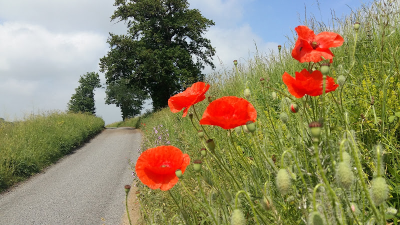
Short circular walk through the Suffolk countryside around the village of Sweffling

A walk around some outstanding Suffolk countryside following the Alde valley south of Sweffling, starting and ending at the Sweffling White Horse pub. There is history too! As well as the many windmills that once sat on the ridge above the valley, the area also boasts a connection with the legends of St Edmund. A tale related by a 14th century manuscript tells of how Edmund defeated his enemies at a place known as Dernford. Although there is no evidence of exactly where this was, some attest that the site was south of Sweffling where Dernford Hall is located.

If you view the Sweffling village sign, on the upright is a heart pierced by a sword, which I am told is the representation of Edmunds victory in the battle.

Saturday 28 July 2018

Cromer to Hopton 40 mile Challenge Walk

Salt marsh

Extensive full day hike around the eastern section of the Norfolk Coast Path

This walk should only be undertaken by experienced long distance walkers or those who have specifically trained for such a feat. This specific route was undertaken from 5am with a high tide around 6am. This allowed for a beach walk from Waxham through to Caister as an alternative to the official dunes paths. A support car was employed to provide the return journey and offer assistance in case of emergency.

Thursday 19 July 2018

Porlock Weir to Minehead Walk Summary

Salt marsh

A 9 mile walk along the SWCP between Porlock Weir and Minehead

Walking in an anti-clockwise direction, this walk marks the end to the South West Coast Path. There are no gold embossed certificates handed out, no congratulating parades to cheer the triumphant walker across the finishing line, or national media around to film the completion of this mammoth 630 mile trek. Just a sculpture of a pair of hands holding an OS map and a self-satisfying sense of achievement with a hint of sadness that the trail is over and another challenge must be sought... or maybe turn around and do it all again in the opposite direction!

Wednesday 18 July 2018

Porlock Weir to County Gate Walk Summary

Salt marsh

A simple 6 mile walk from Porlock Weir to County Gate Car Park

The walk navigates along the higher SWCP route through to Wheatham Combe from where the County Gate car park can be reached along bridleways. This route has the advantage of some fantastic views over the coast as opposed to the lower route through the wooded lower reaches of the cliffs. This walk does need the assistance of a friend or acquaintance to provide a return journey between the two ends of the walk, alternatively the walk can use the lower SWCP to make a circular route.

Tuesday 17 July 2018

County Gate to Lynmouth Circular Walk Summary

Salt marsh

Circular walk linking the County Gate car park and Lynmouth

There is no public transport between Porlock and Lynmouth, therefore a days linear walk is not possible if one requires to return to the start. This walk uses a mid-point of the County Gate car park, located on Exmoor, to provide a circular route using the SWCP and Coleridge Way. The SWCP section is not too strenuous and provides some amazing coastal views whilst the Coleridge Way makes a very pleasant ramble alongside the East Lyn River to return to the County Gate

Tuesday 10 July 2018

Combe Martin to Lynmouth Walk Summary

Salt marsh

Strenuous walk from Combe Martin to Lynmouth passing over the highest point on the SWCP

A strenuous walk between Combe Martin and Lynmouth passing over Great Hangman which at 319m is the highest point on the SWCP. This specific route provides an alternative to the official SWCP path out of the Heddon Valley which does reduce the distance slightly. This does give an advantage if one needs to return to the start using public transport as there is only a limited bus survice back to Combe Martin which involves having to travel via Barnstaple.

Friday 6 July 2018

Hele Bay to Combe Martin Walk Summary

Salt marsh

Short Walk along the SWCP between Hele Bay near Ilfracombe and Combe Martin

This walk offers a few challenges but nothing untoward and is probably one of the best routes to introduce anyone to the SWCP. The views are outstanding and the numerous coves and small beaches tempting to spend a little more time in exploring. A very popular area with frequent transport links and plenty of refreshment options along the route.

Thursday 5 July 2018

Hele Bay to Braunton Walk Summary

Salt marsh

Extensive Walk along the SWCP between Hele Bay near Ilfracombe and Braunton

This route provides an alternative to the official SWCP whereby it short cuts the headland at Baggy Point and goes directly into Braunton omitting the section around Braunton Burrows. This achieves a sub 20 mile walk with bus access between Braunton and Ilfracombe. The cliffpath from Hele Bay to Woolacombe provides spectacular views and challenging walking whilst the sands of Woolacombe and Croyde make an easier terrain to navigate across.

Wednesday 4 July 2018

Saturday 16 June 2018

South West Coast Path - Westward Ho! to Barnstaple

Salt marsh

One of the few low level and flat walks on the SWCP, 12.5 miles between Westward Ho! to Barnstaple

A very easy walk that can be split into two if required. The first part navigates around Northam Burrows, the duned area that juts out into the Taw and Torridge estuary. A ferry at Appledore links across to Instow where the trail continues making use of the former Bideford and Barnstaple railway trackbed.

Saturday 28 April 2018

Norwich Riverside Walk

View to Whitefriars bridge

A simple 2.5 mile walk alongside the River Wensum through Norwich.

This picturesque walk through the centre of Norwich links the Marriott's Way at Barn Road roundabout on the inner ring road with The Wherryman's Way and Boudicca Way at Norwich Railway Station. There is a lot of history to the bridges over the River Wensom and associated folklore which is detailed in the features to this walk.

Tuesday 20 March 2018

Eye to Hoxne Circular Walk

Hoxne village

A 10 mile walk around the Suffolk villages of Eye and Hoxne

Hoxne is said to be where St Edmund was Martyred by the Viking invaders in the 9th century. The village is full of reminders of the gruesome event including the cross which marks the place of the oak tree his assailants tied him to, beat him, fired arrows at and eventually beheaded and the bridge he reputedly hid trying to escape his captors.

Monday 26 February 2018

A Norfolk Ramble around the Burnhams

Holkham Hall lake

A 16 mile circular walk from Wells-next-the-sea taking in Burnham Thorpe, Burnham Market and Burnham Norton

This full days walk has everything to offer the adventurous rambler. There is a wander through the stately grounds of Holkham Hall in order to reach the humble church at Burnham Thorpe with its tributes to Norfolk's most famous son, Lord Nelson who was born and grew up in the area. Country lanes lead down to Burnham Market and the church of the old parish of Burnham Ulph. Heading down to the coast there is the church of Burnham Norton with its resplendent medieval paintings. The ramble returns along the vast expansive beaches in front of Holkham.

Sunday 4 February 2018

In Search of Sizewell and Thorpe Beacons

Sizewell

A 10 mile walk following the southern side of the parish boundary of Leiston in Suffolk

This is the second article devoted to the walk following the route of a 17th century perambulation around the southern side of the Leiston Parish boundary. This article is concentrates on two landmarks from the past, namely Sizewell and Thorpe Beacons, which are thought to have been part of the Armada warning system.

Sunday 10 December 2017

Southwold to Blythburgh along the former Southwold Railway

Blythburgh

A linear walk along the former trackbed of the Southwold Railway to Blythburgh

The Southwold Railway was a narrow gauge line that linked Halesworth and Southwold. This closed in 1929 but the track bed is still in existence to Blythburgh and makes an excellent walk. The White Hart pub offers a place for refreshment before returning along the same route. Outstanding views across the Blyth estuary and easy walking across heath and woodland make this a well worthwhile excursion.

Saturday 5 November 2016

Essex Walks Map

Essex Map image

As an aid to navigating and finding a map specific to your geographical requirements, we have generated a Google map of all Suffolk walks that are detailed on this site. The map below is zoomable and uses icons to locate each walk, specified on the geographical location of either the start/end of the walk or its main feature. Click on any icon to display a brief description which contains a link to the full walk details.

Monday 9 May 2016

Seaside Walk Week

Seaside Walk Week

It will soon be 2016 Seaside Walk Week. From Sunday 29 May to Sunday 5 June, this event, which is in its second year and organized by the charity Family Holiday Association, is dedicated to getting everyone outside to enjoy some fresh air and the beauty of the Great British seaside. The event will launch with an official walk in Scarborough, Britain’s first seaside resort, and end with another official walk as part of a grand finale weekend in Weston-super-Mare. Full details are available from their website page for Seaside Walk Week.

Friday 1 January 2016

Norfolk Walks Map

Norfolk Map image

As an aid to navigating and finding a map specific to your geographical requirements, we have generated a Google map of all Norfolk walks that are detailed on this site. The map below is zoomable and uses icons to locate each walk, specified on the geographical location of either the start/end of the walk or its main feature. Click on any icon to display a brief description which contains a link to the full walk details.

Wednesday 30 December 2015

Suffolk Walks Map

Suffolk Map image

As an aid to navigating and finding a map specific to your geographical requirements, we have generated a Google map of all Suffolk walks that are detailed on this site. The map below is zoomable and uses icons to locate each walk, specified on the geographical location of either the start/end of the walk or its main feature. Click on any icon to display a brief description which contains a link to the full walk details.

Saturday 24 October 2015

Walk Summaries

Latest walk summaries are basic information sheets for walks that have yet to be fully documented. These provide links to maps, public transport and walks stats, although detailed notes and features are not included.

Latest Walk Summaries

Featured Walk

In Search of Sizewell Chapel

A 10 mile walk following the southern side of the parish boundary of Leiston in Suffolk This walk follows the route of a 17th century peramb...

What is GPX

All you need to know about GPX, electronic mapping and how to use modern apps and mobile devices as navigation devices

Popular Walks

Maps