Suffolk Coast Path - Lowestoft to Southwold Beach Route
|
Wednesday 23 February 2022
|
No comments |
![]()
Lowestoft to Southwold Beach Route
An exhilarating 12 mile coastal walk along the Suffolk Coast.
NOTE
This is a walk summary intended to provide the user with just the essential information in order to navigate the walk route. Fully detailed information notes, refreshment stops and walk features are not included in this. A full write up will be included in the near future.
Lowestoft to Southwold Beach Route - Essential Information
Walk Statistics (calculated from GPX):
- Start location: Lowestoft
- End location: Southwold
- Distance: miles ( km)
- Total Gain: ft ( metre)
- Total Descent: ft ( metre)
- Min Height: ft ( metre)
- Max Height: ft ( metre)
- Walk Time:
- Walk Grade: Easy
- Terrain: Beach
Maps:
The following maps and services can assist in navigating this route. There are links to printed maps and links to downloadable GPX route data for importing into navigational software and apps.
- Ordnance Survey Explorer Map
- OS Explorer 231 - Southwold & Bungay
- GPX Route File
Route Verification Details
- Date of Walk: 10/08/2019
- Walk Time: 11:00:00 to 15:00:00
- Walkers: Griff, Kat
- Weather Conditions: Blustery day but very warm
Walk Notes
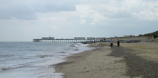
Route: From Lowestoft walk along the promenade southwards following the Suffolk Coast Path waymarkers. At Pakefield you need to go down onto the beach. Keep walking along the beach - providing to Southwold. Due to constant coastal profile changes it should be mentioned that inland access can be found at Kessingland, Covehithe and Southwold itself. I have been informed by another walker that there is access between Easton Broad and Southwold. This has never been validated by Griffmonster Walks.
Pub: The Sailors Home, Kessingland: Seafront pub with a resident parrot. A couple of guest ales on and some very satisfying home made soup.
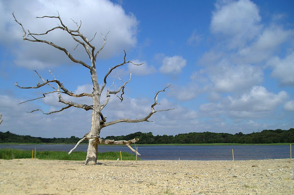
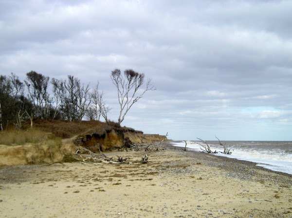
Walk Feature: Coastal Erosion: The main feature of this walk is the coastal erosion and the curious sight of trees succumbing to the sea at Benacre Broad. It probably wont be long before the broad is engulfed also. At Easton Bavents there is more erosion. The home of retired engineer Peter Boggis once sat atop the cliffs and over the years he fought to defend his property from the sea. In December 2008 a judge ruled that a decision by Natural England to allow the cliffs near his home to continue to erode for scientific reasons was unlawful. But this ruling was overturned in the High Court in October 2009. In 2020 the house was demolished and views of the house can be seen on the BBC Website.
Notes: We have walked this route many times and each instance is always a voyage of discovery due to the ever changing beach profiles and eroding cliffs. This section of coastline is often quoted as being the fastest eroding in the whole of Europe and therefore one should approach the walk with special caution. Always time the walk such that low tide occurs mid-walk. Do not attempt this during storms when surges can cut off access. Be aware that access can be blocked at Benacre Broad, Covehithe Broad and Easton Broad when tidal run off can breach the beach. Inland access can be found at Kessingland and Covehithe
Summertime is the preferable time to undertake the walk due to more clement weather and less likelihood of storms affecting the beach profiles. It is possible to clamber to the top of cliffs in places but there is no public access and it should be stressed these cliffs are unstable with frequent falls. If the beach profile has changed such that the sea reaches the cliffs return the way you came, do not attempt to paddle onwards. The last time Griffmonster Walks accessed this route there was a pinch point just beyond Pakefield where there was little left of the beach but enough to provide onward access at low tide.
This coast is not always eroding, in parts it increases where a Ness is migrating northwards. A classic example can be seen at Kessingland. During my childhood in the 1970s, this was the place for family holidays where a short shingle beach led down to the sea and groynes stuck out from the prom to assist in retaining the eroding beach. These days there is a half mile trek across a vast shingle landscape to reach the sea, and all the groynes are buried in that shingle. This shingle is Benacre Ness that has moved northwards over the decades. Back in the 70's it was in front of Benacre Broad which is now no more than the beach away from the sea.
Tide times for Southwold can be found on the Tideschart Website, as can the Lowestoft tide times. Check these before attempting this walk.
Transport: A regular bus service connects Southwold and Lowestoft.
Summary of Document Changes
Last Updated: 2022-02-23
Images


Beach Walk, Coast Walk, Distance:long, Features:Coastal Erosion, OSmap:231, Suffolk, Suffolk Coast Path, summary


0 comments:
Post a Comment