The Essex Coast - Tollesbury to Maldon
|
Tuesday 22 February 2022
|
No comments |
![]()

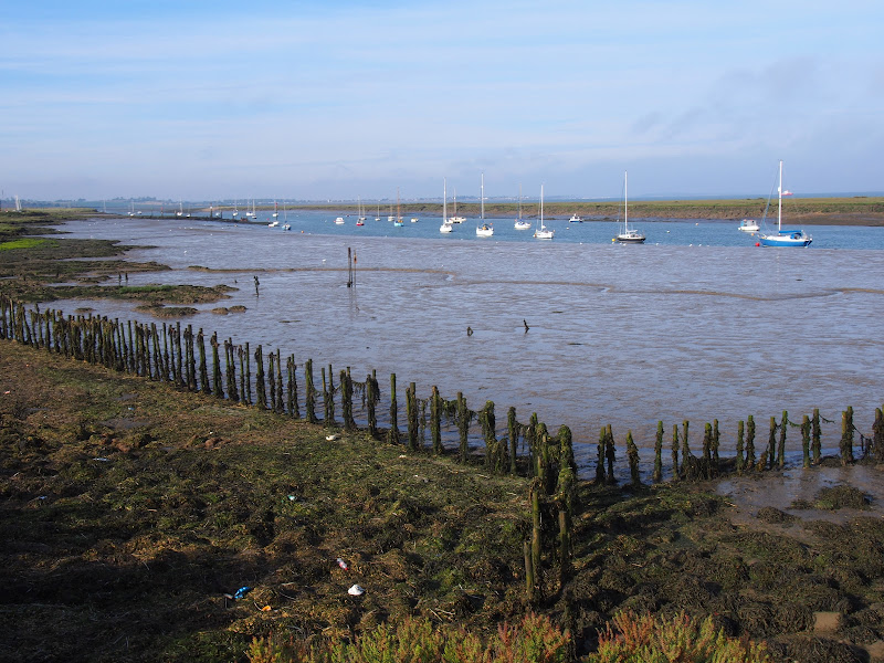
Tollesbury to Maldon
The seventh and last stage of a weeks walking along the Essex Coast between Manningtree and Maldon.
|
Tuesday 22 February 2022
|
No comments |
![]()
The seventh and last stage of a weeks walking along the Essex Coast between Manningtree and Maldon.
|
|
No comments |
![]()

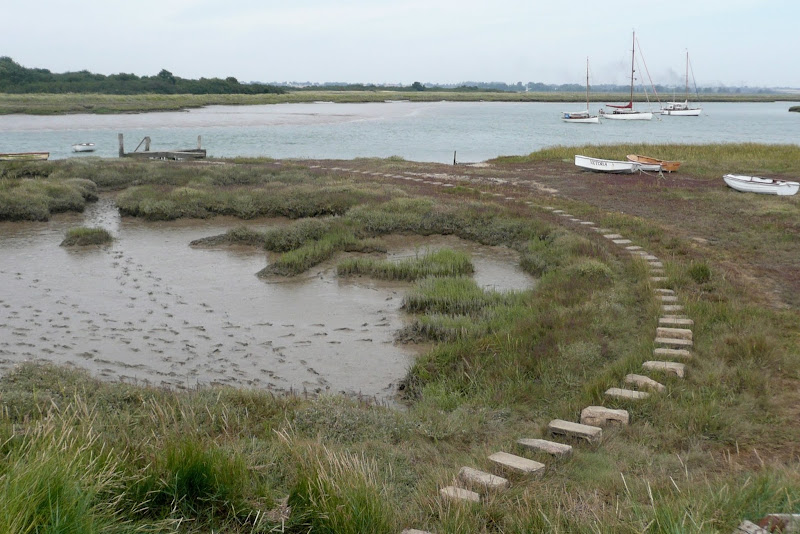
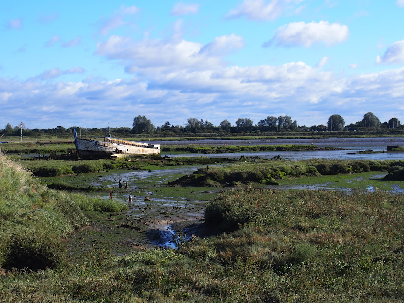
A walk around the Tollesbury Marshes
|
|
No comments |
![]()

The sixth stage of a weeks walking along the Essex Coast between Manningtree and Maldon.
|
|
No comments |
![]()

The fifth stage of a weeks walking along the Essex Coast between Manningtree and Maldon.
|
Monday 21 February 2022
|
1 comment |
![]()
The fourth stage of a weeks walking along the Essex Coast between Manningtree and Maldon.
|
|
2 comments |
![]()

The third stage of a weeks walking along the Essex Coast between Manningtree and Maldon
|
Wednesday 12 January 2022
|
No comments |
![]()
A 10 mile along the Essex Coast from Great Oakley to Walton-on-the-Naze
The walk follows the edge of the marshes in front of Skipper Island and Horsey Island and the Naze with little views of the open sea. The route is predominantly defence banks that border the creeks and springs that meander through the marshland. There is plenty to see from the wild life to the decaying hulls of wrecked boats that sit disregarded on the mud banks.
|
Friday 14 May 2021
|
No comments |
![]()
A day walk along the Essex Way
A fine piece of walking along the Essex Way to provide some glorious views of the Stour estuary before turning inland to avoid Harwich and Dovercourt. Estuary views, marsh, woodland and open fields make for a varied scene throughout the walk.
|
Saturday 8 May 2021
|
No comments |
![]()
The England Coast Path section along the Essex coast between Mistley to Harwich
The proposed route of the England Coast Path between Mistley and Harwich. This takes in parts of the Essex Way. It should be noted that this route is still in the process of determination by Natural England
|
Wednesday 18 December 2019
|
No comments |
![]()
An 11 mile Walk along the River Stour incorporating sections of the Stour Valley Path, the Essex Way and St Edmund's Way
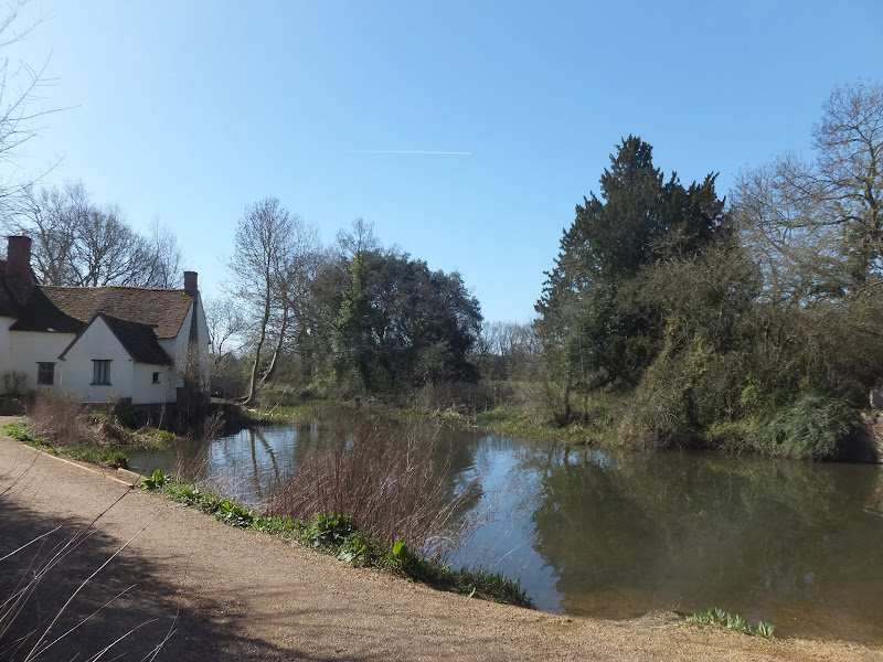
Flatford Mill is the idyllic English country scene encapsulated by John Constables renowned paintings including the instantly recognizable 'Haywain'. This circular route is an exceptional walk by all accounts and the perfect way to engross oneself in this landscape that sits on the Suffolk and Essex border.
|
Sunday 20 January 2019
|
No comments |
![]()
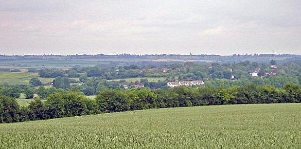
A 16 mile walk along the Icknield Way between Fowlmere and Hinton
The path keeps to the ridge along the hills, though the land now flattens out as it heads eastwards. There are picturesque villages and hamlets as the route winds its way through some traditional old English countryside.
|
Sunday 13 January 2019
|
No comments |
![]()

A 3 mile circular walk around the small Essex town of Great Dunmow
With plenty of historic buildings, a fine 13th century church, some great pubs and a fantastic Indian Restaurant this provides any visitor a taste of this ancient town. The walk is simple and easy and one cannot visit Dunmow without discovering the interesting history of the Dunmow Fitch which is the main feature to this walk.
|
Tuesday 28 August 2018
|
No comments |
![]()
A walk around creeks and countryside of coastal south Essex
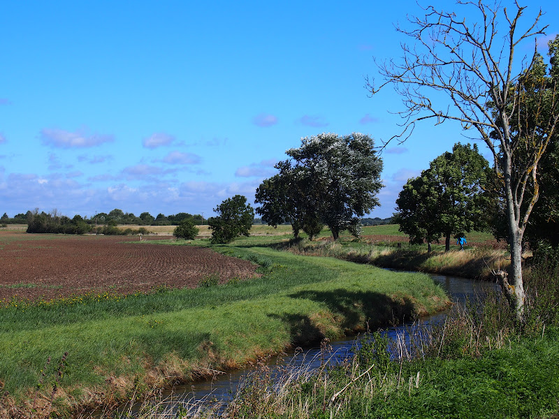
The start of the walk is a call to the ferryman. He is based on the far side of the River Crouch and a telephone call has him sailing across in no time. The ferry drops its passenger on Wallasea Island which sets the scene for the day. It is an island but only separated from the mainland by a creek. This low level land is full of creeks, dykes, ditches and it is difficult to determine what is an island and what is part of the mainland.
For this walk we navigate across to the village of Paglesham and then down to the banks of the River Roach which we follow up to the town of Rochford. One could simply catch the train at Rochford and return to Burnham. It wouldn't be a bad idea if you are following this route as the remaining leg to Southend is predominantly urbanised and not a pleasure to walk. The alternative to taking the road is to follow the creeks through to Shoeburyness but that is a whole days walking in itself.
There are limited places for refreshment along this route. There is the Punch Bowl pub at Paglesham but this has limited opening hours. In this instance we returned to Burnham-on-Crouch where the Queens Head is a little back street pub that specialises in micro brewery ales which are rare to find in this part of Essex, in fact any ale of any description is hard to find in this part of Essex.
|
Sunday 26 August 2018
|
No comments |
![]()
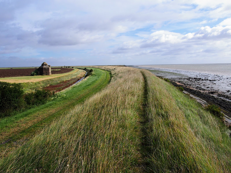
A 15 mile walk along the remote Essex coast from Burnham-on-Crouch to Bradwell
Many publications have stated that the section of the Dengie peninsular that borders the sea, east of the town of Burnham-on-Crouch, is the most remote place in the entirety of England. It is true that this isolated area of Essex is far from any major centres of population but walking this coast path one is never completely devoid of the signs of civilisation. Although one may never meet another soul on this lonely path, there are farms and machinery working the fields, haystacks and narrow lanes heading inland. All evidence that civilisation is not far away and, indeed, the nearest town is never more than 5 miles away as the crow flies.
The route is predominantly defence banks with a panorama of flat marsh to one side and acres of flat farmland on the other leaving with just the defence bank the tallest structure around. This leaves one distinctly exposed to the elements and faced with wind and rain it can require additional effort to push onwards. There are wide areas of cut grass on the landward side of the banks which can be utilized as a sheltered walking refuge when the going becomes a struggle or when the top of the bank is overgrown as found it some sections in this instance.
It has to be said that the constant unchanging scenery of this flat landscape can become somewhat monotonous as the miles slowly slip away. The smallest of landmarks then become a haven for curiosity. A sluice gate. A WWII pill box. Discarded tyres and debris in the marsh mud. The skeletal remains of a ship rotting on the marsh. A metal 5 bar gate with numerous plastic pieces of jetsom and flotsam seemingly purposely tied to it cluttering the mind with wonder as to its intentions.
The final part of the walk leaves the coast to navigate up the lanes to the village of Bradwell. There is a bus service from here although buses are few and far between. The D4 service returns to Burnham-on-Crouch. The alternative, as in this instance where accommodation was at St Lawrence is the D1 Service which links Bradwell, St Lawrence and the village of Latchingdon where the regular 31 service proceeds to Burnham-on-Crouch.
|
Thursday 23 August 2018
|
No comments |
![]()
A 16 mile walk along the Blackwater estuary from St Lawrence to Tillingham
The area that is bordered by the Blackwater Estuary to the north and the River Crouch to the south is known as the Dengie peninsular, a somewhat isolated area of marsh and low lying farmland. The remoteness of this area is its beauty and given the clear blue skies and a little warmth in the air this can be a true delight to walk.
The route detailed here heads along the Blackwater estuary, passing Bradwell nuclear power station as the coast slowly curves around from the estuary to face the open sea. In the distance, Mersea island is easily seen and sitting on the mudflats as river meets sea, visible at low tide, are a line of concrete filled barges that were sunk to provide a sea defence for the marshes. Further along is the remote St Peters Chapel, the oldest church in England and said to have been constructed in AD654. It is a working place of worship and well worth the visit into its humble and peaceful confines.
It is at this point that the long distance trail known as St Peters Way reaches its destination. This 45 mile trail starts at Chipping Ongar and passes through the Essex country side and villages in its journey to the coast. This well waymarked trail serves as the return for this route to St Lawrence. The trail leads across the low lying fields and marsh into the village of Tillingham arriving through the church yard. There is a pub on the green where one can rest ones weary legs before the final stage back to St Lawrence.
The St Peters Way slowly climbs to some 30m after leaving Tillingham, and this provides glorious views of the coastline. The route departs the trail at St Lawrence to follow a country lane out onto the main road. This is busy and caution should be observed when walking along this short section to the road down to St Lawrence Bay. There is a footpath marked on the OS that would negate this section. However this was certainly inaccessible when walking the route in September 2017. .
|
Wednesday 22 August 2018
|
No comments |
![]()
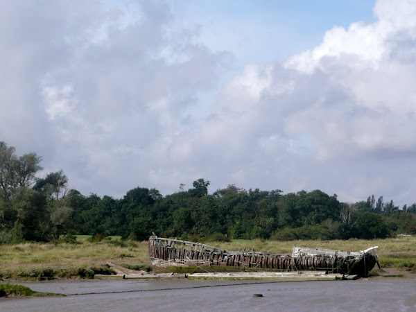
A walk along the southern side of the Blackwater estuary from Maldon to St Lawrence
This 16 miles walk provides great views of the Blackwater estuary with vast open panoramas of the tidal river. Mudflats and gulleys provide havens for wildlife and there are numerous old dilapidate river craft that sit decaying into the mud, forgotten and forlorn.
The path navigates around the numerous creaks and inlets that abound this southern side of the estuary. The path uses the compacted river defence banks which makes it hard on ones feet and offers no shelter from the elements. Given a brisk breeze and light showers, it can take its toll on ones enthusiasm as the path winds in and out of the creaks through to Maylandsea, at times seemingly navigating in the wroing direction.
This specific route does offer a shortcut out of Maylandsea by following the St Peters Way path. This links Lawling Creek and Mayland Creek and provides a short but welcome change of scenery.
The route ends at the Waterside Park in St Lawrence. This provided touring accommodation for those wanting to explore this coastline. Having said this, the park was taken over in December 2017 and it is uncertain whether touring sites are still available. Recent Trip Advisor reports are not encouraging.
Note that public transport in this area is very limited and most major roads can be choked with traffic especially at rush hour. There is a limited bus service between St Lawrence and Maldon.
Few of the pubs and bars offer any real ale and it was a unexpected discovery to find that the modern Blackwater Bar provided a very good example of St Austells Proper Job ale. Admittedly this is far from its Cornish homeland but in the ale desert of this part of Essex it was a just reward for days walking.
|
Tuesday 21 September 2010
|
No comments |
![]()

A 10 mile walk following the southern side of the parish boundary of Leiston in Suffolk This walk follows the route of a 17th century peramb...


