Norfolk Coast Path - Heacham to Brancaster
|
Thursday 24 February 2022
|
No comments |
![]()

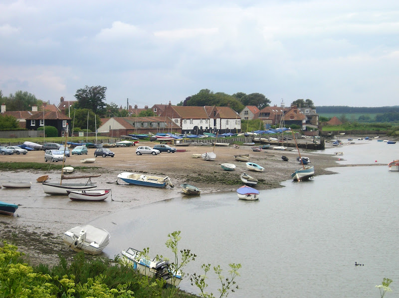
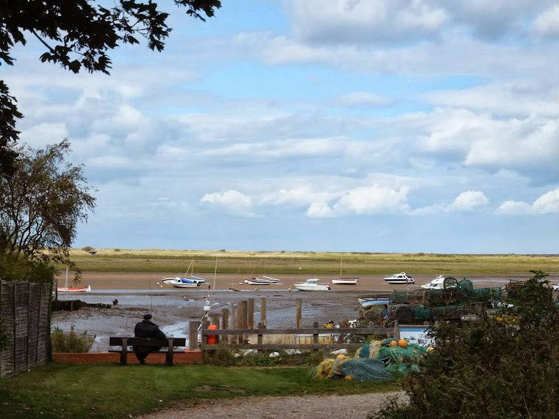
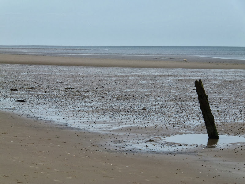
Heacham to Brancaster
A walk of beach, prom, dunes and marsh. A thoroughly varied landscape all told
|
Thursday 24 February 2022
|
No comments |
![]()
A walk of beach, prom, dunes and marsh. A thoroughly varied landscape all told
|
Sunday 6 February 2022
|
No comments |
![]()

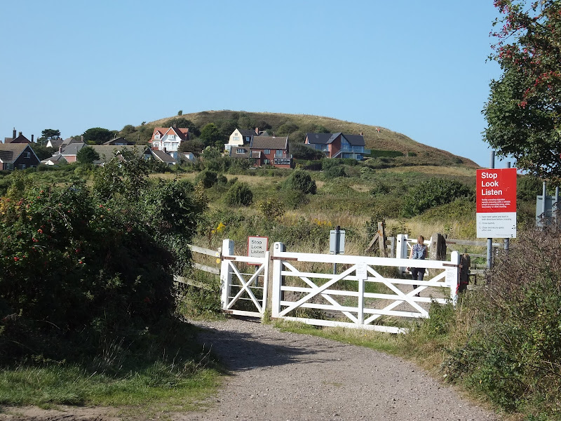
A great full days walk that takes in the ruins of Binham Priory
|
|
No comments |
![]()

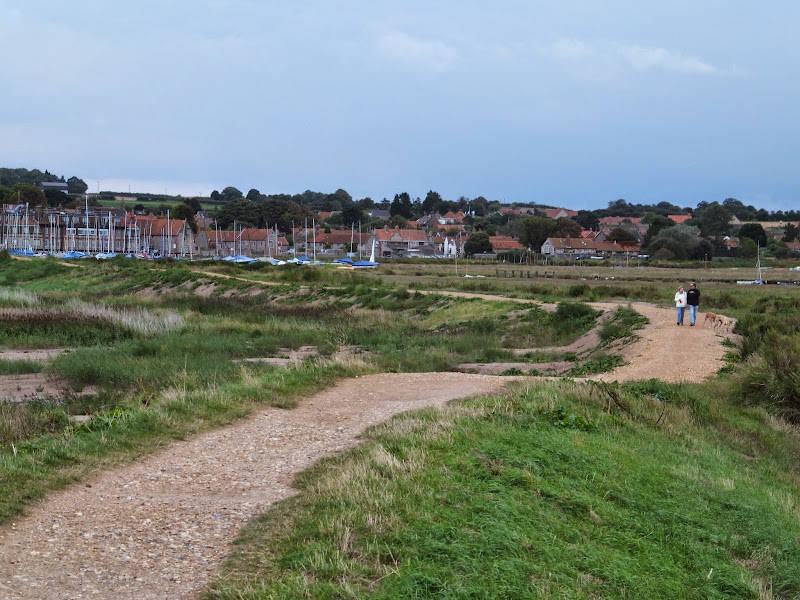
A challenge walk along the Norfolk Coast between Hunstanton and Wells
|
Tuesday 24 December 2019
|
No comments |
![]()
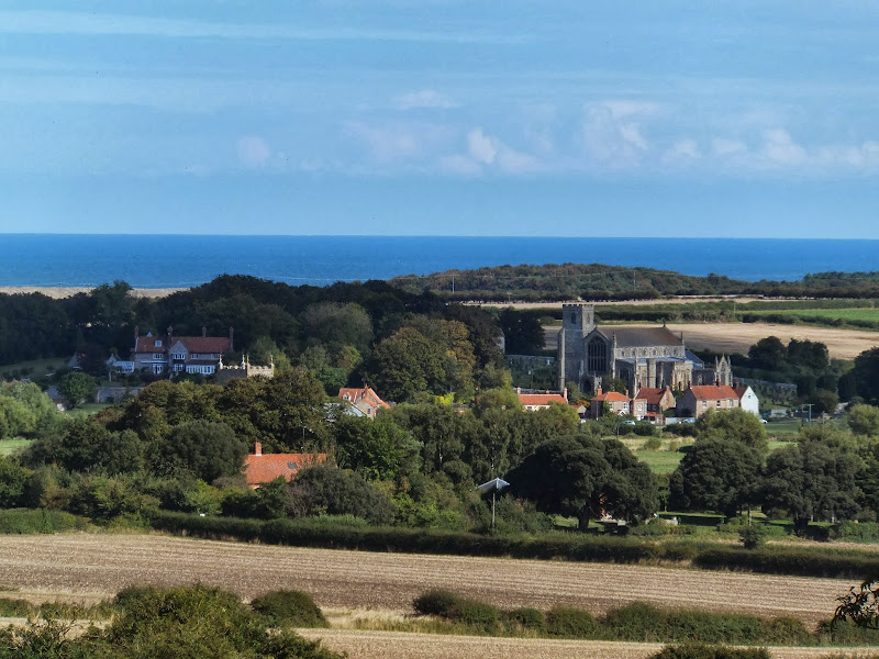
A 7 mile walk following the North Norfolk Coast Path between Wells-next-the-Sea and Burnham Overy Staithe
This amble includes some magnificent beach walking along the sands in front of the Holkham National Nature Reserve. Acres upon acres of golden sand when the tide is out with big skies and thousands upon thousands of razor shells which are washed up on the high tide mark. The walk ends at Burnham Overy Staithe, the quiet hamlet which is said to be where Nelson learnt to row and sail.
|
Thursday 19 December 2019
|
2 comments |
![]()
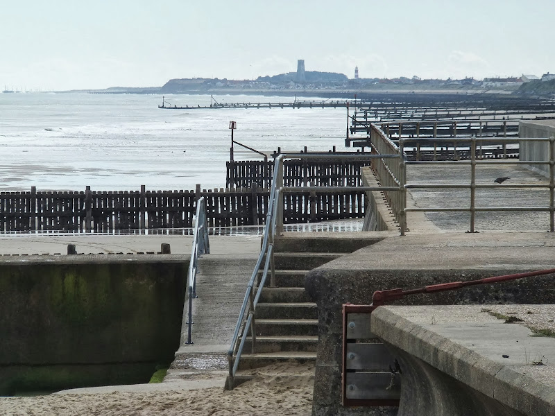
A 6 mile walk along the original route of the Norfolk Coast Path between Cromer and Sheringham
Up until December 2014 the official route of the Norfolk Coast Path from its start at Cromer Pier through to Sheringham navigated inland along the hills of the Cromer Ridge, the highest ground in Norfolk. This original route can still be walked and contrasts with the cliff-top route of the realigned path which is now part of the England Coast Path. With shady lanes and tracks through the woodland, spectacular views from the summit of Beacon Hill and the challenging ascent to the iconic Beeston Bump, this walk is a worthwhile excursion from the coastal route.
|
|
No comments |
![]()

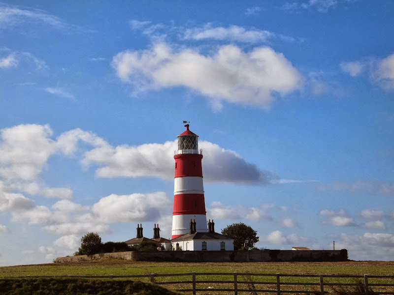
A beach walk along the Norfolk Coast between Mundesley and Cromer including a clifftop stroll from Cromer to Overstrand.
This section of the Norfolk Coast can only be walked when the tide allows as high tide reaches the foot of the cliffs and is impassable at Overstrand. There is frequent erosion all along the route so the scenery changes from year to year. The beach is predominantly sand with numerous groynes that present frequent obstacles to get past - sometimes decaying steps assist getting over the groynes and sometimes, at low tide or with boots and socks off, it is possible to get around the end of some of the groynes. Mostly, it involves clambering as best as you can over these eroded, seaweed covered, mussel encrusted defences but that is half the fun of it! Although there is a cliff top path from Cromer to Overstrand, which has some outstanding views, beyond this there is no official right of way and a full circular walk would involve heading inland, using the Paston Way. However, a frequent bus service links Overstrand and Mundesley to make a good and easy days coast walking.
|
|
No comments |
![]()

A 6 mile beach walk to witness the damage caused by the 2013 Storm Surge at Cromer and Sheringham
Both Cromer and Sheringham bore the brunt of the storm surge on the night of December 5th 2013. Although repair work is well under way there are still the signs of what damage the sea can cause. There have also been many cliff falls along this length of coastline with the cliff faces providing a fascinating view sculptured by the weather and tides and offering multi coloured strata.
|
Wednesday 18 December 2019
|
2 comments |
![]()

A 4 mile beach walk to witness the damage caused by the 2013 Storm Surge along the shingle bank between Cley and Salthouse
The December 2013 Storm Surge caused widespread flooding of the marshes and sea defences along the North Norfolk Coast, resulting in the closure of the Coast path between Blakeney and Cley. It is still possible to walk out to the beach from Cley village via the road where a walk along the shingle will astound those who have walked this section prior to the December storm. The shingle ridge has been levelled, with the excess cast across the marshes.
|
|
2 comments |
![]()
The future of the 2.5 mile walk along the sea defences between Blakeney and Cley
The December 2013 Storm Surge caused major damage to the sea defences along the Norfolk Coast Path that encompasses the Blakeney Freshes. Work is currently being carried out to repair the breaches, however the long term future of both the Freshes and the coast path at this point is uncertain.
|
|
No comments |
![]()
A 6 mile walk taking in the Wiveton Downs as an alternative to the coastal route between Cley and Blakeney
An alternative route to the Norfolk Coast Path between Cley and Blakeney taking in the high ground across Wiveton Downs. Spectacular views of the coastline can be had from this area and the route also includes the Shell Museum at Glandford and the dominating church at Cley
|
|
No comments |
![]()
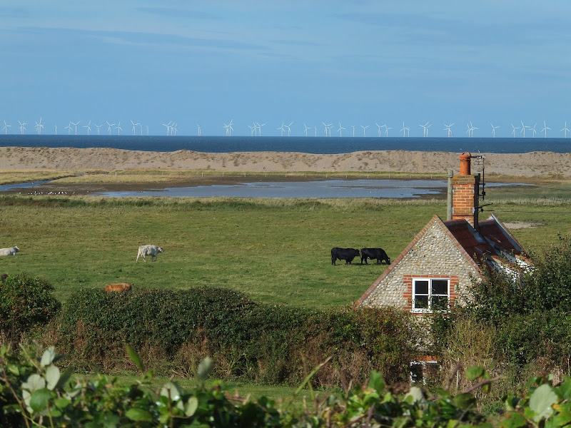
A 6 mile walk following the North Norfolk Coast Path between Burnham Overy Staithe to Brancaster
Wide open areas of marshland provide an enticing setting for this easy walk. Sailing boats, marsh, a tidal pool and the site of a Roman fort provide plenty of interest, together with three pubs, what more could one ask for of an afternoons stroll.
|
Tuesday 17 December 2019
|
No comments |
![]()
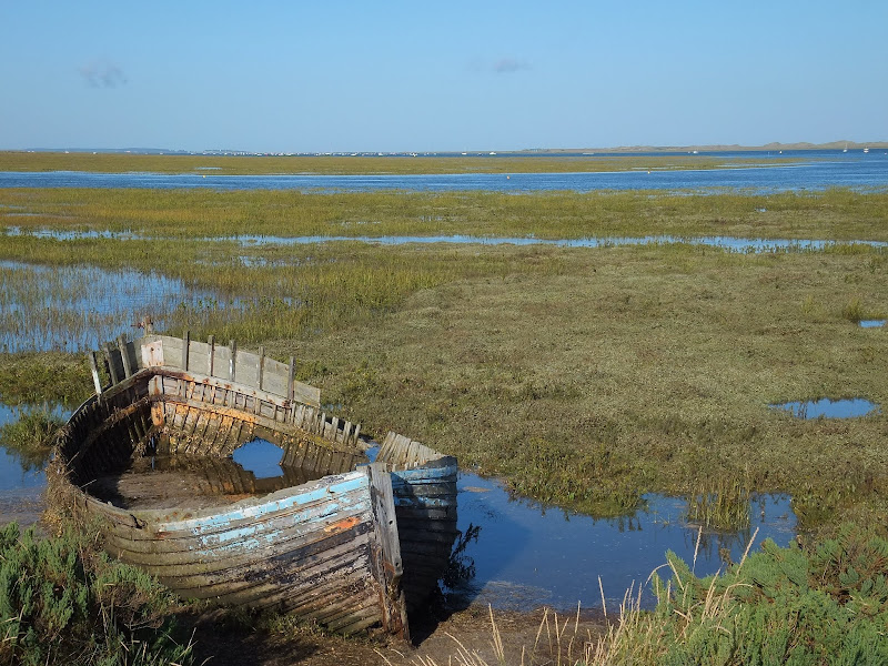
A 3 mile walk out to Brancaster Beach returning across the marsh to Titchwell
Although not included in the official Norfolk Coast Path route, this simple walk is a well worth excursion to witness the expanse of sand and dune as well as a petrified forest and an old wreck. Always be mindful of tide conditions and particularly do not attempt to get across to the wreck which lies across the Harbour channel.
|
Saturday 26 January 2019
|
No comments |
![]()
A 10 mile walk following the Norfolk Coast Path between Cley and Wells-next-the-Sea
An easy walk along the Norfolk Coast Path navigating out across the marshes to Blakeney then along the marsh perimeter to Wells. Blakeney is a worthy stopping point to explore Mariners Hill and the Guildhall and take in the legends of the Blakeney tunnels and the tragic story of the Blakeney Fiddler who is depicted on the village sign.
|
Thursday 24 January 2019
|
1 comment |
![]()
A 4 mile walk between East Runton and Cromer searching out old folklore
Using country lanes and tracks, this circular trail navigates around a East Runton to visit the various locations in Runtons history and folklore. Woodhill House is the location of an unidentified skeleton found during road widening. Thains Lane has the village's old smithy. The old Windmill sets the scene for the emanation of ghostly lights that crossed over to a copse. With a pub stop at Cromer and return via the redefined course of the Norfolk Coast Path, this makes for an excellent short walk on a spooky Autumn evening.
|
Friday 11 January 2019
|
No comments |
![]()

A 15 mile circular walk along the Norfolk Coast between Happisburgh and Horsey Gap to witness the Seals
This section of Norfolk's east coast is dependant upon time and tide so one needs to plan it well. At low tide there are vast sandy stretches all the way through to Horsey with such delights as witnessing seals sunning themselves on the beach, a sight one cannot fail to be impressed with. Whole colonies lay on the beach and each and every one of them appears to have a photogenic aptitude. With the advent of the England Coast Path, there is a route all the way back through the dunes or on the landward side of them.
|
|
2 comments |
![]()
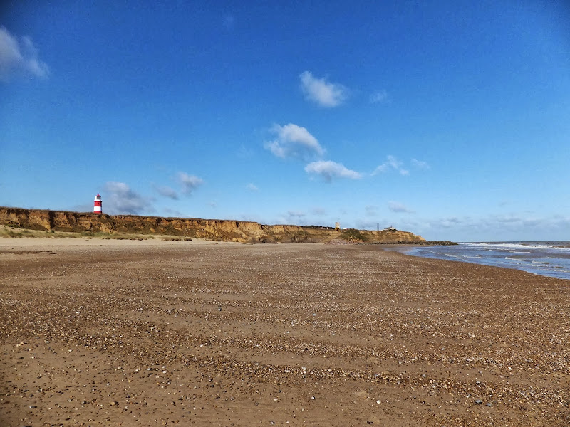
A simple 3 mile circular walk along the Norfolk Coast between Happisburgh and Eccles
Happisburgh is curious - it is slowly being taken by the sea, its houses slowly falling victim to the tides. The pub gardens boast a signal box to a railway line that never got built. A lighthouse stands guard to the south and its lifeboat is located at the next village of Eccles. In recent times the tide has uncovered prehistoric human footprints. And there is local folklore of ghostly smugglers and misdeeds. Very curious indeed.
|
Thursday 10 January 2019
|
No comments |
![]()
An 11 mile beach walk between along the Norfolk coast from Happisburgh to Winterton
Providing the tide is right, this is a fantastic beach walk with miles of golden sand and, if you are lucky, the sight of seals basking in the sunshine. Probably one of the best beach walks on this coastline.
|
|
No comments |
![]()

A 9 mile circular walk along the North Norfolk Coast between Holkham and Wells-next-the-sea
An alternative to the North Norfolk Coast Path, which follows the landward side of the large belt of pine trees known as Holkham Pines, is to walk along the glorious sandy Holkham beach. This was such a well worth experience with acres upon acres of sandy beach and dunes. With clear blue skies and a little sunshine this makes for a superb walk at any time of the year. The Albatros, a sailing ship that is permanently moored at Wells Quay provides some fine and simple lunches including fresh mussels which provide a fitting half way point to this walk. The return uses the tracks around the Holkham estate taking in views of the hall, the lake and obelisk.
|
Saturday 29 December 2018
|
No comments |
![]()
A 13 mile walk between the Norfolk coastal villages of Mundesley and Happisburgh
This walk comprises of a circular route taking in both the beach and the cliff-top paths between the two Norfolk coastal villages of Mundesley and Happisburgh. The centre of this walk is at Walcott where the cliffs recede and access to the beach is obtainable. This enables the walker to customise this route according to tidal conditions as both Happisburgh and Bacton beaches can be cut off by high tides.
|
Sunday 16 December 2018
|
1 comment |
![]()
A 10 mile alternative route for the North Norfolk Coast Path between Sheringham and Cley
This walk takes diversions from the official route of the North Norfolk Coast Path via the North Norfolk Railway and the Weybourne Priory Ruins. A further alternative is then used to navigate away from the strenuous shingle walk along the coast to a more gentle amble up to the village of Salthouse and across the hills to Cley. This provides a scenic and interesting alternative to the official route of the North Norfolk Coast Path and gives some spectacular views across the marshes from the hillside between Salthouse and Cley.
A 10 mile walk following the southern side of the parish boundary of Leiston in Suffolk This walk follows the route of a 17th century peramb...


