Halesworth to Bungay
|
Wednesday 8 June 2022
|
No comments |
![]()

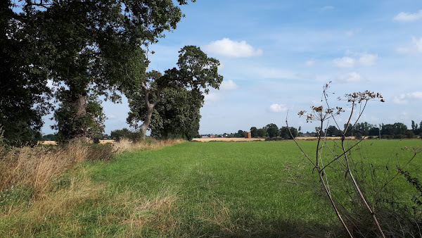
Halesworth to Bungay
A walk through the Suffolk countryside between Halesworth and Bungay
Latest walk summaries are basic information sheets for walks that have yet to be fully documented. These provide links to maps, public transport and walks stats, although detailed notes and features are not included.
|
Wednesday 8 June 2022
|
No comments |
![]()
A walk through the Suffolk countryside between Halesworth and Bungay
|
Wednesday 27 April 2022
|
No comments |
![]()

A circular walk taking in the Weavers Way, Honing and Dilham
|
Thursday 17 March 2022
|
No comments |
![]()

A walk across the coastal Suffolk countryside to the village of Middleton
A splendid way to spend a days walking, cross fields and countryside and heading to the location of the Middleton Watermill. There are churches to stop and investigate on the way.
|
Wednesday 16 March 2022
|
No comments |
![]()

A ramble through the North Norfolk countryside
A walk using country lanes, footpaths to provide a circular walk inland from the coast at Cromer
|
|
No comments |
![]()

A ramble through the North Norfolk countryside
A walk using country lanes, footpaths, permissive paths and tracks to create a route between Holt and Melton Constable attempting to follow the route of the old M&GN railway line that linked the two towns.
|
Saturday 5 March 2022
|
No comments |
![]()
Sizewell, Goose Hill, Kenton Hills and Sizewell Belts
|
Monday 28 February 2022
|
No comments |
![]()
A walk linking the Bittern Line stations of Worstead and Wroxham
|
|
No comments |
![]()

A walk liing the Bittern Line stations of NorthWalsham and Worstead
|
Thursday 24 February 2022
|
No comments |
![]()

A walk of beach, prom, dunes and marsh. A thoroughly varied landscape all told
|
|
1 comment |
![]()

A trek along the Peddars Way, following an excursion to Heacham for accommodation.
|
|
1 comment |
![]()

A long and straight trail across lanes and tracks from Watton to Castle Acre.
|
|
1 comment |
![]()

An easy trek across Breckland on the initial stages of the Peddars Way.
|
Wednesday 23 February 2022
|
3 comments |
![]()

A trek from Thetford to the start of the Peddars Way
|
|
No comments |
![]()
An exhilarating 12 mile coastal walk along the Suffolk Coast.
|
Tuesday 22 February 2022
|
No comments |
![]()

The seventh and last stage of a weeks walking along the Essex Coast between Manningtree and Maldon.
|
|
No comments |
![]()

A walk around the Tollesbury Marshes
|
|
No comments |
![]()

The sixth stage of a weeks walking along the Essex Coast between Manningtree and Maldon.
|
|
No comments |
![]()

The fifth stage of a weeks walking along the Essex Coast between Manningtree and Maldon.
|
Monday 21 February 2022
|
1 comment |
![]()
The fourth stage of a weeks walking along the Essex Coast between Manningtree and Maldon.
|
|
2 comments |
![]()

The third stage of a weeks walking along the Essex Coast between Manningtree and Maldon
A 10 mile walk following the southern side of the parish boundary of Leiston in Suffolk This walk follows the route of a 17th century peramb...


