SWCP Braunton to Croyde
|
Sunday 6 February 2022
|
No comments |
![]()

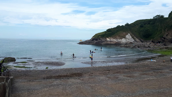
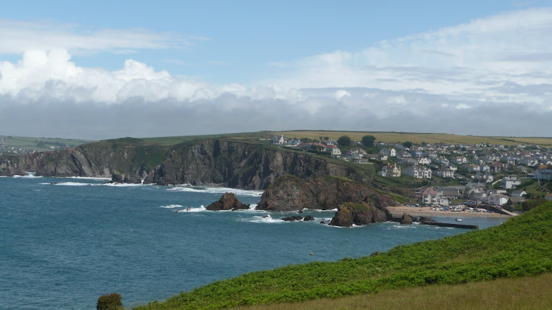
Braunton to Croyde
Walk along the South West Coast Path between Braunton and Croyde on the North Devon Coast
|
Sunday 6 February 2022
|
No comments |
![]()
Walk along the South West Coast Path between Braunton and Croyde on the North Devon Coast
|
|
No comments |
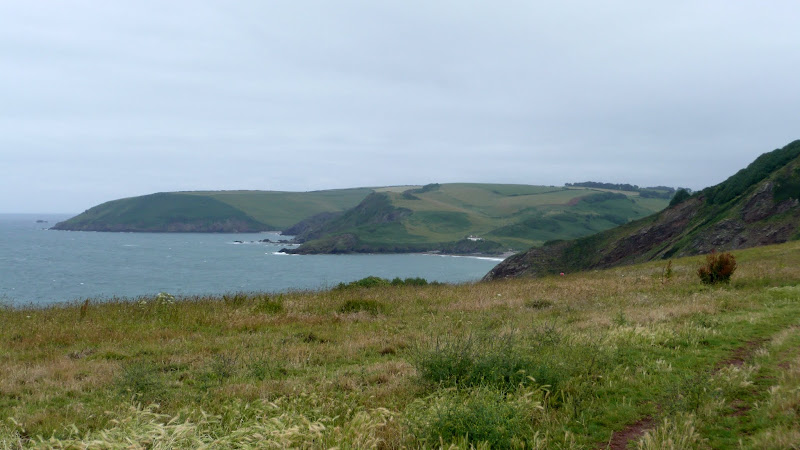
![]()

Short walk round the headland known as Baggy Point
|
|
No comments |
![]()

Circular route from Ilfracombe along the old railway track to Lee Bay, returning along the South West Coast Path
|
Saturday 5 February 2022
|
No comments |
![]()

An amazing walk full of spectacular views along this rugged part of the North Devon coast
|
|
No comments |
![]()
A short but strenuous walk across Hillsborough Hill that separates Ilfracombe and Hele Bay.
|
Monday 26 April 2021
|
No comments |
![]()
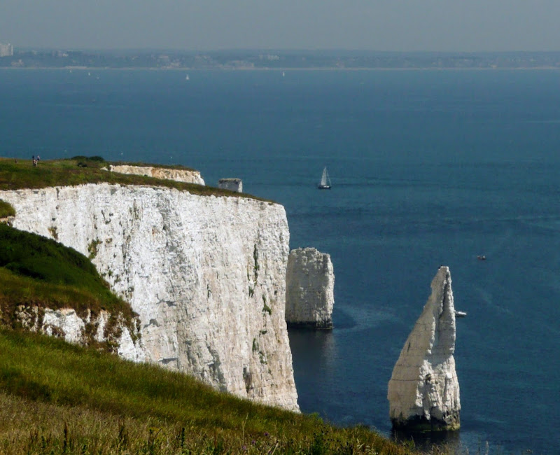
An moderately easy walk to the end of the South West Coast Path at South Haven Point
Old Harry Rocks is the highlight of this walk, and the ascent to Handfast Point, off of which the rocks are located, is the only real effort that has to be expended during the duration of this walk.The rest of the walk is easy all the way through to the end of the South West Coast Path at South Haven Point.
|
Sunday 11 April 2021
|
2 comments |
![]()
A challenging walk along the South West Coast Path between Langton Matravers to Swanage
Not quite a circular walk, with bus to connect the missing distance between Langton Matravers to Swanage. Some amzing coastline with a memorable climb to the top of St Adhelms Head.
|
Wednesday 22 July 2020
|
No comments |
![]()
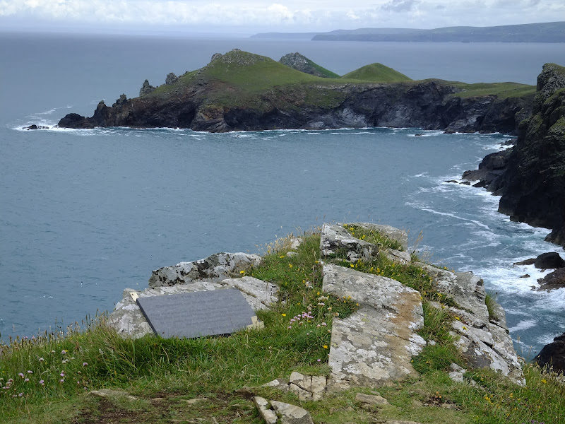
Short circular walk around the headland that fronts Pozeath
An awesome wander around Pentire Point from the village of Polzeath. This is a must for anyone who visits this classic piece of Cornish coastline. A few challenges but nothing that an average walker can muster
|
Sunday 19 July 2020
|
No comments |
![]()
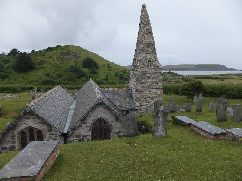
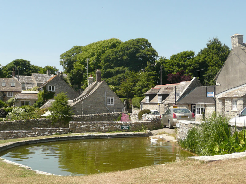
Short walk to St Endocs Church, buried in the sands of the coastal area close to Polzeath
The church of St Endoc is located in the coastal area close to the coast path alongside the Camel estuary. The church was buried in the shifting sands for some 300 years, being unearthed in the 19th century. Whether walking the coast path or visiting this area, the church is well worth a visit
|
|
No comments |
![]()
Short walk from Rock ferry to Polzeath along the Camel Estuary
A short section of the South West Coast Path that can be undertaken either as part of a more extensive hike or merely as a return ramble from Polzeath and across to Padstow. Fairly easy by SWCP standards and stunning scenery as is always the case with this Cornish coastline, and whilst taking all of this in one can contemplate the legendary Doom Bar that sits in the waters of the estuary.
|
Thursday 19 December 2019
|
No comments |
![]()
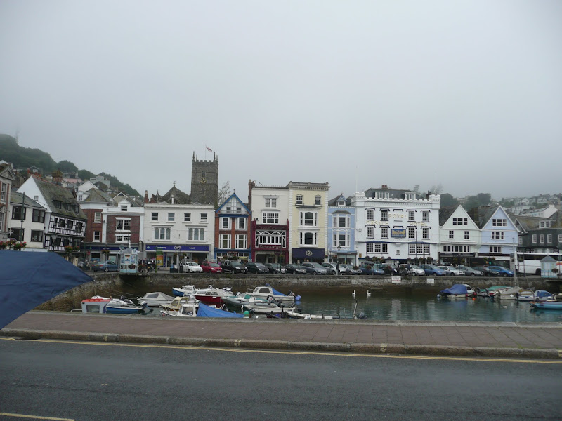
A 9 mile walk along the South West Coast Path between Dartmouth and Torcross.
This section of the walk starts at the deep water port of Dartmouth which is famed for where the second and third crusades departed in the 12th century. Across the River Dart is Kingswear, and down the estuary is Dartmouth Castle, built in the 15th Century. Passing the castle, the path heads round the coast and up to the village of Stoke Fleming, then meanders across the hills and lanes either side of the main Dartmouth road until it meets Strete. Here it descends down to Slapton Sands, which despite its name, is a shingle beach on one side and Slapton Ley, a natural freshwater lagoon, on the other. A simple walk with a few hills to negotiate and a bus service that links the two ends of the walk.
|
Wednesday 18 December 2019
|
No comments |
![]()
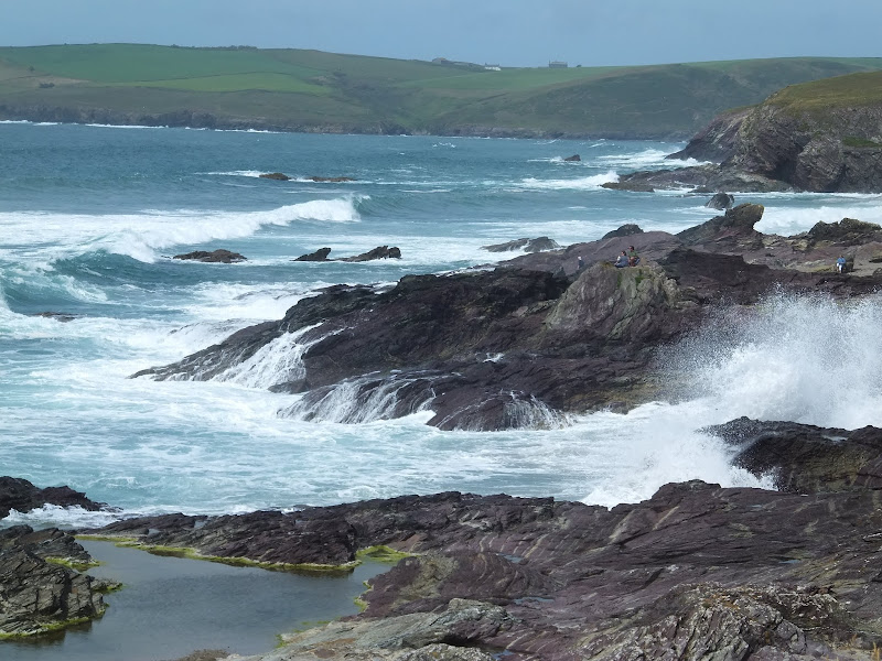
An 11 mile walk along the South West Coast Path between Coverack and The Lizard
A challenging but rewarding walk along the south West Coast path. There are spectacular views along the coastline with The Lizard being in view virtually the entire distance. The picture postcard village of Cadgwith is a worthy resting point before embarking on the final few miles that include the rock formation known as The Devil's Frying Pan.
|
|
1 comment |
![]()
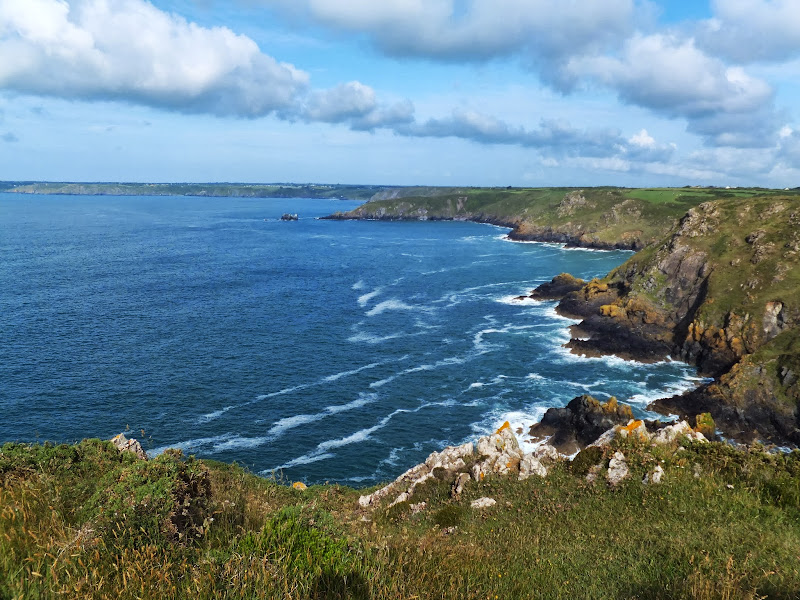
A 17 mile walk along the South West Coast Path between Churchstow and Salcombe.
This walk heads out from Churchstow through country lanes down to the South West Coast Path at Bantham on the Avon estuary. The Coast Path starts with easy walking along the low cliffs past Thurlestone and includes an 80 yard footbridge across South Milton Ley before it arrives at Hope Cove, a picturesque little fishing village. The section from Bolt Tail to Bolt Head is a little more strenuous with the path tracking up and down the cliffs and around a few craggy sections with steps built out of the stone. At Bolt Head the coast bears round to the north passing Sharp Tor which is cut out of the cliff-face, before it heads down into the pretty village of Salcombe.
|
Tuesday 17 December 2019
|
No comments |
![]()

An 16 mile walk along the South West Coast Path between Bucks Cross and Hartland
An easy start to a walk through the tree covered cliff-tops makes a pleasant ramble through to Clovelly. There follows a couple of challenging valleys to cross and then broad open meadows for more easy walking through to Hartland Point. At this stage the coast turns South to reveal a coastline that can only be described as truly spectacular.
|
|
No comments |
![]()

An 8 mile walk along the South West Coast Path between Bucks Cross to Westward Ho!
A moderate walk along the cliffs to Westward Ho!, the town renowned for being the only place in Britain to have an exclamation mark in its name. This walk presents a good introduction to the South West Coast Path being under 10 miles and with few difficult or strenuous ascents and descents. There are amazing panoramas of the coastline throughout with views to Hartland in the west and Westward Ho! and north Devon to the East and North.
|
|
No comments |
![]()

An 16 mile walk along the South West Coast Path between Bude and Boscastle
A challenging walk along a spectacular part of the South West Coast Path. Although this can be achieved in a single day there is the village of Crackington haven near to the half way mark which allows one to cut the walk into two smaller options. Waterfalls to see, steep valleys to cross and some amazing views of the coastline.
|
|
1 comment |
![]()

A 12 mile walk along the South West Coast Path between Brixham and Paignton.
There are a few moderately strenuous sections to this walk but nothing too arduous. The walk starts by heading out to Berry Head, the site of a an iron age fort, although most of this has been destroyed by late 18th century fortification for the Napoleonic Wars. The path then descends down into Brixham town where there are refreshment houses and shops set around the harbour. Brixham is much more of a heritage fishing town rather than its commercialized holiday resort neighbours of Paignton and Torquay. Out of Brixham, the path makes its way across the cliffs descending to Broad Sands and Goodrington Sands before reaching Paignton.
|
|
No comments |
![]()
A 10 mile walk along the South West Coast Path between Brixham and Kingswear.
This section is one of the most strenuous walks along the Exmouth to Plymouth section of the Coast Path but offers some spectacular views. There are craggy cliff-face paths as well as gentle wooded zig-zags before it finally meets the lanes that emerge by the railway station at Kingswear. A frequent bus service operates between Brixham and Kingswear to allow the walker to return to the start point.
|
Monday 16 December 2019
|
No comments |
![]()

An 5 mile walk along the South West Coast Path between Boscastle and Tintagel
A scenic walk that is not too much of a challenge to any seasoned walker. Rocky Valley presents a steep climb in and out but this really is a delight to behold and well worth the effort to get across it. The end of the walk is at Tintagel with all its Arthurian legend. Behold Camelot.
|
Saturday 7 December 2019
|
No comments |
![]()

An 11 mile walk along the South West Coast Path between Perranporth and Newquay
By South West Coast Path standards this is an easy walk along the low level cliffs with no particularly difficult climbs with the usual spectacular coastal views. The main obstacle on this section is crossing the River Gannel estuary. There are three footbridges but these are all dependant upon the state of the tide so tide tables need to be consulted and the walk planned appropriately.
A 10 mile walk following the southern side of the parish boundary of Leiston in Suffolk This walk follows the route of a 17th century peramb...


