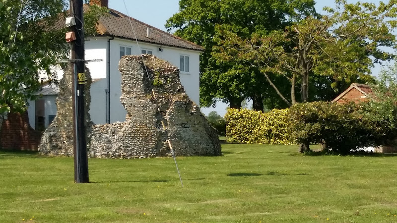
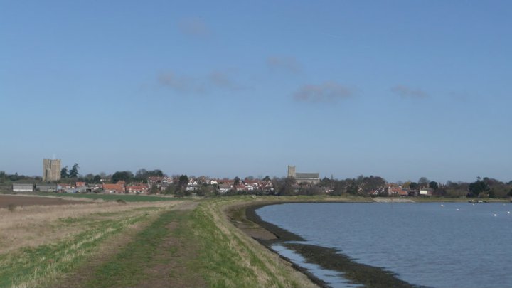
This walk provides a days ramble to view the ruins of Buxlow church. Many may have never heard of the parish of Buxlow, even those local to the area, and they can be forgiven for their ignorance since the parish was consolidated with Knodishall on 22nd February 1721.
Little is left of Buxlow church, which was dedicated to St Peter. There is merely a remnant of a wall from the old round tower that now rests in the garden of a domestic house which is viewable from the track that runs between the two houses. There are suggestions that the church was one of those recorded for Knodishall in the Domesday book and records certainly show there was a rector of the parish from 1301 onwards. By the middle of the 17th century it was reported to be 'decayed and ruinated tyme out of mind' although a rectors of the parish were still being recorded up to 1716 when Robert Witchingham held the honour.
Whilst admiring this piece of history the lady from the adjacent house engaged us in conversation stating that there have been many archaeological finds in the fields to front of the ruins. She even remarked of the many Roman coins that were constantly being unearthed. This is certainly not recorded on the Suffolk Heritage website so this is merely word of mouth. This does spark the imagination as the nearby hamlet of East Green is one of the suggestions of the long lost Roman station of Sitomagus. Maybe there was a connection from East Green to Aldringham which local folklore states was was a Roman port, the river Hundred in those days said to be navigable to sea going ships.
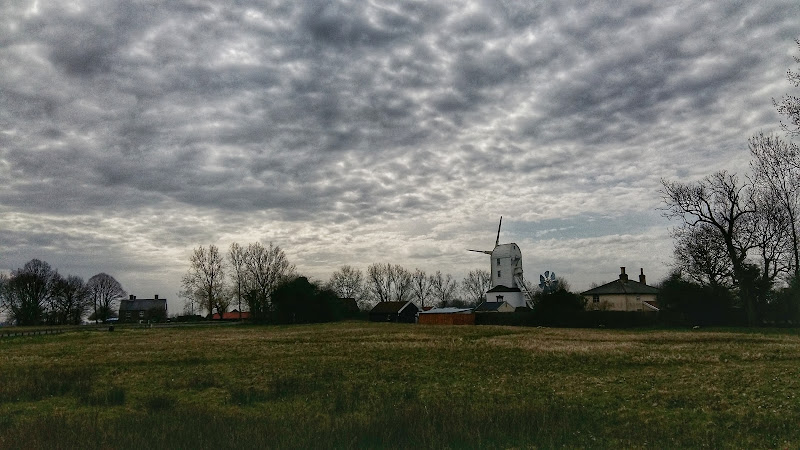
A country ramble through rural Suffolk taking in the villages of Saxtead and Earl Soham
This walk can be described as a typical Suffolk rural ramble. Quiet country lanes and accessible footpaths make this suitable for anyone.
Highlights begin almost immediately with the working Saxtead Green Post Corn Mill, preserved and maintained by English Heritage. As the route descends into Earl Soham there is the 13th century church of St Mary which is well worth visiting. The village of Earl Soham is a real piece of picture postcard Suffolk with its broad leafy main street providing an air of tranquillity. At the western end the road passes across the River Ken which is no more than a babbling brook that feeds into the River Deben.
At the edge of the village is the traditional old pub known as The Victoria. Unspoilt and unmodernised, this is a delight to visit. It once hosted a brewery, but due to demand it was moved across the road and has subsequently moved out of the village although it still supplies the pub with its traditional local ales.
A 2 day challenge walk to complete the Suffolk Coast Path
The first day of a 2 day challenge walk to walk the Suffolk Coast from Languard Fort to the county boundary at Hopton. This first day terminates at approximately the half way point of Sizewell
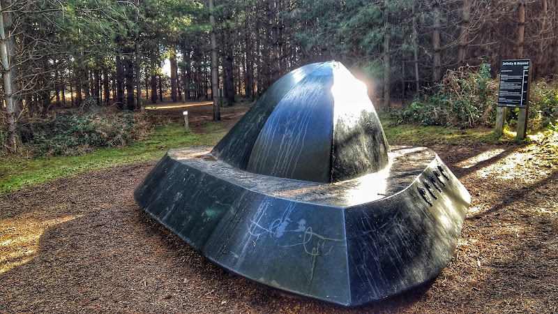
A woodland walk, a UFO encounter, quiet country lanes and a good old country pub
This is a great way to spend a day exploring. Rendlesham forest has many trails created by the Forestry Commission in order to discover this working forest. However this trail goes off piste to discover a little more. The first notable thing of the walk is the runway close to the car park. Although now redundant, this was a RAF air base that was taken over by the USAF and was a key hub during the Cold War. The forest surrounding the base is renowned as the location of a UFO encounter by US military that occurred during December 1980 and the Forestry Commission have a trail dedicated to this. The first part of this route heads out along this trail to view the UFO sculpture that depicts the craft encountered at one of the alleged landing sites. Some claim that the forest is still subject to strange unearthly occurrences so tread carefully!
The route heads out to view the curious sculpture which substitutes as the village sign for the village of Capel St Andrew. This iron man was commissioned at the millennium and created by local sculptor Paul Richardson. It is said to represent St Andrew as a fisherman, with his left hand clutching an eel whilst his right holds a fish. He is surrounded by oak trees that once covered this landscape and at his feet is a chapel from which the word capel is derived.
The walk also pays a visit to the ruins of Butley Abbey which dates from the 12th century. All that is left is a tall arch from the original church building which is now hidden away within a group of farm buildings. Further north is the impressive building of Butley Priory which was originally a 14th century gatehouse to the abbey. These days it is renovated and used as a wedding venue.
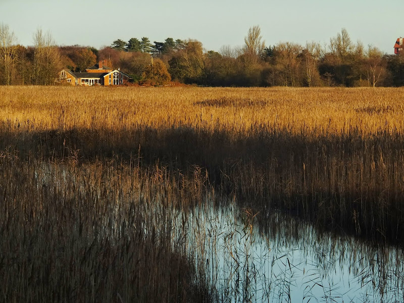
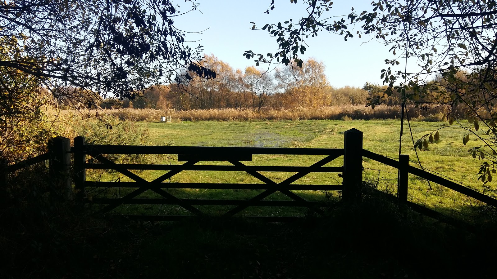
This is one of Suffolk's little secrets, hidden away from roads and off the beaten track. Tranquillity is guaranteed and there are some times of the year when one can walk around the entire route without seeing a soul. The area known as Aldringham Fens is a secluded haven of nature and wildlife, an area of marsh and reed-bed fed by the Hundred river which passes to the southern side of the fens.
It is thought that the fen may have possibly been the result of medieval peat extraction. It is known that before the railway arrived The Fens were a continuation of what is now Thorpeness Mere, the whole area being a vast shallow expanse of salt marsh. The railway provided an embankment to separate the Mere from the fen and the Mere became the modern day boating lake as part of Glencairn Stuart Ogilvie's early 20th century vision of a creating an idyllic Seaside village by the sea.
Access to the walk is via a footpath from Aldringham through to the picturesque Aldringham church. This is a pleasant path through an undulating Suffolk coastal countryside. The path continues down to the fen through more country side before circumnavigating the wetland by footpaths across boardwalks, across heath and through woodland . Return is back via the church.
This walk can equally be accessed from the village of Thorpeness, navigating along the side of the Mere to North Warren where there is access onto the Fen path.
A walk along the Stour estuary following the Stour and Orwell long distance path.
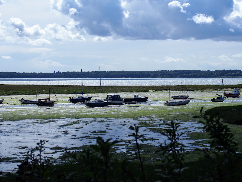
The Stour and Orwell Walk is a long distance trail that follows the estuaries of South Suffolk. This 42 mile trail links Felixstowe and Manningtree and this specific walk is the southern most section that follows the north side of the River Stour estuary. There are some superb views across the wide waters that separate Suffolk and Essex and although there is not full access along the waterfront, the route provides a pleasant days ramble to the head of the Shotley peninsular. This specific route also diverges from the official route to take in the village of Erwarton, a quiet and tranquil Suffolk community that is a pleasure to meander through.
The route is waymarked throughout although it is advisable to use an OS map or GPX tracker software to clarify the route in a few specific points where the way onwards becomes ambiguous. Do check tide times as there is a short section along the beach by Sutton Ness which can become inaccessible during periods of high tide.
The main limitation of this walk is the transport access between the two ends. There is no direct bus service and one needs to use Ipswich as a link. Having said this, the services do allow ample time to perform the walk.
It is advisable to take food and drink as there are little opportunities to purchase any on the route, with the only pub encountered being that at the end of the walk.
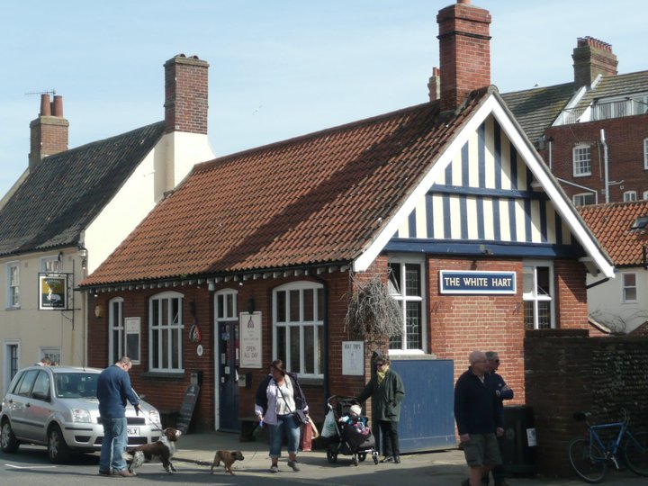
A 13 mile circular walk from Leiston to the White Hart Beer Festival in Aldeburgh
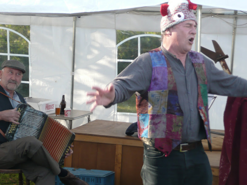
Easter 2011 was a really warm and sunny occasion and what better way to spend a Good Friday and Easter Monday than a casual walk through to Aldeburgh where The White Hart pub was holding its 9th Annual Beer Festival. Over 30 ales from across the country plus a selection of real cider, this really had to have something for everyone.
This walk is an arduous ordeal across shingle but worthwhile to see the site where the iconic Orfordeness lighthouse once stood. There are warning signs deterring visitors from straying beyond Slaughden but the large number of fishermen that dot the shoreline throughout demonstrates that public access is tolerated along the beach. This fascinating, stark and eerie landscape is really a sight to behold.
A circular walk from Sizewell to Aldeburgh along the Suffolk Coast Path
The Suffolk Coast Path does not go into Aldeburgh but it is a simple excursion to continue along the beach all the way down to the unique clover leafed Martello Tower at the vanished village of Slaughden using the old railway track to make a circular walk.
An overview of the Sandlings Walk, a 55 mile long distance path through the forests and heaths of East Suffolk
The Sandlings is a 55 mile walk starting at Rushmere Heath on the eastern side of Ipswich with Southwold, passing through the remaining fragments of East Suffolks Sandling Heaths. The trail leads through Rendlesham, Tunstall and Dunwich forests and also includes riverside walks at Woodbridge and heathland walks across Rushmere Heath, Sutton Heath, Thorpeness Common and Dunwich Heath..
A 10 mile walk following the southern side of the parish boundary of Leiston in Suffolk
This walk follows the route of a 17th century perambulation around the southern side of the Leiston Parish boundary. The walk uses the ancient track down to Sizewell and continues down to Thorpe before turning inland to follow the River Hundred through to Cold Fair Green. The details are contained in two articles, this being the first, focusing on the medieval history of Sizewell.
A 16 mile walk around the Orford Loop section of the Suffolk Coast Path
The main Suffolk Coast Path cuts through Tunstall Forest from Iken Cliff to Chillesford. However, more recently, a path has been added which allows access to Orford by following the Alde estuary. This then cuts back across Gedgrave marshes and Sudbourne Hall to return to the main path at Chillesford.
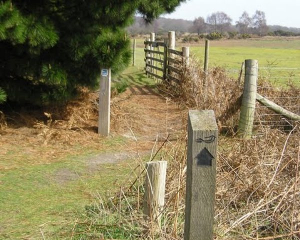
A 12 mile circular walk starting at Eyke and incorporating the UFO Trail in Suffolk's Rendlesham Forest
The Rendlesham UFO trail is a waymarked 3 mile trail around the eastern end of Rendlesham Forest that navigates around the key areas that were involved in the Rendlesham Forest Incident of 1980 in which both civilian and military personnel witnessed unexplained craft land within the forest. Although this can be walked by parking up at the visitor car-park in the forest, a longer alternative is to take the footpaths from Eyke, and make a day of this most wonderful and intriguing part of Suffolk.
A 7 mile walk along the Alde estuary, following the Suffolk Coast Path from Snape to Iken
There are disputes as to whether Iken is the land of Icanho that St Botolph was granted by King Ethelmund to build his minster in the 7th century. If it was then there were marsh demons in these parts during those time and one can still feel the eeriness of the area with the mysterious Yarn Hill where Botolph reputedly drove away the ghosts and marsh demons in order to build his minster. It was eventually completed on the site of the historic church at Iken which still bears his name. The church is a fascinating place to visit - be sure to spend a little time here and see St Botolphs stone cross which was unearthed in 1977 and is on display within the church.
A 22 mile circular walk between Leiston and Walberswick incorporating sections of the Suffolk Coast Path and Sandlings Walk.
This walk uses the beach at low tide to get from Sizewell to Walberswick, returning through Dunwich forest. Walberswick is said to be the most haunted place in Britain though one would not think it from its relaxed and laid back character, famous for its crabbing pastimes.
An easy 7 mile circular walk through the woodland around Sizewell on the Suffolk Coast
Suffolk is not best known for its hills and Kenton Hill and Goose Hill probably would not be regarded as hills but for their name. However this wooded area offers an ever changing scenery throughout the year with the mixture of conifer and broad leafed trees, flora and fauna and a variety of wildlife. There is also a viewing platform overlooking the Minsmere marshes
An 8.8 mile circular walk through the Suffolk countryside to attend the 2011 Suffolk Herring Festival at Middleton.
I have been to music festivals and folk festivals and country fairs and even the novel barrel fair, but I can honestly say that I have never ever attended a Herring Festival until this walk. Held on the grounds of the Farm Shop in the village of Middleton this two day event features food and drink, exhibitions, music and games, competitions, and demonstrations of herring preservation and preparation.
A circular walk around the Area of Outstanding Natural Beauty at Sizewell
This walk has a diverse landscape that has something for everyone. Woodland, coast and beach, freshwater marsh and Sandlings Heath which is a delight to any visitor and worthy of its status as an Area of Outstanding Natural Beauty. The walk heads out of Leiston alongside the man-made Aldhurst Farm nature reserve, an area of wetland, heath and grassland created in 2015 as a sweetener for the local folk should the proposed Sizewell C Power Station get approval. It isn't presently accessible to the public other than the established footpath that runs along the valley and a new path running adjacent to Valley Road. The north side of the reserve was once known as Winters Heath, common land that was enclosed in the early 19th century. Therefore this is not so much as giving something to the community as returning the access rights to the people that such common land once afforded.
Views across the marsh to minsmere, an area that will be covered with spoil heaps from the construction of Sizewell C
Moving on up to the top of the hill on Lovers Lane where we take the track off to the right as the road bends around to the left. An interesting feature on the OS maps at this location is an area marked as Fiscal Policy. This is thought to be a so called Trap Street, a fictitious location that is used as a copyright marker for the cartographers work. This specific fictitious location has been added to OS maps since the 1920s and has varied its exact location over the decades, although keeping within the general area of the western side of Kenton Hills. It is certainly not a location known to locals and appears on no other maps of the area other than the Ordnance Survey. It is notable that there are many references to the area of Fiscal Policy made in modern documentation written by both Suffolk Council and EDF, the Power Station operators. This goes to show the lack of local knowledge these bureaucrats and business managers have which may account for their scant respect for the surrounding landscape.
The route then heads through a car park and into the woodland through the areas known as Kenton (marked as Tenton on 19th century OS maps) and Goose Hills. The naming of the area as Hills is not self evident from the tree covered landscape. It has to be said that there is a triangulation station in the depths of Goose Hill but this is only at an altitude of 9m with the surrounding landscape no less than 5m. I guess a mere 4m high piece of land surrounded by marsh may look like a hill but it certainly is not self evident within the dense forest. The names of Kenton Hill and Goose Hill date back from long before the forest was planted, when the area was Sandlings heathland. It wasn't until the 1960s, with the coming of Sizewell Nuclear Power Station, that the heath was planted with a managed forest. Going back further in history the area is thought to have been parkland attached with the 14th century Leiston Abbey, some documents describing it as a deer park.
There are many tracks through the woods including a section of the The Sandlings long distance trail as well as specific colour coded way-marked trails. This particular route takes the unmarked perimeter paths out to the extremities of Goose Hill where there are views onto the marshes to the south of Minsmere and a purpose built hide for those who want to spend some time discovering the wildlife of the marsh. Whatever route one takes, navigating to the eastern edge one will find two footbridges which provide access across to the coastal section of this walk.
Goose Hill and Kenton Hill Woodland
Sizewell beach offers both coastal heath and a shingle beach to walk along. The northern section at the point where the path emerges from the woods, was once a 19th century rifle range which I believe was also used during WWI as target practice for the troops. The beach and heath paths pass in the front of the two power stations at Sizewell and is a very popular for both tourists and locals walking through to Minsmere Sluice and beyond. For those wanting refreshments there is the Vulcan Arms pub at Sizewell as well as the Sizewell T cafe although this is closed over the winter months.
Return uses the medieval track through to Broom Covert. This was the original route between Leiston and Sizewell before the modern road was introduced in the 19th century. Broom Covert is an area of ancient Sandlings heath that is a delight to walk through and is another highlight of this walk, its contoured grassland hinting at hidden earthworks that may lie beneath. It is thought that this area was extensively used for troop training during WWII and there may be hidden structures dating from this period lying beneath the surface.
A permissive path leads across the meadow at Round Covert to Reckham Pits Wood which was originally part of Leiston Common, the woodland growing up in the early 20th century after it had been used for aggregate excavation. The mixed woodland is a much wilder landscape than that of Kenton Hills, with a cacophony of trees, foliage and fauna all competing for space, a blaze of colour and light in all seasons. Above the woodland is what is left of Leiston Common, correctly known as Leiston Dry Common to distinguish it from Leiston Wet Common which once occupied part of the marshes. The Common features in many local tales and stories of 18th century smugglers who would stash their booty in holes dug into the sandy soils of the common. There is a permissive path on the north side of the common that leads down to the marsh known as Sizewell Belts and across to Kenton Hill woods. The public footpath leads out onto Lovers Lane with a new footpath adjacent to Valley Road to take the walker back into Leiston.
Broom Covert, natural Sandlings heathland
It has to be stated that much of the landscape this route passes through may disappear in the next decade due to industrial usage despite its status as an Area of Outstanding Natural Beauty. The proposed Sizewell C power station will claim some of the woodland, specifically much of Goose Hill which will be replaced by an access road to the construction site and a railhead. The route of the proposed railway will run adjacent to Kenton Hills and may well devastate the fictitious area known as Fiscal Policy!. No doubt Goose Hill will be flattened with the introduction of the road, its trig point no longer applicable with the tallest structures becoming the 20-30m high spoil heaps which will dominate the landscape from the present site of Sizewell B through to Minsmere sluice and across to Eastbridge.
Public access to the woodland may become limited with no access through to the beach. The coastal access will be restricted during the construction of a loading jetty and sea defences, and the coast path may be blocked up for the duration of the build depending upon the design of the pier head that is chosen. The long distance routes of the Coast Path and the Sandlings Path will get diverted along Lovers lane and then taking the roads through to Eastbridge, a lengthy diversion along asphalt which is not conducive to committed walkers and hikers. There will no doubt be contention between road users and pedestrians, such confrontations already occur when walking the local roads so this will only get worse with the increased traffic. This re-routing is a big concern as many walkers make use of the coastal section from Sizewell through to Minsmere which makes the local area an attraction for outside visitors who may well be put off by such unpleasant walking diversions.
On the southern side of the route, Broom Covert was set to be requisitioned for the construction of Proposed East Anglia One/Two Windfarm Substations which were set to dominate the area, its buildings being some 18m in height. There was much opposition to this, the land being a prime example of Sandlings Heath and deserving of its Area of Outstanding Natural Beauty status. Fortunately it seems this threat has abated in preference to a site at Friston which itself is gaining significant opposition. The coastal land between Thorpeness and Sizewell is still threatened to be torn up and footpaths blocked up. Considering that this area is popular with both locals and visitors alike, it demonstrates the lack of local knowledge these corporations have of the area and just how much it attracts visitors. When, at a recent exhibition of the proposed development, the question about the blocking up of footpaths was put to ScottishPower Renewables, the rep seemed honestly aghast that we had walked two miles to get to the exhibition in Thorpeness. This demonstrates their lack of knowledge of the area. We walk. Two miles is around the corner. We do not want to be forced into cars. These footpaths are our access along the coast.
There are already two windfarm substations constructed at Sizewell. The big issue with all of this is each Power company appears to want their own substations whereas a more holistic and integrated policy would cause less development, less disruption and benefit all. Probably the best idea would be to have an off-shore ring main to connect all of these power sources rather than bringing the lines to a separate substations for every single wind farm that is built. However the power companies do not appear to be interested in such solutions. Cooperation appears to be a dirty word to these monolithic corporations.
To cap it all, there is an idea being put about to market this section of natural heath, marsh and sandling coastline as The Energy Coast. This is a gimmick to put a cosy name to what will be no more than industrialisation of the Suffolk Coastline. There are a lot of people out there, both local and from further afield who would prefer this to stay as a natural coast, a coast that harbours wildlife, where one can seek solace and peace, where one can sit or stand and admire the landscape, not a huge construction site under the marketed guise of The Energy Coast.
Finally, jumping the gun with the assumption that the construction of Sizewell C is a foregone conclusion, EDF have been given the permission to extend Sizewell B, destroying the 100 year old Coronation Wood in the proceess in order to accommodate a car park. This is currently being opposed by a local groups who have succeeded in forcing a judicial review in the High Court to challenge the planning decision.
Without a doubt this landscape will change drastically in the near future. Therefore if you want to enjoy this natural beauty, do so sooner rather than later or you will probably never get to see it due to the plethora of industrial constructions that are being proposed to completely devastate this area for the next 20 years and probably beyond. Gone the marsh. Gone the sandlings. Gone the peace. Gone the landscape. However, if you are into concrete landscapes, massive industrial constructions, busy roads, endless traffic, hoards of lorries then you will be in your element.
A very easy 2 mile walk around the Suffolk Village of Bromeswell
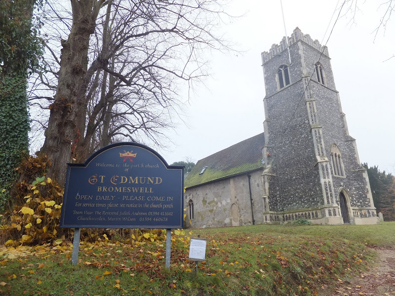
The Sandlings Path avoids the busy road between Melton and the footpath across the Heathland to Rendlesham Forest by navigating around the quiet village of Bromeswell. Although only a short distance, it is worth taking ones time to explore this quiet village with its typically East Anglian church of St Edmund.
Latest walk summaries are basic information sheets for walks that have yet to be fully documented. These provide links to maps, public transport and walks stats, although detailed notes and features are not included.