A Walk to Suffolks Mystery Brampton Standing Stone
|
Thursday, 28 November 2019
|
No comments |
![]()

A 14 mile walk between Halesworth and Beccles along the East Suffolk Line Path
This waymarked route links the railway stations at Halesworth, Brampton and Beccles. Taking the train between these towns will provide an interesting glimpse of what is in store along the walk, including the rather curious Belle Grove Farm looking as if it is out of some fantasy movie and the mysterious Brampton Standing Stone just south of Brampton Station.
A Walk to Suffolk's Mystery Brampton Standing Stone - Essential Information
Walk Statistics:
- Start location: Halesworth
- End location: Beccles
- Distance: miles ( km)
- Total Gain: ft ( metre)
- Total Descent: ft ( metre)
- Min Height: ft ( metre)
- Max Height: ft ( metre)
- Walk Time:
- Walk type: Linear
- Walk Grade: Easy
- Terrain:
Maps:
The following maps and services can assist in navigating this route. There are links to printed maps and links to downloadable GPX route data for importing into navigational software and apps.
- Ordnance Survey Explorer Map
- OS Explorer 231 - Southwold & Bungay
- GPX Route File
Transport:
Details of public transport that is required for the walk
Greater Anglia - Train Service
- Service Details
- East Suffolk Line - There is a two hourly service between Saxmundham and Lowestoft and an hourly service between Saxmundham and Ipswich
- Timetable
- http://www.nationalrail.co.uk/
Route Verification Details
- Date of Walk: 2012-02-25
- Walk Time: 10:30 to 16:00
- Walkers: Griffmonster, Kat
- Weather Conditions: Sunny day, a little warmth in the sunshine but with a chill north-westerly breeze
Walk Notes
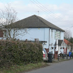
The East Suffolk Line Walks are a series of connected footpaths and country lanes that link the stations along the East Suffolk railway line that runs from Ipswich up to Lowestoft. There is a free booklet available online that documents each walk with this specific walk a combination of two of the documented walks, namely the Wolfpack Walk and the Walk in Adrian Bell Country which connect at Brampton. This combination results in a 14 mile trek which is easily achievable as a day walk for anyone of average fitness. The footpaths are marked with the distinctive circular East Suffolk Line Walk waymarkers that depict a windmill and church in a rolling landscape with a rising sun on the horizon. These provide a great way to explore the East Suffolk towns and countryside.
The starting point for this walk is preferably Beccles which has free parking at the Quay car park whereas Halesworth town parking is pay and display and works out expensive for a full days parking. The walk can then either be undertaken directly to Halesworth with a return journey by train or, as the case here, the train is caught to Halesworth and then walk back. This has some distinct advantages - the journey provides a preview of the landscape one is to walk through including a view of the quirky Belle Grove farm where one gets a better view from the window of the train than from the path passing the area. This fairy tale building was constructed in 2011 by the farm owners Nick Fisher and Jo Jordan. It was inspired by a sketch from a Russian architect and is fashioned from bricks from the original farm house with timber frames and bales of straw for walls. Trees from Dunwich Forest were used to create the tower with the huge metal mesh dragon on top peering down the chimney stack. The interior is just as unique with corrugated iron from the farm workshop acting as kitchen cupboard doors, and a twisted elm trunk from a local ditch placed as a centre piece in the house. The building is a truly remarkable sight with a bell shaped tower.
The second advantage is timetable schedules. Catching the outward bound train leaves no schedule to stick to and unlimited time to complete the walk. It has to be said that the railway is well served and since the frequency of the service has increased to hourly trains then such concerns are now longer a prime consideration.
From Halesworth station the route leads up to the former Holton Airfield, a WWII airbase that was principally used by the American Air Force, with the 56th Fighter Group and the 489th Bomb Group being based here. The airfield closed shortly after the war and there is now a Holton Airfield Museum dedicated to those who served at the base. The path passes by this windowless brick building on the edge of the former airfield although opening times are strictly limited to Bank Holidays and Sundays.
The route uses lanes and footpath through to Brampton Station. On the final part of this section the walk diverges from a track and up to the railway. This passes through a meadow where an 8 foot standing stone can be seen. Looking weathered and its top covered in moss, its history is a mystery. Suffolk certainly is not a county renowned for its standing stones and the few stones that can be found are merely what are termed as glacial erratics, stones moved from upland areas by galciers during the last ice age. There is certainly nothing of this size or nature that I know of in Suffolk. If anyone has any information then please get in touch.
The path then heads up to Redisham and its surrounding parkland which is a sheer delight to walk through. Next is the village of Ringsfield Corner and with a short diversion one can take in the Three Horseshoes pub for a worthy refreshment. Further on there is Ringsfield village with its picturesque thatched roofed church of All Saints. Although there is a church recorded here in the Domesday Book, this building is mostly a Victorian restoration project. One intriguing aspect to this church is a graveyard display on the north side of the church where the nave meets the transept. Atop the fenced in tomb is an elaborate stone angel which looks down upon a tilted cross on the tomb with two smaller angels at its foot and the whole scene rests on an inscribed stone with raised crests at its head. This is the resting place of Princess Caroline Murat who was directly related to Napoleon Bonaparte and the King of Naples. She lived and died at Redisham Hall after marrying a local squire, John Lewis Garden.
The final stage of the walk cuts down through the wooded area at the bottom of Hangmans Lane and then across to Puddingmoor at Beccles.

Directions
A simple walk following the East Suffolk Line Walk waymarkers.
Beccles Quay to Beccles Station
The free car park at Beccles Quay is a rough piece of ground on the edge of the north side of the town. From the car park turn left and follow the Fen Lane around to the junction. Turn left up to the junction with the main road. Turn right and head into town. The station is on the left opposite the mini roundabout.
Halesworth to Brampton
From the South bound platform at Halesworth station, emerge onto the road heading southwards, following the road around into the housing estate. At the end is a footpath down the side of one of the houses. this leads round to a track. Turn left (no waymarker) and continue up the lane with the cemetery on the right. On reaching Town Farm the waymarkers are on a post just inside the farm boundary but it would appear that the path is now diverted, picked out by the trod down grass diagonally across the preceding small field. This leads along another track. Continue to the road, go straight across until it emerges onto a road opposite the old Holton airfield and museum. Turn left and follow the road round the airfield, continuing right onto the road around the airfield perimeter. Follow the road round to the left, past Moat Farm and take the bridleway on the right. This crosses the railway and crosses the Spexhall to Westhall road at Deadmans Grave crossroads. Turn right and before the railway bridge take the footpath on the left. (Belle Grove Farm is just before the bridge). The footpath crosses directly across the first field, turns right at the boundary for a few yards, then goes out across the next field. when it meets the next field boundary, turn right and follow the edge around past the farm buildings and out onto the road. Turn right and just past the farm is a track on the left. Keep to the track until it meets some woods on the right and starts to bend around to the left. There is a footpath on the right through the trees down to a little footbridge across a stream and then up to the railway. In the pasture by the railway is Brampton Standing Stone. The path passes through a gate and alongside the railway to emerge on the road at Brampton station.
Brampton to Beccles
Take the road westwards from the station and when it bends sharply round to the right there is a footpath through the hedge and across the field. The waymarker has been felled here and it is not obvious where the path is. Continue across the fields, across the road and down to Wood Farm. Go around the right hand side of the Farm cottages, into what seems like the rear garden, then follow the path by the pond and down to the bridleway in front of Great Wood. Turn right and keep to the bridleway which turns into a track to pass in front of Redisham Hall. As the track bears round to the left, continue straight on along the footpath alongside the stream. Follow this through until it emerges onto the road at Pound Farm. Keep to the road up to Ringsfield village crossroads. Turn right and the Three Horseshoes pub is about a third of a mile down the road on the left. Return to the crossroads, go straight across and just past the school on the left is a bridleway on the right. Follow this through until it junctions with a track just across a stream. Turn right and follow the track through to Ringsfield church. Continue along the road and take the track on the right. At Lodge Farm turn right and follow the path up alongside the field boundary. Cross the boundary and keep following the footpath until it meets with a road at a sharp bend. There is a track down the hill which comes out opposite Roos Hall on the main Bungay road. Go right towards Beccles and then left down Puddingmoor. When the road junctions turn left and follow Northgate down to the quay. Cross the Quay on the footbridge and the car park is at the end of the creek.

Pubs
Three Horseshoes, Ringsfield View in OS Map | View in Google Map
- Address
- Three Horseshoes, Ringsfield
- Website
- https://thehorseshoesinn.co.uk/
Small local pub on the edge of Ringsfield Corner. The building dates from the early 1800's with the earliest recorded landlord being Robert Bettram. Guest ales and pub grub available.
Friendly village pub. They had two ales, Green King Abbott and Everard's Tiger. I was hoping for some local micro-brews but even so, the Tiger was a rewarding pint. A variety of pub grub was on offer, all at very reasonable prices. We opted for ham, egg and chips and was delighted with the chunks of ham and two eggs laid across a plateful of chips.

Features
Deadmans GraveView in OS Map | View in Google Map
The ancient practice of burying suicides at crossroads
The crossroads on the Spexhall to Westhall road where Nollers Lane junctions with Butts road is locally known as Deadmans Grave. There is no recorded history about this name or this crossroads but it is assumed that this could well be the site of a suicide burial.
It was the custom in middle-ages England to bury such 'blood guilty' people at crossroads during the hours of darkness. It was considered that the spirit of the guilty may well return to reek revenge and by placing their bodies at a crossroads would confuse the spirit as to the direction of their home. To further prevent the spirit from raising it was often customary to also drive a wooden stake through the heart.
This type of burial is documented as far back as 1510 when Robert Browner, the superior of Butley Priory in Suffolk, hanged himself after mismanaging monastery finances. The practice was finally outlawed by an Act of Parliament passed in 1823 which allowed suicides private burial in a churchyard, but only at night and without a Christian service. A review of the law resulted in a new Act in 1882 allowing normal burial. Parliament did not decriminalise suicide until 1961 (Suicide Act 1961.
Brampton Standing StoneView in OS Map | View in Google Map
Just south of Brampton station, alongside the public footpath and stood in the centre of an area of rough pasture is a Standing Stone. This large solitary stone of approx 8ft x 4ft x 2ft dimensions stands upright in roughly a northwest-southeast direction. Despite exhaustive research consulting many historic texts and catalogues of ancient stones, there is no reference to this item so the history of this stone remains a complete mystery. The northwest side is covered in moss, and, not being a geologist, I would not like to guess as to its origins or its substance. I can only say that I have never noticed this stone, which is visible from the railway, in the pasture before. That is not to say that it was not there. The only online reference is a photo from March 2011 from another bemused walker. The only references to 'Brampton Stone' or indeed 'Redisham Stone' as it is closer to this parish, is in connection with a stone in a garden in Beccles and this comes nowhere near the dimensions of this particular stone.
This part of East Anglia does not have any exposed native stone or rock and the stones and boulders that do occur on the landscape are the result of glacial drift during the last ice age. These stones were venerated by early occupants of the area and used as ancient way-markers or meeting places. When Christianity arrived churches were often sited close to such stones as they were often considered hallowed ground.
Not far from this stone is the famous Stockton Stone, on the main A146 road between Beccles and Norwich and placed on the grass besides a lay-by. Local legend states that if anyone moves it they will be cursed and suffer a premature death. This was emphasized when the road was straightened in the 1960's when the workman entailed with moving the stone suddenly died.
Therefore, in conclusion, and this is purely guesswork and conjecture, I have to say that this stone at Brampton may well be a modern day folly or joke. A stone placed there by a landowner as a conversation piece or purely a practical joke. I would like to think that this is not the case, but such a significant piece of stone so close to a well used railway and a public footpath, is surely something that could not have been overlooked by those who study such artefact's and therefore its absence in records of ancient stones around East Anglia is noticeable. Even so, this conclusion still begs the question of how the stone was placed here. The only access is the footpath from the station which is narrow and bordered by thick hedges and the narrow footbridge across the stream from the other direction both routes being too restrictive for such a large feature. The other two sides of the pasture are bordered by a hedge and the railway.
Redisham HallView in OS Map | View in Google Map
18th century mansion
Redisham Hall is a modern mansion standing in 400 acres of parkland to the south-west of Ringsfield village. The extensive grounds contain the ruins of the church of the quondam parish. The Hall is an 18th Century Grade II listed building partially used as holiday cottages. The hall occupies the site of a mansion built by Nicholas Garneys during the reign of Queen Elizabeth and demolished to make way for the present building, constructed in 1823 for John Garden with further additions in 1904.
References
All Saints Church, RingsfieldView in OS Map | View in Google Map
Quaint thatched village church
Probably the most notable aspect of this Victorian thatched church is the rather flamboyant angel at the side of the church. This is the grave of Princess Caroline Murat who was married to the local squire and was the great-niece of Napoleon Bonaparte and a grand-daughter of the King of Naples. On the south side of the church is a brick memorial to Nicholas Garneys, who died in 1599. The top of the memorial is decorated by a terracotta mermaid.
References
Roos HallView in OS Map | View in Google Map
Roos Hall (also known as Rose Hall) is a Grade I red brick Tudor manor house dating from 1583 set in medieval parkland with river frontage. It is said to be among the most haunted houses in England. One legend states that on each Christmas Eve, at midnight, a ghostly carriage pulled by four horses and a headless driver draws up to the Hall. A beautiful woman is then said to step down from the coach but if any person dares to look into her eyes then they will be driven to madness or instant death. This was said to have been the fate of two poachers in the late 19th century.
A guest-room is also said to be haunted and the Devils hoofmark can be seen burnt into a wall inside the Hall. There is also a tale concerning a certain window which can never be kept closed. A blacksmith had once ironed the window permanently shut yet the next morning it was found in its usual open state.
In the grounds stands an old oak tree which is said to be the site of a gibbet where many criminals had been hanged in chains as a warning to others. It is said their ghosts now haunt this area. Legend says that if you are brave enough to walk around the oak tree six times counter-clockwise then the Devil himself will appear and ask your business.

Gallery
Below are a selection of images taken from from the photo album for this walk. Feel free to browse through these or click on an image to view a larger version in the Gallery.


Summary of Document Changes
Last Updated: 2021-12-12
Distance:long , East Suffolk Line Path , Features:Churches and abbeys , Features:Folklore , Features:Manor Houses and Halls , full-detail , OSmap:231 , Railway Walk , Suffolk


0 comments:
Post a Comment