South West Coast Path - Mousehole to Marazion
Saturday, 29 December 2018
|
No comments
|
![]()

A 7 mile walk along the Cornish section of the South West Coast Path between Mousehole and Marazion
A simple and easy walk along paved coastal areas of Mousehole, Newlyn, Penzance and Marazion. As on this occasion, even if it is dreadful weather, the path can still be completed safely and without aid of maps or navigation aids.

Walk Statistics

Maps
The following maps and services can assist in navigating this route. There are links to printed maps and links to downloadable GPX route data for importing into navigational software and apps.
- Ordnance Survey Explorer Map
- OS Explorer 102 - Land's End
- GPX Route File
Accommodation
Mill Lane Camping and Caravan Park, PorthlevenView in OS Map | View in Google Map
- Website
- https://www.facebook.com/MillLaneCampsite/
- Description
- Mill Lane Camping and Caravan Park, Mill lane, Porthleven, Cornwall TR13 9LQ
Transport
Bus Service
- Service Details
- At the time of walking this route the local 2 bus service was provided by First Kernow and linked Penzance, Helston, Falmouth and Truro. Due to the ever changing landscape of public transport it is advised to use the Traveline website to get the latest timetables and operators
- Timetable
- Traveline Website
Walk Notes
This was the ninth day of a two week walking holiday along South Cornwall section of the South West Coast Path using a base-camp at Porthleven and public transport to get to and from each days walk.
The luxury of a pocket Radio
Camping is supposed to be a natural escape from the hum drum of normal life and as such I have always frowned at the idea of having electricity piped into a tent. Thats just not camping. There is something magical about eating camp food cooked with billy-cans on a small gas stove, of having a dimming lantern swinging from the tent poles and a book and the sunset as the only forms of entertainment. That's the way I like it. That's what makes camping so special, it is a get-away from modern living. However, on this particular expedition we had invested in a small battery powered Pocket Radio. The principal reason for this decision was to have a weather forecast as we would be walking for two weeks and forecasts beyond seven days can be a bit hit or miss. This turned out to be a fantastic investment and also provided some simple entertainment in the evenings listening in to BBC Radio Cornwall. I have never been a fan of local radio stations but this one gave a detailed weather forecast each and every day, plus an entertaining evening show. It did confuse me somewhat when they announced 'and now the News in Cornish' expecting it to be followed by the News in English which never came! The radio is now a regular feature of our expeditions.
It was thanks to the radio and listening in to the weather forecast that we decided to do the walk on this day. We had scheduled in the Helford to Coverack but the forecast was for heavy overnight rain which would continue into the next day, brightening up from the west later. That meant a full morning of wet weather and this particular walk was one of the few urbanised sections of the South West Coast Path. This would provide hard surfaces when the usual paths would be muddy and wet. We would start at Penzance and if the weather was good to us we could continue on the cliff paths from Marazion through to Porthleven.
The Walk
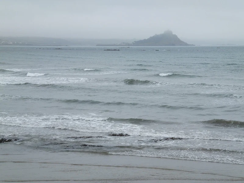
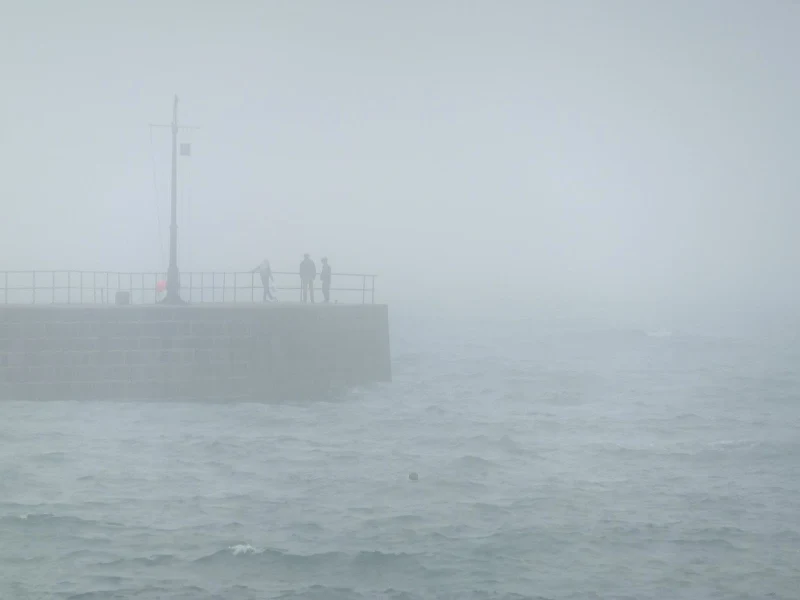
Penzance bus station. The rain teemed. That fine rain that seems to get into everything. The scenery was masked in horrible misty fog. There was little sign that this would let up. Grey sky. Very grey. Occasional glimpses of St Micheal's Mount appeared in the hazy conditions. A portakabin opposite the bus station housed a cafe. It seemed an opportunity to while away some time in the hope that things may get better. A bacon buttie and mug of tea sitting listening to the conversation of a gang of bin-men. Watching buses come and go, including the open top buses. A British summer and the open top buses still run despite the weather, its the British way of enjoying oneself whatever the weather. Eventually there was no putting it off, we had to head off into the downpours. We donned wet weather gear, including the plastic top for the rucksack. I had done away with leggings some years ago in favour of wearing a good pair of cotton trousers. They quickly get wet, but soon dry out and leggings always seem to hog the sweat and soak ones trousers anyway.
Initially the rain wasn't too bad with the breezes at our backs at least we could hold heads up and admire the wet scenery. We traipsed onwards, watching the ominous views of St Micheal's Mount pale and brighten through the varying mist. numerous trains rolled by on the main line into Penzance adjacent to the broad empty cycle track. As the coast curved round the breezes started to blow rain into our faces making our heads droop to the floor and flagging the spirits and enthusiasm. By the time we reached the start to Marazion the rain was coming down all the more heavier than before. A shelter of a bus was a welcome sanctuary from the torrid conditions. We were soaked but it was a chance to shake the rain hoods off and survey the miserable day. Another man joined us. He had rain gear and a rucksack. A few simple words of exchange soon found that he was a walker. Punctuated silence led to more information and conversation. As a summer vacation he was filling in gaps that he had missed on previous walks of the Coast Path. He was a sectional walker and had started at Minehead. A section near Bude had been closed due to the weather making it treacherous. He watched the rains. Not impressed. He then declared that he would catch the bus to his evenings bed and breakfast and put off the days walk for another occasion. It did make us think of doing the same but we decided to persevere.
On we traipsed through Marazion, determined to carry on despite the weather. Beyond the town there is a track by a cemetery that leads down to the coast and the more typical coastal footpaths. The track was stony and easy to walk along but this curved off to the right and the footpath branched to the left. A grass and mud footpath heading down a steady but not steep incline. We glanced down it. Water was running in torrents, giving the impression of a small stream rather than a footpath. It didn't look good. It could be treacherous with conditions like this. There was no alternative and it didn't take much discussion to head back up to the road where we could catch a bus back into Penzance and then decide what to do with the rest of the day.
Back in Penzance the rain continued. We wasted time tramping up the main street before taking advantage of the opportunity of being in town to search for a pole repair kit for the tent. The first night camping had been in a raging storm with gale force winds and one pole had split laterally. I had taped it up but a better solution was needed. A pole repair kit was the solution and a suitable outdoor equipment shop sought. On leaving the shop a little minibus stopped just down the road with Mousehole on its destination board. On the spur of the moment we went for it knowing at least the walk back to Penzance would be on paved surface.
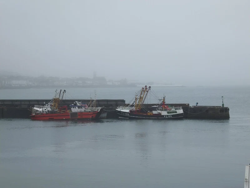
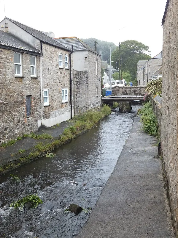
At least the rain appeared to be easing when we got to Mousehole. And despite the greyness the village was more like a typical Cornish fishing community than the urbanisation of Penzance down to Marazion. After a drink at the Ship overlooking the harbour front we set off towards Newlyn and Penzance. Paved walking all the way. Points of interest lurked in the murk. Scarecrows on the allotments. The raging brook passing through Newlyn. The harbour full of boats. A public convenience where a notice on the door stated, 'In an emergency please telephone Cornwall Council on.....' and the amusing thought of phoning some council official to hurriedly declare ones urgent need to attend to the call of nature. That was our wet day. At least we got a little walking in!
Directions
Follow the well marked South West Coast Path trail which is marked with the usual National Trail Acorn waymarkers.
The path sticks to the pavements, promenades and cycletracks that follow the coast. Navigation is simple even without an OS map.
Pubs
The Ship, Mousehole View in OS Map | View in Google Map
- Address
- The Ship, Mousehole
- Website
- https://shipinnmousehole.co.uk/Home.html
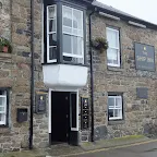
A St Austells pub overlooking the harbour at Mousehole. Alcoved bar offers the usual St Austell ales and a variety of food. Accommodation available.
The pub celebrates Tom Bawcocks Eve which occurs shortly before Christmas and commemorates a terrific storm which bettered the village. A huge fish pie is baked and consumed by the patrons of the Inn. This event encapsulates the entire village party and attracts many visitors from both near and far.
A charming pub on overlooking the harbour. Quiet on this occasion and comforting watching the wet scenes outside. St Austells Tribute as pleasant as ever.
Features
MouseholeView in OS Map | View in Google Map
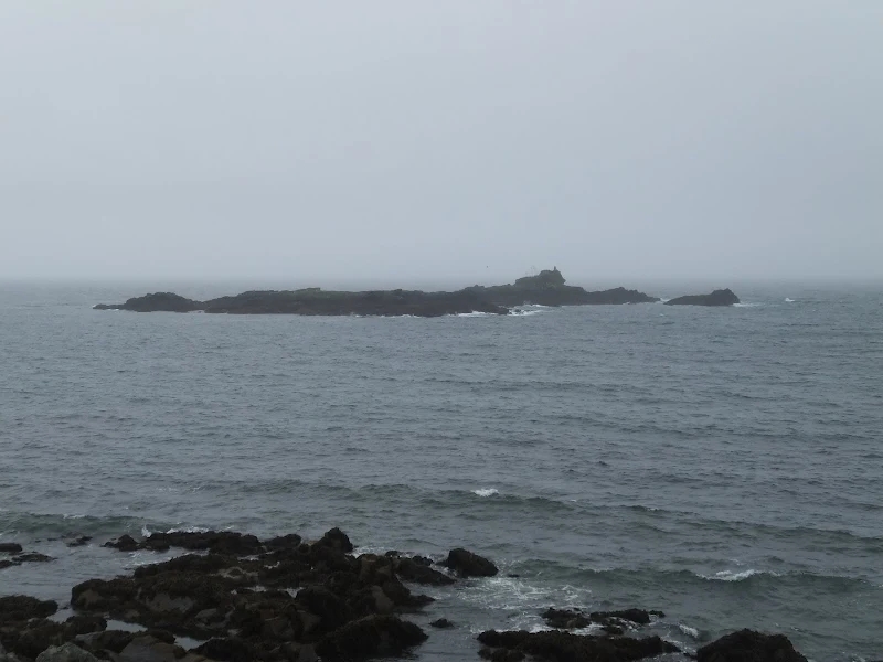
Mousehole (pronounced "Mowzel") was described by Dylan Thomas as the loveliest village in England and it is the archetypal Cornish fishing village with a small harbour overlooked by the houses that are set on the hillside. Just offshore from the harbour is a small rocky islet known as St Clement's Isle. It is said that this was the home to a hermit many years ago.
Up until the 16th century it was one of the principal ports of Mount's Bay but the town was destroyed in 1595 by Spaniard Carlos de Amésquita. The only building that survived the attack was the 'Keigwin Arms' a former pub and a plaque on the building commemorates the event stating "Squire Jenkyn Keigwin was killed here 23 July 1595 defending this house against the Spaniards".
Another memorial in the village is dedicated to Dolly Pentreath who is credited with being the last person to fluently speak the Cornish language. It is said that she could not speak a word of English until the age of twenty. She died in 1777 but a letter sent a year later to the lawyer Daines Barrington from a local fisherman listed the names of several other people who could still speak the language.
References
NewlynView in OS Map | View in Google Map
Newlyn, a small fishing town adjacent to Penzance is the southernmost town on the British mainland. Records mention the town as far back as 1279 and its Cornish name of Lulyn which is derived from the Cornish for 'pool for a fleet of boats' which refers to the shallow offshore waters known as Gwavs Lake which is the traditional mooring for the local fishing fleet. Newlyn comprises of three discrete hamlets, Tolcarne, Street-an-Nowan and Trewarveneth, which were originally separated by bodies of water.
Before the 1890s, Newlyn had strong connections with the nearby parish of Paul. The steep route from Newlyn Cliff to Paul passes an area known as Gwavas where, up until the mid-20th century, an ancient stone cross venerating of the Cornish sea deity Bucca was sited. The name 'Bucca' has often been used as a nickname for people resident in Newlyn.
References
PenzanceView in OS Map | View in Google Map
Penzance is derived from the Cornish for 'holy headland' and is a reference to the location of a chapel nowadays called St Anthony's that is said to have stood over a thousand years ago on the headland to the west of what became Penzance Harbour. There are no early documents mentioning an actual dedication to St Anthony which seems to depend entirely on tradition and may be groundless. The only remaining object from this chapel is a carved figure, now largely eroded, known as 'St Raffidy' which can be found in the churchyard of the parish church of St Mary's near the original site of the chapel. Until the 1930s this history was also reflected in the choice of symbol for the town, the severed 'holy head' of St John the Baptist. It can still be seen on the civic regalia of the Mayor of Penzance and on several important landmarks in the town.
References
Image Gallery


Route Validation Cards
Validation Date - 2012-07-02
- Time of Walk: 08:30 to 13:30
- Validators: Griffmonster, Kat
- Weather Conditions: Very wet with heavy rainfall, mist and fog
- Notes: Initial route undertaken
Summary of Document Changes
Last Updated: 2026-04-20
- 2012-10-21 : Initial Publication
- 2018-12-29 : General website updates
- 2021-03-17 : Update website improvements and removal of ViewRanger reliance
- 2021-12-01 : Removal of ViewRanger links due to its imminent demise
- 2026-01-12 : Major website update with all walks recast to the new format


0 comments:
Post a Comment