South West Coast Path - Par to Mevagissey
Friday, 28 December 2018
|
No comments
|
![]()

A 10 mile alternative route for the South West Coast Path between Par and Mevagissey.
With the highlights of Charlestown and Mevagissey this walk holds a lot of expectation. When the weather turns against the avid walker and the conditions along the coast path become slippery and dangerous then this route provides an alternative. Always put safety first and during times of dense fog and or heavy rain always use a sense of caution when proceeding.

Walk Statistics
- Start location: Par Station
- End location: Mevagissey
- Distance: miles ( km)
- Total Gain: ft ( metre)
- Total Descent: ft ( metre)
- Min Height: ft ( metre)
- Max Height: ft ( metre)
- Est. Walk Time:
- Walk type: Linear
- Walk Grade: The official coast path is challenging but this route is easy
- Terrain:

Maps
The following maps and services can assist in navigating this route. There are links to printed maps and links to downloadable GPX route data for importing into navigational software and apps.
- Ordnance Survey Explorer Map
- OS Explorer 105 - Falmouth & Mevagissey
- Ordnance Survey Explorer Map
- OS Explorer 107 - St Austell & Liskeard
- GPX Route File
Accommodation
Bay View Caravan and Camping SiteView in OS Map | View in Google Map
- Website
- https://www.looebaycaravans.co.uk/camping.htm:
- Description
- Bay View Camping and Caravan site, located 2 miles east of Looe
Transport
Train Service
- Service Details
- First Great Western trains, Looe to St Austell changing at Liskeard
- Timetable
- https://www.nationalrail.co.uk/
Bus Service
- Service Details
- At the time of walking Western Greyhound provided the 526 regular service between Mevagissey to St Austell. This has since been taken over by First Kernow after Western Greyhound went into administration. Due to the ever changing landscape of public transport it is advised to use the Traveline website to get the latest timetables and operators
- Timetable
- https://www.traveline.info/
Walk Notes
This was the third day of a two week walking expedition along South Cornwall section of the South West Coast Path based at the Bay View Campsite near Looe
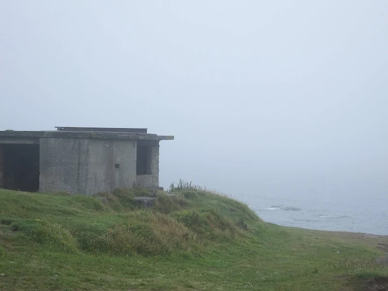
Fog, fog and more fog
The day started with fog. Thick dense fog that drifted in the air current but didn't seem to immediately wet the surroundings. We took the car down to Looe Station from the campsite, headlights glaring through the fog, with the intention of getting the train through to Par from where the days walk would commence. The scenery on the train journey was marred with fog, visibility varying from the track-side trees to being able to glimpse outlines of the hills. The walk from Par Station down to Par beach was through thick fog. One doesn't really expect such fog in June. Fog is an autumn weather, not summer. However, we had experienced fog the previous year walking the south coast of Devon and it generally cleared as the day wore on, so there was a little expectation of the fog lifting.
The official path follows the A3082 towards St Austell, navigating around the front of a china clay works, then heads to the cliffs along Carlyon Bay. There was definitely a cliff edge and beyond was the sound of the sea though despite these cliffs only being 20-30 metres in height the fog masked any view of the briney below. At least this part of the walk was easy to navigate with fairly level ground and the broad expanse of a grassy path that bordered a golf course. Ghostly silhouettes of a group of hardy golfers idled along, dragging caddies behind them, determined to outdo the weather. My mind boggled on how they managed to locate their balls in such weather and for a few brief minutes we watched the apparitions pass by in the opposite direction. They plodded on. No sign of playing a shot. Maybe they were spending their morning in the not-so-popular sport of golf-ball-location rather than golf.
The path came to a field of overgrown grass with an hotel on its right hand boundary. There was no clear indication of where the Coast Path headed, although the OS map depicted it exiting the field on the far left corner which was completely masked by the fog. There was no obvious track, no trodden mud that evidenced a likely route, no trampled grass that pointed the way other walkers may have proceeded. The only indication of any wear was along the fence alongside the hotel and this lead to an entrance onto the road. It was the easy option to take the road from where we could find the official route further up, nothing of significance would be missed in such dense fog.
Indeed, the official path waymarker was found where the road turned inland. A well trod path at the end of the houses led across a couple of fields and down to Charlestown along the cliff-top. The village could not be seen until the path turned into the cove to reveal the amazing sight of two ghostly tall sailing ships. These huge and impressive craft were docked in the quay and the footpath led round three sides giving a mighty fine sight of these historic luggers. At the far side of the dock was the Wreckers Restaurant and Cafe (Note that this is now namedSpringtide)which was a good enticement to take a break, a cup of coffee and the chance to escape the fog, which by now, also had rain drizzling within it. I didn't think it could rain in fog but this proved me completely wrong.
At this point there seemed to be no indication that this fog would clear and the weather conditions looked like they would deteriorate if anything. We needed to weigh up some options. So far we had attempted to stick to the official South West Coast Path route through both Dorset and Devon. However, one has to weigh up the weather and path conditions with respect to safety along the trail. It had been easy going along the relatively flat grassy surfaces from Par but beyond Charlestown the OS map depicted a more strenuous route with a few deep valleys to cross. The official Guide Book states this section of the Coast Path as challenging
which generally means a lot of steep ascents and descents. The present weather conditions had resulted in some very slippery surfaces as experienced on previous days walks and now combined with the fog there was extremely limited visibility. It was only a few weeks before that I had spoken with a campsite owner down at Porthleven who had related that she had walked a section of the coast path some weeks before and had to use the road due to safety concerns attributed to the weather. If a local expresses such concerns then a visitor should take heed all the more seriously. The Coast Path will always be around. If one steps too close to an edge or makes a slip on a steep ascent then the consequences can be dire. Even with the adequate gear and thorough knowledge of the path, if one is determined to pursue the days walk then one should always inform others before venturing out in such weather, providing estimated times of completion and taking some form of communication. We had no other persons to inform and although we were suitably kitted out for the conditions, the path was an unknown entity.
With this in mind the decision was taken that we should seek an alternative route for the section through to Mevagissey. It would be unfortunate to miss out on some good walking and coastal views, but judging by the conditions so far, the walking would be extremely slippery and the views would be non-existent in the dense fog. We could not put off this walk as there was a schedule to keep, having already pre-booked the next campsite on the Roseland peninsular. It was disappointing to have to sacrifice this section to an alternative route, but the path would always be there for another day.
Therefore the route chosen was the road that led down to Pentewan. Currently there was a Coast Path diversion which briefly navigated along this road before returning to the coast at Porthpean due to a cliff fall (note that this diversion has subsequently been rectified and the coast path reinstated along the cliffs). The road was little more than a country lane after which it picked up the main road into Mevagissey.
Setting out along this alternative route, it was soon found that the fog was less dense with a greater degree of visibility across the landscape. The fog was being driven up by convection currents from the sea water and somewhat dissipated at higher altitudes. With the road navigating along the higher contours of the hills it did provide a some better, albeit patchy, views. In fact there was even some coastal views approaching Pentewan with the cliffs across the broad beach distinctly visible. There was minimal traffic on this lane making the walk both pleasant and easy. Some time was taken out at Pentewan to visit the gift shops and to take a break for some rucksack lunch. In all we made the most of a pretty dismal day.
I have often been told that when foggy and wet conditions affect the south coast of Devon and Cornwall, one can hop across to the north coast and be bathed in sunshine. This was certainly disputed when we got to The Ship Inn in Mevagissey. A group of customers who came in after us, and who were obviously locals, spoke with the barman, relating how their trip across to Newquay resulted in worse weather than Mevagissey. 'Heavy rain as well as fog' they described in no uncertain terms. So it is not always the case of the north coast is better! We did spend a little more time in Mevagissey, which was crowded with tourists due to it being feast week, an annual event that has been celebrated for hundreds of years. It was originally held in December each year but was moved to June in 1752 when Mevagissey adopted St Peter as its patron saint, whose traditional feast day to mark the saints martyrdom is 29th June.
Return to Looe
The bus was caught back to St Austell and then a train journey returned us to Looe by which time the fog was clearing and there was even a few signs of blue sky. Before returning to camp, and with it being the last night at Looe, we decided to celebrate with a pint of beer. Looe has a few pubs, four of which we had visited during our short stay. Sauntering through town we soon came to an establishment that we had yet to visit, Ye Olde Fisherman's Arms on Higher Market Street is reputed to be the oldest pub in Looe dating from the early 17th century. From the outside it certainly looked the part and this was enough enticement to provoke us into stepping inside. We were greeted with a timbered ceiling and undressed stone floors with music playing to the bar devoid of custom. An unkempt barman slothfully leaned up against a cluttered bar-top opposite the main entrance, head down, chewing on gum and reading a newspaper. Undeterred, we ventured across the dark and dingy surroundings. There was one ale on. Sharps Doom Bar. I politely requested two pints. The barman looked up and eyed me like a man disturbed. He muttered, hobbled up the bar, leaned down to retrieve two musty glasses and set about the laborious and painful task of pulling the pump. We watched hesitantly. Nerves were on tenterhooks as the beer slowly drooled into the glass with each pull of the pump. We watched, hoping, praying, silently pleading that the barman's slobbering gum-chewing mouth did not exude spittle into our beer. It was not a pretty sight but with two pairs of hawk-eyes intently staring at the scene we were confident that our final pints were gob free. We paid up and made our way to the window seat from where we scanned over the surroundings. Clearly the place had not been cleaned for days, weeks, maybe months. The place smelt strongly of dog, and that is saying something for a person who has little sense of smell. The offending mangy mutt lay on the opposite side of the room in front of a large stone fireplace. The pint of beer was pleasant enough. Not outstanding but as good as any other run-of-the-mill pint of Doom Bar I have tasted. However, the thought of spittle, the essence of dog and the musty atmosphere was not conducive to savouring the ale and discussing its merits. It took a matter of minutes to sup up and get out of the place.
During that evening we did take an investigative look at the footpath leading from the campsite through to Seaton which we had diverted from on the first day due to torrential rain. It was extremely slippery, wet and muddy. Not impassable for the determined but enough to convince us that the days road diversions in the fog would have seen similar conditions over more challenging paths. A camper had discreetly pitched in the scrub land by the path. We had heard he had walked away from Bay View campsite when quoted the price of a pitch. It was the same price whether one was a hiker or had a huge tent and a motor. Ok for us treating it as a base-camp but a short overnight stay did seem a little steep at £17 for the night. He sat poking out of his backpack tent, brewing something up on a little stove. He did not acknowledge us, nor did we him.
Directions
Follow the well marked South West Coast Path trail which is marked with the usual National Trail Acorn waymarkers.
Alternative Route from Charlestown to Mevagissey
At Charlestown the official route is diverted out of the village along the road. At the junction turn left. The official route then takes the next left back down into Porthpean. When weather conditions are unsuitable an alternative route can be taken by continuing along the road rather than going back down to Porthpean. This road goes through to Pentewan and does pass the field containing Castle Gotha, a small Iron Age oval shaped settlement, originally with a bank and ditch around it.
The alternative route meets back with the official Coast Path route at Pentewan and follows this out of the village along the main B3273 Mevagissey road. Continue along this road to the top of the hill from where a quiet lane leads down into Mevagissey.
Pubs
The Ship Inn, Mevagissey View in OS Map | View in Google Map

- Address
- Fore Street, Mevagissey
- Website
- https://www.theshipinnmeva.co.uk/
The Ship Inn was built during the 17th Century and is one of two surviving pubs from that period when the town was said to have 10 pubs. It was re-built in the 18th century which has survived to the present day. The inn has five letting rooms, serves a range of St Austell ales and offers locally sourced home cooked food including fresh fish.
Busy pub in the heart of the town. Dartmoor ale was on offer but the barman struggled to get a full pint stating that it was 'air in the line'. The ale was not its best, it wasn't off but it was lifeless and lacklustre. It was interesting to note that when the next customer asked for a pint of Dartmoor the barman turned the clip and stated that it was off. I would have preferred that he was up front with me. Surely a barman knows when a barrel is at its end. There shouldn't be air in a line anyway. Maybe in future I should ask for it to be changed.
Features
CharlestownView in OS Map | View in Google Map
Charlestown was originally a small fishing village called West Polmear until the late 18th century when it was developed as a new town to be named after a local landowner named Charles Rashleigh. The main function for the development was to to enable the exports of china clay from local quarries. By the time of Charles Rashleighs death in 1823 the family estate was in so much debt that all the leasehold property of Charlestown was used as settlement for the arrears.
Today Charlestown harbour is owned by Square Sail, a company that owns and sails a small fleet of tall ships, including Kaskelot, whose name is Danish for Sperm Whale, which was built in Svendborg, Denmark in 1948 and is the flagship of the Square Sail Fleet. Other ships include Pheonix and the Earl of Pembroke.
Charlestown harbour has been used as a filming location including the films The Eagle Has Landed and Alice in Wonderland, 1970s dramas Poldark and The Onedin Line and an episode of Dr Who called The Curse of the Black Spot.
MevagisseyView in OS Map | View in Google Map
The first recorded mention of Mevagissey dates from 1313 when it was known as Porthhilly, although there is evidence of settlement dating back to the Bronze Age. Towards the end of the 17th century, Porthhilly merged with the hamlet of Lamoreck to make the new village. It was named after two Irish saints, St Meva and St Issey (the "g" comes from hag, the Cornish word for "and"). At this time the main sources of income for the village were pilchard fishing and smuggling and the village had at least ten inns, of which the Fountain and the Ship still remain. The current harbour is built on the site of a medieval quay. There are currently 63 registered fishing vessels in the harbour worked by 69 fishermen.[citation needed] The harbour also offers tourist fishing trips and there is a regular summer passenger ferry to Fowey.
Image Gallery


Route Validation Cards
Validation Date - 2012-06-26
- Time of Walk: 09:00 to 14:30
- Validators: Griffmonster, Kat
- Weather Conditions: Dense Fog throughout
- Notes: Initial route undertaken
Summary of Document Changes
Last Updated: 2026-04-20
- 2012-08-18 : Initial publication
- 2018-12-28 : General website updates plus rework notes
- 2021-03-17 : Update website improvements and removal of ViewRanger reliance
- 2021-12-01 : Removal of ViewRanger links due to its imminent demise
- 2026-01-12 : Major website update with all walks recast to the new format


0 comments:
Post a Comment