South West Coast Path - Portreath to Hayle
Sunday, 23 December 2018
|
No comments
|
![]()
A 12 mile walk along the North Cornish section of the South West Coast Path between Portreath to Hayle
Although there are a couple of climbs at the Portreath end of this walk, this is predominantly an easy clifftop path along with dune or beach walking across the sands between Godrevy Point and Hayle.

Walk Statistics
- Start location: Portreath
- End location: Hayle
- Distance: miles ( km)
- Total Gain: ft ( metre)
- Total Descent: ft ( metre)
- Min Height: ft ( metre)
- Max Height: ft ( metre)
- Est. Walk Time:
- Walk type: Linear
- Walk Grade: Moderate
- Terrain: Cliff paths, some steep ascents and descents near Portreath, but predominantly easy going with dunes or beach on the final miles to Hayle
- Obstacles: The path does go close to the cliff edges in parts, always exercise appropriate caution in such cases

Maps
The following maps and services can assist in navigating this route. There are links to printed maps and links to downloadable GPX route data for importing into navigational software and apps.
- Ordnance Survey Explorer Map
- OS Explorer 102 - Land's End
- GPX Route File
Accommodation
Mill Lane Camping and Caravan Park, PorthlevenView in OS Map | View in Google Map
- Website
- https://www.facebook.com/MillLaneCampsite/
- Description
- Mill Lane Camping and Caravan Park, Mill lane, Porthleven, Cornwall TR13 9LQ
Transport
First Group - Bus Service
- Service Details
- 37/34 - At the time of walking this route the local 37/34 bus service was provided by First Kernow and linked Helston and The Lizard. Due to the ever changing landscape of public transport it is advised to use the Traveline website to get the latest timetables and operators.
- Timetable
- Traveline Website
Bus Service
- Service Details
- At the time of walking this route the local 2 bus service was provided by First Kernow and linked Penzance, Helston, Falmouth and Truro. Due to the ever changing landscape of public transport it is advised to use the Traveline website to get the latest timetables and operators
- Timetable
- Traveline Website
First Group - Bus Service
- Service Details
- 18 - At the time of walking this route the local 18 bus service was provided by First Kernow and linked Penzance and Hayle. Due to the ever changing landscape of public transport it is advised to use the Traveline website to get the latest timetables and operators.
- Timetable
- Traveline Website
First Group - Bus Service
- Service Details
- 47 - At the time of walking this route the local 47 bus service was provided by First Kernow and linked Truro, Redruth and Portreath. Due to the ever changing landscape of public transport it is advised to use the Traveline website to get the latest timetables and operators.
- Timetable
- Traveline Website
Walk Notes
Fog, fog and more fog
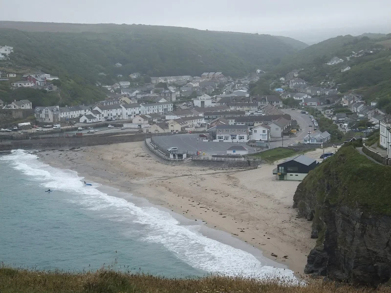
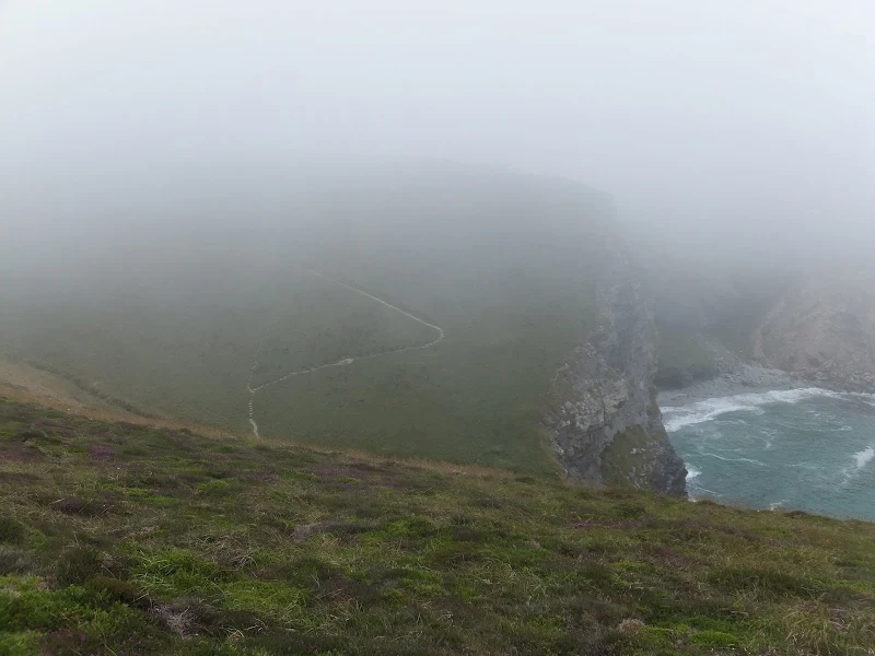
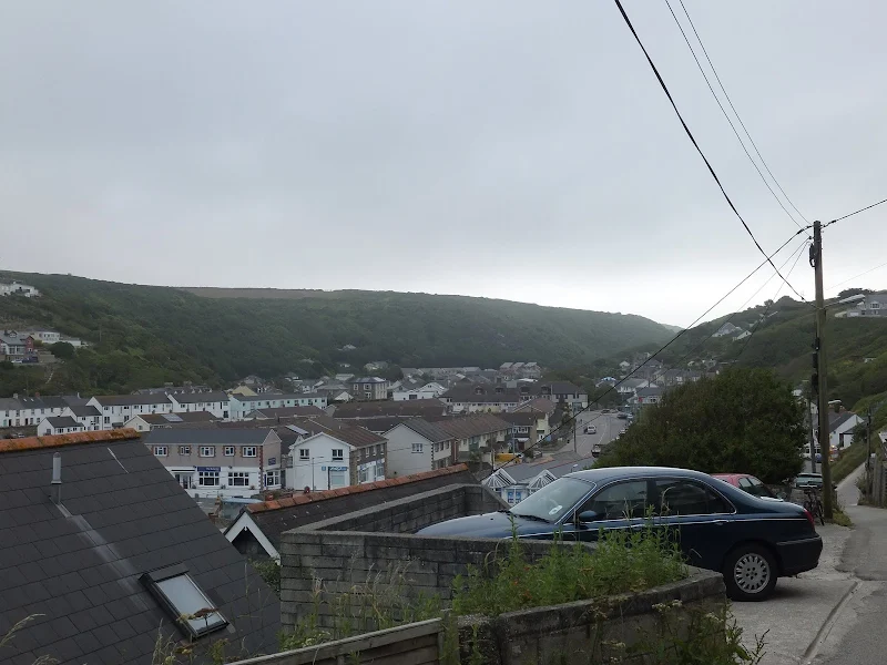
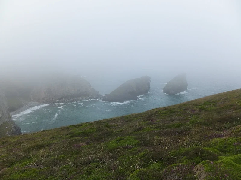
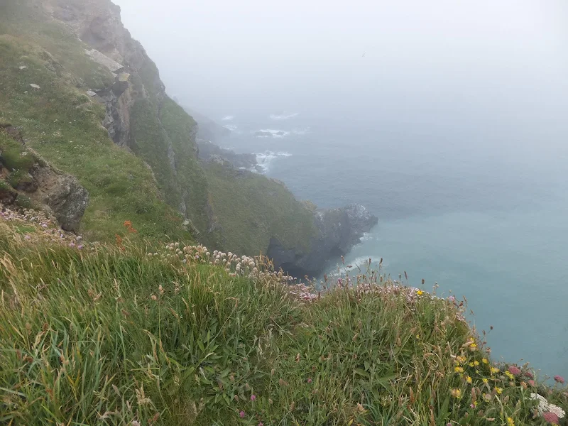
Fog had been a constant annoyance on both the South Devon and Cornwall sections of the Coast Path during previous expeditions along this National Trail, at times being so dense that alternative paths were sought due to safety considerations. This particular walk is easy no matter what the conditions and even in dense fog there are little safety implications other than basic common sense as the route follows well defined paths with little climbing apart from the initial climbs out of Portreath. Once past Western Hill and Porth-cadjack Cove the rest of the walk follows the rolling cliff-tops along the Reskajeage Downs and out to Godrevy Point. This is followed by dunes with the option of a beach walk along the vast sands that form the beach around Hayle Bay.
The walk would undoubtedly have been better without fog. This fog was not the dense pea-souper that had hampered progress around Par but all the same it is never the best weather to walk through. Droplets forming in ones hair. Clothing taking on a clinging dampness. The sights and the glory of the Cornish coastline masked from prying eyes. Landmarks but hazy shadows. The sea no more than a distant sound from below.
The fog had been predicted. The local BBC radio station weather forecast the previous evening had quite rightly stated that there would be early fog, but then had predicted that this would soon burn off by the warmth of the summer sun. Well, it was 9am at Portreath. Thick fog. It was past 11am by the time we reached Hells Mouth cafe. The fog drifted in waves, sometimes no more than wetting mist, other times a density that hid the sea below the cliffs. Hells Mouth cafe provided shelter for a whole host of walkers, retreating from the weather for the warmth of a cup of tea and bacon butties and a chance to shed some waterproofs only to find that the dampness had pervaded through to inner clothing. We joined the throngs and watched the passing mist outside and amused ourselves with the multiple reflections from the mirrors that surrounded the breakfast bar.
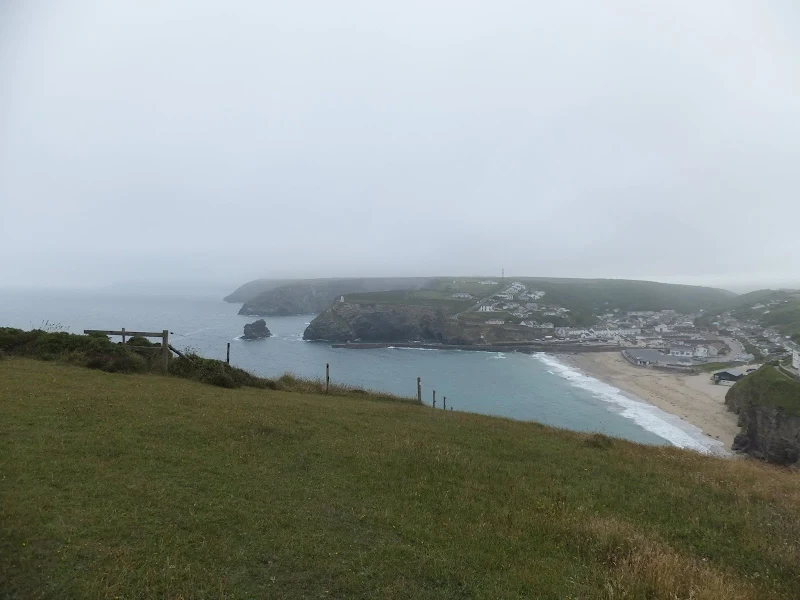
Beyond Hells Mouth the path wanders around Godrevy Point before descending to the dunes through to Hayle. Donkeys occupy this open moorland, but they were hidden by the mist until one walks immediately past them. They looked unamused, maybe they had heard the same weather forecast and had that depressed feeling that once again the weathermen had got it oh so wrong. At Kynance Cove groups of people stood peering down through the mist to the sea below. The sea was just visible. Maybe it was the fascination that one could actually see the sea on this fog ridden day that had captivated these people. But then following pointing fingers and with squinting of eyes one could see what the spectacle was all about. A seal. Bobbing up and down in the water. Just a solitary seal. No more seals or if there were they were completely shrouded in the fog.
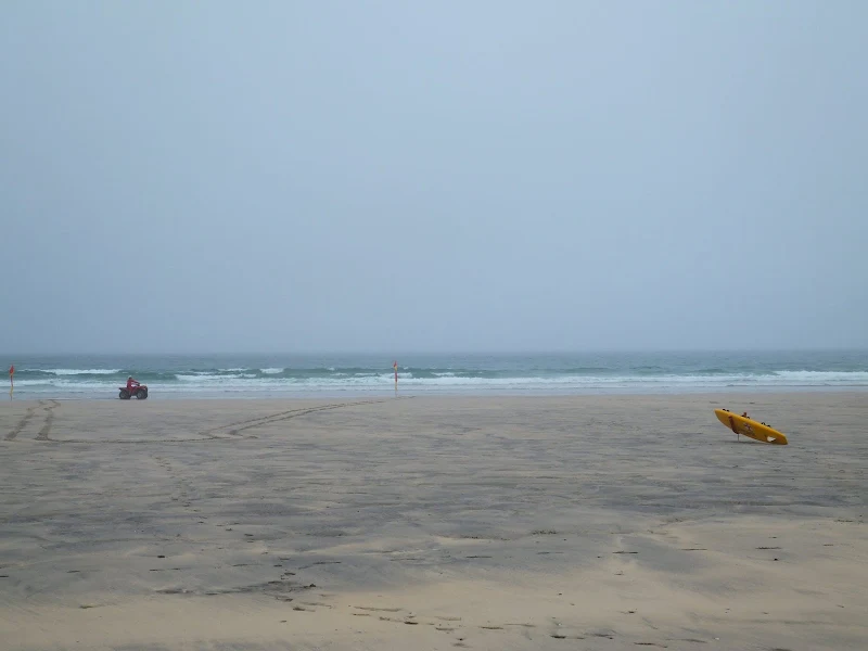
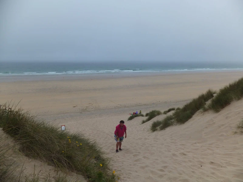
Rounding Godrevy Point the path descends to Gwithian Towans, then Upton Towans, then Phillack Towans and Mexico Towans before reaching The Towans. Towan is the Cornish word for 'sand dune' and is very descriptive of this section. It is indeed sand dune, with distinctive markers that plot the winding course through them. At first this was a something of an interesting challenge to navigate through to the next marker. At these lower levels the fog was less dense and visibility certainly a lot greater than along the clifftop paths. But then eventually one sand dune becomes much the same as the next sand dune. And the next. Then up to the top of another dune to survey what was ahead. Sand dune! Eventually the enticement of the the beach for a change of scenery beckoned. A wide open beach. On a clear day it was a sight to behold, and even on a foggy day it gave some hint of the glory that it held. With the tide well out, there was plenty of firm sand to trudge across. Despite the weathr, there was still plenty of surfers heading out to sea and people walking the beach.
Finally the path leads around the Hayle estuary and into the town itself. It was now the afternoon. There was still a mistiness with no sign of sunshine. Now I had been told by many people that it can be dense fog on one side of Cornwall and a few miles across to the opposite coast it can be the hottest day of summer. With no pubs along the route, the invitation to a Hayle hostelry did not appear inviting in this fog. Therefore hedging our bets we decided to catch the bus back to Penzance then down to basecamp at Porthleven. This proved to be a wise decision with regard to the weather, however the bus journey was probably not the wisest of decisions.
Buses of Cornwall
Portreath is probably the furthest limits that one can go from a central base at Porthleven using public transport allowing for time to walk along the South West Coast path. This involves and early start with the number 2 service up to Helston, where a change for the Reduth service is required to meet with the 47 service to Portreath Beach. Catching the early 6.51 bus got us there for 8.46 using the summer timetables.
The return journey from Hayle is easier with a service from Hayle to Penzance followed by the number 2 service back to Portreath. Although this involves five separate journeys, it can all be done with the 7 day rover tickets available from First Kernow. £30 family ticket for 7 days travel for two adults is absolutely unbeatable in my book and I would recommend this as the cheapest option of getting around this amazing county. Obviously, the passing years since this expedition have resulted in increases in fares and ticket availability so do check with the bus operator for the latest deals.
One thing that is very noticeable about the buses in this part of Cornwall is their age. First Group are the predominant operator and their vehicles in this part of the world are not the newest examples one may encounter. The shabby and well used interiors behold their age, and their registration plates provide the evidence of the years they have had in service. Certainly the double deckers were consistently of the age when the old registration nomenclature of a letter followed by three numbers and three letters was in use. That's definitely 20th century. The initial letter indicates the year of registration. S registered, R registered, P, N, L and K registered vehicles. That equates to 1999 as the most recent and 1992 for the older K registered models. As off 2013, the year this expedition was undertaken, that's over 20 years old and they were still going. The oldest was a fleet of open top Volvo double deckers which were on a D registered plate. That's 1986. I know that because that was the registration of my old Ford Capri which has sadly long departed this world. I am certain one could go to a vintage bus rally and see more recent examples of buses. Credit to First Group for keeping them going, although it does give the impression that Cornwall is the dumping ground for the older vehicles of their national fleet.
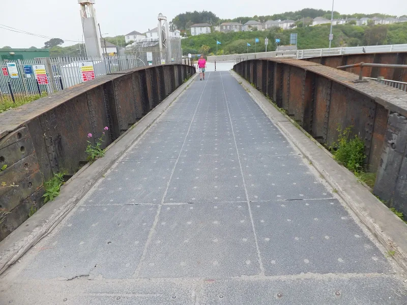
I suppose that it was inevitable that we would eventually encounter a broken down bus on our travels and this proved to be the case a couple of days earlier. One of the 1986 open tops had come to a unscheduled stop at some traffic lights in Penzance, causing a little traffic chaos. That had been the only encounter until this day, on the bus back to Penzance. The bus, a S registered Volvo Olympian, arrived at the scheduled time at Hayle viaduct. There was no indication that the bus would not make the journey. It did not purr along, but more of a blaring growl of engine noise as is the case with these old buses, but that is not unusual. The bus made it through to the start of Crowlas village and here it pulled into an assigned bus stop. There had been no request to stop. There had been no one waiting at the stop. When the engine died and then the lights all went off it was an ominous sign that something untoward was happening. Then the customary traipse up the stairs by the driver and the announcement to those sitting upstairs that the bus had broken down and would not be going any further. I say customary as this is not an uncommon experience. First Group are also the main operator in Norfolk and Suffolk and I have to use them on a daily basis and breakdowns are a constant occurrence. It is amazing that the only time I can remember a bus breakdown during all my years of bus usage was in my school years when an old Bristol MW single decker broke down on the way to school. Despite years of using public transport it wasn't until recent years following privatisation when using the First Group buses that I have had the experience happen again. And again. And again. Maybe I was lucky in my formative years. Maybe I just look back with rose tinted spectacles at the days of the old National Bus days and other breakdowns have long been forgotten. Or are buses these days just not as reliable as they were back then?
The bus wasn't overly full, and before all its passengers had exuded onto the pavement the driver was hailing down a St Ives to Penzance bus. At least this driver had the initiative to resolve this situation. Despite the St Ives bus being relatively full, enough room was made to accommodate the extra passengers and everybody managed to get to their destination pretty much on time. At least the First Cornwall drivers all seem cheerful workers, but who wouldn't be cheery in such a fabulous and beautiful county.
Directions
The South West Coast Path is well defined by the distinctive acorn logo waymarkers.
The bus stops at the Portreath Beach car park. From here take Battery Hill on the left hand side of the beach and the Coast Path is marked at the bottom leading off to the left up Western Hill. From here the path is easily running along the top of the cliffs all the way through to Gothian Towans. There are markers to guide through these dunes. The going is not particularly arduous although it can become enduring therefore an alternative is to walk along the beach from this point.
Features
Godrevy LighthoiuseView in OS Map | View in Google Map
Just beyond Godrevy Point lies a dangerous rocky reef locally known as the stones. This has been the peril of many vessels throughout the years including the Nile steamer which lost all passengers and crew when it founder on the reef on 30th November 1854. This tragedy prompted the call for lighthouse and eventually, in 1859, Trinity House decided to erect such a beacon.
The construction was of stone rubble bedded in mortar to forma octagonal tower 26 metres in height. This, together with keepers cottages were erected on the largest of the rocks. The original mechanism was of a clockwork design which was powered by a large weight held in the cavity wall. There were two lights, one with a white beam and 10 second period, and a second red light to mark the Stones rocks.
A new catadioptric lens was installed in 1939 along with an acetylene burner which automated the light thus the need for constant supervision of keepers who withdrawn. More modernisation occurred in 1995 with the power source converted to solar power and the light moving to a lighthouse tower on the adjacent rock.
References
Image Gallery


Route Validation Cards
Validation Date - 2013-06-23
- Time of Walk: 10:30 to 15:30
- Validators: Griffmonster, Kat
- Weather Conditions: Warm summers day. Fog and mist
- Notes: Initial route undertaken
Summary of Document Changes
Last Updated: 2026-03-30
- 2014-04-29 : Initial publication
- 2018-12-23 : General website updates
- 2021-03-17 : Update website improvements and removal of ViewRanger reliance
- 2021-12-01 : Removal of ViewRanger links due to its imminent demise
- 2026-01-12 : Major website update with all walks recast to the new format


0 comments:
Post a Comment