Norfolk Coast Path - Cley to Wells-next-the-Sea
Saturday, 26 January 2019
|
No comments
|
![]()

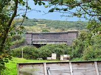
A 10 mile walk following the Norfolk Coast Path between Cley and Wells-next-the-Sea
An easy walk along the Norfolk Coast Path navigating out across the marshes to Blakeney then along the marsh perimeter to Wells. Blakeney is a worthy stopping point to explore Mariners Hill and the Guildhall and take in the legends of the Blakeney tunnels and the tragic story of the Blakeney Fiddler who is depicted on the village sign.

Walk Statistics
- Start location: Cley
- End location: Wells-next-the-Sea
- Distance: miles ( km)
- Total Gain: ft ( metre)
- Total Descent: ft ( metre)
- Min Height: ft ( metre)
- Max Height: ft ( metre)
- Est. Walk Time:
- Walk type: Linear
- Walk Grade: Easy
- Terrain:

Maps
The following maps and services can assist in navigating this route. There are links to printed maps and links to downloadable GPX route data for importing into navigational software and apps.
- Ordnance Survey Explorer Map
- OS Explorer 251 - Norfolk Coast Central
- GPX Route File
Accommodation
Woodhill Park CampsiteView in OS Map | View in Google Map
- Website
- https://www.woodhill-park.com/
- Description
- Located on the clifftops at East Runton, half way between Sheringham and Cromer, this highly recommended touring site is ideal for exploring North Norfolk with public transport available to many destinations from the entrance to the site.
Transport
Various Operators - Bus Service
- Service Details
- Coasthopper CH1, CH2, CH3 - The Coasthopper services link Hunstantion, Wells-next-the-Sea, Sheringham, Cromer, Mundesley and North Walsham including all intermediate villages. See the Traveline website to determine the current timetables and services.
- Timetable
- www.traveline.info
Walk Notes
This is an easy section of the Norfolk Coast Path although in times of adverse weather it can present a challenge with the exposed path that leads out to the site of the old Blakeney Chapel. This section follows the top of the defence banks and leaves the walker at the mercy of the elements. A couple of years prior to this walk we had walked in the opposite direction with a stiff westerly at our backs and a rain shower caught us before we got to Cley. This was not too bad as it was behind us but we passed a few walkers heading in the opposite direction, heads down, weatherproof jackets tied tight around there bodies and hoods held down as best as possible to keep out the torrents of rain that were gusting on the winds. At the time it had started out as a pleasant Sunday afternoon albeit with a keen breeze, however this quickly deteriorated and although this is only a couple of miles in distance such weather can catch walkers out.
On this particular walk we were blessed with sunshine, blue skies and little in the way of breezes. It was most pleasant and being early morning there were plenty of other folk out, some exercising their dogs, some casually taking in the sights, some hastening past in a jog but all taking advantage of the morning sunshine.
Blakeney Chapel
At the furthest point out on this marsh is the site where the old Blakeney Chapel used to rest. The OS map indicates an alternative path leading out to the location but this is no longer possible due to the re-routing of the River Glaven in 2005/6 which was designed to reduce the risk of flooding in the villages of Cley and Wiveton. Before the river was moved an archaeological investigation of the area of the Chapel was undertaken revealing evidence of prehistoric farming. Also discovered was the foundations of the Chapel dating from the 14th or 15th centuries which was probably associated with the friary at Blakeney. By the 16th century it had been converted into a house.
Blakeney
Blakeney is referred to as Esnuterle in the Domesday Book of 1086. Later, as referenced by the book A General History of the County of Norfolk (by J Stacy published in 1829), it is called Snitterley, the book stating this name was attributed 'during the seventh year of the reign of Henry III' (1223). The name Snitterley is derived from the word Snet or Snyte and is an old English name for many rivers or streams of water. The first mention of the name Blakeney dates from 1240 when it was recorded that the village lay in the lee of the shingle ridge, with the name probably derived from the term "Black Island". The village developed into an important fishing port also trading in goods such as cereals and the import of timber, iron and coal. The port gained a bad reputation for piracy, its sheltered harbour luring in boats seeking haven from storms only for their cargoes to be stripped from them when they put ashore. Today the harbour has silted up and is unusable by cargo ships.
At Blakeney, adjacent to the Guildhall is the Manor Hotel, this has a small walled garden facing the the Mariners Hill which contains a 400 year old Mulberry tree which is worth seeking out. Both the Guildhall and Mariners Hill are well worth investigating.
Flooded Marshes
Walking along the coast path into Blakeney, it soon became evident that there had been a very high tide with signs of the car park in front of the quay being flooded prior to our arrival. The waters, by this time, were receding and the flow out from the quay was pretty significant which was quite an amazing sight to behold. The damp surroundings, the couple preparing their yacht for sail, the relaxed sight of a sunny morning Blakeney quay were all worthy of sitting and pondering over whilst tucking into a bacon buttie and mug of tea from the little mobile cafe at the edge of the quay. Many a time I have read the local papers reporting another motorist returning to their parked car on Blakeney Quay to find it swilling with water because they had not been aware of how high the tide can be here. Today there was a few cars standing on the quay but all had obviously parked up after the tide had receded. There are plaques on the walls around the quay recording the heights of the severe floods of 1897, 1953 and 1978.
Although the waters were abating this did leave consequences on the footpath beyond Morston. The boatyard had been flooded and water was left in the dips and gulleys of the marsh through which the footpath is routed, necessitating a diversion around the track through the boatyard. Beyond this point the path runs along the edge of the marshes with frequent areas of flooding evident. In most instances these were just large puddles in the gulleys that could be easily negotiated around with a hop or a jump. But there were some more extensive areas of flooding between Morston and Freshes Creek that entailed more thought. There was one instance where the ground dips down and is usually filled with mud and water even at the driest of seasons no matter what the tide does and this was completely awash with a small lake of water. This had to be walked around by taking a well trodden route along the edge of the obstacle and into the field beyond. Another stretch proved not so easy and did have us contemplating taking shoes and socks off to get across. Eventually a route through the undergrowth on higher ground was trampled down to get around the waters.
All of this goes to show just how vulnerable this part of the coast is and it is easy to see that it would not take much to plunge all the marshes under water. Usually a spring tide accompanies a full moon or within a couple of days either side but the full moon was fourteen days away, half way through the lunar cycle. The weather was settled with no encroaching storms that would produce a tidal surge. Therefore I am not certain why there was such a high tide.
Wot no Llamas
The last occasion we walked this section we encountered a group of people out walking their llamas. I have never seen anyone walking a llama prior to this, or indeed since. Dogs yes, a parrot on a shoulder, a mouse in a blazer pocket and even the rare sight of someone with a cat on a lead but a llama most definitely not. According to those learned gentlemen who formed the intellectual troupe which went by the name of Monty Python, a llama is a quadruped which lives in big rivers like the Amazon. It has two ears, a heart, a forehead, and a beak for eating honey. It is provided with fins for swimming. We were nowhere near the Amazon but I can definitely tell the avid reader that these creatures did posses two ears and a forehead. No honey was in evidence. Luckily there was no sign of anyone swimming in the Wells Salt Marshes otherwise I would have had to calmly clear my throat and shout in strong voice 'Look out, there are llamas' as llamas, according to Mr Cleese et al, are dangerous.
On this days walk, although we kept a keen eye out, we did not encounter any llamas, no honey and no-one swimming.
Pubs and other points of interest
There are a number of pubs along this route but for this particular walk we were aiming to get to our favourite North Norfolk bar on the Albatros which is anchored in Wells quay. Other notable pubs along the route include The Kings Arms at Blakeney, The Anchor at Morston and The Red Lion at Stiffkey. Details of the first two can be found in the Search for the myths and legends of Stiffkey
Directions
The path is simple and easy to follow, with the distinctive acorn National Trail waymarkers pointing out the route.
Cley to Blakeney
Follow the coast road out of Cley and the path leads out onto the marshes just beyond the river crossing. This keeps to the defence banks as it follows the Riven Glaven towards the sea, eventually turning just before the site of the old Blakeney Chapel. The final leg follows the Blakeney Channel down to the quay.
Blakeney to Wells-next-the-Sea
Keep to the edge of the quay and follow this around until it meets the path along the edge of the marsh. This leads directly through to Morston. Walk through the boatyard and the path crosses a small section of marsh then over the earthed defence wall. Follow the track which leads along the edge of the marshes. This continues all the way through to Wells
Shorter Alternative
There are multiple access points up to the coast road where the Coasthopper bus service can return the walker to their starting point. From Blakeney the road from the quay will lead up to the Coast Road, at Morston the car park leads out onto the road and there are a couple of tracks that lead out to Stiffkey.
Pubs
The Albatros, Wells-next-the-sea View in OS Map | View in Google Map

- Address
- The Albatros, Wells-next-the-sea
- Website
- https://camra.org.uk/pubs/albatros-wells-next-the-sea-189186
No visit to Wells is complete without a visit to The Albatros. Captain Ton Brouwer, bought the vessel in 1980 and operated it as the last European sailing cargo vessel up until 1996 when it was refurbished as a passenger ship. In 2001 the Albatros became based in Wells-next-the-Sea where it was used as an educational centre supported by a trust called The Albatros Project. This lasted until 2005 when, in order to keep her commercially viable, the ship was used as a bar, restaurant, music venue and B and B which has now become a full time all year round business. In 2020 Ton Brouwer closed down its operation as a bar and restaurant and sold the ship to Bob Richardson. It has since undergone a full refurbishment and is hoped to be open for Easter 2026.
When Ton Brouwer captained the ship, the former cargo hold was decorated in sea charts and an assortment of bric-a-brac, which served as the restaurant and bar. A variety of traditional Dutch Pancakes and other Dutch specialities were served together with Woodfordes ales straight from the barrel. Live music was offered every Friday and Saturday night, and Sunday afternoon.
From the deck of the ship there are superb views across the quay and marshes and out to sea. There is no better way of spending a warm sunny afternoon than sitting watching the tide come and go from the deck of the Albatros.
The atmosphere, the surroundings and the whole experience of this ship based bar is totally unique. On this occasion in addition to the usual Wherry and Nelsons Revenge ales from Woodfordes they also had their summer ale Sundown which was a mighty fine example of this drink and a perfect accompaniment to the plateful of cheese, gherkins, olives and salami that we shared. The fact that these ales are served from pins rather than the usual firkin means the beer is always fresh. The only disappointment on this visit was the noticeable absence of the captain, Ton Brouwer, who we were told was not aboard. Nonetheless the experience always first class as ever.
Features
Blakeney GuildhallView in OS Map | View in Google Map
Blakeney Guildhall can be found at the eastern end of the quay. It was originally a two storey building with its entrance to the upper storey from the higher southern ground. All that remains today is the 15th century brick vaulted undercroft. There is little knowledge of its early history but it is thought that it was probably built by a wealthy Blakeney fish merchant with its undercroft being used as storage. There are deeds dating from 1627 that record the transfer of ownership to the villagers of Blakeney. Today it is under the ownership of English Heritage and admission in free
The undercroft has seen a variety of uses over the years including the storage of cargo, a grain store, a coal bunker, mushroom growing and a bait store for the local fishermen. During the years of WWI it was used as a mortuary for drowned sailors.
Tunnels
It is said that tunnels once linked the Guildhall to the chapel which once stood on the marshes by the mouth of the River Glaven, and one which went to Wiveton Hall with another said to run a full 8 miles to Baconsthorpe Castle. Folklore states that these were built by the White Friars of the nearby Carmelite Friary which was also linked by a tunnel. There is evidence from 1924 that the tunnels once existed, when workmen who were digging on Mariners Hill came across the barrel roof of a tunnel which they attested 'went right under the houses on top of the hill'. There was no more investigation undertaken at the time and the hole was filled back in once their work was completed. When the old Crown and Anchor Inn was demolished in 1921 more tunnels were uncovered and another tunnel was exposed in the grounds of the White Horse Hotel in 1976. This was said to lead towards the Blakeney Hotel, the site of the former Crown and Anchor Inn, in one direction and the British Legion Car Park in the other.
The legend of the fiddler and his dog
A local legend tells of a fiddler who, accompanied by his dog, set off to explore the tunnels, fiddling as he went. The villagers, led by the mayor, followed above ground, their steps guided by the sound of the fiddle. After a few miles the fiddle music abruptly stopped, they waited and listened but no more was heard. Their conclusion was that both the fiddler and his dog had been taken by the devil and to mark the point they constructed an earthen mound. This mound is still known as Fiddlers Hill and is located on the road between Binham and Warham, on the southern side of a crossroads (Map Ref TF 962 411)
In 1933 the road was widened at these crossroads which resulted in part of the mound being removed. During the work the skeletons of three humans and a dog were discovered. Maybe one of these human remains was the fiddler. The mound is thought to be a bronze age burial mound or barrow, although being placed at a crossroads it could well have been used at later times as the burial ground for hangings and the outcast.
The village sign pays homage to the event, clearly depicting the fiddler to the left hand side of the ship motif with his dog a few paces ahead and the entrance to the tunnel on the right. There are also similar tales about tunnels and a fiddler associated with Binham Priory.
References
Mariners HillView in OS Map | View in Google Map
The distinctive grass covered mound standing 7.1 m in height is sited at the eastern end of the quay next to the Guildhall is known as Mariners Hill. It consists of a main mound with a seating platform adjoined by a smaller mound causing a stepped appearance. During WWII an air raid shelter was dug into the mound and the smaller mound may be the spoil from this excavation.
It is uncertain why or when it was constructed with little evidence to suggest whether it pre or post dates the Guildhall which cuts into its structure. It may have been a harbour lookout dating from the medieval or post medieval periods, though there are suggestions that it was a motte but with no evidence of a bailey it is thought this explanation is unlikely. Being placed adjacent to the manor house of an important manor with a friary could imply that it was a beacon.
Image Gallery


Route Validation Cards
Validation Date - 2018-07-14
- Time of Walk: 08:30 to 13:00
- Validators: Griffmonster, Kat
- Weather Conditions: Clear blue skies, sunshine, warm
- Notes: Initial route undertaken
Summary of Document Changes
Last Updated: 2026-04-20
- 2013-01-06 : Initial publication
- 2017-12-22 : general maintenance updates
- 2019-01-26 : general maintenance updates
- 2019-12-18 : general maintenance updates
- 2021-03-17 : Update website improvements and removal of ViewRanger reliance
- 2021-12-01 : Removal of ViewRanger links due to its imminent demise
- 2026-01-12 : Major website update with all walks recast to the new format


0 comments:
Post a Comment