In Search of Sizewell and Thorpe Beacons
|
Sunday, 4 February 2018
|
No comments |
![]()

A 10 mile walk following the southern side of the parish boundary of Leiston in Suffolk
This is the second article devoted to the walk following the route of a 17th century perambulation around the southern side of the Leiston Parish boundary. This article is concentrates on two landmarks from the past, namely Sizewell and Thorpe Beacons, which are thought to have been part of the Armada warning system.
In Search of Sizewell and Thorpe Beacons - Essential Information
Walk Statistics:
- Start location: Leiston
- Distance: miles ( km)
- Total Gain: ft ( metre)
- Total Descent: ft ( metre)
- Min Height: ft ( metre)
- Max Height: ft ( metre)
- Walk Time:
- Walk type: Circular
- Walk Grade: Easy
- Terrain: Footpaths, country lanes and beach
Maps:
The following maps and services can assist in navigating this route. There are links to printed maps and links to downloadable GPX route data for importing into navigational software and apps.
- Ordnance Survey Explorer Map
- OS Explorer 212 - Woodbridge & Saxmundham
- GPX Route File
Route Verification Details
- Date of Walk: 2018-01-14
- Walk Time: 11:00 to 15:00
- Walkers: Griffmonster, Kat
- Weather Conditions: Bright and cold
Walk Notes
This is the second article in a walk around the southern boundary of Leiston parish as documented in a AD1620 perambulation documented in Alfred Sucklings 1846 book titled The History and Antiquities of the County of Suffolk. The previous article to this walk, In Search of Sizewell Chapel, explored the route from Leiston to the coast at Sizewell following the medieval track. The article concluded that during the 12-14th centuries Sizewell was a prosperous and thriving community with both a market and a chapel. After this period the town rapidly declined due to flooding and coastal erosion. Once again, it is worth reiterating the perambulation as described in Suckling's book:
First therefore beginning this perambulation at the Est Bridge, leaving the manor on the right hand going after the Brooke eastward, including all the Lady Old Abbey, untill you come to the most northerly end of Syswell shole at the sea side, and from thence going southward after the sea and Syswell shole, untill you come unto Syswell Beacon, and from the same beacon going still southward after the sea side untill you come unto a place called Sea Fell, where the town of Syzwell and Thorpe divide at the fee-farm land of Thorpe, and soe from the said place called the Sea Fell, still following the sea untill you come unto Thorpe Beacon, and from the same beacon going between the sea and Thorpe towne towards the west, after the old ditch that includeth Thorpe fee-farm untill you come unto Thorpe fens, where the brooke divideth between Thorpe and Haselwood manors, and soe following that brooke between Thorpe and Haselwood manor untill you come unto Friday Market Heath, and then leaving the water course following the hedge south-west untill you come unto a green way beyond the Jebott, and so following that way north-west over the heath untill you come unto a tenement called Dearing's, which lyeth in Knoddishall, excluding the same tenement on the left hand going between the heath and inclosiers untill you come unto a cross at St. Andrewes Green, which is made between the manor of Leiston and Knodeshall
This article continues the exploration as it heads down the coastal section to Thorpe where we attempt to follow the medieval boundary as close as possible. Unfortunately access is limited these days, restricted by Thorpeness Mere and private land that surround the river Hundred as it leads through to Coldfair Green. In 1620, the only notable landmarks that are referenced along the coastal section are the Beacons at Sizewell and Thorpe. These were probably defence Beacons that would be lit as a method of communication in times of imminent attack from the sea. They have probably been lost to the sea due to the ever persistent erosion of this coastline. Further information and discussion is included as the main feature of this article.
Looking back at the boundary description we find a reference to Sea Fell where the town of Syzwell and Thorpe divide
. This location can be determined by the boundary marked on 19th century OS maps which place the boundary on the northern side of the present day Beach View holiday park. Sea Fell is obviously a landmark of some description although it is uncertain what it refers to, the word Fell not specifically a Suffolk word. Judging by the erosion of Sizewell referenced in historic documents, we can make a very god guess that Sea Fell in now under the waves of the North Sea.
Continuing south, we pass Sizewell Hall which certainly was not there during the 1600's. The present building dates from 1920 after the original thatched house was destroyed by a fire though it is uncertain exactly when this original building dated from. It had previously been known as Sizewell House and was purchased by the Ogilvie family in 1859 who extended it and enhanced the name to Sizewell Hall. Ironically, this is in Thorpe not Sizewell.
We now continue down to Thorpe Beacon where the boundary heads inland following the Hundred river. Thorpe Beacon no longer exists but just there is a lane named Beacon Hill Lane which certainly gives us a clue as to where this may have been located. The fact the instructions refer to following the sea to Thorpe does suggest it was either close to the beach or visible from the beach. Therefore the obvious position would be where Beacon Hill Lane leads out to the sea at the bottom of North End Avenue. We can only surmise that erosion has claimed the beacon and the hill it sat upon.
We now need to head west between the town and the sea. A few things should be noted here. Firstly that the 19th century boundary leads inland half way along the row of seafront cottages in front of Thorpe Road to join the Hundred river and then uses the river as a boundary. As rivers tend to form natural boundaries the question has to be asked as to why this is not the case all the way through to the coast, which is known as Thorpe Haven, presuming the boundary has not changed since the 17th century.
A clue can be found in a reference quoted on page 427 in Suckling's History and Antiquities of Suffolk where he reveals a passage taken from a 1725 dispute over land
the parish of Aldeburgh is divided from the parish of Thorpe by the south point at Clockwill's in a direct line to the sea side. That the haven which bounded the manors lye about a quarter of a mile southward of Clockwill. That the haven had been stopped up about 40 years and that there since had been another haven halfway between Aldeburgh and Thorpe parishes, also called Thorpe haven which was about half a mile southward of old Thorpe haven and that the new haven lies about half a mile more southward into Aldeburgh manor than the new one
This clearly demonstrates the migration of the river mouth southwards into Aldeburgh parish. Over the centuries it also silted up and is now virtually non existent to the casual visitor to the area, its flow secreted in a pipe under the shingle with the only evidence being the marker of the outfall in the sea. We can therefore assume that it must have been a lot closer to the Beacon and Beacon Hill and the description of following a route between the town and the sea westwards may even have been further north than that indicated on the 19th century OS maps.
The route then leads across to the fens which still exist today, and then follows the brook which is the Hundred river which skirts around the southern side of the fens.
There are claims that the River Hundred had been a much larger river than the humble watercourse that remains today with some suggestions that during Roman times the haven was large enough to harbour ships, with the river able to take barges to ply their trade up to Aldringham. It is worth noting that in the 1888 publicationA History of the Foreshore and the Law Relating Thereto, there is a passage that is quoted from the Quo Warranto rolls
, which are sets of records created by the government of Edward I (reigned 1272 to 1307) and commonly known as the hundred rolls.
The Abbot of Leiston claims wreck from the port of Minsmere to the port of Aldmouth and he says that that place is in his manor of Leiston
This is referring to the coastal section of the Leiston boundary and the interesting thing to note is the reference to Aldmouth which one has to conclude is the outlet of the River Ald(e). Now, what we know as the river Alde is not only outside of the Leiston parish boundary but outside the Blything Hundred, across the border in the Plomesgate Hundred. The obvious conclusion is that the Hundred river is being referred to as the River Alde. There are other historic documents that also point to a similar conclusion. It is interesting to note that the river is not named in the perambulation and is just referred to as the Brook that separates the parishes. Even in this period the river had probably lost its importance, with the haven successively being silted up with shingle and migrating southwards.
We now head inland. The route following the River Hundred is inaccessible so we have to negotiate a path up past the House in the Clouds and around the northern side of the Mere which is commonly known to have been created by Glencairn Ogilvie in the early 20th century. The fact that the pleasure boat mere was created at this time is true, but it is certainly not true to say the Mere did not exist prior to this time. An 1870 publication by Nicholas Fenwick Hele entitled Notes or jottings about Aldeburgh contains a description of Thorpe Mere which states that this saltwater lake was in two sections, both of which are said to have been a mass of mud. It goes on to say that there was no sluice control at the Haven and was often chocked with shingle. Such conditions provided the habitat for oyster beds, and in earlier years, cockles were said to have been abundant in the Mere although never harvested.
Beyond the Mere we can take the old railway track-bed to the southern side of the river, and around the area known as the Fens, which is mentioned in the perambulation, and get back to the boundary. The Fens was a originally a continuation of the Mere until the railway came and the embankment separated the two. The modern footpath leads along the southern side of the fen before crossing over the fen and up to Aldringham Church. This certainly isn't mentioned in the perambulation which faithfully follows the course of the brook (River Hundred). However, the modern day walk up to the church does provide a means to digress for a brief interlude as the church was most certainly in existence during the time of the perambulation.
Suckling describes Aldringham as a small decayed village in the south eastern angle of the hundred of Blything
. Aldringham church dates back to the 13th century and in 1280 came under the stewardship of Leiston abbey. The present building is a Victorian renovation rebuilt from the ruins of the church that was left to decay from 1687 onwards. The present picturesque village church offers a humble open belfry at the western end where once stood a tower that was added in the 15th century. Suckling describes the ruins of the tower as a lofty and substantial tower of flints
. He goes on to describe his own visit to the church where he finds the tower in a dilapidated state, adding that it had been shattered by lightning
. His visit must have coincided with the initial stage of the restoration in 1842 for he noted that fragments of the tower were being employed in restoring the western wall of the nave. A painting, which depicts the ruins of the church and tower and painted in 1842, hangs inside the church and is replicated below.

The final part of the walk crosses the river once again and then head down to the medieval area of Friday Market Heath. This appears to be the area south of the river and bounded by Fitches Lane, an ancient green way. This is discussed in more detail in the article on this site entitled In Search of Leiston Gibbet. This still causes me some concern as the parish boundary in the 19th century follows the course of the river which seems the logical and natural boundary marker. However the instructions in the perambulation from 1620 are explicit, leaving the water course following the hedge south-west untill you come unto a green way beyond the Jebott
. Why this was the case is unclear as this is in what was Hazelwood Parish and is now Aldeburgh parish. We can only assume that the river at this point was fully in Leiston Parish all the way through to St. Andrew's Green which we know as Coldfair Green, and was part of Leiston right up until the 1980s.
Directions
A walk around the southern side of the Leiston Parish Boundary
From the town centre cross road with the White Horse on the corner, proceed into town heading straight on at Barclay's Bank, where the road tuns right into the High Street. This is Valley Road which is the route of the ancient track to Sizewell. Follow Valley road out of town. It passes under a railway arch then leads out into countryside up a hill known locally as Kemps Hill. At the top it junctions with the main Sizewell road, known locally as Lovers Lane. Go straight ahead and follow the road past the cottge on the left then take the track on the right before the cottages. Keep to this track. Leiston Common is on the left behind the houses.
Where the track junctions bear around to the right and follow this. There is a kissing gate out onto the heathland. Keep to the main track ignoring a lesser track that leads off to the left. At the end of the heath a second kissing gate provides access to a path that leads along the edge of some woodland masking the Wind Turbine substation. This junctions with a track where Rosary Cottage sits to the left. The original route would have led straight ahead taking a route diagonally across the field. This is no longer accessible so turn right and follow the lane down to the road. Turn left and follow the road to the coast.
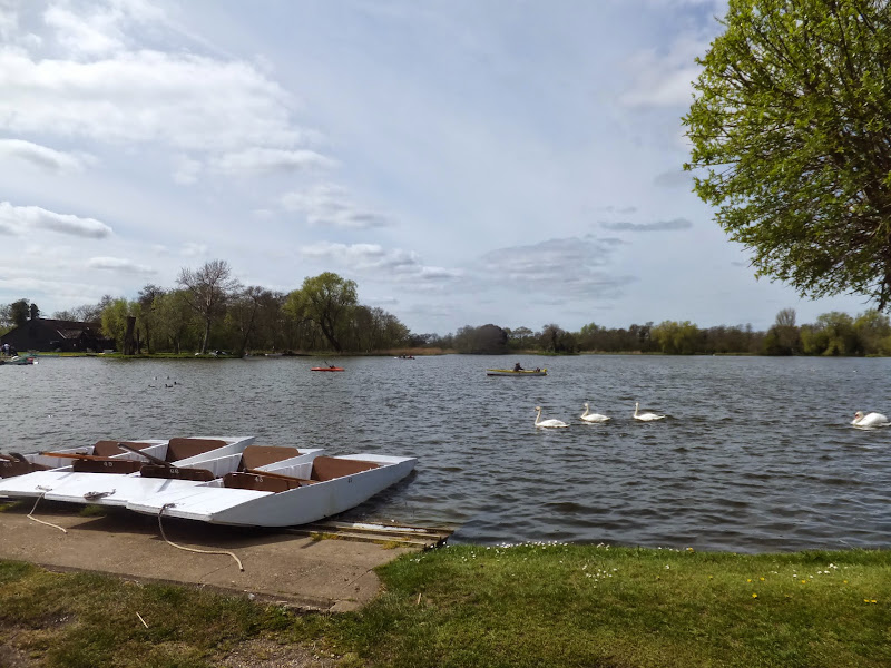
The coastal section can either be walked along the beach or along the cliff tops. It must be noted that at the Thorpeness end the beach is inaccessible at high tide. Do not be tempted to try to get along by the edge of the cliffs at this point as they are extremely unstable. Unfortunately in 2016 they claimed the life of a man who was buried in a cliff fall at this point. If in any doubt follow the alternative route along the top of the cliffs. There is a pathway up to the top of the cliffs before the coast turns. This leads out onto Thorpeness common. Follow the cliff top path which leads out onto a residential road. Keep to the road into the village. Either follow the road around on the right or take the road ahead that leads to the Mere. Either way this is no more than a circular route with The Mere at the far end.
The original boundary cannot be accessed as it passes on the southern side of the Mere so we need to follow the northern side. This is accessed by following the road around the mere. There is access to the Country Club then a few yards on a track that leads to both Thorpeness windmill and the House in the Clouds. Take this, pass by the two landmarks, continue across the golf club access and follow the path which leads along the edge of the Mere with the Golf course on the right. This path leads out onto the old railway track which is now a permissive path. There is a house on the right, a view of the Fens straight ahead and the permissive path to the left. Take this path, following the distinctive waymarkers for the Sandlings Footpath. This will soon point you down to the right, off the trackbed and into some woodland. Keep following the waymarkers bearing round to the right at the end of the woodland. This leads out onto a grassy path around the southern edge of the fens.
At the junction of paths where a bench labelled as Peggys Perch and a metal sculpture reside, turn right and head down this path into the Fens. This leads across the Hundred River and through the marshes along boardwalks. There is a viewing point half way along which provides views across the whole Fens and provides captivation for ornithologists who frequent this area.
The path leads up out of the Fens emerging between the gardens of some large houses. Follow the road around to the right and then take the immediate left down to a farm. Keep to the path that leads to the left of the farms buildings. The path then follows the field boundary up the hill. At the top it turns right then leads down a slope on the left to lead across an open piece of land before heading up a hill to Aldringham Church.
Walk through the churchyard passing by the church on the right. Keep to the left hand side of the graveyard. This leads onto a path that heads back down to the Hundred River. It passes over the river and leads out onto the main road. Turn right and follow the verge briefly before a pavement. Walk along the road until there is a footpath sign on the left pointing up a track, known as Fitches Lane. Take this up to the top. A footpath leads down the side of the house at the top. Alternatively take a footpath on the right just before this which leads down to the river. At the end, do not cross the river, instead bear round to the left and follow the path back up to Fitches Lane, this being the old boundary as described in the 1620 perambulation.
Follow the lane and take the first footpath on the right into Coldfair Green, more commonly known as Knodishall these days. This emerges onto the main road, Turn right and then follow the track that bears off to the right which is the old road through the village. At the end, turn left and get back onto the main road to continue back to the start of the walk

Pubs
The Vulcan Arms, Sizewell: View in OS Map | View in Google Map

- Address
- The Vulcan Arms, Sizewell:
- Website
- vulcanarms.freehostia.com/
Another curious named pub with an award wining sign to match. The history of this establishment goes back many years. It was recorded as being an alehouse in the census of 1540 but then changed to a blacksmith under Cromwell's reforms. Eventually it returned to being a pub in the early 1700's when it took the name of The Vulcan Inn, Vulcan being the Greek god of fire and smithery. It also has a history of smuggling, Sizewell Gap being the haunt of many smuggling operations, including the infamous Hadleigh Gang during the 1700's. Local folklore suggests that there was a tunnel linking the Vulcan cellar to the beach. Unfortunately the original cellar was filled in during WWII.
The pub offers a caravan site, food each lunctime and evening with Saturday evening carveries and Sunday Roast dinners. Ales on offer are Greene King IPA and Abbott and Woodfordes Bure Gold.
Woodfordes Bure Gold is quite exceptional here - a real thirst quencher and hard to find in this part of Suffolk

Features
Sizewell and Thorpe BeaconsView in OS Map | View in Google Map
This research investigates the locations of the Sizewell and Thorpe Beacons as described in the 1620 perambulation of Leiston parish boundary which is quoted in Alfred Suckling's The History and Antiquities of the County of Suffolk. Sizewell and Thorpe Beacons are the two principle references made on the coastal section of Leiston parish boundary which stretches from Minsmere Haven, a point close to Dunwich Heath, down to Thorpe, which is present day Thorpeness.
From Minsmere Haven we are instructed to walk southwards untill you come unto Syswell Beacon
and then continue to a location called Sea Fell, where the town of Syzwell and Thorpe divide
. It is considered that the Thorpe/Sizewell boundary is probably the same as that in presented on 19th century OS maps which places it just north of the present day Beach View Holiday Park. The perambulation then continues following the sea until you come unto Thorpe Beacon
.
We therefore have two Beacons yet little to determine where they were placed in terms of the modern day landscape. Since this is following the coastline they were most likely close to the beach, and being beacons, probably sitting atop a cliff. There is plenty of evidence to suggest that this coastline suffered both flooding and erosion in the 16th and 17th centuries so we must assume both Beacons were lost to the sea many centuries ago.
There are a couple of possibilities as to the use of these beacons. One is that they were some kind of seamark or navigation beacon of which there were examples along the Suffolk coast during this time period, including two at Aldeburgh which are noted as timber structures on a 16th century map. This does appear to be a foolish construction for the beacons would have employed a fire as a light and timber is not the most resilient of materials to withstand fire.
The second possibility is that these were Beacons employed as part of a defensive warning system against attack from the sea. Such a system was employed at the time of the Spanish Armada in 1588 and similar systems have been used throughout the centuries as a method of communicating via a relay system of burning beacons. With the date of the Armada being only 32 years prior to this perambulation then these may have been constructed specifically for that purpose. Some contemporary descriptions of the era describe such beacons as being no more than a bonfire on the hill. Clearly the perambulation's mention of the Beacons would indicate that there was some sort of marker or structure associated with these specific beacons.
There are other such references to Beacons in the history books of the area including one example at Beacon Hill in Dunwich, a landmark now long gone. Another is at Red House Warren in Aldeburgh presumably somewhere around the Red House area and also no longer in existence. Yet another is said to have been in Westleton parish dating from the 13th century and placed at Cachecliff, which was described as a headland on the southern limits of Dunwich, probably at the south east end of Dunwich Common and once again a landmark now long gone.
One final possible location which does still remain to the present day is on the road between Leiston and Theberton, and is commonly referred to as Theberton Mound or Mount. There have been many suggestions that this 15 foot high, 25 feet diameter mound of earth was a beacon, some antiquarians stating specifically that it was part of the Armada Early Warning Beacons. Debate continues about the origin of the landmark, now covered in trees and ivy and hidden in the tall overgrown hedgerow by the roadside. Various other suggestions as to its purpose include it being a folly or some kind of landscaping feature and also as a placement for cannon which local folklore states was employed by Thomas Cromwell's men in order to wreak their destruction of Leiston Abbey.
One of the few references to the mound is in Henry Montagu Doughty's 1910 publication titled Chronicles of Theberton which quotes an extract from the sale in 1805 of a property known as The Brick House, which subsequently became Theberton House and is the impressive building on Potters Lane. Included in the inventory of items within its land is The Mount. It is interesting to note that Doughty states The mount or mound remains, but the prospect or summer-house, which then stood upon it has disappeared.
The summer-house confers with Hodskinsons map of 1783 where it is marked as Mount House. It is difficult to comprehend that a summer house could ever have stood atop this mound whose rounded rough summit would struggle to contain even a simple 4x4 garden shed. We may therefore conclude that this summerhouse was associated with the Mount due to its close proximity rather than have been built on it.
The suggestions of a folly or landscaping feature also appear to stretch the imagination as there appears to be no specific style or form to this mound other than a huge heap of earth. The suggestion of it being employed by Cromwell to destroy the Abbey is also called into question by many historians and archaeologists. This story is purely local folklore and there is nothing in historic documentation to back it up. The Abbey is some 600yards away and is within range of Cannon available during this period of time but one has to question why employ from such a distance and why destroy the buildings when the stone would have been far more useful and valuable for building projects rather than destroyed as target practice. It is also notable that, thus far, no canon balls have been discovered from recent digs at the Abbey site.
This leaves us with the possibility of the purpose of the mound being a Beacon and therefore may give us an idea of the possible construction of the Sizewell and Thorpe beacons. There are no records thus far discovered that mention the construction details of the Beacons although there are records of payments made toward Sizewell Beacon. These can be found in the Cratfield Accounts, where for the year of 1597 there are several entries for payment towards the watching of the Beacon
. What this entailed is unclear. If this was a defence Beacon then it may have been the fee for keeping a lookout at the beacon. If it was a navigational beacon then it would presumably be for keeping it alight during the night.
An example of these records is shown below:
5s4d paid 27th June for the watchinge of Sysewell Beacon
4s paid 22nd August toward the watchinge of Sizewell Beacon
8s paid unto the chief constable the 19th December toward the watchinge of syswell beacon
The obvious place for any beacon would be at the highest point along this coastline so no doubt the Sizewell Beacon would have been placed atop the cliffs. However, the landscape in the 18th century may have been quite different to that of today. Erosion has taken much land along this coastline and it is known such Beacon locations as Beacon Hill in Dunwich and Cachecliff in Westleton have both succumbed to the tidal ravages of the sea. The area around Sizewell village was known as Sizewell Gap during the 18th century when it became infamous as the landing point for contraband. The name is taken from the fact that it appears from out at sea as a gap between the cliffs and was therefore easily recognised by the illicit traders. Thus far I have found no reference to the name of Sizewell Gap that pre-dates the early 18th century so we cannot assume the landscape was the same. It is therefore difficult to place this Beacon. It is obviously north of the present day Beach View campsite, and probably south of the Minsmere marshes but it is anyone's guess as to exactly where.
The Thorpe beacon is probably easier to place. There is a road named Beacon Hill Lane that leads inland from the sea. The obvious assumption is that it was somewhere towards the coast as pointed by this road. There is no hill but given the centuries since this was written it does not take much imagination to think that coastal erosion has claimed both the beacon and the hill it stood upon.
References
- The History, Topography, and Antiquities of Framlingham and Saxsted, Whittaker, Treacher, 1834, p34
- General Report to The King in Concil, 1837, p445
- The Suffolk Shore Yarmouth to Adleburgh, J A Steers, 1925, p445
- Cratfield: a transcript of the acconts of the parish, from A.D. 1490 to A.D. 1642, William Holland, 1894, pp124-125
- The Victoria history of the county of Suffolk, William Page, 1907, p231
- The history and antiquities of the county of Suffolk, Alfred Inigo Suckling, 1846, pp426-427

Gallery
Below are a selection of images taken from from the photo album for this walk. Feel free to browse through these or click on an image to view a larger version in the Gallery.


Summary of Document Changes
Last Updated: 2021-12-07


0 comments:
Post a Comment